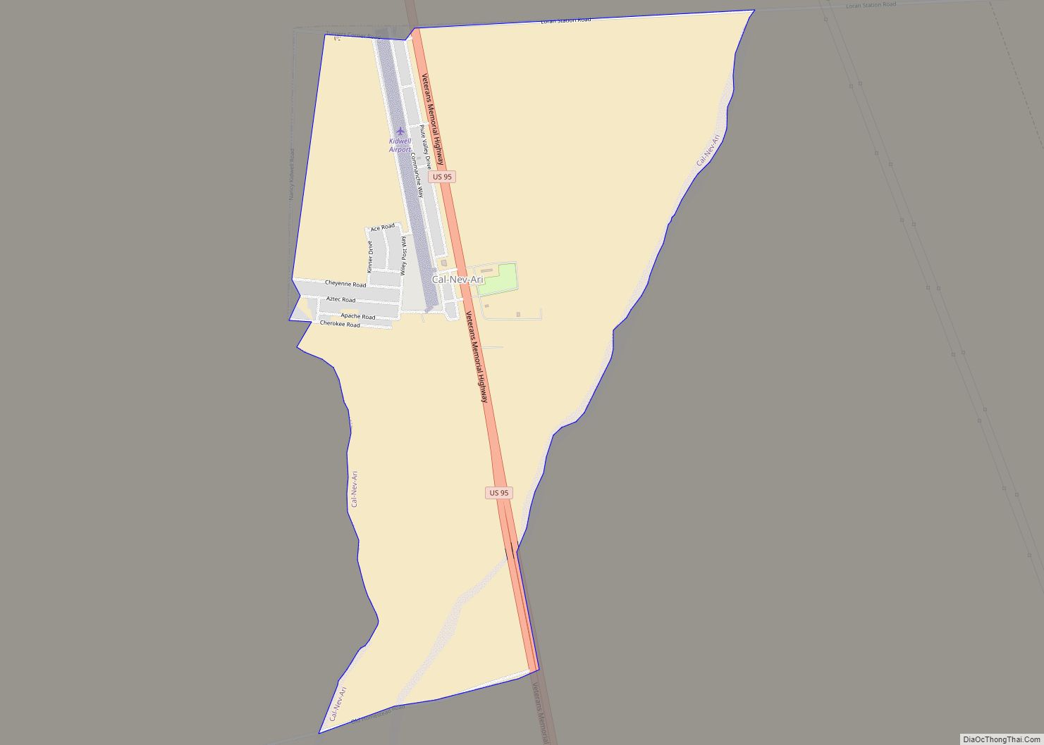
Cal-Nev-Ari is a census-designated place on U.S. Route 95 in Clark County, Nevada, United States, near the state’s southernmost point. As of the 2010 census, the town had a population of 244. The town’s name is a syllabic abbreviation of California, Nevada and Arizona.
Cal-Nev-Ari was created in the mid-1960s by Nancy and Everette “Slim” Kidwell, who acquired a 640-acre (260 ha; 1.00 sq mi) section of land from the U.S. government and commenced development of an airport-based community an hour by road from Las Vegas. In addition to the FAA-designated Kidwell Airport, the community has grown over the years to include a casino, motel, RV and mobile home parks, convenience market, and over 100 residential lots.
The town was listed for sale in 2016 for $8 million although it had been originally listed in 2010 for $17 million. It sold for the $8 million price to Heart of Nature, an organic minerals company, which plans to use the water to manufacture sulfur products for farms.
| Name: | Cal-Nev-Ari CDP |
|---|---|
| LSAD Code: | 57 |
| LSAD Description: | CDP (suffix) |
| State: | Nevada |
| County: | Clark County |
| Founded: | 1960s; 62 years ago (1960s) |
| Elevation: | 2,579 ft (786 m) |
| Total Area: | 2.28 sq mi (5.90 km²) |
| Land Area: | 2.28 sq mi (5.90 km²) |
| Water Area: | 0.00 sq mi (0.00 km²) |
| Total Population: | 144 |
| Population Density: | 63.19/sq mi (24.39/km²) |
| ZIP code: | 89039 |
| Area code: | 702 and 725 |
| FIPS code: | 3208600 |
| GNISfeature ID: | 0858257 |
Online Interactive Map
Click on ![]() to view map in "full screen" mode.
to view map in "full screen" mode.
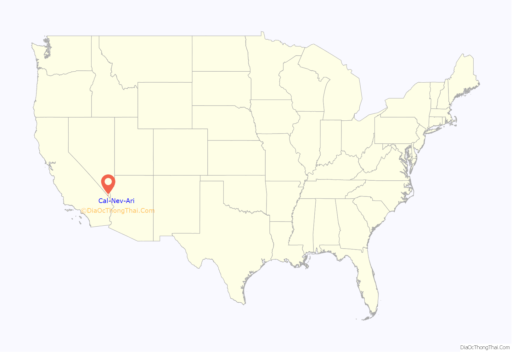
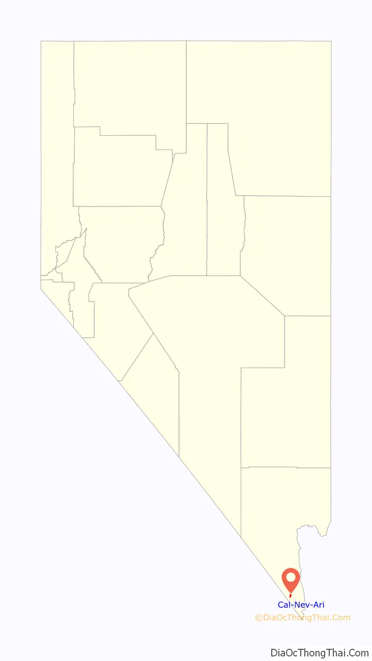
Cal-Nev-Ari location map. Where is Cal-Nev-Ari CDP?
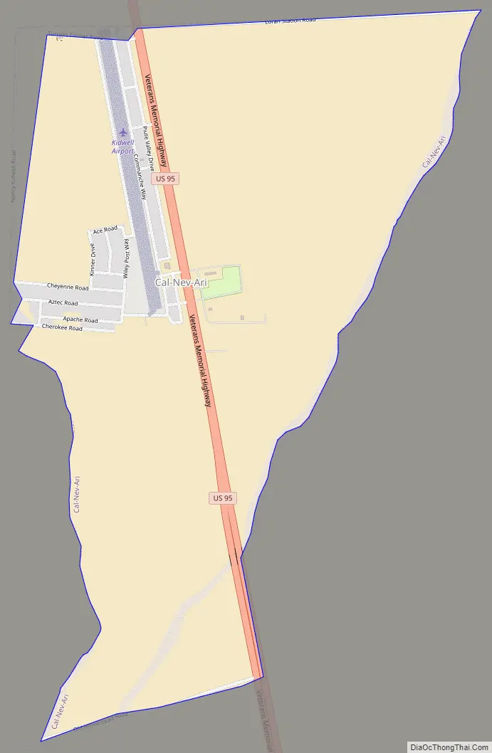
Cal-Nev-Ari Road Map
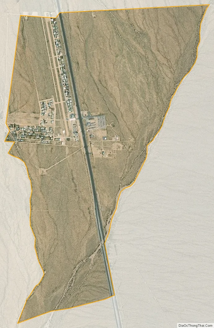
Cal-Nev-Ari city Satellite Map
Geography
Cal-Nev-Ari is located at 35°18′12″N 114°52′51″W / 35.30333°N 114.88083°W / 35.30333; -114.88083Coordinates: 35°18′12″N 114°52′51″W / 35.30333°N 114.88083°W / 35.30333; -114.88083 (35.303196, -114.880795).
According to the United States Census Bureau, the CDP has a total area of 2.3 square miles (6.0 km), all of it land.
See also
Map of Nevada State and its subdivision: Map of other states:- Alabama
- Alaska
- Arizona
- Arkansas
- California
- Colorado
- Connecticut
- Delaware
- District of Columbia
- Florida
- Georgia
- Hawaii
- Idaho
- Illinois
- Indiana
- Iowa
- Kansas
- Kentucky
- Louisiana
- Maine
- Maryland
- Massachusetts
- Michigan
- Minnesota
- Mississippi
- Missouri
- Montana
- Nebraska
- Nevada
- New Hampshire
- New Jersey
- New Mexico
- New York
- North Carolina
- North Dakota
- Ohio
- Oklahoma
- Oregon
- Pennsylvania
- Rhode Island
- South Carolina
- South Dakota
- Tennessee
- Texas
- Utah
- Vermont
- Virginia
- Washington
- West Virginia
- Wisconsin
- Wyoming