Goodsprings is an unincorporated community in Clark County, Nevada, United States. The population was 229 at the 2010 census.
| Name: | Goodsprings CDP |
|---|---|
| LSAD Code: | 57 |
| LSAD Description: | CDP (suffix) |
| State: | Nevada |
| County: | Clark County |
| Founded: | 1900; 123 years ago (1900) |
| Elevation: | 3,707 ft (1,130 m) |
| Total Area: | 0.98 sq mi (2.53 km²) |
| Land Area: | 0.98 sq mi (2.53 km²) |
| Water Area: | 0.00 sq mi (0.00 km²) |
| Total Population: | 162 |
| Population Density: | 165.81/sq mi (64.03/km²) |
| ZIP code: | 89019 |
| Area code: | 702 and 725 |
| FIPS code: | 3229500 |
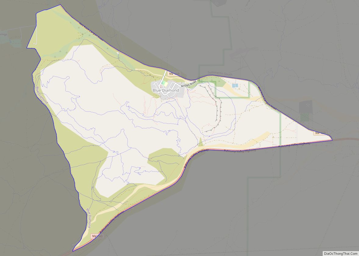
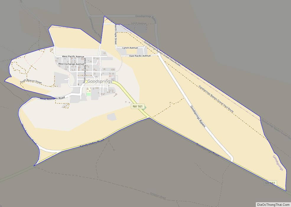
Online Interactive Map
Click on ![]() to view map in "full screen" mode.
to view map in "full screen" mode.
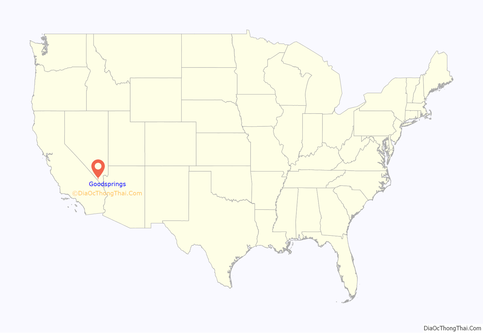
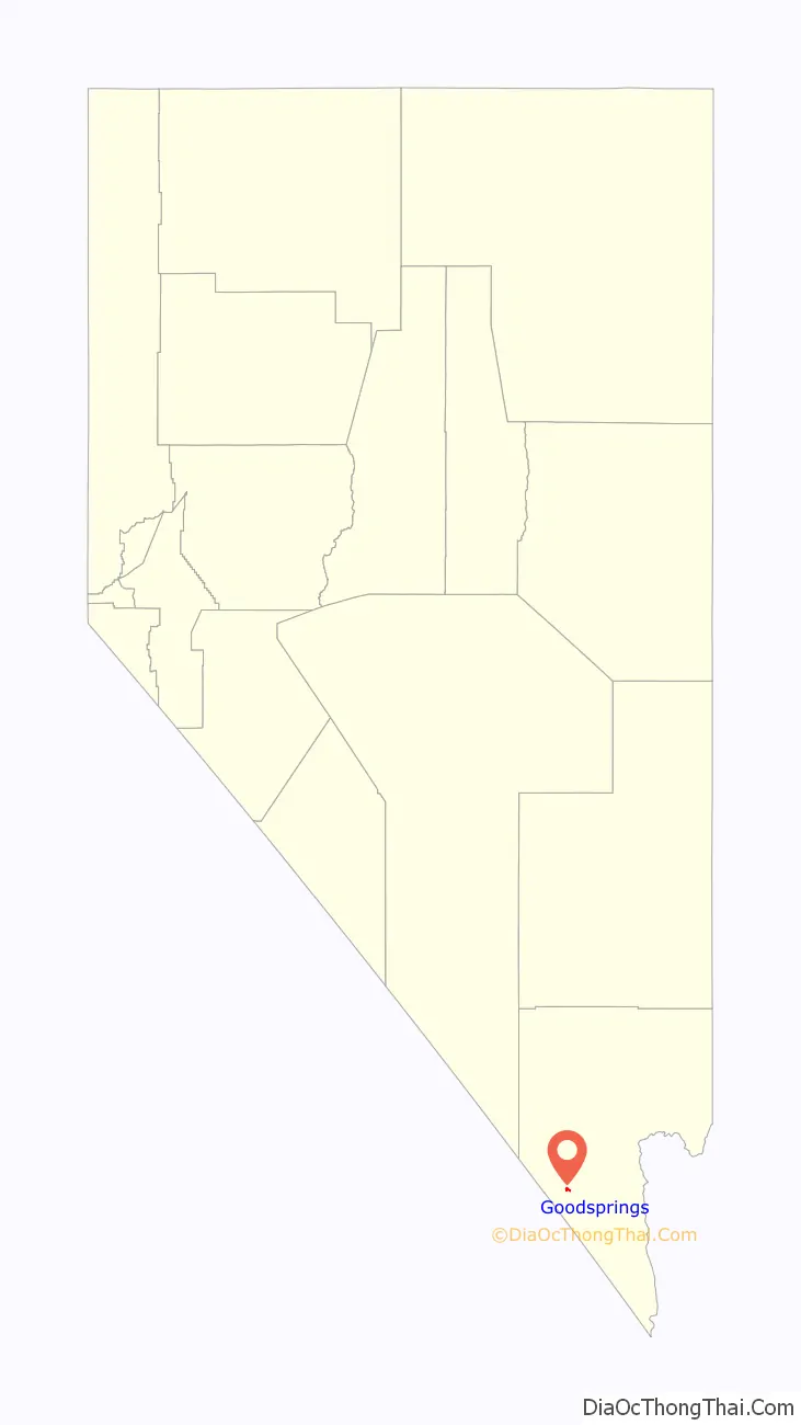
Goodsprings location map. Where is Goodsprings CDP?
History
Named for Joseph Good, whose cattle frequented a spring nestled in the southeastern foothills of the Spring Mountains, Goodsprings was once the heart of the most productive mining districts in Clark County. Over the years, lead, silver, copper, zinc and gold have all been mined from this area. Before 1900, a small cluster of tent cabins and a mill were erected, and a post office. Lincoln County established Goodsprings Township. In 1904, Salt Lake City mining interests platted the Goodsprings Township. Most early buildings in the town were constructed during the boom spurred by the railroad in 1910–1911.
After a number of moves, the current Goodsprings Schoolhouse was erected in 1913. Now on the National Register of Historic Places, it is the oldest school in Clark County that was built as a school and is still used as a school. Due to a shortage of funds, however, the Clark County School District is currently considering shutting the school down.
After World War I, mining slowed and families moved away. World War II created a second boom, but it too slowed after the war ended. The town’s population has dwindled to approximately 200.
Goodsprings is the home of the Pioneer Saloon, considered to be one of the oldest saloons in Nevada (over 100 years old). The saloon features a bullet hole on the side of the building and a coroner’s letter describing how it was created. The saloon is said by many to be haunted by the victim’s ghost. In addition, the Pioneer Saloon has a small memorial to both Clark Gable and Carole Lombard. Ms. Lombard’s plane TWA Flight 3 crashed into nearby Potosi Mountain on January 16, 1942. The saloon and hotel were the centers of operations for the search. The accident resulted in her death.
The Goodsprings Waste Heat Recovery Station opened in 2010, providing 5MW of energy from waste heat produced at a Kern River Pipeline compressor station.
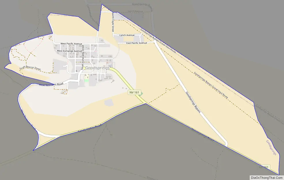
Goodsprings Road Map
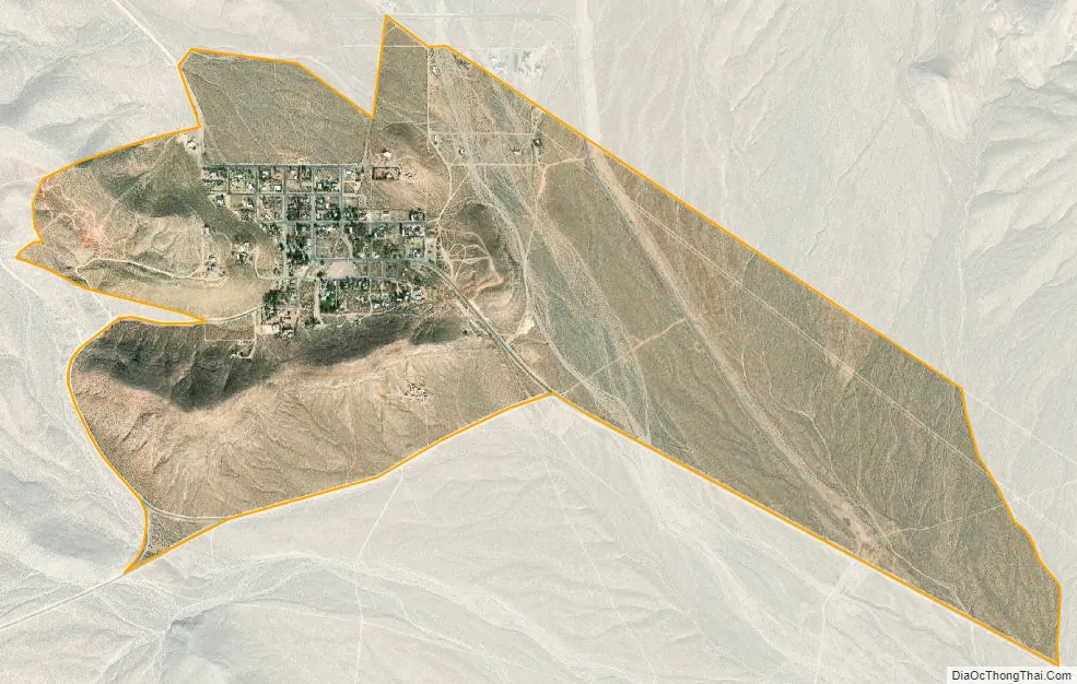
Goodsprings city Satellite Map
Geography
Goodsprings is in the Goodsprings Valley of southern Nevada. The Bird Spring Range lies to the northeast with Las Vegas beyond. The community is on Nevada State Route 161 five miles northeast of Jean and Interstate 15.
According to the United States Census Bureau, the census-designated place (CDP) of Goodsprings has a total area of 1.5 square miles (3.9 km), all of it land.
Climate
Goodsprings experiences an arid climate with long, hot summers, and mild winters.
See also
Map of Nevada State and its subdivision: Map of other states:- Alabama
- Alaska
- Arizona
- Arkansas
- California
- Colorado
- Connecticut
- Delaware
- District of Columbia
- Florida
- Georgia
- Hawaii
- Idaho
- Illinois
- Indiana
- Iowa
- Kansas
- Kentucky
- Louisiana
- Maine
- Maryland
- Massachusetts
- Michigan
- Minnesota
- Mississippi
- Missouri
- Montana
- Nebraska
- Nevada
- New Hampshire
- New Jersey
- New Mexico
- New York
- North Carolina
- North Dakota
- Ohio
- Oklahoma
- Oregon
- Pennsylvania
- Rhode Island
- South Carolina
- South Dakota
- Tennessee
- Texas
- Utah
- Vermont
- Virginia
- Washington
- West Virginia
- Wisconsin
- Wyoming