Mesquite is a city in Clark County, Nevada, United States adjacent to the Arizona state line and 80 miles (130 km) northeast of Las Vegas on Interstate 15. As of the 2020 census, the city had a population of 20,471. The city is located in the Virgin River valley adjacent to the Virgin Mountains in the northeastern part of the Mojave Desert. It is home to a growing retirement community, as well as several casino resorts and golf courses.
| Name: | Mesquite city |
|---|---|
| LSAD Code: | 25 |
| LSAD Description: | city (suffix) |
| State: | Nevada |
| County: | Clark County |
| Incorporated: | 1984 |
| Elevation: | 1,601 ft (488 m) |
| Total Area: | 32.23 sq mi (83.47 km²) |
| Land Area: | 31.76 sq mi (82.27 km²) |
| Water Area: | 0.47 sq mi (1.20 km²) |
| Total Population: | 20,471 |
| Population Density: | 644.47/sq mi (248.84/km²) |
| ZIP code: | 89024, 89027, 89034 |
| Area code: | 702 and 725 |
| FIPS code: | 3246000 |
| GNISfeature ID: | 0842060 |
| Website: | www.mesquitenv.gov |
Online Interactive Map
Click on ![]() to view map in "full screen" mode.
to view map in "full screen" mode.
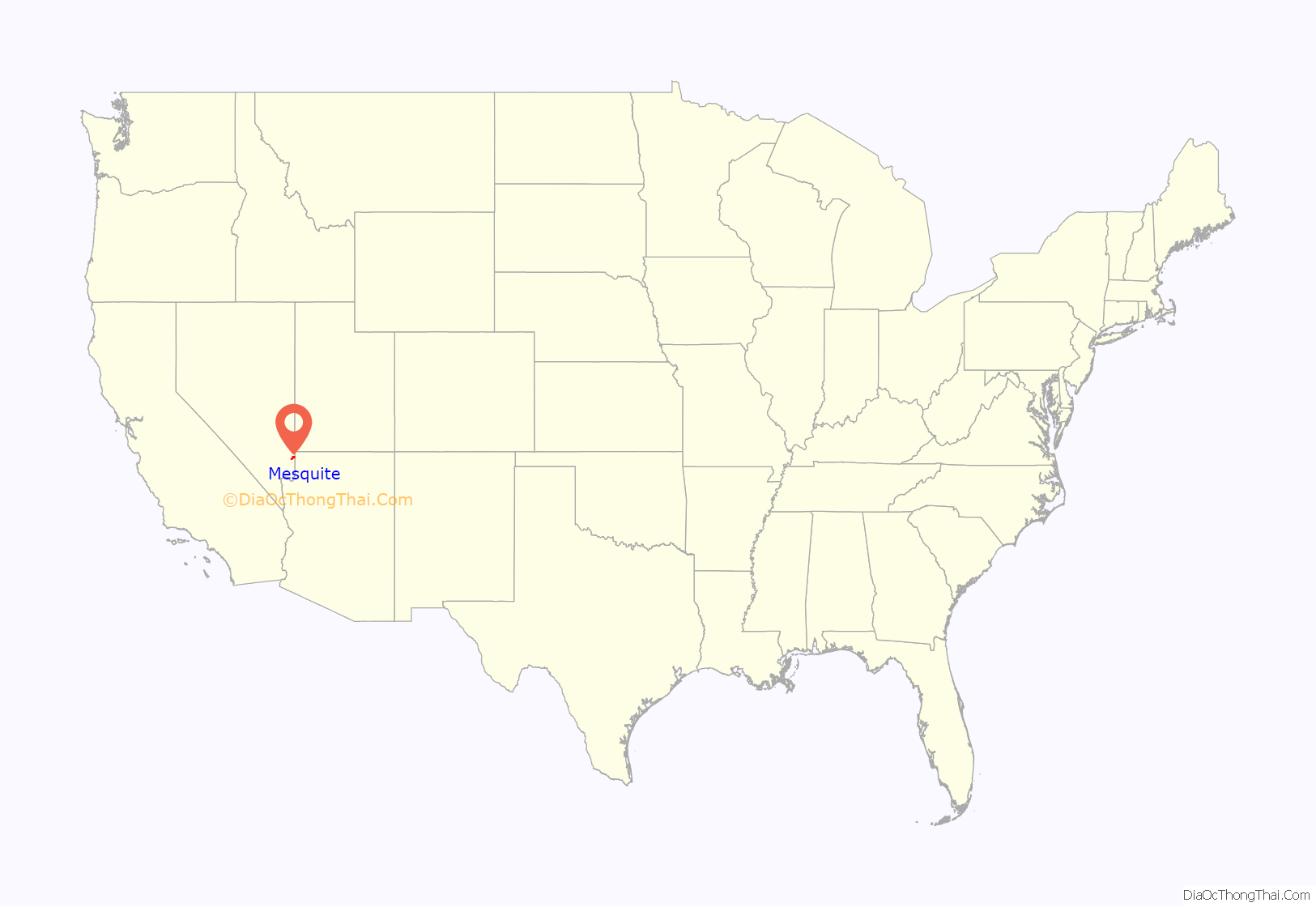
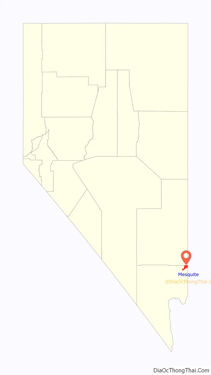
Mesquite location map. Where is Mesquite city?
History
Mesquite was settled by Mormon pioneers in 1880, who called it Mesquite Flat. The community was finally established on the third attempt after having been flooded out from the waters of the Virgin River. The name was later shortened to Mesquite, and the city was incorporated 1984. The community was named for the mesquite timber near the original town site. Mesquite, like nearby Bunkerville, had its origins in farming. The Peppermill Mesquite casino, which opened in the 1970s, drove Mesquite’s diversified economy. The city incorporated in 1984 and established a master development plan during the early 1990s. In the mid-1990s, more casinos opened. By 2006, Mesquite was one of the fastest-growing small towns in the United States, though the late-2000s recession led to the closure of the Oasis (formerly the Peppermill) casino.
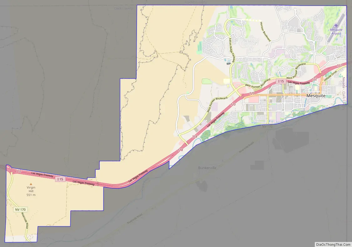
Mesquite Road Map
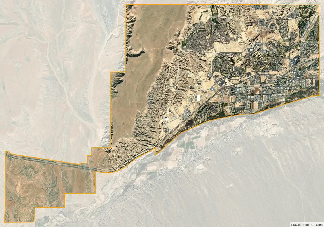
Mesquite city Satellite Map
Geography
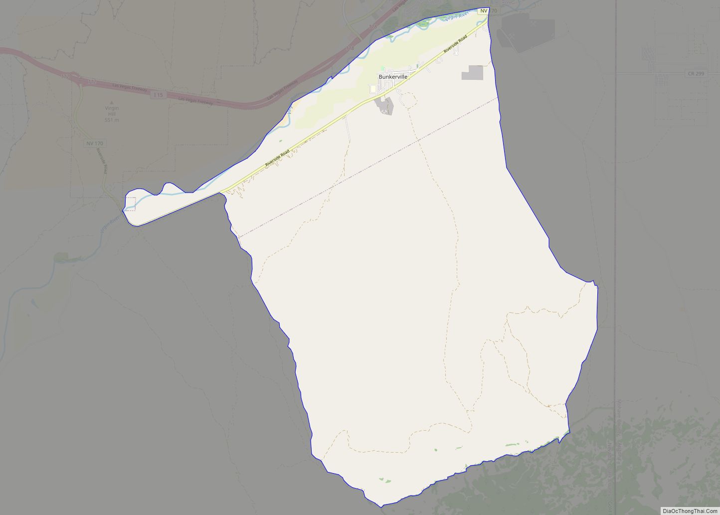
Mesquite occupies the northeast corner of Clark County. The eastern border of the city is the Arizona state line. The city is in the Virgin River valley, occupying the northern side of the river. The city lies adjacent to the Virgin Mountains in the northeastern Mojave Desert near the southern mouth of the Virgin River Gorge.
Interstate 15 passes through the city, leading southwest 80 miles (130 km) to downtown Las Vegas and northeast 39 miles (63 km) to St. George, Utah. Nevada State Route 170 leads south from the center of town, crossing the Virgin River into the unincorporated community of Bunkerville before looping back to I-15 at the western city limits of Mesquite.
According to the U.S. Census Bureau, the city of Mesquite has a total area of 32.4 square miles (83.8 km), of which 31.9 square miles (82.6 km) is land and 0.46 square miles (1.2 km), or 1.40%, is water.
See also
Map of Nevada State and its subdivision: Map of other states:- Alabama
- Alaska
- Arizona
- Arkansas
- California
- Colorado
- Connecticut
- Delaware
- District of Columbia
- Florida
- Georgia
- Hawaii
- Idaho
- Illinois
- Indiana
- Iowa
- Kansas
- Kentucky
- Louisiana
- Maine
- Maryland
- Massachusetts
- Michigan
- Minnesota
- Mississippi
- Missouri
- Montana
- Nebraska
- Nevada
- New Hampshire
- New Jersey
- New Mexico
- New York
- North Carolina
- North Dakota
- Ohio
- Oklahoma
- Oregon
- Pennsylvania
- Rhode Island
- South Carolina
- South Dakota
- Tennessee
- Texas
- Utah
- Vermont
- Virginia
- Washington
- West Virginia
- Wisconsin
- Wyoming