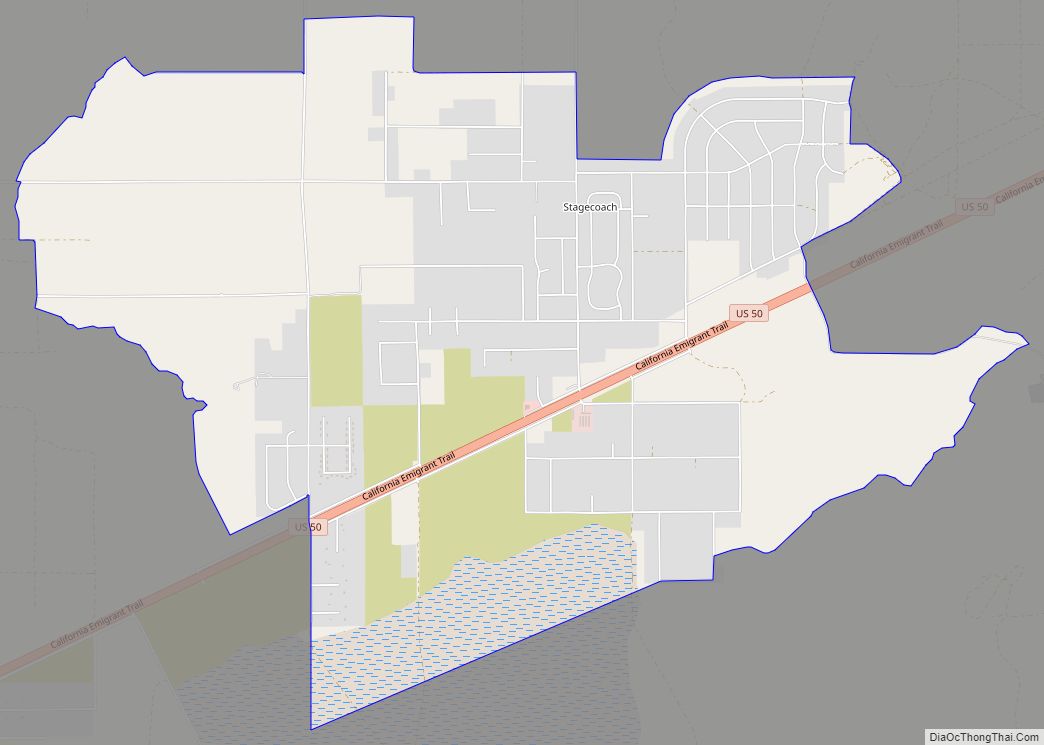
Stagecoach is an unincorporated community and census-designated place (CDP) in Lyon County, Nevada, United States, located east of Reno. Its name is likely derived from its place as the Overland Stagecoach station at Desert Well. Typically, the mail that was heading towards California was delivered on a steamship through Panama. But in 1857, the Overland mail company was created, and the Desert Well station was a dual stop for both the stagecoach line and the Pony Express.
As of the 2010 census, the population of Stagecoach was 1,874.
| Name: | Stagecoach CDP |
|---|---|
| LSAD Code: | 57 |
| LSAD Description: | CDP (suffix) |
| State: | Nevada |
| County: | Lyon County |
| Elevation: | 4,347 ft (1,325 m) |
| Total Area: | 8.35 sq mi (21.61 km²) |
| Land Area: | 8.35 sq mi (21.61 km²) |
| Water Area: | 0.00 sq mi (0.00 km²) |
| Total Population: | 2,022 |
| Population Density: | 242.30/sq mi (93.55/km²) |
| ZIP code: | 89429 |
| FIPS code: | 3268800 |
| GNISfeature ID: | 0850746 |
Online Interactive Map
Click on ![]() to view map in "full screen" mode.
to view map in "full screen" mode.
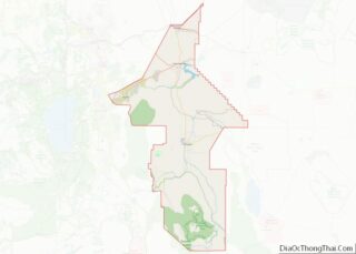
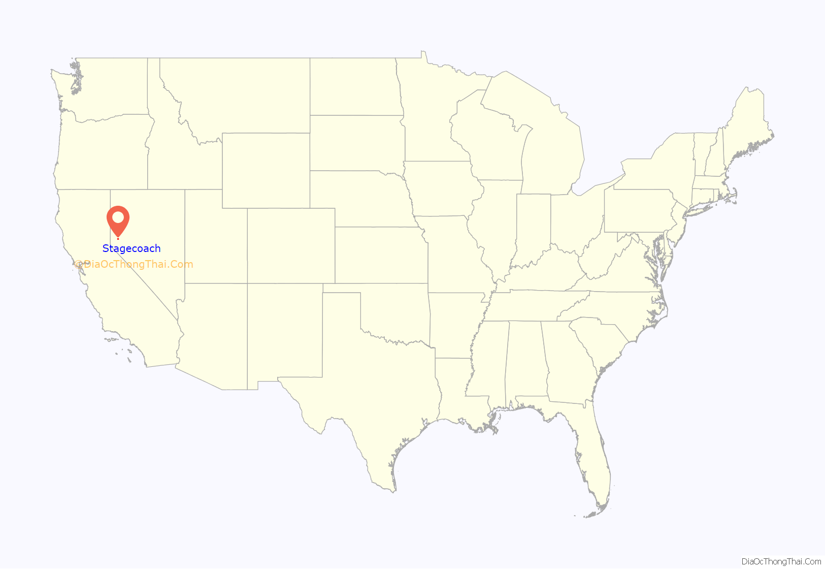
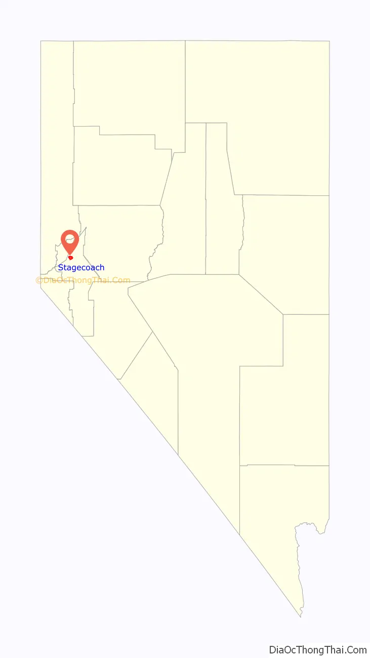
Stagecoach location map. Where is Stagecoach CDP?
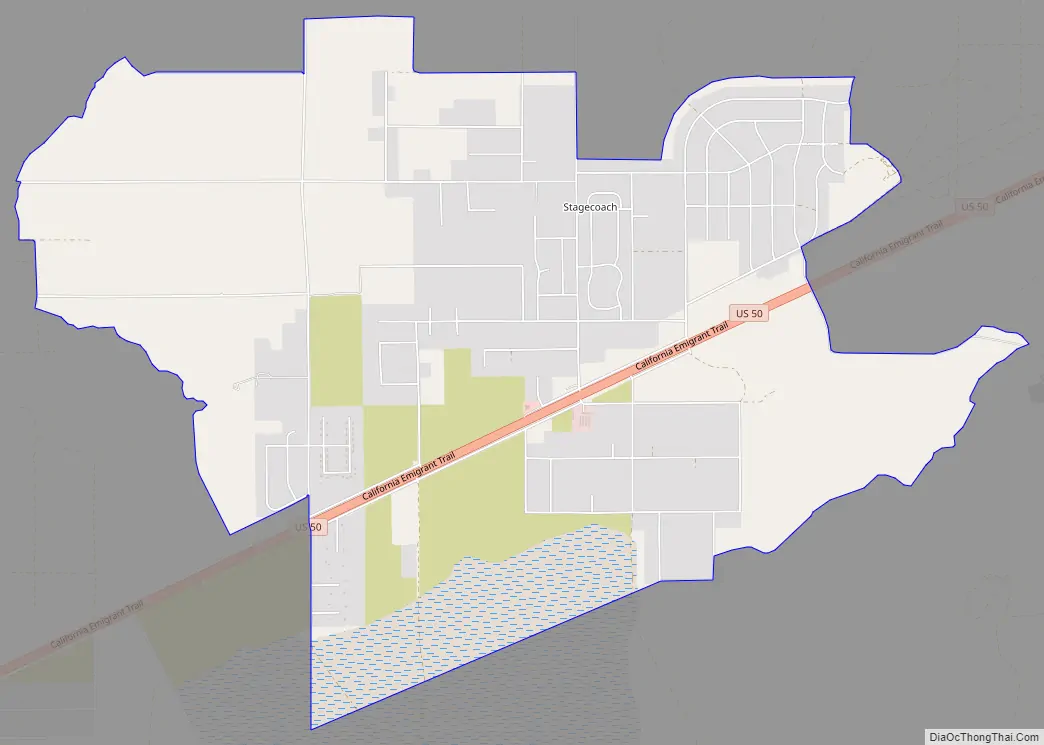
Stagecoach Road Map
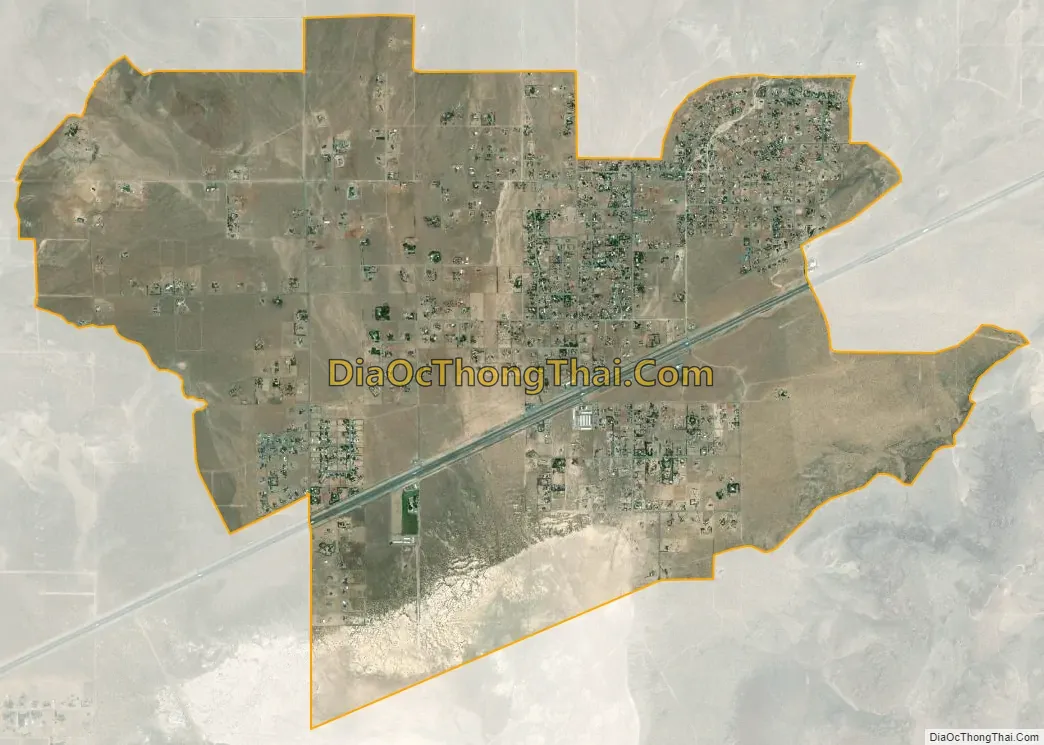
Stagecoach city Satellite Map
Geography
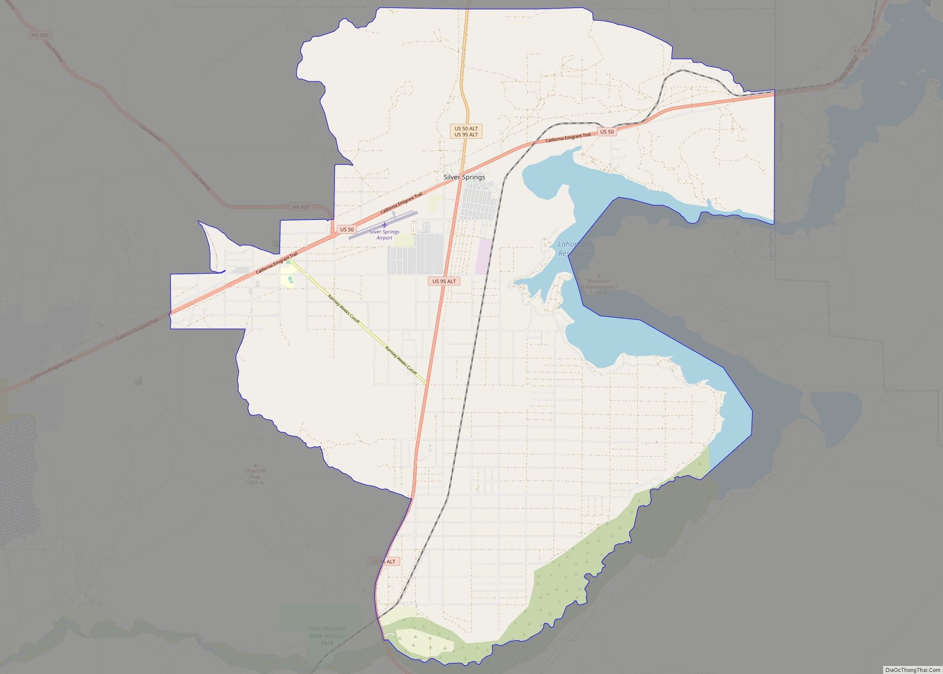
Stagecoach is located along U.S. Route 50, 9 miles (14 km) west of Silver Springs, 16 miles (26 km) northeast of Dayton and 27 miles (43 km) east of Carson City. According to the U.S. Census Bureau, the Stagecoach CDP has an area of 8.3 square miles (21.6 km), all land.
See also
Map of Nevada State and its subdivision: Map of other states:- Alabama
- Alaska
- Arizona
- Arkansas
- California
- Colorado
- Connecticut
- Delaware
- District of Columbia
- Florida
- Georgia
- Hawaii
- Idaho
- Illinois
- Indiana
- Iowa
- Kansas
- Kentucky
- Louisiana
- Maine
- Maryland
- Massachusetts
- Michigan
- Minnesota
- Mississippi
- Missouri
- Montana
- Nebraska
- Nevada
- New Hampshire
- New Jersey
- New Mexico
- New York
- North Carolina
- North Dakota
- Ohio
- Oklahoma
- Oregon
- Pennsylvania
- Rhode Island
- South Carolina
- South Dakota
- Tennessee
- Texas
- Utah
- Vermont
- Virginia
- Washington
- West Virginia
- Wisconsin
- Wyoming