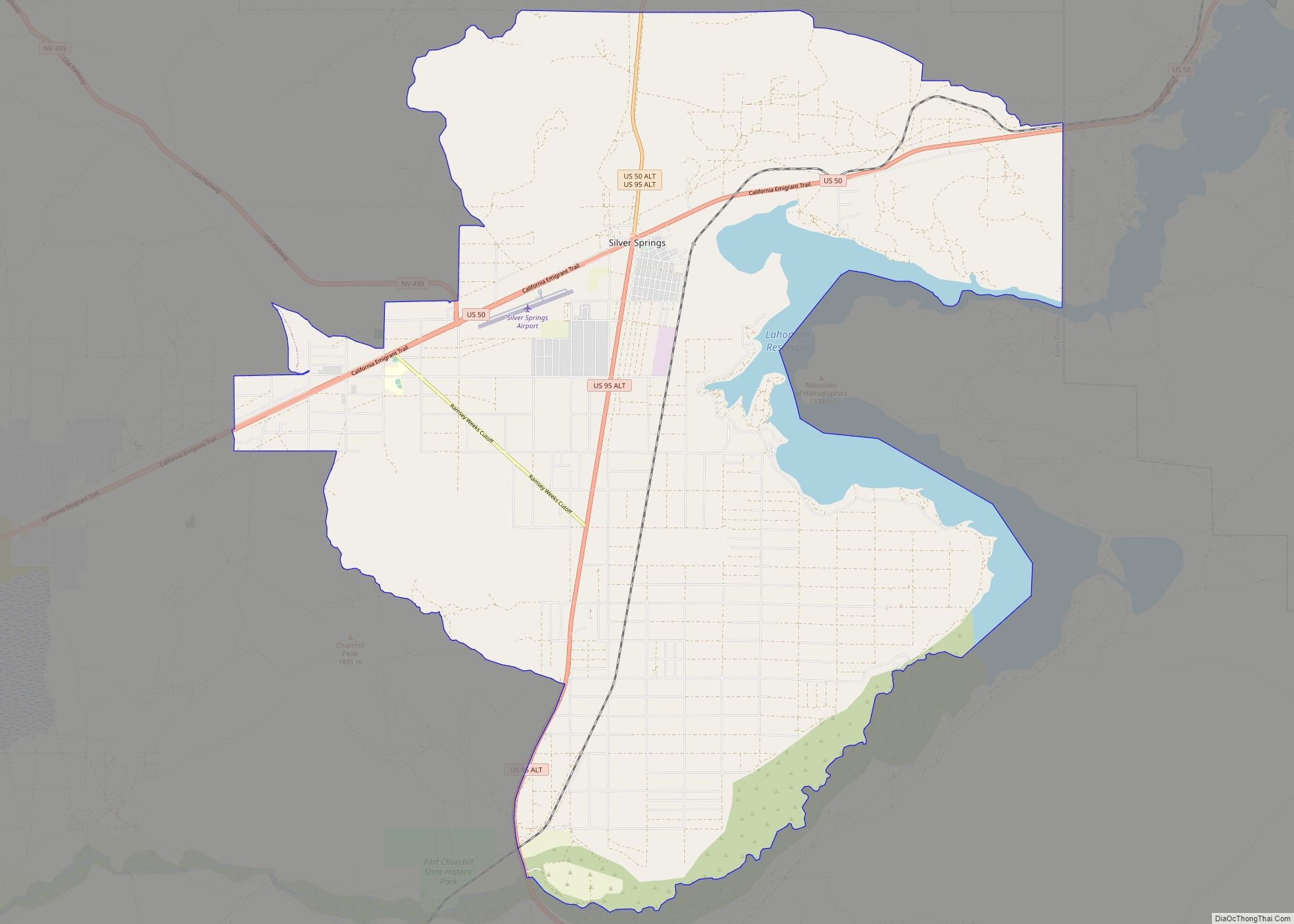
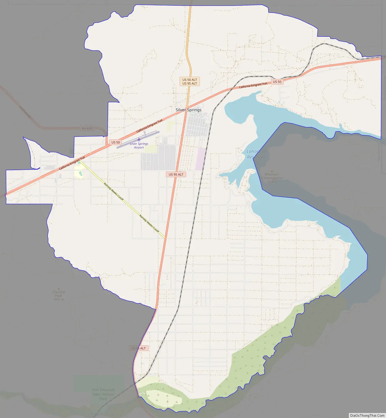
Silver Springs is a census-designated place (CDP) in Lyon County, Nevada, United States at the intersection of US 50 (California Trail) and US 95A. The population was 5,296 at the 2010 census. Lahontan Reservoir, Lahontan State Recreation Area and historic Fort Churchill State Historic Park are all located nearby. The area is served by the Silver Springs Airport.
| Name: | Silver Springs CDP |
|---|---|
| LSAD Code: | 57 |
| LSAD Description: | CDP (suffix) |
| State: | Nevada |
| County: | Lyon County |
| Elevation: | 4,200 ft (1,300 m) |
| Total Area: | 77.14 sq mi (199.78 km²) |
| Land Area: | 71.63 sq mi (185.51 km²) |
| Water Area: | 5.51 sq mi (14.27 km²) |
| Total Population: | 5,629 |
| Population Density: | 78.59/sq mi (30.34/km²) |
| ZIP code: | 89429 |
| Area code: | 775 |
| FIPS code: | 3267200 |
| GNISfeature ID: | 0858187 |
Online Interactive Map
Click on ![]() to view map in "full screen" mode.
to view map in "full screen" mode.
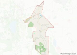
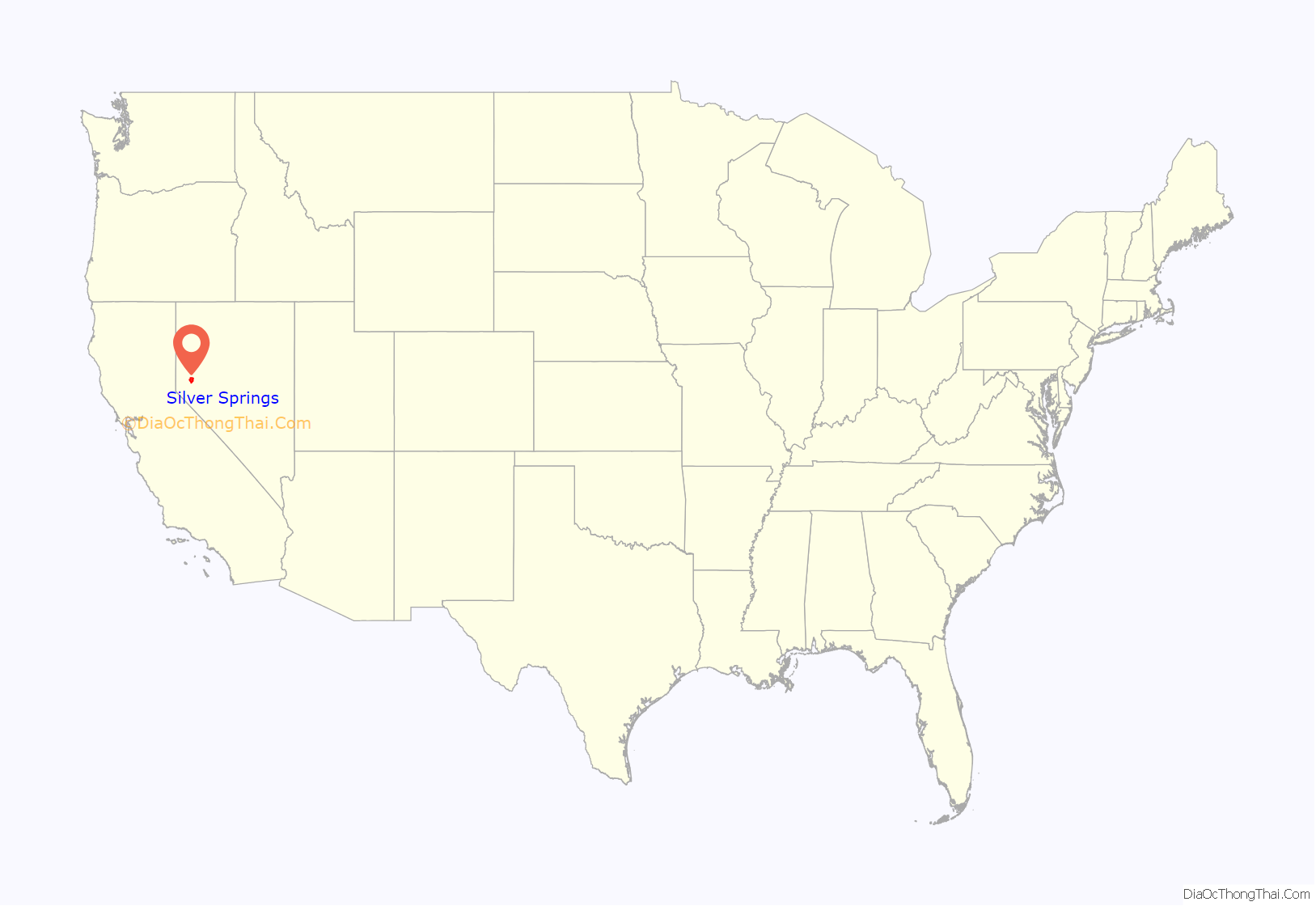
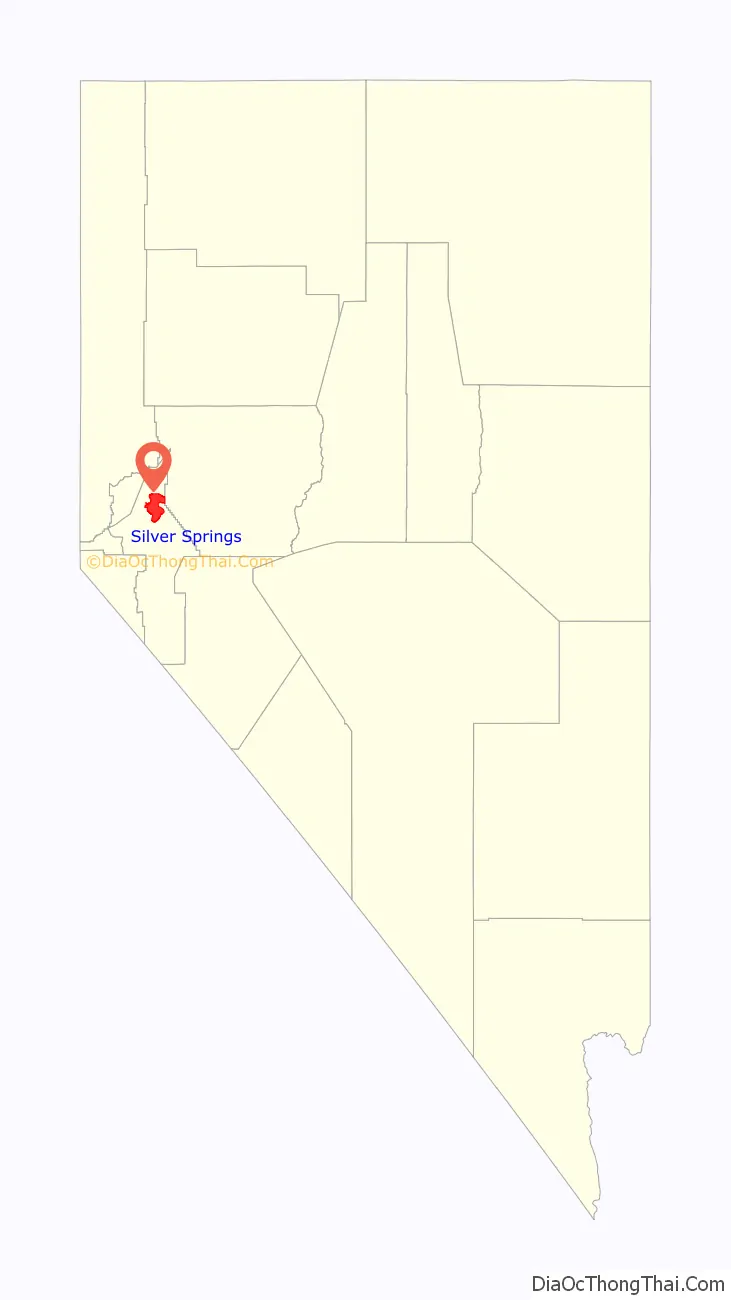
Silver Springs location map. Where is Silver Springs CDP?
Silver Springs Road Map
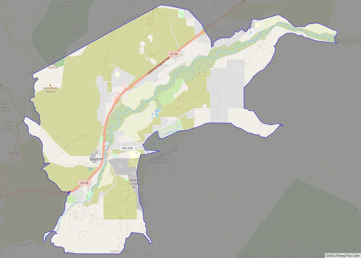
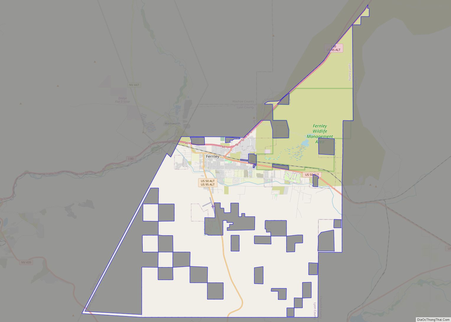
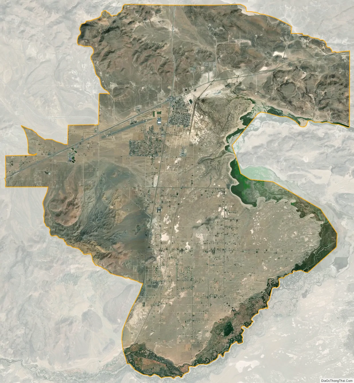
Silver Springs city Satellite Map
Geography
Silver Springs is located in northern Lyon County at 39°22′14″N 119°13′15″W / 39.370429°N 119.220862°W / 39.370429; -119.220862. U.S. Route 50 leads east 26 miles (42 km) to Fallon and west 36 miles (58 km) to Carson City, the state capital. U.S. Route 95A leads north 15 miles (24 km) to Interstate 80 at Fernley and south 32 miles (51 km) to Yerington, the county seat.
According to the United States Census Bureau, the CDP has a total area of 77.1 square miles (199.7 km) of which 71.6 square miles (185.5 km) are land and 5.5 square miles (14.3 km), or 7.15%, are water. The Carson River forms the southern and eastern edges of the CDP; on the east side it is impounded to form Lahontan Reservoir. Lahontan State Recreation Area, on the shores of the reservoir, is within the CDP. Fort Churchill State Historic Park is just west of the CDP boundary, 9 miles (14 km) south of the US-50/US-95A junction.
See also
Map of Nevada State and its subdivision: Map of other states:- Alabama
- Alaska
- Arizona
- Arkansas
- California
- Colorado
- Connecticut
- Delaware
- District of Columbia
- Florida
- Georgia
- Hawaii
- Idaho
- Illinois
- Indiana
- Iowa
- Kansas
- Kentucky
- Louisiana
- Maine
- Maryland
- Massachusetts
- Michigan
- Minnesota
- Mississippi
- Missouri
- Montana
- Nebraska
- Nevada
- New Hampshire
- New Jersey
- New Mexico
- New York
- North Carolina
- North Dakota
- Ohio
- Oklahoma
- Oregon
- Pennsylvania
- Rhode Island
- South Carolina
- South Dakota
- Tennessee
- Texas
- Utah
- Vermont
- Virginia
- Washington
- West Virginia
- Wisconsin
- Wyoming