Fernley is a city in Lyon County, Nevada, United States, and part of the Reno–Tahoe-Sparks metropolitan area CSA. The city was incorporated in 2001. The population of the city was 19,368 at the 2010 census.
Fernley was home to the historic and one of the first Amazon.com centers in the world, which has since relocated within the metro area. Naval Air Station (TOPGUN), the U.S. Navy’s Naval Strike and Air Warfare Center & TOPGUN training program since 1996, was moved nearby, to Fallon, from Naval Air Station Miramar. The city is home to the Reno-Fernley Raceway, Tesla’s Gigafactory 1 that produces battery packs and vehicle components nearby at the Tahoe Reno Industrial Center, and an under-construction lithium recycling plant by American Battery Technology Company.
| Name: | Fernley city |
|---|---|
| LSAD Code: | 25 |
| LSAD Description: | city (suffix) |
| State: | Nevada |
| County: | Lyon County |
| Founded: | 1904; 119 years ago (1904) |
| Incorporated: | July 1, 2001; 21 years ago (2001-07-01) |
| Elevation: | 4,160 ft (1,270 m) |
| Total Area: | 128.39 sq mi (332.52 km²) |
| Land Area: | 121.65 sq mi (315.07 km²) |
| Water Area: | 6.74 sq mi (17.44 km²) |
| Total Population: | 22,895 |
| Population Density: | 188.20/sq mi (72.67/km²) |
| ZIP code: | 89408 |
| Area code: | 775 |
| FIPS code: | 3224900 |
| GNISfeature ID: | 0840446 |
| Website: | www.cityoffernley.org |
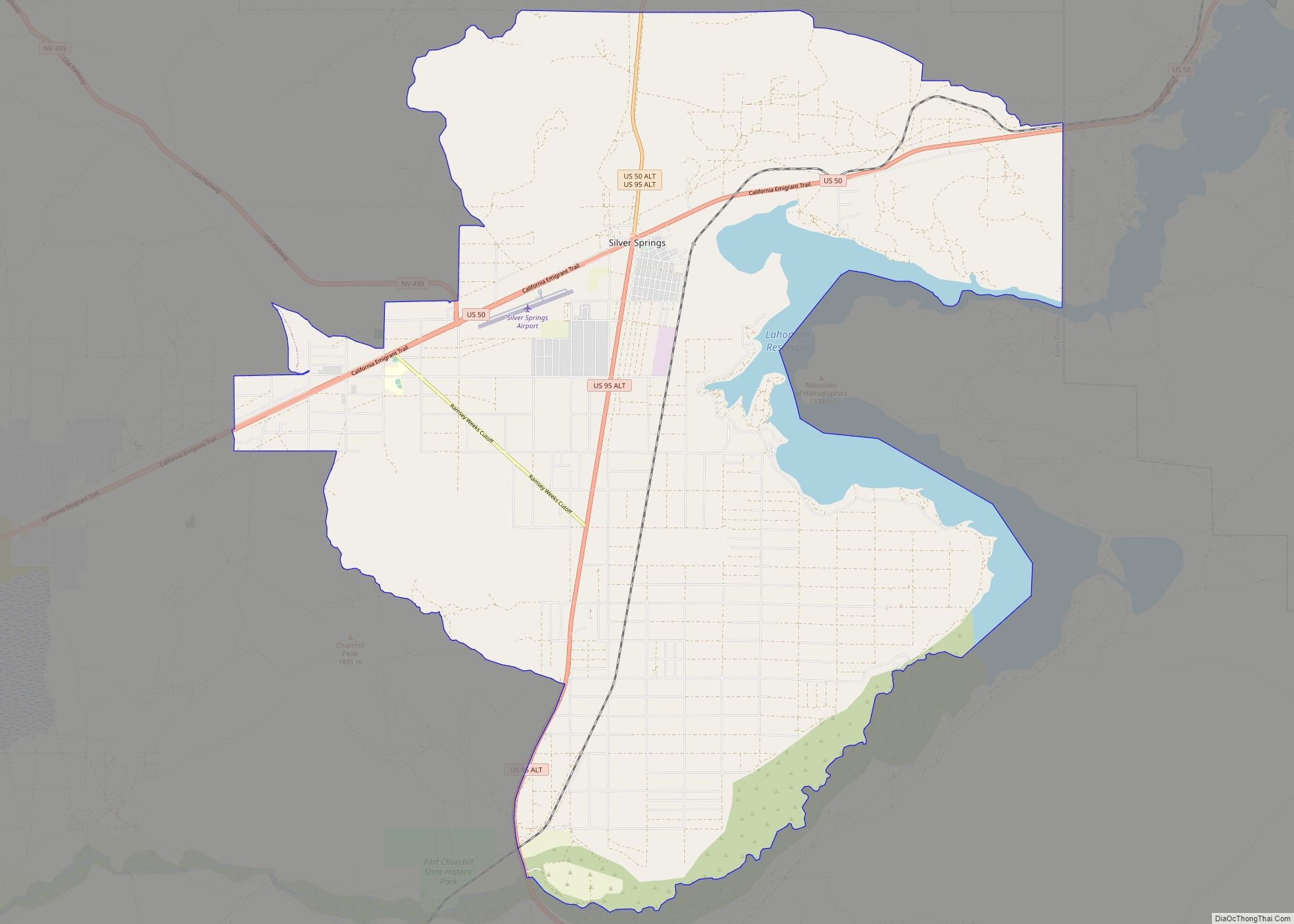
Online Interactive Map
Click on ![]() to view map in "full screen" mode.
to view map in "full screen" mode.
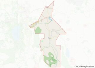
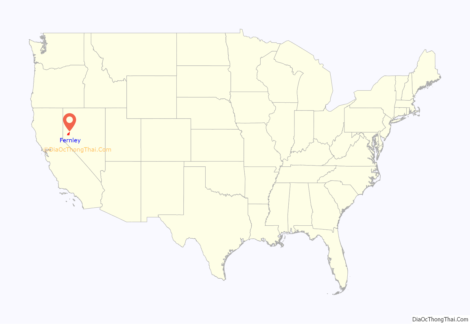
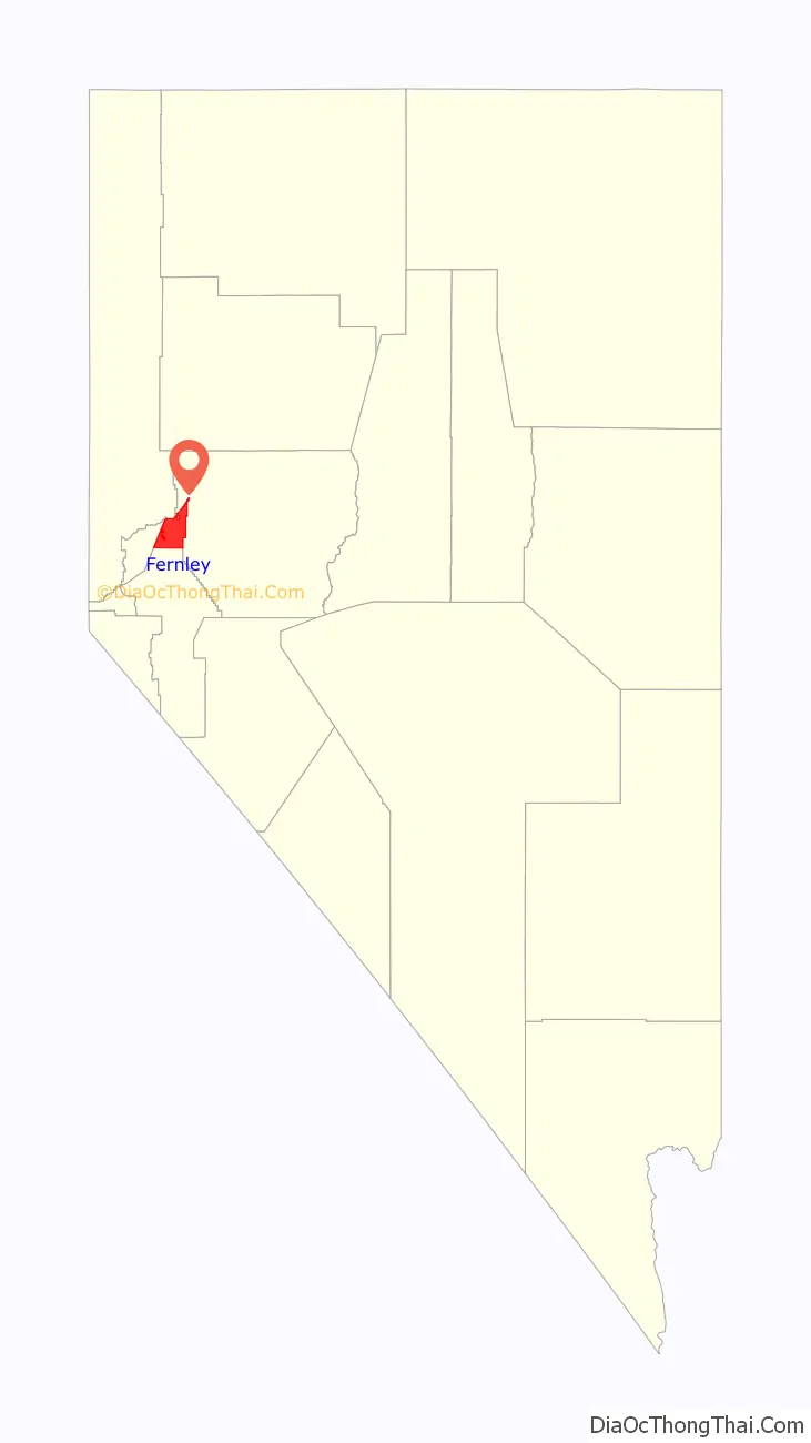
Fernley location map. Where is Fernley city?
History
Fernley, established in 1904, developed as primarily an agricultural and ranching community in proximity to Reno. It is unknown why the name “Fernley” was applied to this community. It, along with the defunct settlement of Fernley, California are the only two known places in the world to have the name Fernley.
Much of the farmland in the Fernley area was developed through the Newlands Irrigation Project, which was a result of the Newlands Reclamation Act of 1902. The project established an irrigation system that delivers water to an area stretching from Derby Dam, along the Truckee River, to the Lahontan Reservoir near Fallon, Nevada. Construction and expansion of the system took place from the inception through the 1960s. Many of the concrete irrigation headgates, still in use today, are embossed with the CCC (Civilian Conservation Corps) stamp and date of construction. In addition to the irrigation system in the Fernley area, a drainage system was also constructed to carry away excess water and mineral salts from the farmlands. This system consists of channels (5 to 15 feet (1.5 to 4.6 m) deep) dug adjacent to fields; it eventually terminates in the sink northeast of Fernley. The irrigation system is administered and maintained through the Truckee–Carson Irrigation District.
The Southern Pacific Railroad completed the Fernley and Lassen Railway in 1914. The transcontinental Lincoln/Victory Highways was built through town in the 1920s.
In 1965, the Nevada Cement Company started operation in a new plant built on the north side of the city between Fernley and Wadsworth. This was the first significant non-agricultural/ranching business to come to Fernley, aside from the railroad. Primary employment in Fernley began a steady transition to an industrial and commuter base. Beginning in the 1970s, parts of the formerly agricultural and ranching-based lands were transitioning to housing subdivisions to support the growing population, much of which was spilling over from rapid growth in the Reno-Sparks area. Close proximity to Interstate 80 and abundant land for housing made Fernley an attractive alternative to the increasingly congested and expensive Truckee Meadows housing market. Beginning near the established parts of the town, growth moved to the Fremont Street area in the mid to late 1970s, nearer farming areas in the 1980s, and has continued along the Farm District Road areas to the present. Numerous subdivisions were built along the Farm District Road, including an 18-hole golf course and a new elementary school.
In 1999, Amazon.com opened a 750,000-square-foot (70,000 m) order fulfillment center in the industrial park located in the northeast side of the city, following major initiatives and investments by investors from Seattle. Stanley Works had previously used the facility; Amazon.com moved west to Reno, NV and has redesigned the interior systems and greatly expanded the capacity in the years since. The investment has provided thousands of new jobs for the city and invigorated the economy in the metropolitan area. Since that time, more companies have opened facilities in the park, including Trex Inc., Allied Signal, UPS Worldwide Logistics (Honeywell), ARE Campers, Johns Manville. Sherwin Williams Paint and the newly constructed Polaris are part of the newer industrial area on the north east side of town, with more companies interested in relocating to the area.
On July 1, 2001, the city of Fernley was incorporated. Fernley was one of the worst hit towns in the 2008 financial crash.
On January 5, 2008, a levee along the Truckee Canal broke, forcing the rescue and evacuation of 3,500 people from the town as 3 to 6 feet (0.91 to 1.83 m) of water filled houses. A 2021 lawsuit seeks to block the U.S. Bureau of Reclamation from lining the bottom of the Truckee Canal with concrete, on the grounds that Fernley’s municipal water supply depends on seepage from the canal for groundwater recharge.
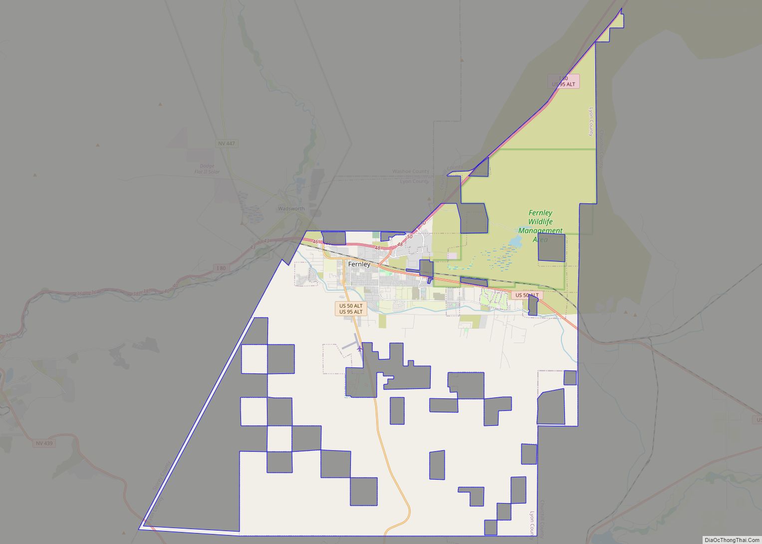
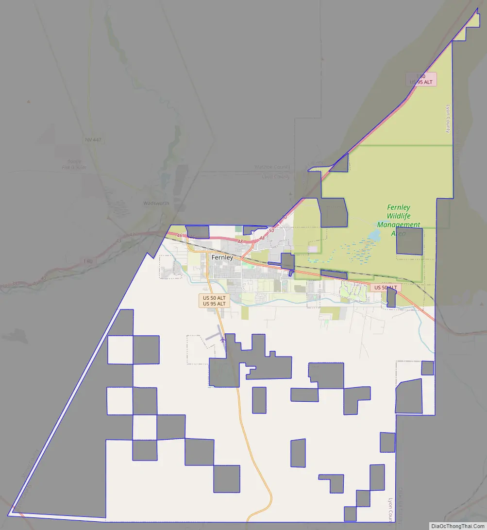
Fernley Road Map
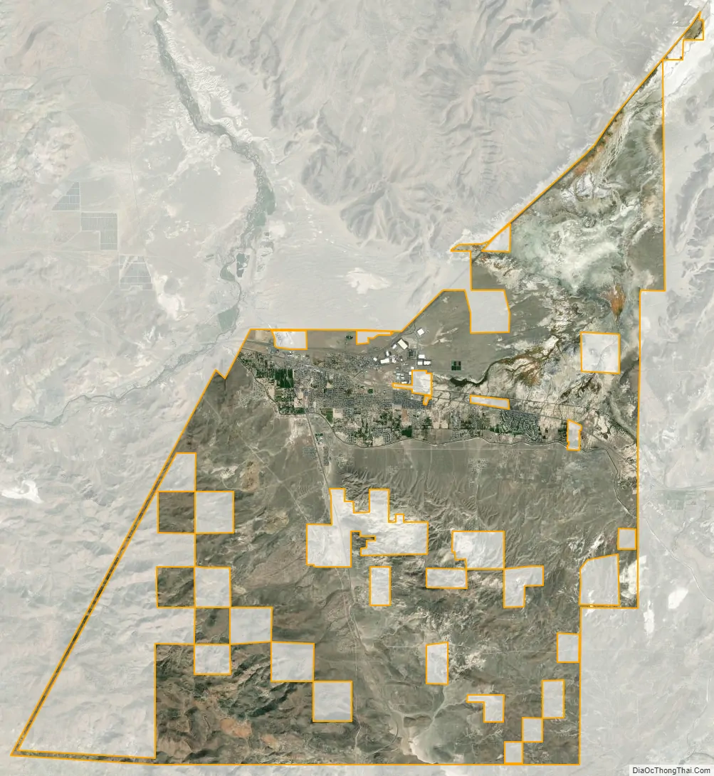
Fernley city Satellite Map
Geography
Fernley is located at the intersection of Interstate 80, U.S. Route 50 Alternate and U.S. Route 95 Alternate (US 95A). Although it originally spanned the Lyon/Washoe County line, a county boundary change in 2005 left it entirely in Lyon County.
According to the United States Census Bureau, the city has a total area of 128.8 square miles (333.7 km), of which 122.1 square miles (316.3 km) is land and 6.7 square miles (17.4 km), or 5.22%, is water.
Climate
Fernley’s climate is typical of high desert environments. The winter may bring cold temperatures and some snow, but nothing extreme is normally experienced. Summers are generally hot and very dry. Fernley’s average annual rainfall is 5 inches (130 mm).
According to the Köppen climate classification, Fernley has a cold desert climate (abbreviated BWk).
See also
Map of Nevada State and its subdivision: Map of other states:- Alabama
- Alaska
- Arizona
- Arkansas
- California
- Colorado
- Connecticut
- Delaware
- District of Columbia
- Florida
- Georgia
- Hawaii
- Idaho
- Illinois
- Indiana
- Iowa
- Kansas
- Kentucky
- Louisiana
- Maine
- Maryland
- Massachusetts
- Michigan
- Minnesota
- Mississippi
- Missouri
- Montana
- Nebraska
- Nevada
- New Hampshire
- New Jersey
- New Mexico
- New York
- North Carolina
- North Dakota
- Ohio
- Oklahoma
- Oregon
- Pennsylvania
- Rhode Island
- South Carolina
- South Dakota
- Tennessee
- Texas
- Utah
- Vermont
- Virginia
- Washington
- West Virginia
- Wisconsin
- Wyoming