Bee is an unincorporated community and census-designated place in Johnston County, Oklahoma, United States. Its population was 140 as of the 2010 census.
| Name: | Bee CDP |
|---|---|
| LSAD Code: | 57 |
| LSAD Description: | CDP (suffix) |
| State: | Oklahoma |
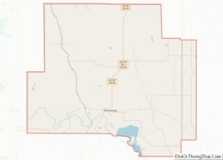
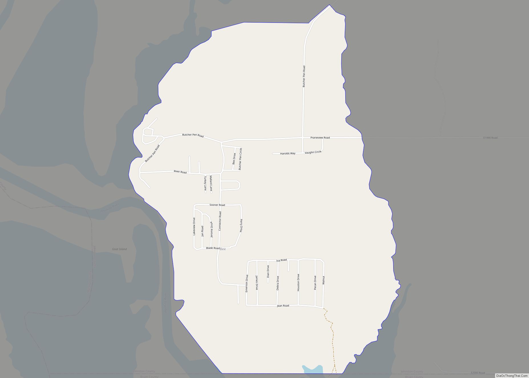
| County: | Johnston County |
| Elevation: | 699 ft (213 m) |
| Total Area: | 1.31 sq mi (3.39 km²) |
| Land Area: | 1.30 sq mi (3.37 km²) |
| Water Area: | 0.01 sq mi (0.02 km²) |
| Total Population: | 135 |
| Population Density: | 103.61/sq mi (40.02/km²) |
| FIPS code: | 4004950 |
| GNISfeature ID: | 1089957 |
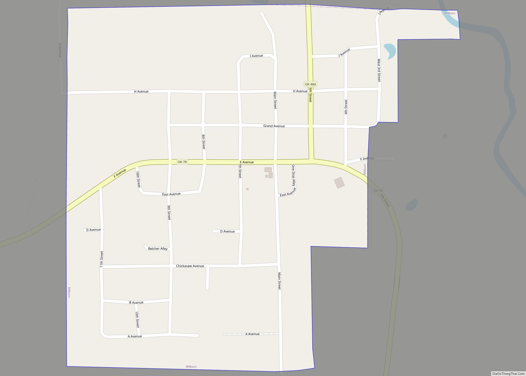
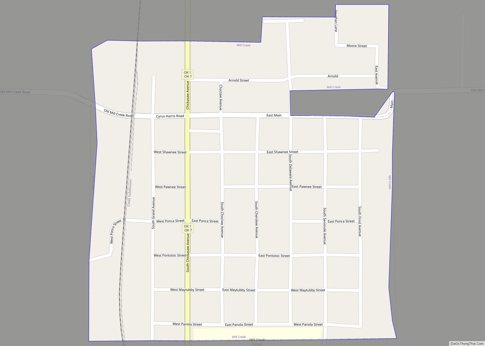
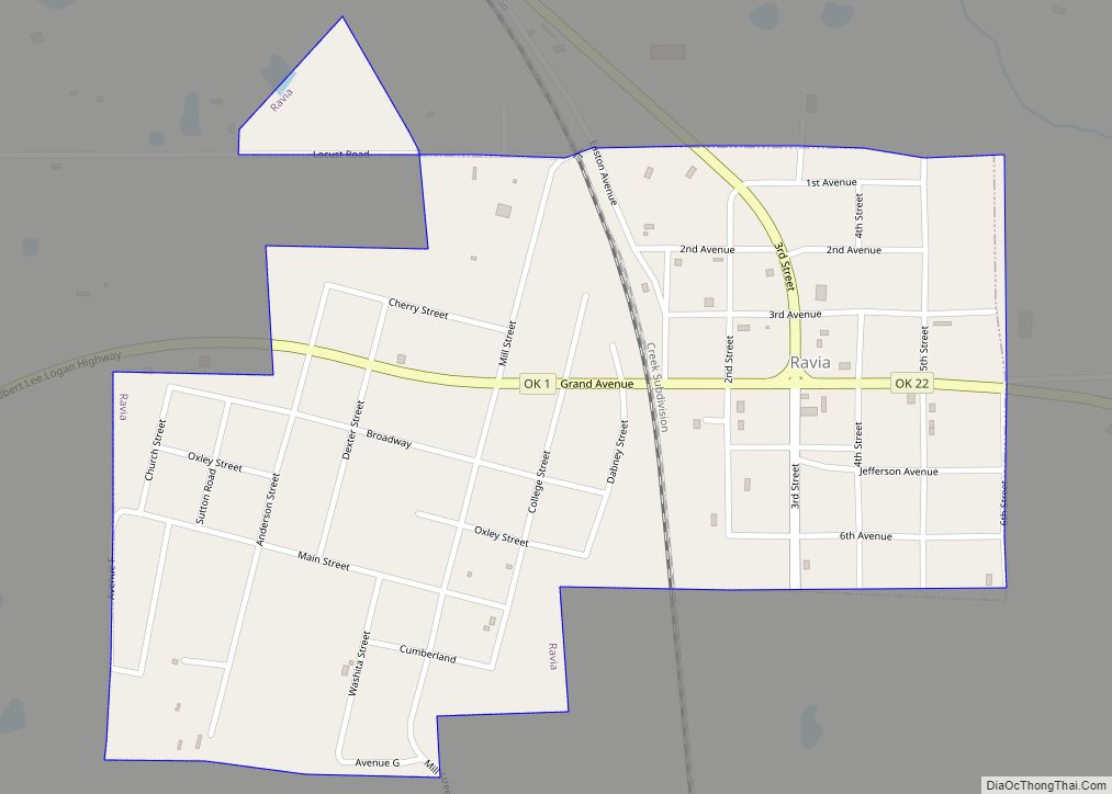
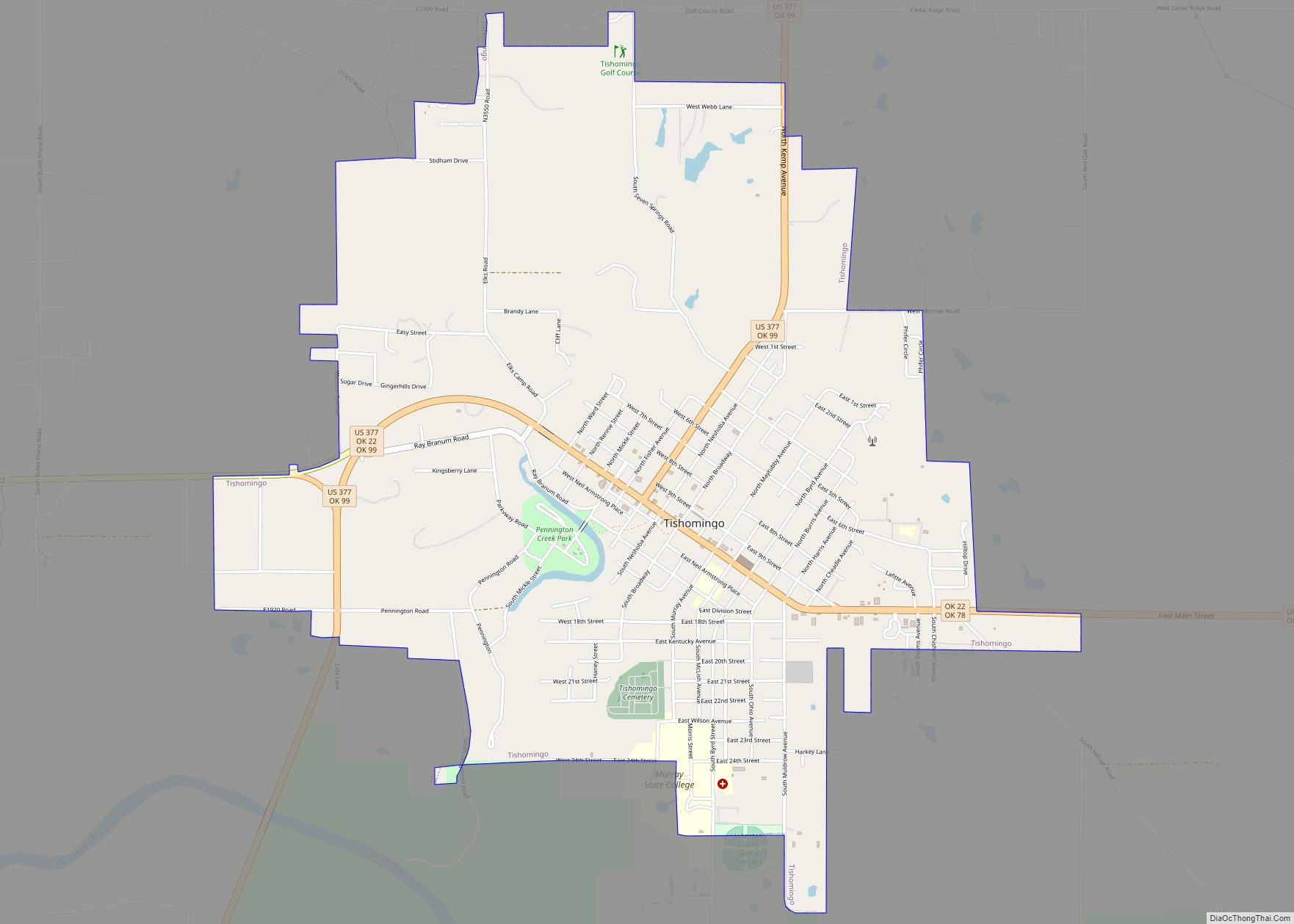
Online Interactive Map
Click on ![]() to view map in "full screen" mode.
to view map in "full screen" mode.
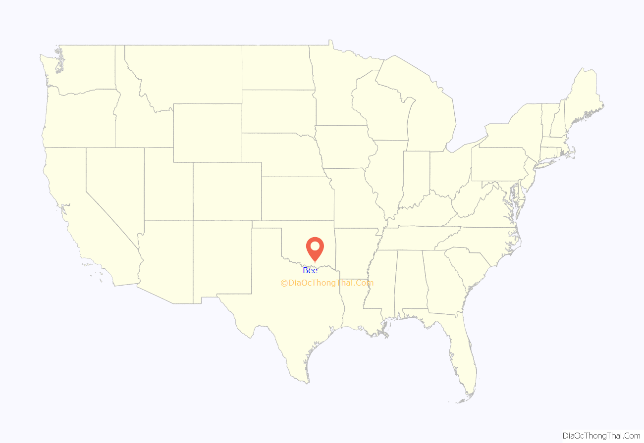
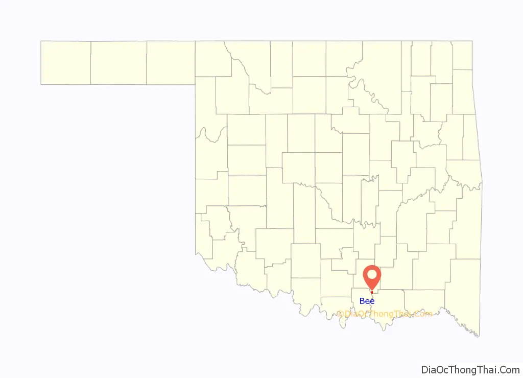
Bee location map. Where is Bee CDP?
History
The community was intended to be named after Dee Taylor, the daughter of two early settlers; however, the U.S. Post Office Department changed the name to “Bee”. Its post office operated from April 5, 1889, until June 15, 1918.
Bee Road Map
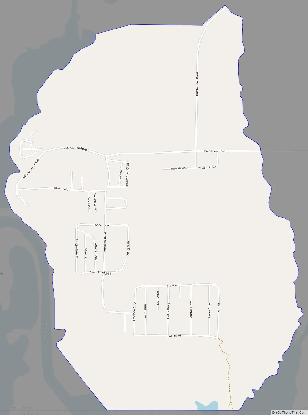
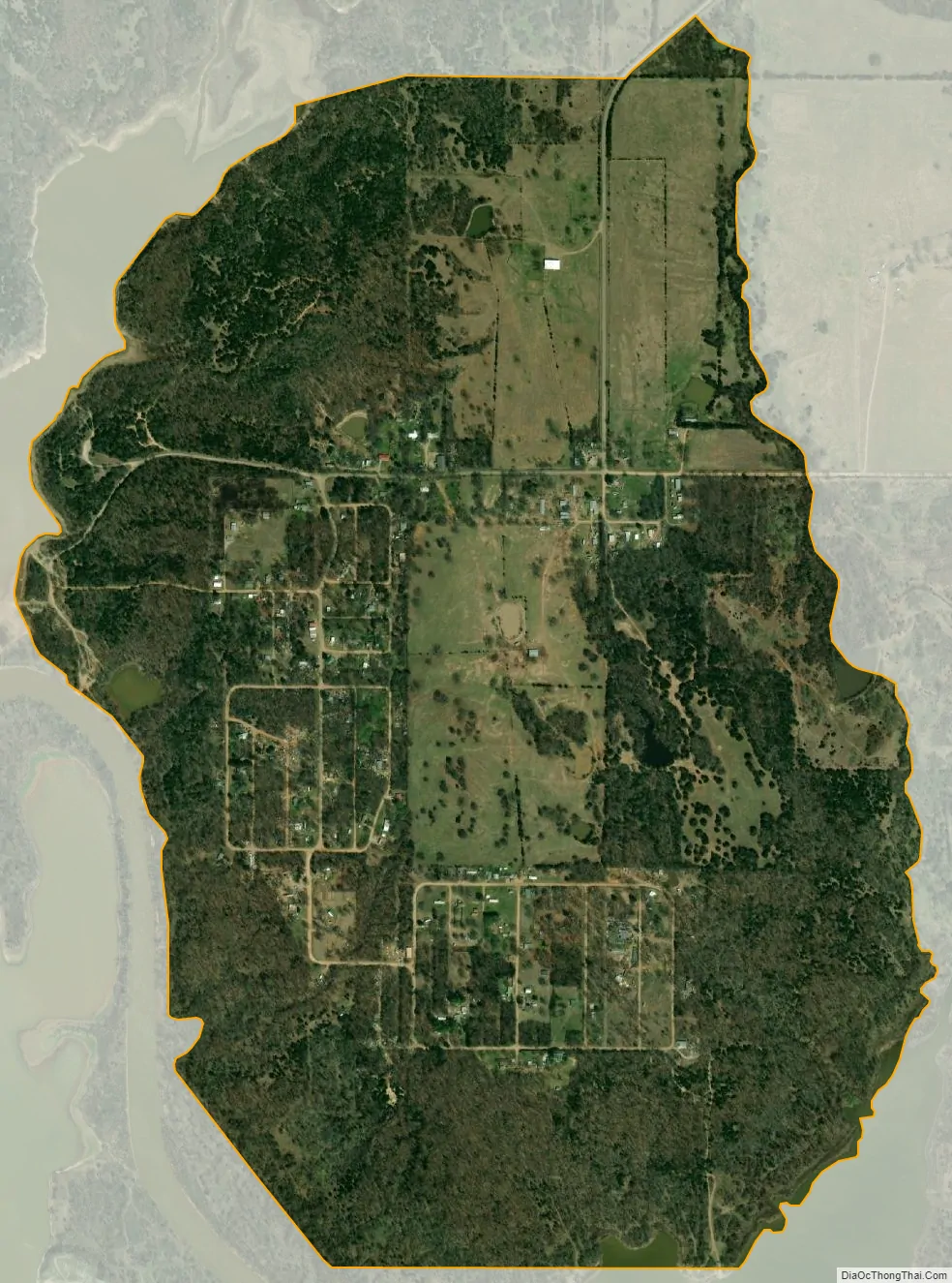
Bee city Satellite Map
Geography
According to the U.S. Census Bureau, the community has an area of 1.306 square miles (3.38 km); 1.299 square miles (3.36 km) of its area is land, and 0.007 square miles (0.018 km) is water.
See also
Map of Oklahoma State and its subdivision:- Adair
- Alfalfa
- Atoka
- Beaver
- Beckham
- Blaine
- Bryan
- Caddo
- Canadian
- Carter
- Cherokee
- Choctaw
- Cimarron
- Cleveland
- Coal
- Comanche
- Cotton
- Craig
- Creek
- Custer
- Delaware
- Dewey
- Ellis
- Garfield
- Garvin
- Grady
- Grant
- Greer
- Harmon
- Harper
- Haskell
- Hughes
- Jackson
- Jefferson
- Johnston
- Kay
- Kingfisher
- Kiowa
- Latimer
- Le Flore
- Lincoln
- Logan
- Love
- Major
- Marshall
- Mayes
- McClain
- McCurtain
- McIntosh
- Murray
- Muskogee
- Noble
- Nowata
- Okfuskee
- Oklahoma
- Okmulgee
- Osage
- Ottawa
- Pawnee
- Payne
- Pittsburg
- Pontotoc
- Pottawatomie
- Pushmataha
- Roger Mills
- Rogers
- Seminole
- Sequoyah
- Stephens
- Texas
- Tillman
- Tulsa
- Wagoner
- Washington
- Washita
- Woods
- Woodward
- Alabama
- Alaska
- Arizona
- Arkansas
- California
- Colorado
- Connecticut
- Delaware
- District of Columbia
- Florida
- Georgia
- Hawaii
- Idaho
- Illinois
- Indiana
- Iowa
- Kansas
- Kentucky
- Louisiana
- Maine
- Maryland
- Massachusetts
- Michigan
- Minnesota
- Mississippi
- Missouri
- Montana
- Nebraska
- Nevada
- New Hampshire
- New Jersey
- New Mexico
- New York
- North Carolina
- North Dakota
- Ohio
- Oklahoma
- Oregon
- Pennsylvania
- Rhode Island
- South Carolina
- South Dakota
- Tennessee
- Texas
- Utah
- Vermont
- Virginia
- Washington
- West Virginia
- Wisconsin
- Wyoming