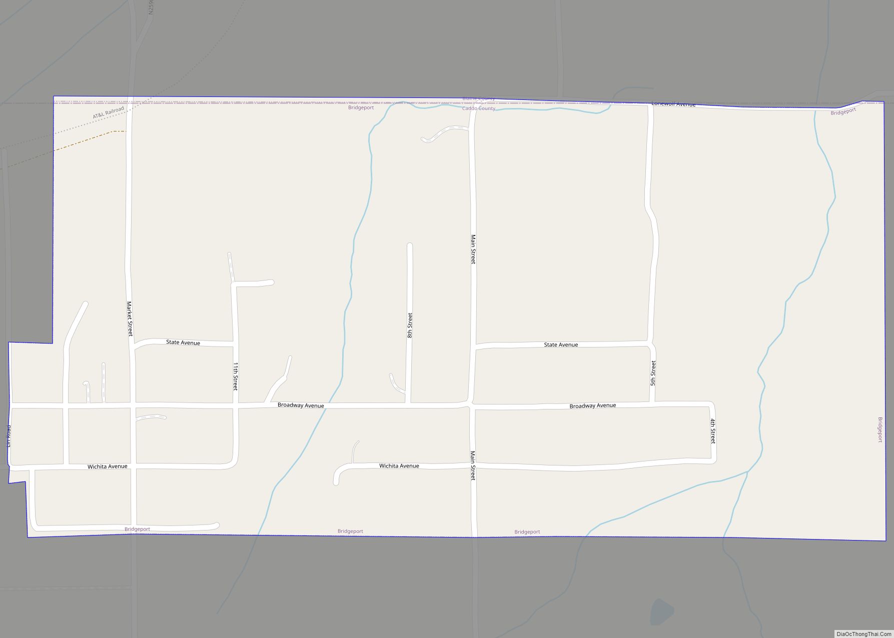
Bridgeport is a town in Caddo County, Oklahoma, United States. The population was 116 at the 2010 census.
| Name: | Bridgeport city |
|---|---|
| LSAD Code: | 25 |
| LSAD Description: | city (suffix) |
| State: | Oklahoma |
| County: | Caddo County |
| Elevation: | 1,503 ft (458 m) |
| Total Area: | 0.54 sq mi (1.39 km²) |
| Land Area: | 0.54 sq mi (1.39 km²) |
| Water Area: | 0.00 sq mi (0.00 km²) |
| Total Population: | 97 |
| Population Density: | 180.63/sq mi (69.75/km²) |
| FIPS code: | 4008750 |
| GNISfeature ID: | 1090491 |
Online Interactive Map
Click on ![]() to view map in "full screen" mode.
to view map in "full screen" mode.
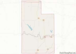
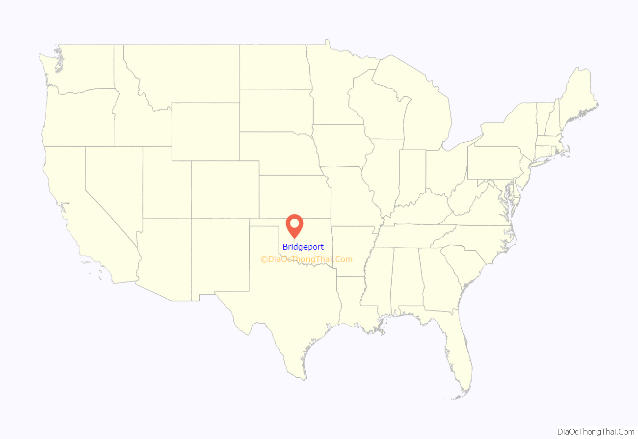
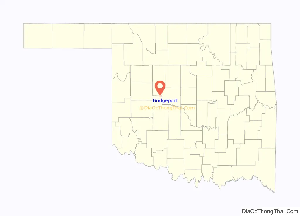
Bridgeport location map. Where is Bridgeport city?
History
Bridgeport was so named on account of there being a toll bridge over the Canadian River at that point.
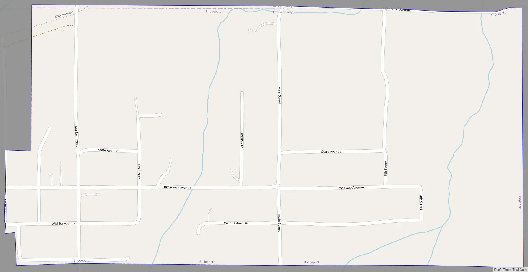
Bridgeport Road Map
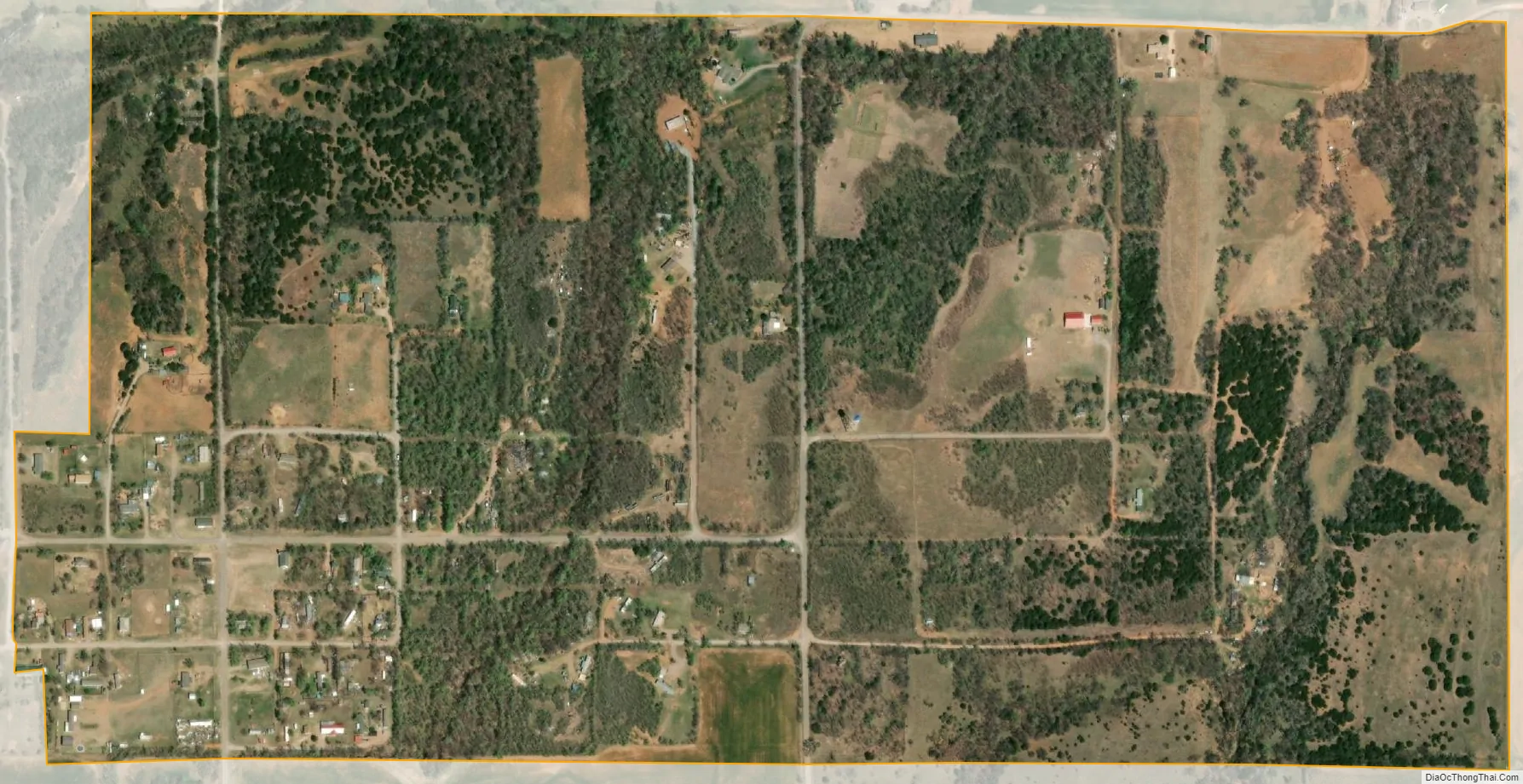
Bridgeport city Satellite Map
Geography
Bridgeport is located on the northern border of Caddo County at 35°32′48″N 98°23′0″W / 35.54667°N 98.38333°W / 35.54667; -98.38333 (35.546717, -98.383401) and at an elevation of 1,428 feet (435 m). It is bordered to the north by Blaine County. The town is built on the south side of the valley of the Canadian River, overlooking its floodplain.
Former U.S. Route 66 is 0.5 miles (0.80 km) to the south of the town, and Interstate 40 runs one-half mile further south, though the closest access is 2 miles (3 km) to the east at Exit 101. Downtown Oklahoma City is 52 miles (84 km) east of Bridgeport.
According to the United States Census Bureau, the city has a total area of 0.54 square miles (1.4 km), all land.
See also
Map of Oklahoma State and its subdivision:- Adair
- Alfalfa
- Atoka
- Beaver
- Beckham
- Blaine
- Bryan
- Caddo
- Canadian
- Carter
- Cherokee
- Choctaw
- Cimarron
- Cleveland
- Coal
- Comanche
- Cotton
- Craig
- Creek
- Custer
- Delaware
- Dewey
- Ellis
- Garfield
- Garvin
- Grady
- Grant
- Greer
- Harmon
- Harper
- Haskell
- Hughes
- Jackson
- Jefferson
- Johnston
- Kay
- Kingfisher
- Kiowa
- Latimer
- Le Flore
- Lincoln
- Logan
- Love
- Major
- Marshall
- Mayes
- McClain
- McCurtain
- McIntosh
- Murray
- Muskogee
- Noble
- Nowata
- Okfuskee
- Oklahoma
- Okmulgee
- Osage
- Ottawa
- Pawnee
- Payne
- Pittsburg
- Pontotoc
- Pottawatomie
- Pushmataha
- Roger Mills
- Rogers
- Seminole
- Sequoyah
- Stephens
- Texas
- Tillman
- Tulsa
- Wagoner
- Washington
- Washita
- Woods
- Woodward
- Alabama
- Alaska
- Arizona
- Arkansas
- California
- Colorado
- Connecticut
- Delaware
- District of Columbia
- Florida
- Georgia
- Hawaii
- Idaho
- Illinois
- Indiana
- Iowa
- Kansas
- Kentucky
- Louisiana
- Maine
- Maryland
- Massachusetts
- Michigan
- Minnesota
- Mississippi
- Missouri
- Montana
- Nebraska
- Nevada
- New Hampshire
- New Jersey
- New Mexico
- New York
- North Carolina
- North Dakota
- Ohio
- Oklahoma
- Oregon
- Pennsylvania
- Rhode Island
- South Carolina
- South Dakota
- Tennessee
- Texas
- Utah
- Vermont
- Virginia
- Washington
- West Virginia
- Wisconsin
- Wyoming