Carnegie is a town in Caddo County, Oklahoma, United States. The population was 1,723 at the 2010 census, a 1.7 percent decline from the figure of 1,752 in 2000.
| Name: | Carnegie town |
|---|---|
| LSAD Code: | 43 |
| LSAD Description: | town (suffix) |
| State: | Oklahoma |
| County: | Caddo County |
| Elevation: | 1,309 ft (399 m) |
| Total Area: | 1.33 sq mi (3.45 km²) |
| Land Area: | 1.33 sq mi (3.45 km²) |
| Water Area: | 0.00 sq mi (0.00 km²) |
| Total Population: | 1,430 |
| Population Density: | 1,072.77/sq mi (414.28/km²) |
| ZIP code: | 73015 |
| Area code: | 580 |
| FIPS code: | 4012050 |
| GNISfeature ID: | 1090977 |
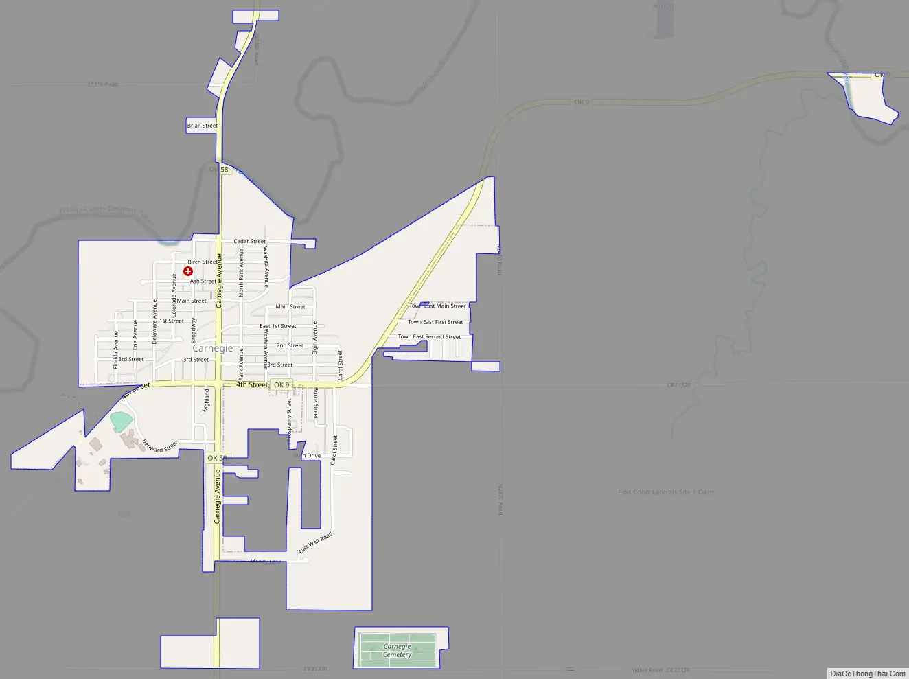
Online Interactive Map
Click on ![]() to view map in "full screen" mode.
to view map in "full screen" mode.
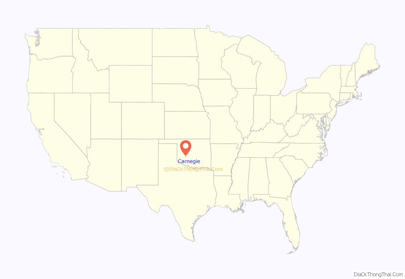
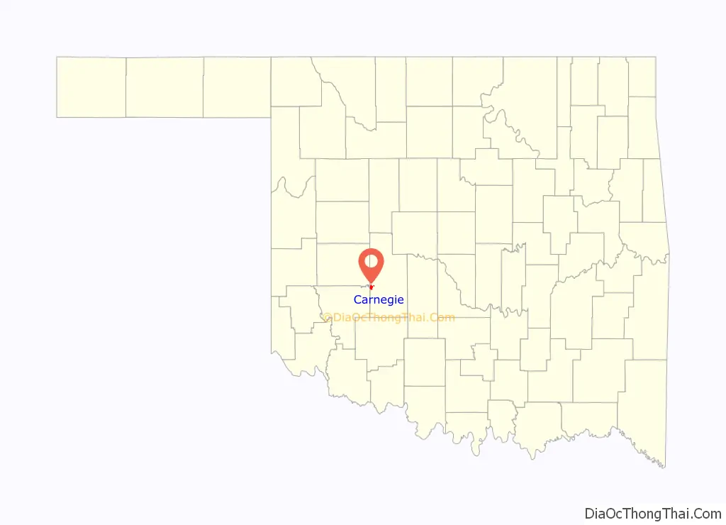
Carnegie location map. Where is Carnegie town?
History
Carnegie was named after the famous Scottish American industrialist and philanthropist, Andrew Carnegie. The original name of the town was Latham. The town was originally platted as North and South Latham. North Latham was north of the Washita River, while South Latham was south of the river. North Latham was really intended to be the commercial hub, but was never developed. The Rock Island Railroad was supposed to go along the north side of the river. The railroad was relocated along the south bank of the Washita. So South Latham became the commercial hub. North Latham withered and/or was never developed.
Leaders of the town decided shortly after incorporation in 1903 to rename the town Carnegie in the hopes he would build a library there. Although the town has a library, Andrew Carnegie never built one there. Of note, there is unofficially a “Carnegie Hall”, known more properly as the Carnegie Memorial Auditorium, where community events are held. While currently on hiatus, for several years there was an annual “Stars of Carnegie Hall” talent show showcases individuals across the region and state in a local talent show, in which both local and regional talent are represented.
Carnegie High School has won three state titles in boys basketball (1988,1992,1996), as well as three titles in girls cross country (2002,2003,2004). Carnegie High also has three won state titles in boys cross country.(1999,2000,2020)
The Kiowa Tribe of Oklahoma headquarters are located in Carnegie.
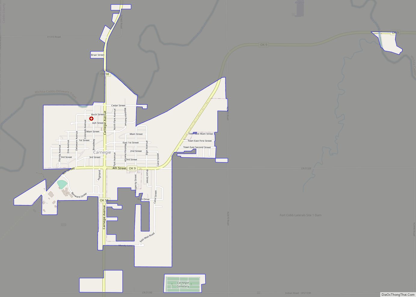
Carnegie Road Map
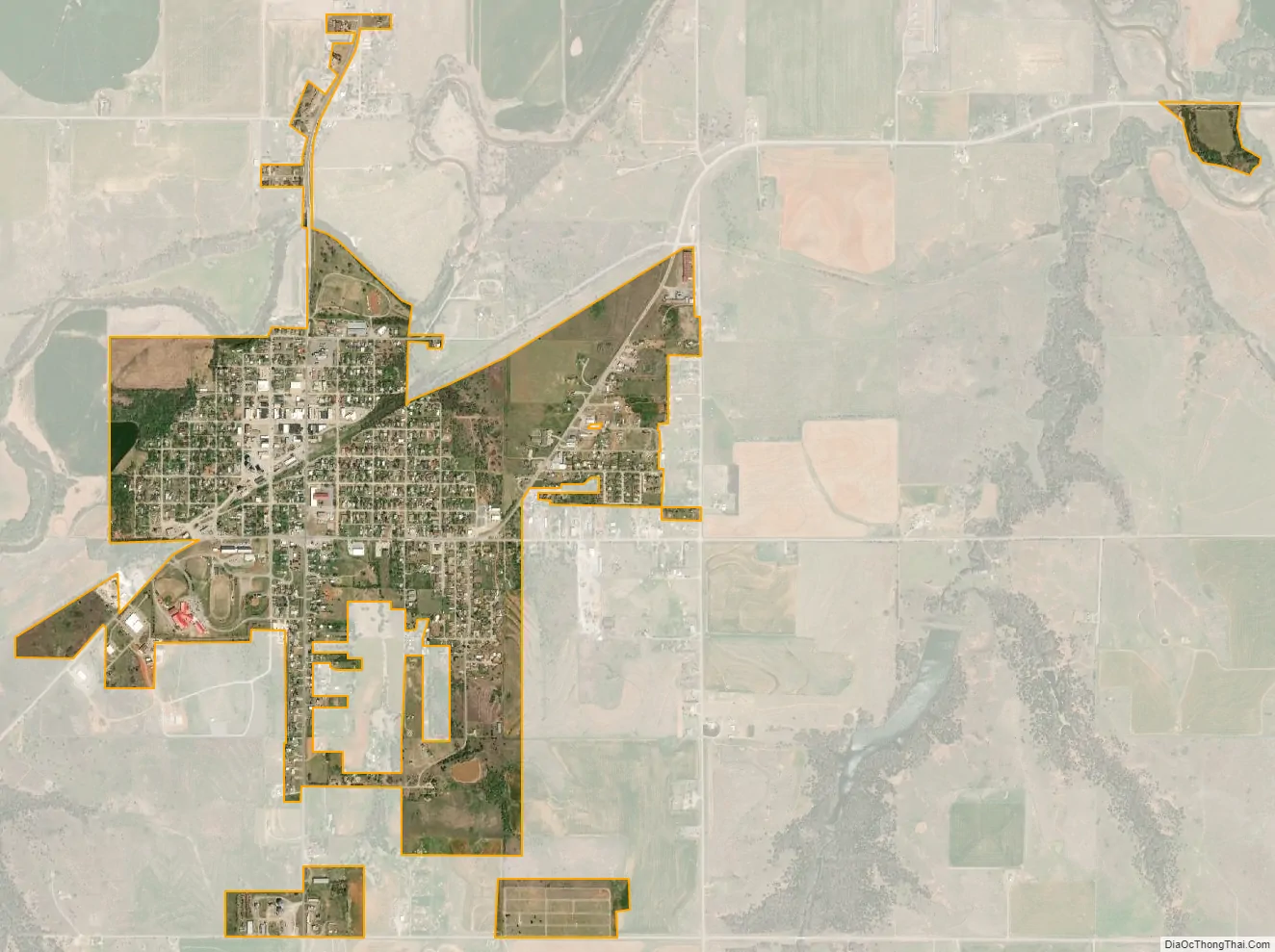
Carnegie city Satellite Map
Geography
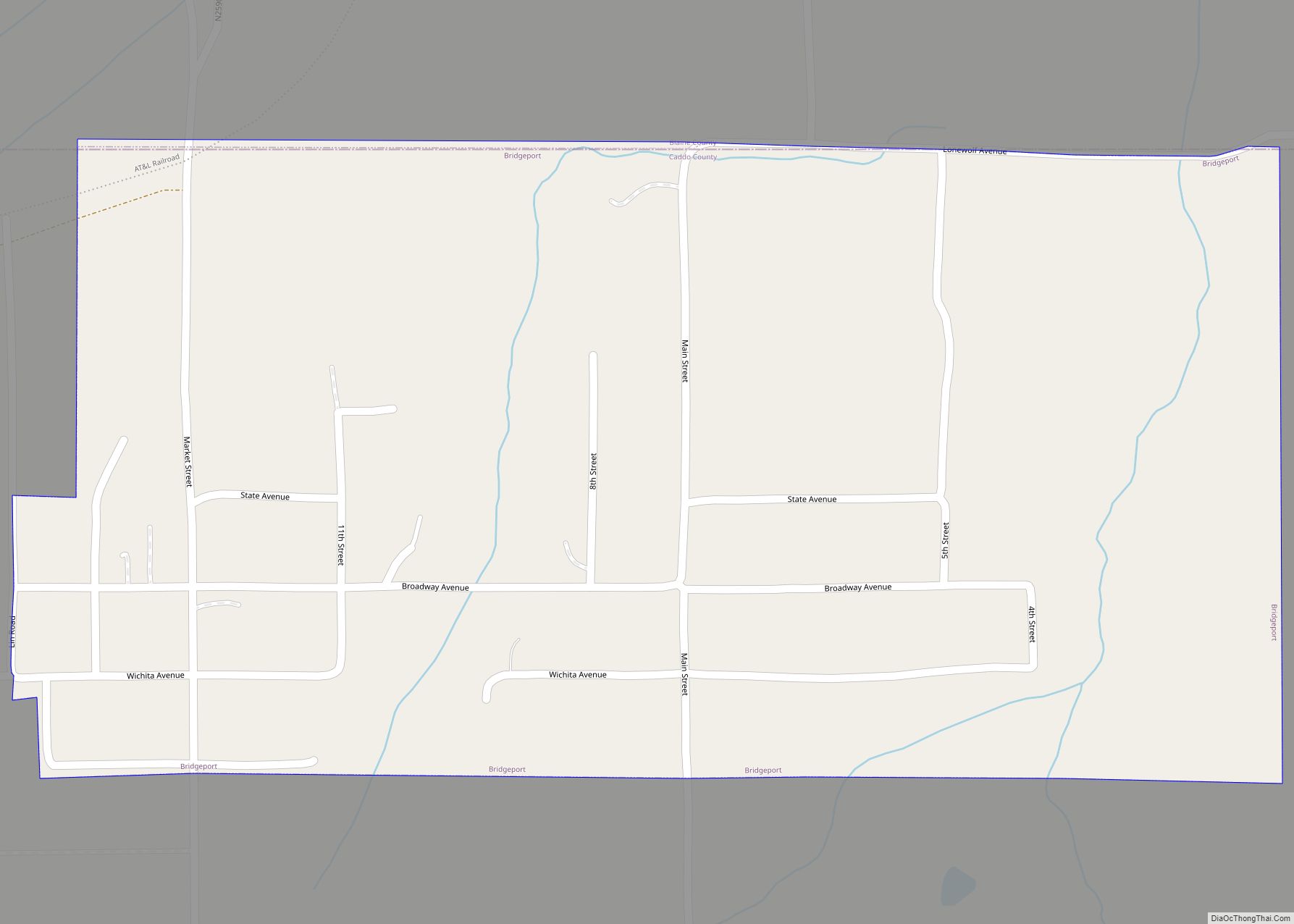
Carnegie is located at 35°6′16″N 98°36′4″W / 35.10444°N 98.60111°W / 35.10444; -98.60111 (35.104334, −98.601166). According to the United States Census Bureau, the town has a total area of 1.37 square miles (3.55 km), all land.
The town is on the south bank of the Washita River, 27 miles (43 km) west of Anadarko, at the intersection of state highways 9 and 58.
Climate
See also
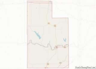
Map of Oklahoma State and its subdivision:- Adair
- Alfalfa
- Atoka
- Beaver
- Beckham
- Blaine
- Bryan
- Caddo
- Canadian
- Carter
- Cherokee
- Choctaw
- Cimarron
- Cleveland
- Coal
- Comanche
- Cotton
- Craig
- Creek
- Custer
- Delaware
- Dewey
- Ellis
- Garfield
- Garvin
- Grady
- Grant
- Greer
- Harmon
- Harper
- Haskell
- Hughes
- Jackson
- Jefferson
- Johnston
- Kay
- Kingfisher
- Kiowa
- Latimer
- Le Flore
- Lincoln
- Logan
- Love
- Major
- Marshall
- Mayes
- McClain
- McCurtain
- McIntosh
- Murray
- Muskogee
- Noble
- Nowata
- Okfuskee
- Oklahoma
- Okmulgee
- Osage
- Ottawa
- Pawnee
- Payne
- Pittsburg
- Pontotoc
- Pottawatomie
- Pushmataha
- Roger Mills
- Rogers
- Seminole
- Sequoyah
- Stephens
- Texas
- Tillman
- Tulsa
- Wagoner
- Washington
- Washita
- Woods
- Woodward
- Alabama
- Alaska
- Arizona
- Arkansas
- California
- Colorado
- Connecticut
- Delaware
- District of Columbia
- Florida
- Georgia
- Hawaii
- Idaho
- Illinois
- Indiana
- Iowa
- Kansas
- Kentucky
- Louisiana
- Maine
- Maryland
- Massachusetts
- Michigan
- Minnesota
- Mississippi
- Missouri
- Montana
- Nebraska
- Nevada
- New Hampshire
- New Jersey
- New Mexico
- New York
- North Carolina
- North Dakota
- Ohio
- Oklahoma
- Oregon
- Pennsylvania
- Rhode Island
- South Carolina
- South Dakota
- Tennessee
- Texas
- Utah
- Vermont
- Virginia
- Washington
- West Virginia
- Wisconsin
- Wyoming