Corn is a town in Washita County, Oklahoma, United States. The population was 503 at the 2010 census.
| Name: | Corn town |
|---|---|
| LSAD Code: | 43 |
| LSAD Description: | town (suffix) |
| State: | Oklahoma |
| County: | Washita County |
| Elevation: | 1,578 ft (481 m) |
| Total Area: | 0.35 sq mi (0.90 km²) |
| Land Area: | 0.35 sq mi (0.90 km²) |
| Water Area: | 0.00 sq mi (0.00 km²) |
| Total Population: | 592 |
| Population Density: | 1,696.28/sq mi (655.82/km²) |
| ZIP code: | 73024 |
| Area code: | 580 |
| FIPS code: | 4017300 |
| GNISfeature ID: | 1091690 |
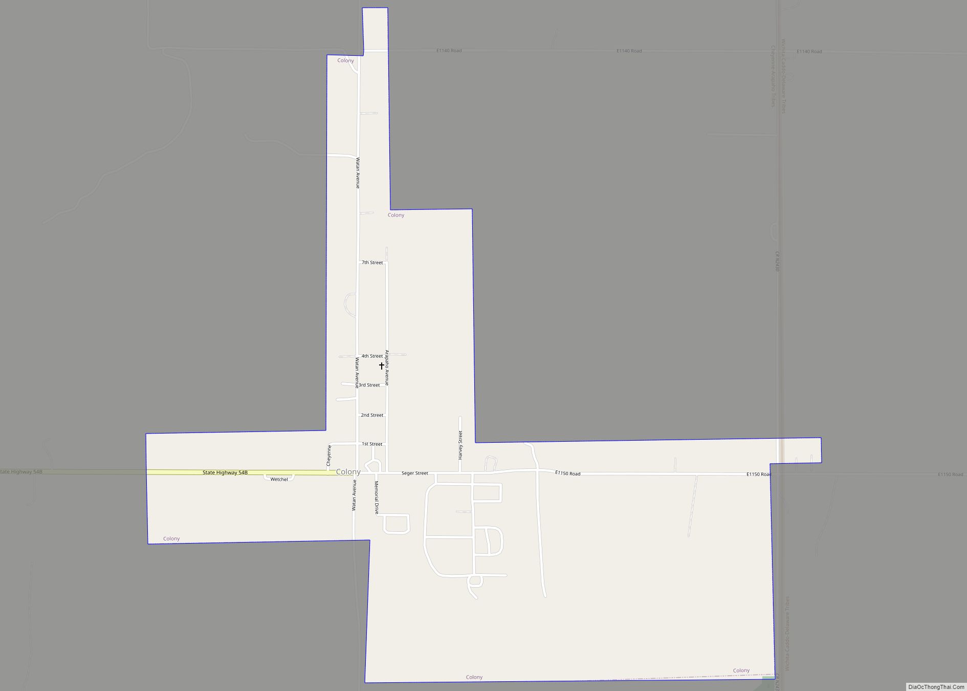
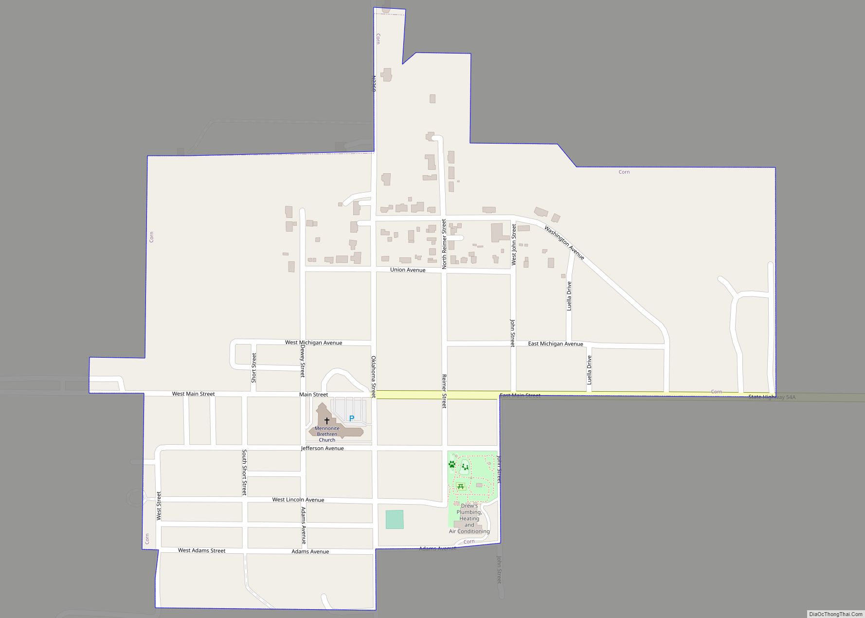
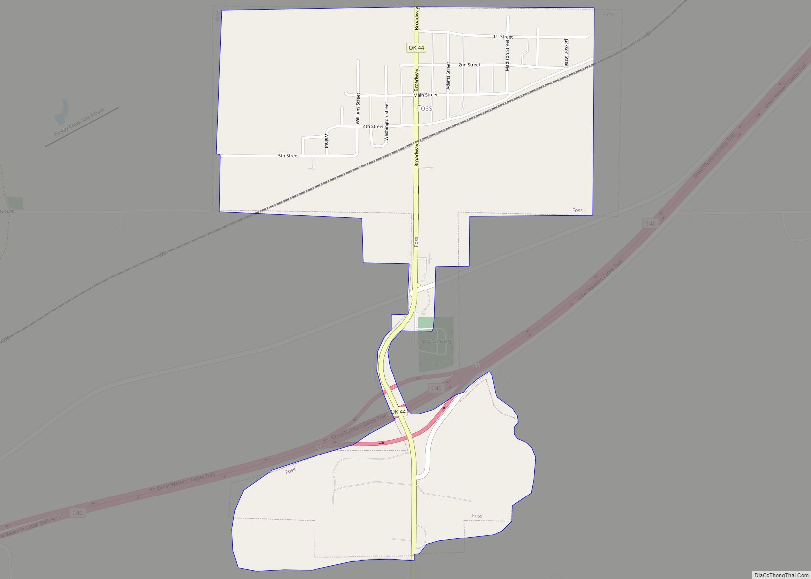
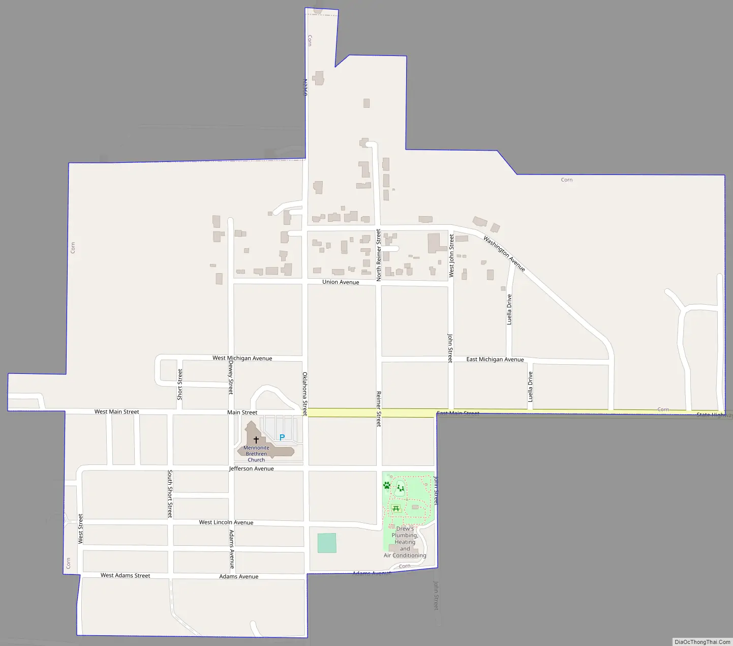
Online Interactive Map
Click on ![]() to view map in "full screen" mode.
to view map in "full screen" mode.
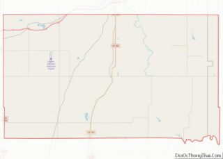
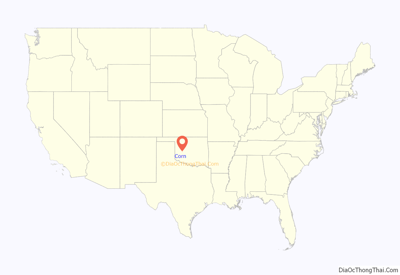
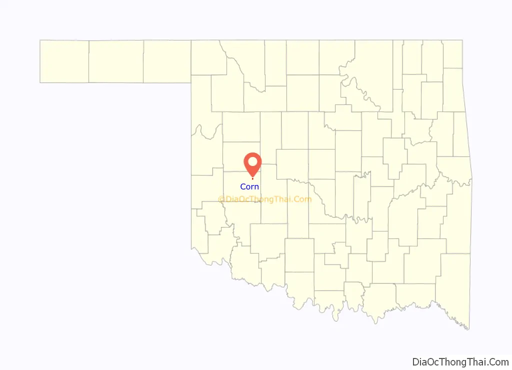
Corn location map. Where is Corn town?
History
Origins of the town name
The word “Korn” itself is a German word translated in English as “grain”. Several sources confirm that the town settled by German immigrants received its name because its first post office was located in (or near) a corn field. As a result of anti-German sentiment during World War I, the name of the town was permanently changed from “Korn” to “Corn”.
Founding and early years
The town of Corn, or Korn—as it was spelled at that time—was originally settled by German-speaking Russian Mennonites. Around the time of the Cheyenne-Arapaho Land Run of 1892, Mennonite missionary John J. Kliewer, who was stationed at nearby Shelly Indian Mission, invited fellow Mennonites from Kansas to homestead lands left unclaimed by Cheyennes and Arapahos. Sixteen Mennonite families staked homestead claims in 1892. By 1893, forty families had settled in the area.
These Mennonite homesteaders brought with them a particular variety of winter wheat known as “Turkey Red”, which grew particularly well in the western Oklahoma soil. In 1894, Peter Bergman donated part of his land to establish a place of worship. A rough Mennonite church was then built; a dugout with a low sloping roof and sides made of sod. Church benches were made from local Cottonwood trees. Between 1893 and 1920, a total of eight Mennonite churches were established within an eight-mile radius of the town. To mark its centennial year, Corn received a historical marker from the state honoring both its agricultural and Mennonite heritage.
On April 27, 1896, the Korn post office was established in a rural home, two and one-fourth miles north of the present-day town. Shortly thereafter, the post office was moved three miles north of the original site to a store owned by James Kendall. When Kendall’s planned townsite failed to develop at the location, the post office was once again moved in 1903 to the present day site of the town of Corn, finding its new home in the merchandise store of George B. Flaming.
World War I brought down harassment both from vigilantes and the Washita County Council of Defense upon many of the Germans and Mennonites that lived in and around Corn. This was due to the combination of their German heritage and their particular Mennonite/Anabaptist theological convictions, which dictated their conscientious objection to participation in warfare. Not only did the town Americanize its name from “Korn” to “Corn” during this time, but the nearby Cordell Christian College closed and a German-language newspaper, the Oklahoma Vorwärts, ceased operation.
Education
A private Christian academy, under the name “Washita Gemeinde Schule”, was established by the Mennonite Brethren Church as a Bible and language school in 1902. Now known as Corn Bible Academy, it has continuously educated students into the twenty-first century and is the oldest Christian school west of the Mississippi. As of 2016, it was serving grades 7-12.
In 1968, the public school of nearby Colony merged with the Corn public schools, forming the Washita Heights School District. On April 23, 2010, a referendum was held asking for voter approval to disband the increasingly small school district of Washita Heights, along with its school in Corn, due to the lack of students within the district and insufficient funding. The dissolution was approved and the nearby Cordell schools annexed the Washita Heights district.
Corn Road Map
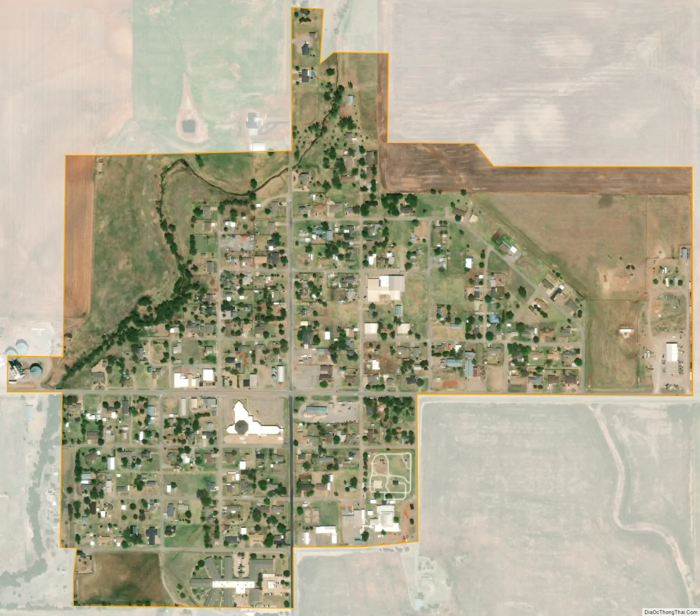
Corn city Satellite Map
Geography
Corn is located 13 miles northeast of Cordell in west-central Oklahoma. According to the U.S. Geological Survey, its geographic coordinates are 35°22′41″N 98°46′55″W / 35.37806°N 98.78194°W / 35.37806; -98.78194 (35.3787092, -98.7820174).
The U.S. Census Bureau, reports that the town has a total area of 0.357 square miles (0.92 km), all land.
See also
Map of Oklahoma State and its subdivision:- Adair
- Alfalfa
- Atoka
- Beaver
- Beckham
- Blaine
- Bryan
- Caddo
- Canadian
- Carter
- Cherokee
- Choctaw
- Cimarron
- Cleveland
- Coal
- Comanche
- Cotton
- Craig
- Creek
- Custer
- Delaware
- Dewey
- Ellis
- Garfield
- Garvin
- Grady
- Grant
- Greer
- Harmon
- Harper
- Haskell
- Hughes
- Jackson
- Jefferson
- Johnston
- Kay
- Kingfisher
- Kiowa
- Latimer
- Le Flore
- Lincoln
- Logan
- Love
- Major
- Marshall
- Mayes
- McClain
- McCurtain
- McIntosh
- Murray
- Muskogee
- Noble
- Nowata
- Okfuskee
- Oklahoma
- Okmulgee
- Osage
- Ottawa
- Pawnee
- Payne
- Pittsburg
- Pontotoc
- Pottawatomie
- Pushmataha
- Roger Mills
- Rogers
- Seminole
- Sequoyah
- Stephens
- Texas
- Tillman
- Tulsa
- Wagoner
- Washington
- Washita
- Woods
- Woodward
- Alabama
- Alaska
- Arizona
- Arkansas
- California
- Colorado
- Connecticut
- Delaware
- District of Columbia
- Florida
- Georgia
- Hawaii
- Idaho
- Illinois
- Indiana
- Iowa
- Kansas
- Kentucky
- Louisiana
- Maine
- Maryland
- Massachusetts
- Michigan
- Minnesota
- Mississippi
- Missouri
- Montana
- Nebraska
- Nevada
- New Hampshire
- New Jersey
- New Mexico
- New York
- North Carolina
- North Dakota
- Ohio
- Oklahoma
- Oregon
- Pennsylvania
- Rhode Island
- South Carolina
- South Dakota
- Tennessee
- Texas
- Utah
- Vermont
- Virginia
- Washington
- West Virginia
- Wisconsin
- Wyoming