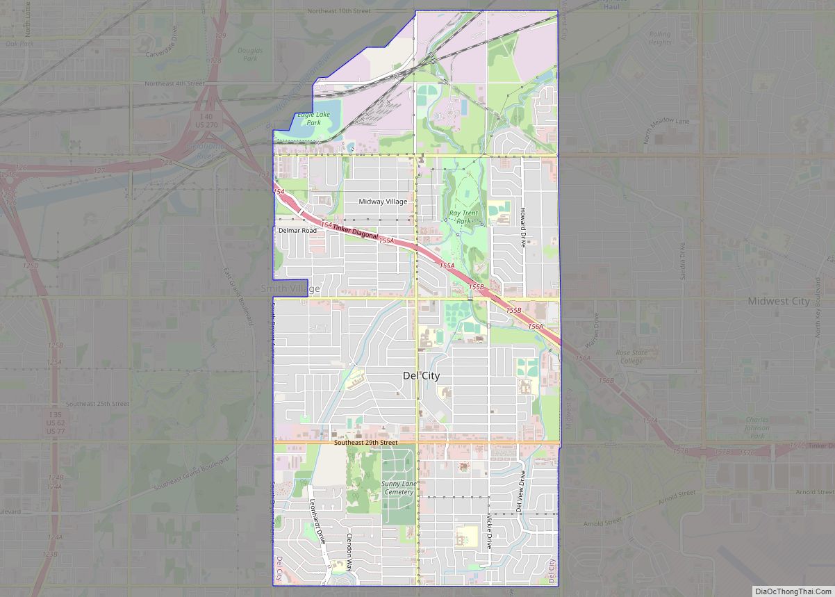
Del City is a city in Oklahoma County, Oklahoma, United States, and a part of the Oklahoma City metropolitan area. The population was 21,822 at the United States Census, 2020, a 2.3% increase from 2010.
Del City is located near two major interstate highways, both of which connect it to Oklahoma City. Interstate 40 bisects the town from the northwest to southeast, and Interstate 35 lies just a short distance west of the city. The city borders southeast Oklahoma City, Midwest City and Tinker Air Force Base. George Epperly, founded the city, which was incorporated by a vote of its residents in 1948. Del City is named after Epperly’s eldest daughter, Delaphene Campbell. Since its incorporation Del City has expanded three times, first by annexing Carter Park in 1954, Midway Village in 1963 and the acquisition of an undeveloped piece of land between the city and Tinker AFB A large area of Del City was significantly impacted by the May 3, 1999, tornado outbreak that passed through the Oklahoma City metro area.
| Name: | Del City city |
|---|---|
| LSAD Code: | 25 |
| LSAD Description: | city (suffix) |
| State: | Oklahoma |
| County: | Oklahoma County |
| Incorporated: | October 9, 1948 |
| Elevation: | 1,201 ft (366 m) |
| Total Area: | 7.52 sq mi (19.47 km²) |
| Land Area: | 7.52 sq mi (19.47 km²) |
| Water Area: | 0.00 sq mi (0.00 km²) |
| Total Population: | 21,822 |
| Population Density: | 2,902.63/sq mi (1,120.68/km²) |
| ZIP code: | 73115, 73117, 73135 |
| Area code: | 405, 572 |
| FIPS code: | 4019900 |
| GNISfeature ID: | 1092026 |
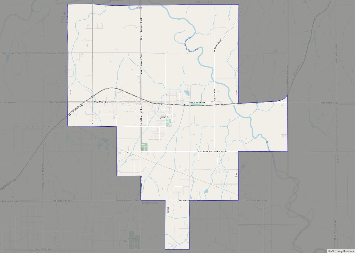
Online Interactive Map
Click on ![]() to view map in "full screen" mode.
to view map in "full screen" mode.
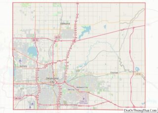
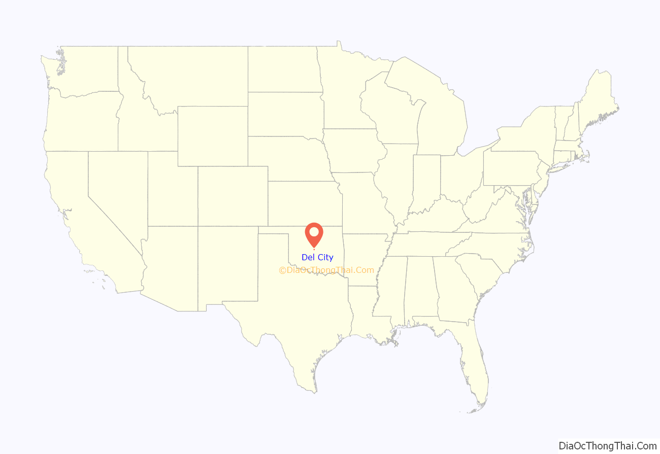
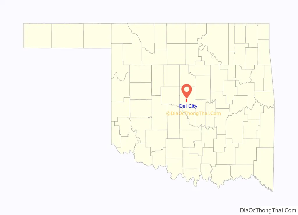
Del City location map. Where is Del City city?
History
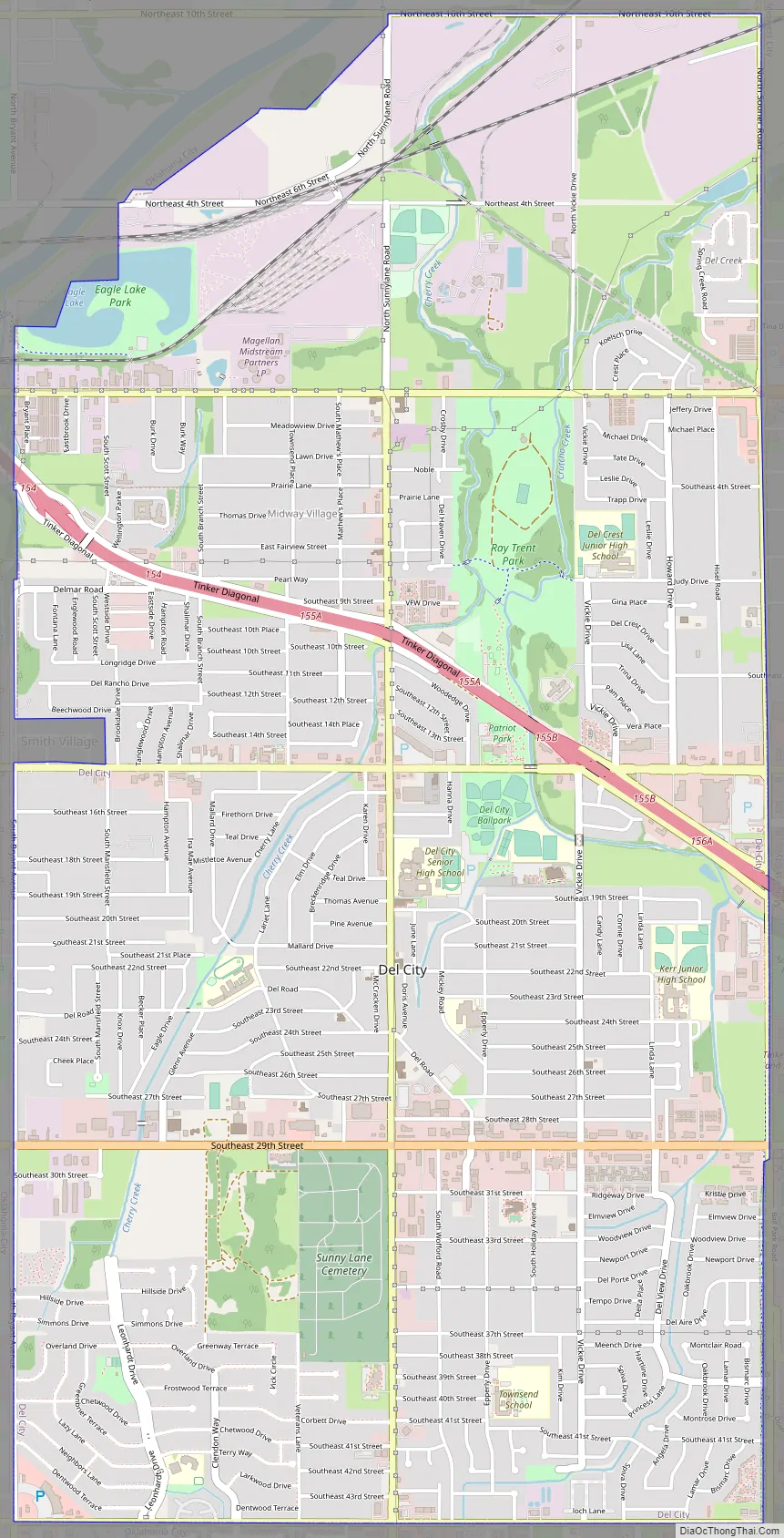
Founded in Boone Township, Oklahoma County, as a “bedroom” community, Del City lies three miles (5 km) east of Oklahoma City and one mile (1.6 km) west of Midwest City. At the turn of the 21st century, Del City was a 7.5-square-mile (19 km) community surrounded on the north, west, and south by Oklahoma City and on the east by Midwest City. Interstate Highway 40 bisects the town from the northwest to southeast. Oklahoma City streets define the boundaries: NE 10th Street on the north; Sooner Road on the east; SE 44th Street on the south; and Bryant Avenue on the west. Northwestern corner of the city is a mile from the junction of Interstate 35 and Interstate 40, justifying its claim to being “the Crossroads of America.”
In the Land Run of 1889, Jordan Pybas and his wife settled in what is present-day Del City. Five generations later the family still lives in the house that was completed in 1907. Before 1946 there were only two families living in what would become Del City. Developer George Epperly purchased a wheat field 160 acres (0.65 km) large at the corner of SE 29th Street and Sunnylane Road in 1946 with a plan to build fifty houses. In 1948 there were 582 homes in Del City, 75% of which were built by George Epperly, Despite opposition, the unincorporated Epperly Heights and its 200 families voted to approve incorporation on October 9, 1948. In February 1959, Del City adopted a charter and a council-manager form of town government. The city was named for Epperly’s daughter, Delaphene Campbell.
The city expanded through the annexation of Carter Park in 1954 and Midway Village in 1963. Del City attempted to annex the Rose Smith Addition but its residents incorporated and became the town of Smith Village. The city also acquired a piece of undeveloped land that separated it from Tinker Air Force Base. Oklahoma City annexed this same piece of land, and a court fight ensued. In District court, Del City won and Oklahoma City appealed to the State Supreme Court. Del City officials, while awaiting the hearing, pursued negotiation again with Oklahoma City this time accepting 20 acres (81,000 m) along the Tinker AFB boundary. Del City, having expanded to its greatest possible physical limits in 1964, joined Midwest City and Norman in underwriting the Little River Reservoir Project that became Lake Thunderbird.
The Del City Historical Society was organized in 1975 with Andy Evans as its first president. Several children of the Eighty-niners (89ers) still lived in the area, and they identified every original homestead within city limits. Residents also learned that their town was on the path of the 1870s Arbuckle Trail, a Texas to Kansas cattle trail. Wrestler and two-time Olympic Gold Medal winner John Smith resided in Del City.
With home building and family-oriented amenities the founding focus, industry was slow to develop in Del City to create any jobs (99 percent of Del Citians commuted to work in 1948, while only 96 percent commuted in 2000). Don’s Alley Restaurant and Midwest Trophy Manufacturing are two businesses of long standing. Don Moore opened his hamburger grill at 4601 SE 29th Street in 1955, and as of 2018, still serves food in there. Midwest Trophy Manufacturing began in David R. Smith’s garage in Del City in 1971. Midwest Trophy Manufacturing (now known as MTM Recognition) employs over 750 people throughout North America, 400 of them in Del City. It is the city’s largest industry. MTM Recognition’s corporate headquarters are in Del City at 3405 SE 29th Street.
Del City is represented in the Oklahoma Legislature by District 94 Representative Andy Fugate and District 46 Senator Kay Floyd who is in her third term. On the national level Del City is represented by 4th district Representative Tom Cole, and by U.S. Senators James Lankford and Markwayne Mullin. Del City as had four newspapers Del City Leader, Del City Sun, Del City Times, and the Del City News. The city also has its own Government-access Channel (KDEL).
Del City Road Map
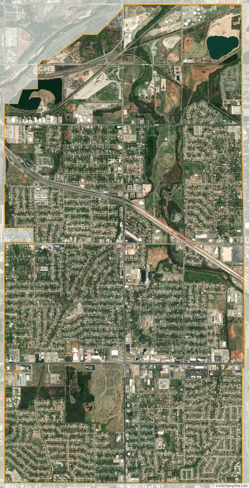
Del City city Satellite Map
Geography
According to the United States Census Bureau, the city has a total area of 7.5 square miles (19 km), all land.
The city is located in the Frontier Country region in the center of the state. Del City lies in the Sandstone Hills region of Oklahoma, known for hills of 250 to 400 feet (76 to 122 m) and two species of oak – blackjack oak (Quercus marilandica) and post oak (Q. stellata).
Del City is in a region dominated by the Cross Timbers, an area of prairie and patches of forest at the eastern extent of the Great Plains. The region is essentially a transition buffer between the wetter and more forested Eastern Oklahoma and the semi-arid high plains of Western Oklahoma, and experiences extreme swings between dry and wet weather patterns. Climate is dominated by large differences in annual rainfall totals, with Central Oklahoma’s western boundary receiving far less rain than compared to its eastern boundary. Because of these convergences of dry and wet weather patterns, Del City is located at the heart of what is known as Tornado Alley, and is in one of the most tornado-prone areas in the United States.
Eagle Lake is located within Del City; the lake is located in the northern part of the city and is the only large body of water. The lake is stocked with bass, catfish, bluegill, carp, vancuren trout and crappie.
Climate
See also
Map of Oklahoma State and its subdivision:- Adair
- Alfalfa
- Atoka
- Beaver
- Beckham
- Blaine
- Bryan
- Caddo
- Canadian
- Carter
- Cherokee
- Choctaw
- Cimarron
- Cleveland
- Coal
- Comanche
- Cotton
- Craig
- Creek
- Custer
- Delaware
- Dewey
- Ellis
- Garfield
- Garvin
- Grady
- Grant
- Greer
- Harmon
- Harper
- Haskell
- Hughes
- Jackson
- Jefferson
- Johnston
- Kay
- Kingfisher
- Kiowa
- Latimer
- Le Flore
- Lincoln
- Logan
- Love
- Major
- Marshall
- Mayes
- McClain
- McCurtain
- McIntosh
- Murray
- Muskogee
- Noble
- Nowata
- Okfuskee
- Oklahoma
- Okmulgee
- Osage
- Ottawa
- Pawnee
- Payne
- Pittsburg
- Pontotoc
- Pottawatomie
- Pushmataha
- Roger Mills
- Rogers
- Seminole
- Sequoyah
- Stephens
- Texas
- Tillman
- Tulsa
- Wagoner
- Washington
- Washita
- Woods
- Woodward
- Alabama
- Alaska
- Arizona
- Arkansas
- California
- Colorado
- Connecticut
- Delaware
- District of Columbia
- Florida
- Georgia
- Hawaii
- Idaho
- Illinois
- Indiana
- Iowa
- Kansas
- Kentucky
- Louisiana
- Maine
- Maryland
- Massachusetts
- Michigan
- Minnesota
- Mississippi
- Missouri
- Montana
- Nebraska
- Nevada
- New Hampshire
- New Jersey
- New Mexico
- New York
- North Carolina
- North Dakota
- Ohio
- Oklahoma
- Oregon
- Pennsylvania
- Rhode Island
- South Carolina
- South Dakota
- Tennessee
- Texas
- Utah
- Vermont
- Virginia
- Washington
- West Virginia
- Wisconsin
- Wyoming