Eakly is a town in Caddo County, Oklahoma, United States. The population was 338 at the 2010 census.
| Name: | Eakly town |
|---|---|
| LSAD Code: | 43 |
| LSAD Description: | town (suffix) |
| State: | Oklahoma |
| County: | Caddo County |
| Elevation: | 1,496 ft (456 m) |
| Total Area: | 0.26 sq mi (0.68 km²) |
| Land Area: | 0.26 sq mi (0.68 km²) |
| Water Area: | 0.00 sq mi (0.00 km²) |
| Total Population: | 293 |
| Population Density: | 1,118.32/sq mi (432.03/km²) |
| ZIP code: | 73033 |
| Area code: | 405/572 |
| FIPS code: | 4022400 |
| GNISfeature ID: | 1092339 |
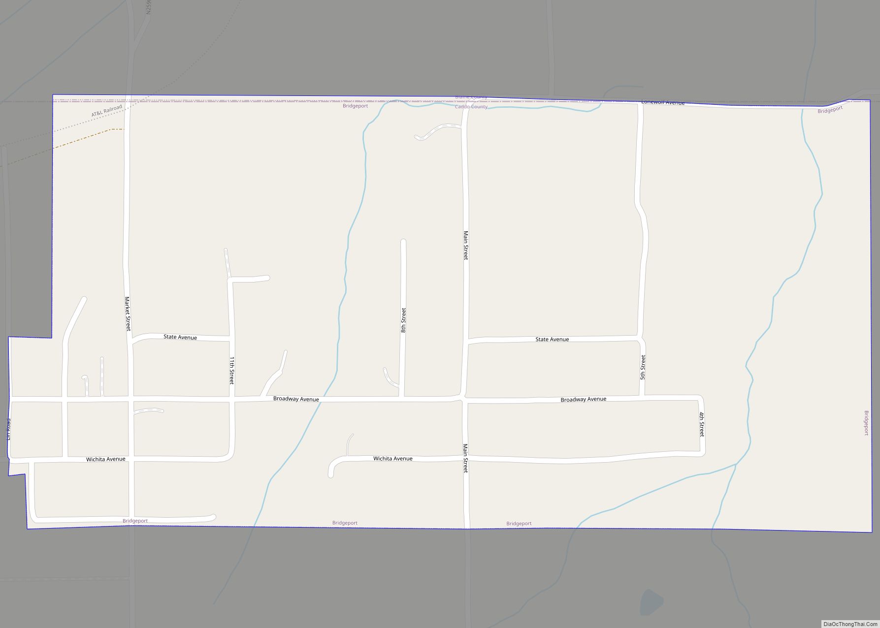
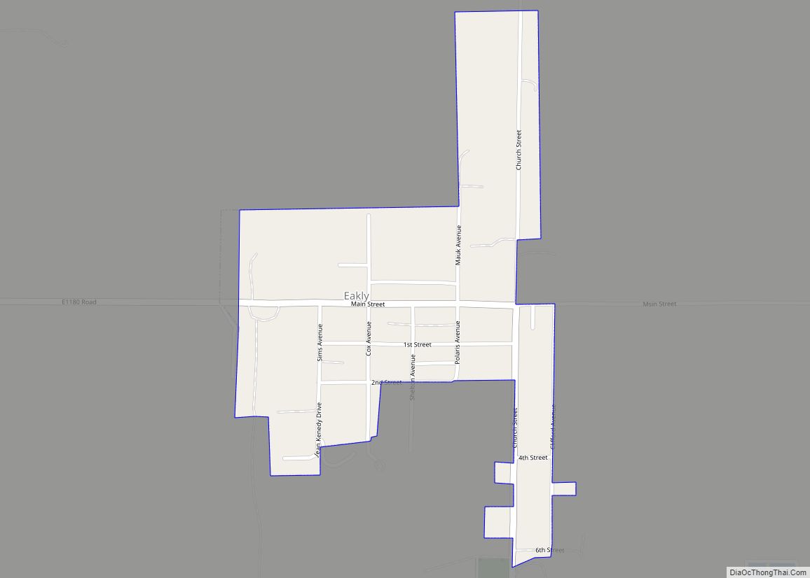
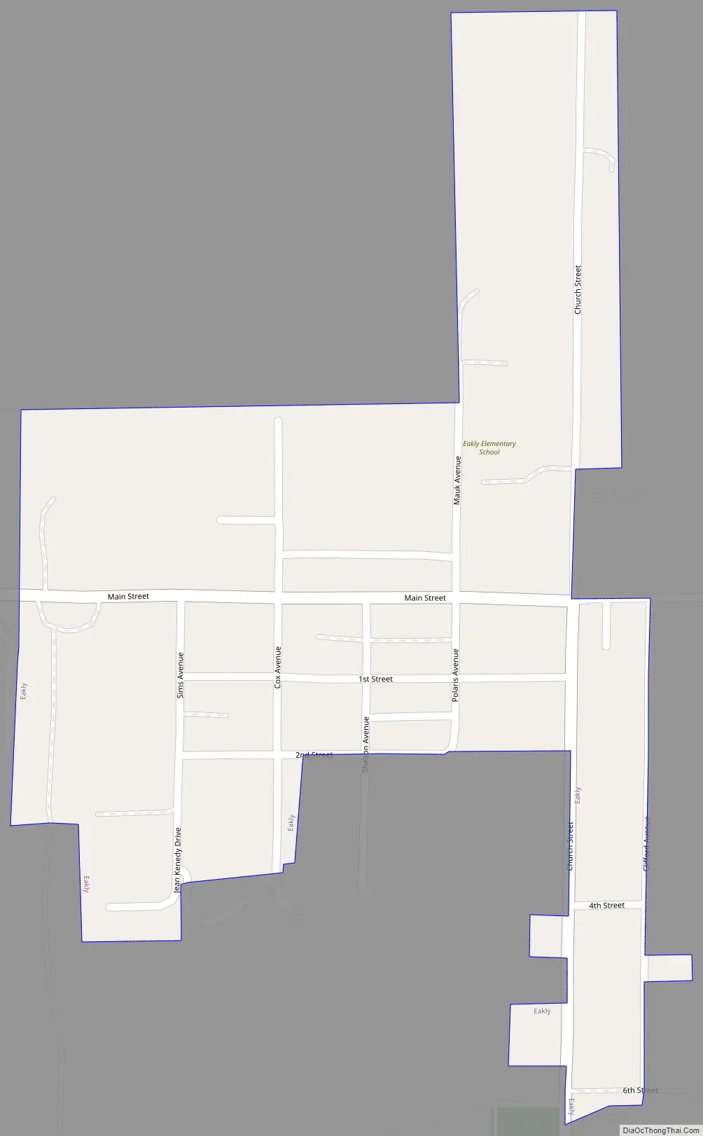
Online Interactive Map
Click on ![]() to view map in "full screen" mode.
to view map in "full screen" mode.
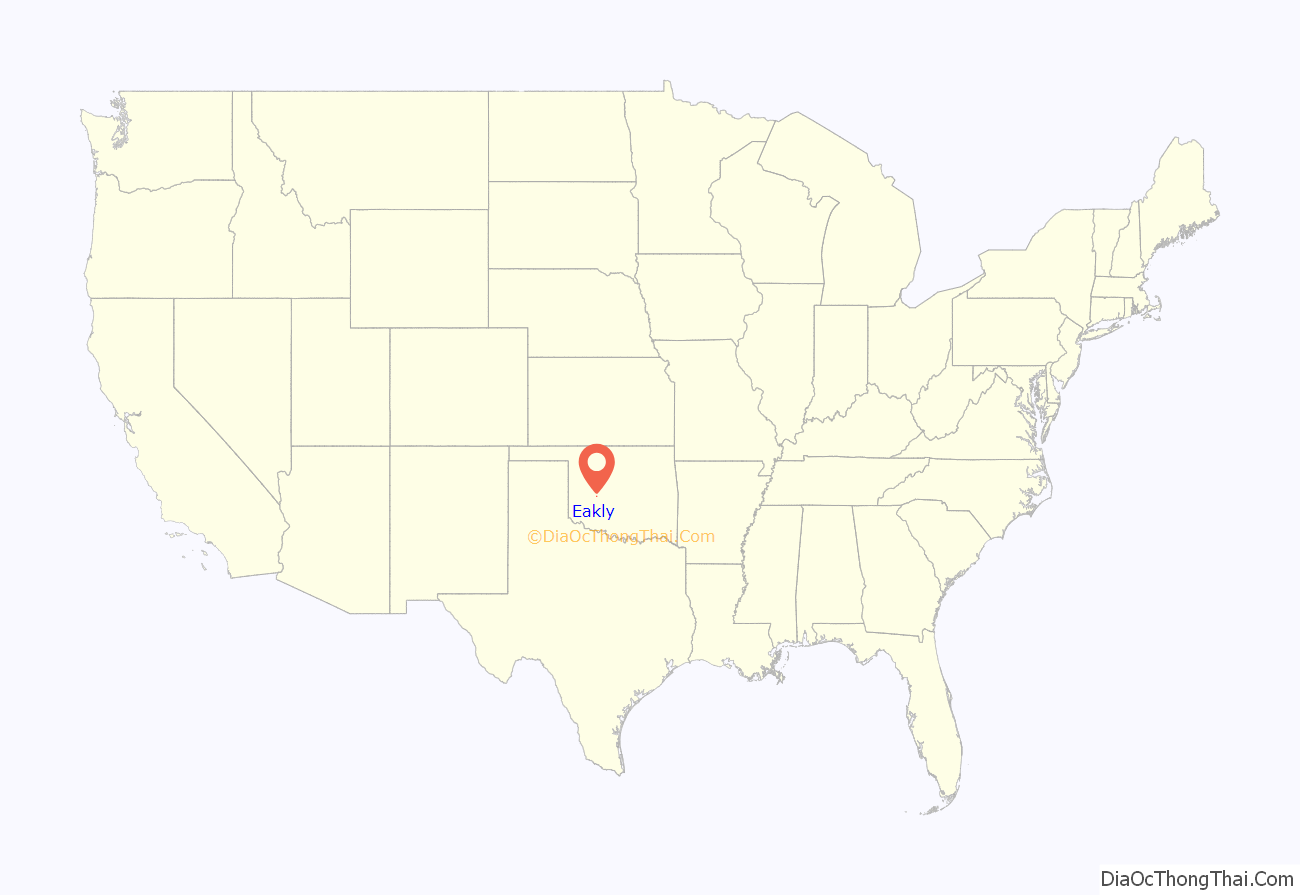
Eakly location map. Where is Eakly town?
History
A post office was established in the community of Eakly in March 1902, while this area was still part of Oklahoma Territory. Apparently, a plat was not filed for the town until the 1920s, which meant that town lots could not be sold during the first two decades of Eakly’s formal existence. Two organizations were exempted from this limit: the Methodist church bought a building site in 1914, and the Bank of Eakly bought a site in 1920. All others who wished to build in the town had to lease the land.
Eakly’s first census was in 1940, showing 231 residents. The population dropped somewhat during World War II, and registered 191 in 1950, probably because people moved to military service and war production work in larger towns and cities. There was an upswing in 1960 and 1970, which peaked at 452 by 1980. The count dropped to 277 in 1990, and has never again approached the 1980 high.
The lack of a registered town plat and the lack of a railroad did not prevent Eakly from prospering as an agricultural center. Cotton farming was the main activity in early decades. After World War II, irrigation began to spread into this part of Oklahoma, enabling more diverse crops. Peanut farming became the leading agricultural activity in the 1960s. The community incorporated as a town in 1957. A house manufacturing plant was built in 1970, but soon went out of business.
In 1999, the Eakly school system decided to end its 78-year existence and merge into the system at Hydro, approximately 12 miles (19 km) north. The closing was attributed to a 1990 state educational reform law that promised financial incentives to small school districts that agreed to consolidate. The surviving district in this case will be known as the Hydro-Eakly District
Eakly Road Map
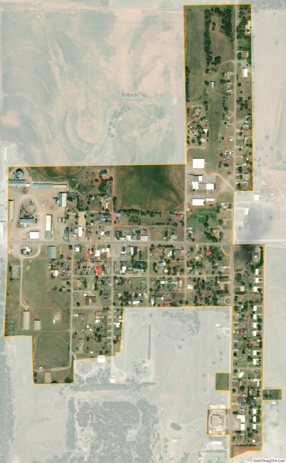
Eakly city Satellite Map
Geography
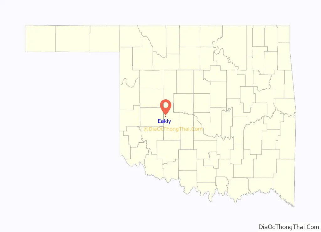
Eakly is located in northwestern Caddo County at 35°18′13″N 98°33′20″W / 35.30361°N 98.55556°W / 35.30361; -98.55556 (35.303547, -98.555436). It is one mile northeast of the intersection of state highways 58 and 152, and 17 miles (27 km) south of Interstate 40 on State Highway 58.
According to the United States Census Bureau, the town has a total area of 0.26 square miles (0.67 km), all land.
Eakly is less than 19 miles from Fort Cobb State Park on Fort Cobb Reservoir.
See also
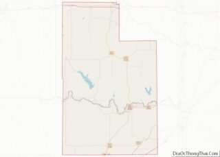
Map of Oklahoma State and its subdivision:- Adair
- Alfalfa
- Atoka
- Beaver
- Beckham
- Blaine
- Bryan
- Caddo
- Canadian
- Carter
- Cherokee
- Choctaw
- Cimarron
- Cleveland
- Coal
- Comanche
- Cotton
- Craig
- Creek
- Custer
- Delaware
- Dewey
- Ellis
- Garfield
- Garvin
- Grady
- Grant
- Greer
- Harmon
- Harper
- Haskell
- Hughes
- Jackson
- Jefferson
- Johnston
- Kay
- Kingfisher
- Kiowa
- Latimer
- Le Flore
- Lincoln
- Logan
- Love
- Major
- Marshall
- Mayes
- McClain
- McCurtain
- McIntosh
- Murray
- Muskogee
- Noble
- Nowata
- Okfuskee
- Oklahoma
- Okmulgee
- Osage
- Ottawa
- Pawnee
- Payne
- Pittsburg
- Pontotoc
- Pottawatomie
- Pushmataha
- Roger Mills
- Rogers
- Seminole
- Sequoyah
- Stephens
- Texas
- Tillman
- Tulsa
- Wagoner
- Washington
- Washita
- Woods
- Woodward
- Alabama
- Alaska
- Arizona
- Arkansas
- California
- Colorado
- Connecticut
- Delaware
- District of Columbia
- Florida
- Georgia
- Hawaii
- Idaho
- Illinois
- Indiana
- Iowa
- Kansas
- Kentucky
- Louisiana
- Maine
- Maryland
- Massachusetts
- Michigan
- Minnesota
- Mississippi
- Missouri
- Montana
- Nebraska
- Nevada
- New Hampshire
- New Jersey
- New Mexico
- New York
- North Carolina
- North Dakota
- Ohio
- Oklahoma
- Oregon
- Pennsylvania
- Rhode Island
- South Carolina
- South Dakota
- Tennessee
- Texas
- Utah
- Vermont
- Virginia
- Washington
- West Virginia
- Wisconsin
- Wyoming