Fairmont is a town in Garfield County, Oklahoma, United States. The population was 134 at the 2010 census, a decrease from 147 at the 2000 census.
| Name: | Fairmont town |
|---|---|
| LSAD Code: | 43 |
| LSAD Description: | town (suffix) |
| State: | Oklahoma |
| County: | Garfield County |
| Elevation: | 1,204 ft (367 m) |
| Total Area: | 0.24 sq mi (0.62 km²) |
| Land Area: | 0.24 sq mi (0.62 km²) |
| Water Area: | 0.00 sq mi (0.00 km²) |
| Total Population: | 132 |
| Population Density: | 554.62/sq mi (214.45/km²) |
| ZIP code: | 73736 |
| Area code: | 580 |
| FIPS code: | 4024950 |
| GNISfeature ID: | 1092702 |
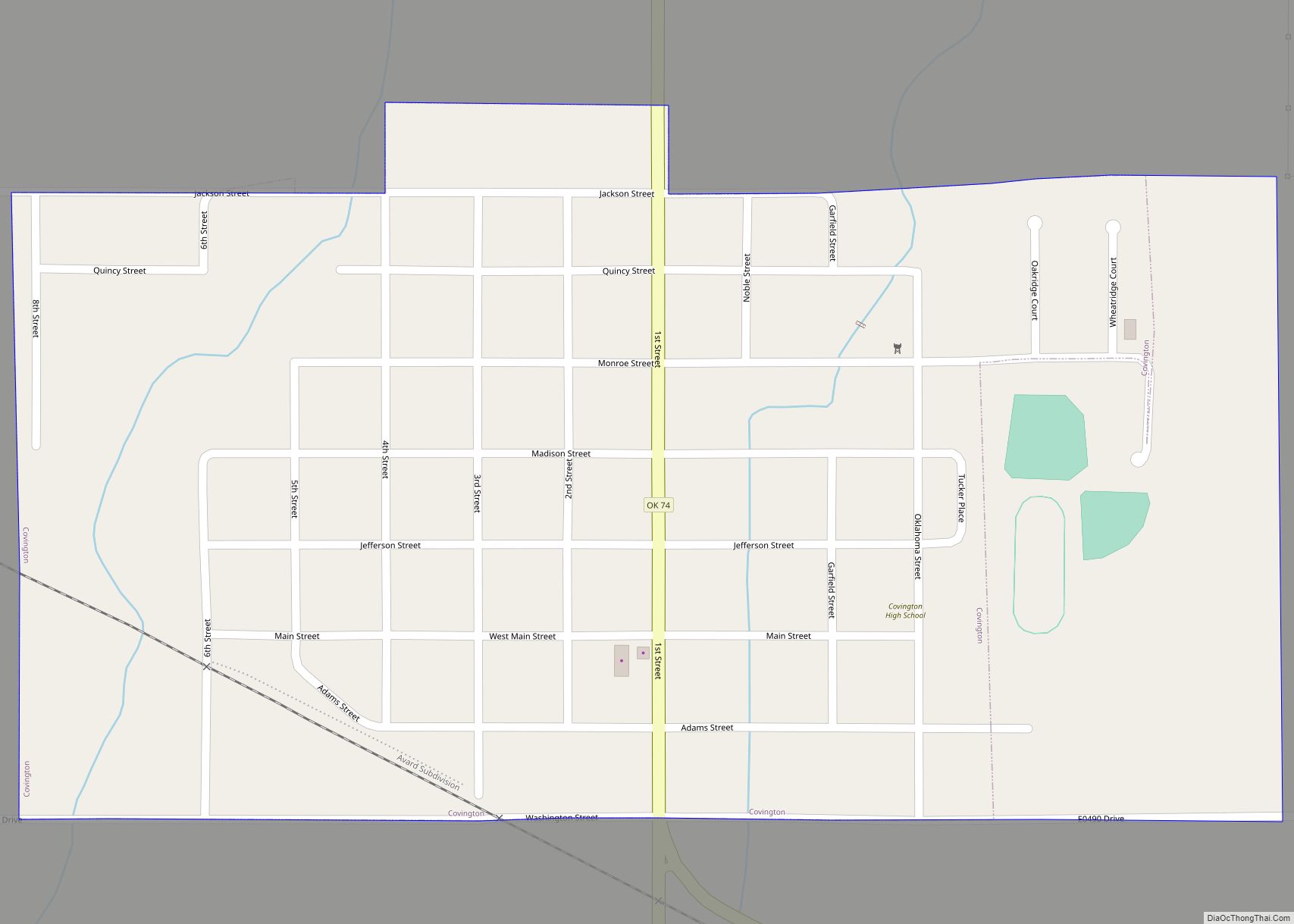
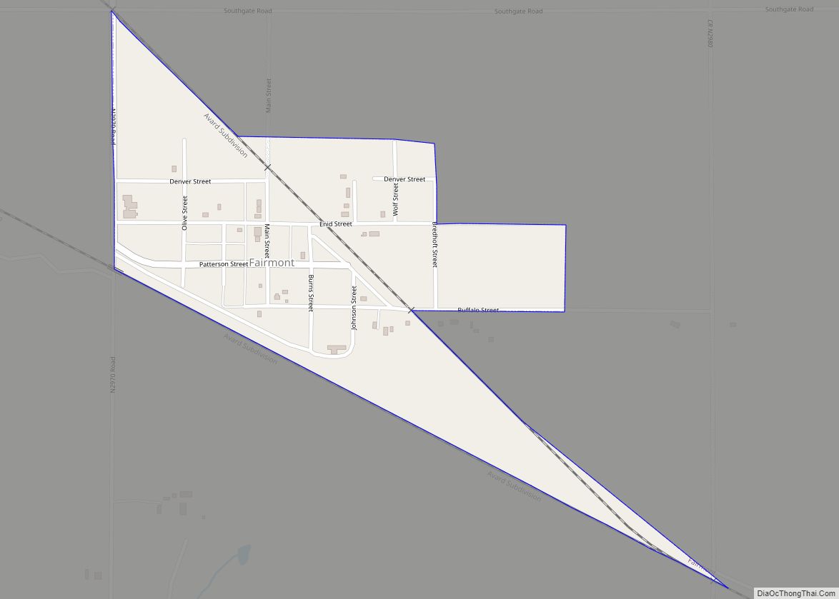
Online Interactive Map
Click on ![]() to view map in "full screen" mode.
to view map in "full screen" mode.
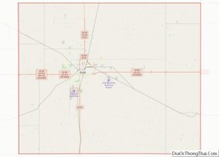
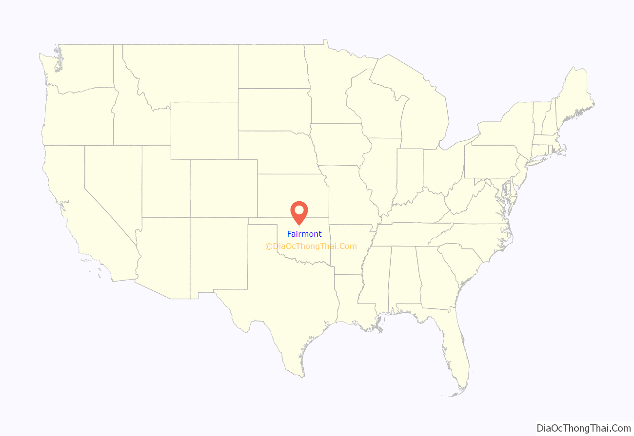
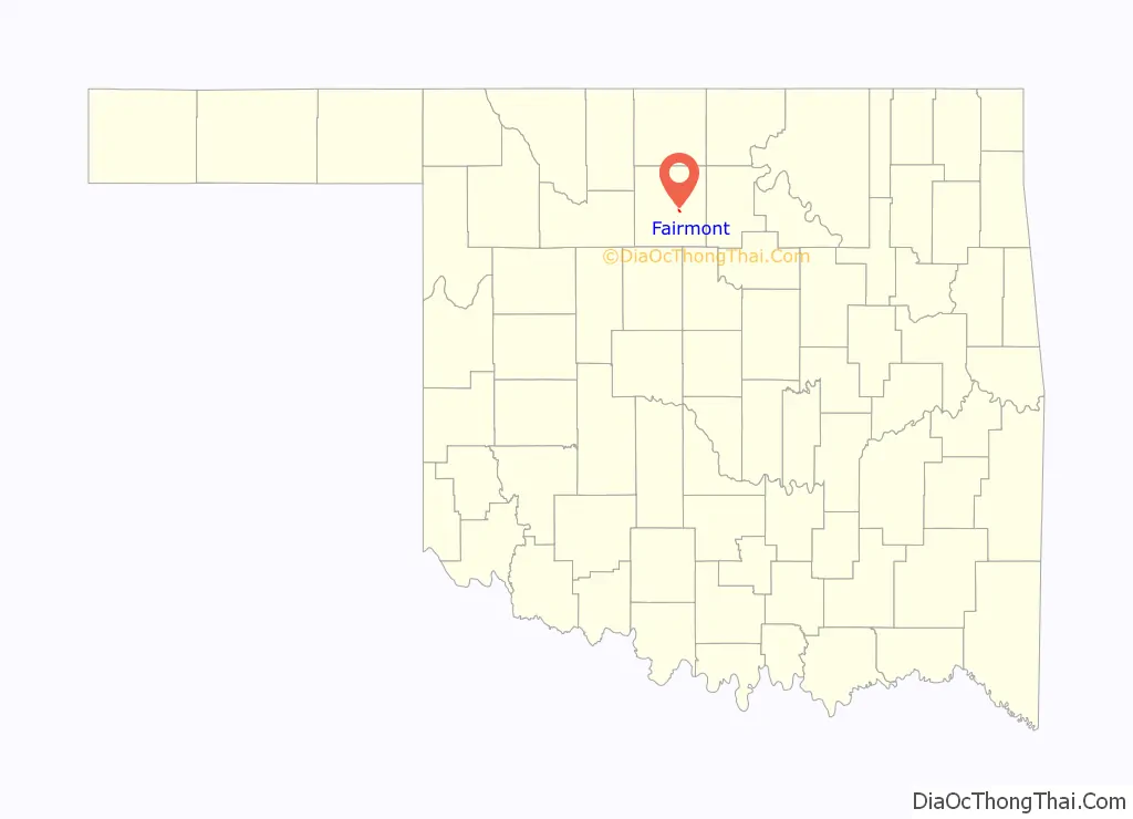
Fairmont location map. Where is Fairmont town?
History
Patterson Township, which surrounds Fairmont, began to be settled in 1893, immediately after the opening of the Cherokee Outlet. The Denver, Enid and Gulf Railroad constructed a line through area in 1902. The Enid Right of Way and Townsite Company platted Fairmont on October 18, 1902. A post office was established in December of that year. Previously, residents had received mail at the Luella post office. The Arkansas Valley and Western Railway constructed a branch from Tulsa through Perry and Covington to Steen (northeast of Enid) in 1902–03. The two railroads crossed at Fairmont, making the town a hub of agricultural services. Two elevators were built along the Frisco and two along the Santa Fe.
Agriculture has been the primary economic base for Fairmont since its founding. The principal crop is wheat. Petroleum bolstered the town after oil was discovered in the county in 1916. An oil refinery was built near Fairmont. It was acquired by the Champlin Refining Company in 1925.
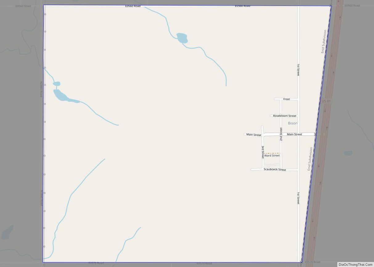
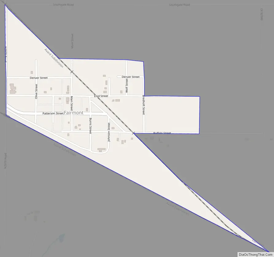
Fairmont Road Map
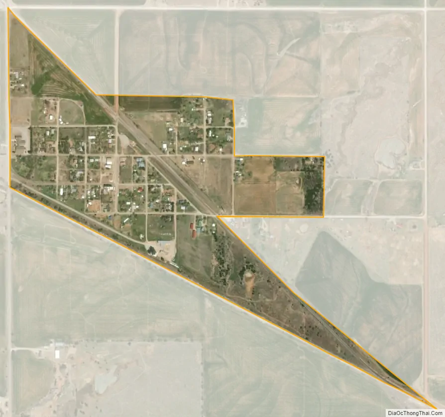
Fairmont city Satellite Map
Geography
Fairmont is located at 36°21′19″N 97°42′18″W / 36.35528°N 97.70500°W / 36.35528; -97.70500 (36.355411, -97.704931). It is 10 miles (16 km) east southeast of Enid, the county seat.
According to the United States Census Bureau, the town has a total area of 0.3 square miles (0.78 km), all land.
See also
Map of Oklahoma State and its subdivision:- Adair
- Alfalfa
- Atoka
- Beaver
- Beckham
- Blaine
- Bryan
- Caddo
- Canadian
- Carter
- Cherokee
- Choctaw
- Cimarron
- Cleveland
- Coal
- Comanche
- Cotton
- Craig
- Creek
- Custer
- Delaware
- Dewey
- Ellis
- Garfield
- Garvin
- Grady
- Grant
- Greer
- Harmon
- Harper
- Haskell
- Hughes
- Jackson
- Jefferson
- Johnston
- Kay
- Kingfisher
- Kiowa
- Latimer
- Le Flore
- Lincoln
- Logan
- Love
- Major
- Marshall
- Mayes
- McClain
- McCurtain
- McIntosh
- Murray
- Muskogee
- Noble
- Nowata
- Okfuskee
- Oklahoma
- Okmulgee
- Osage
- Ottawa
- Pawnee
- Payne
- Pittsburg
- Pontotoc
- Pottawatomie
- Pushmataha
- Roger Mills
- Rogers
- Seminole
- Sequoyah
- Stephens
- Texas
- Tillman
- Tulsa
- Wagoner
- Washington
- Washita
- Woods
- Woodward
- Alabama
- Alaska
- Arizona
- Arkansas
- California
- Colorado
- Connecticut
- Delaware
- District of Columbia
- Florida
- Georgia
- Hawaii
- Idaho
- Illinois
- Indiana
- Iowa
- Kansas
- Kentucky
- Louisiana
- Maine
- Maryland
- Massachusetts
- Michigan
- Minnesota
- Mississippi
- Missouri
- Montana
- Nebraska
- Nevada
- New Hampshire
- New Jersey
- New Mexico
- New York
- North Carolina
- North Dakota
- Ohio
- Oklahoma
- Oregon
- Pennsylvania
- Rhode Island
- South Carolina
- South Dakota
- Tennessee
- Texas
- Utah
- Vermont
- Virginia
- Washington
- West Virginia
- Wisconsin
- Wyoming