Garber is a city in Garfield County, Oklahoma, United States. The population was 822 at the 2010 census. The city is named after Martin Garber, father of Milton C. Garber, former U.S. congressman, Enid mayor, newspaper editor, and judge. The land was previously part of the Cherokee Outlet, until the U.S. government declared it open to non-Indian settlement in 1893.
| Name: | Garber city |
|---|---|
| LSAD Code: | 25 |
| LSAD Description: | city (suffix) |
| State: | Oklahoma |
| County: | Garfield County |
| Elevation: | 1,178 ft (359 m) |
| Total Area: | 0.51 sq mi (1.31 km²) |
| Land Area: | 0.51 sq mi (1.31 km²) |
| Water Area: | 0.00 sq mi (0.00 km²) |
| Total Population: | 725 |
| Population Density: | 1,432.81/sq mi (552.73/km²) |
| ZIP code: | 73738 |
| Area code: | 580 |
| FIPS code: | 4028500 |
| GNISfeature ID: | 1093108 |
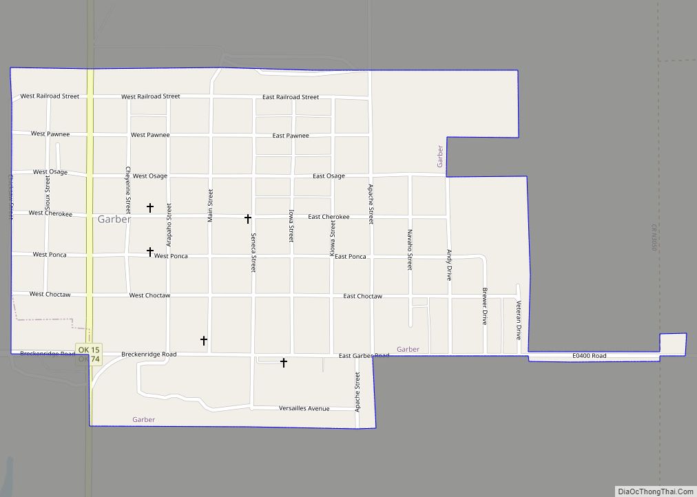
Online Interactive Map
Click on ![]() to view map in "full screen" mode.
to view map in "full screen" mode.
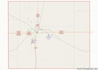
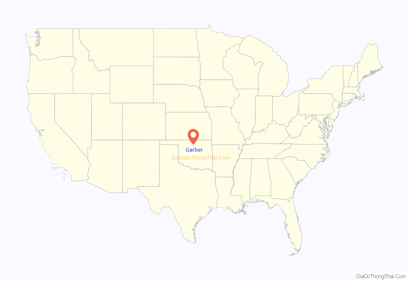
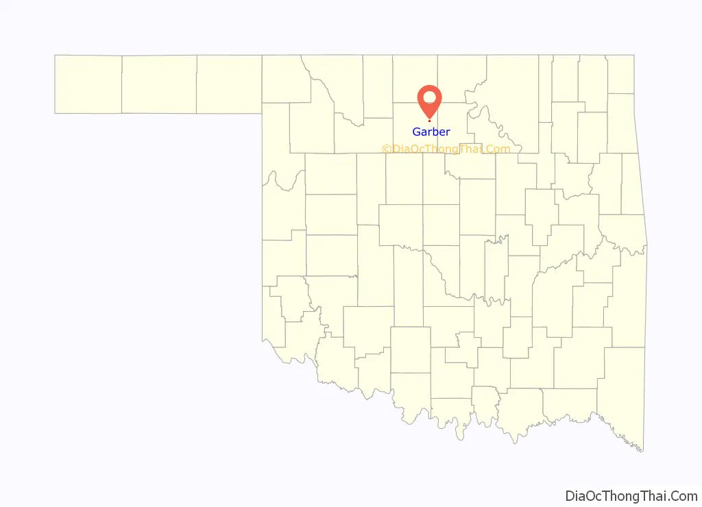
Garber location map. Where is Garber city?
History
The Garber family participated in the Land Run of 1893, claiming 160 acres (0.65 km) of land that would become the city of Garber. The Enid & Tonkawa Railway built a line in 1899 that ran from North Enid to Billings, near the brothers’ land. In October 1899, the Garber Town Company, owned by brothers Milton C. and Burton A. Garber, platted the town. Burton Garber was part-owner of the Garber Oil Company.
Ed Long (1934-2017), Oklahoma state senator and businessman, was born in Garber.
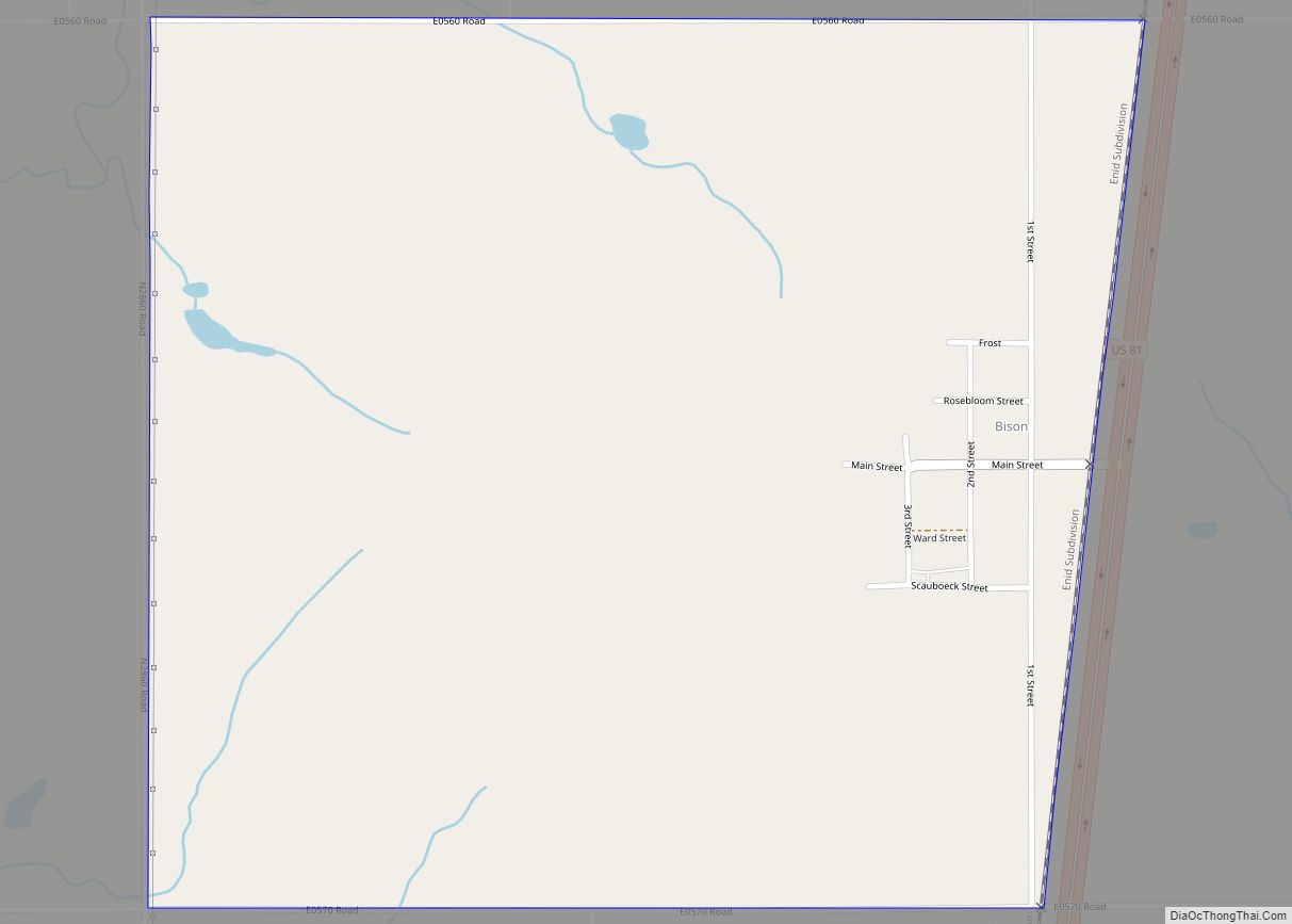
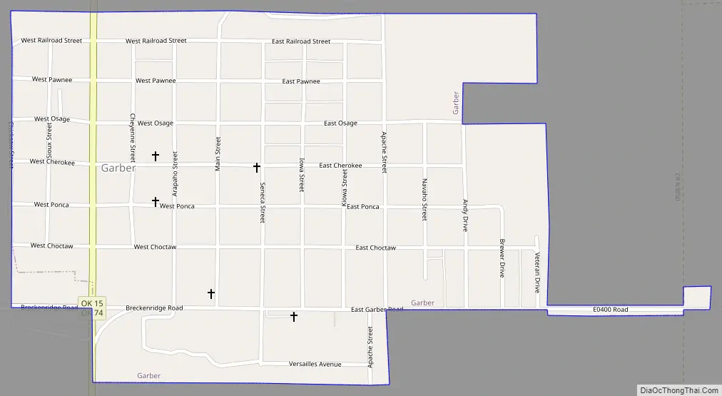
Garber Road Map
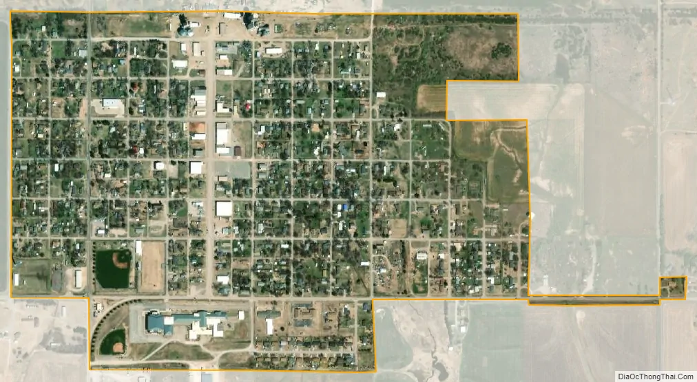
Garber city Satellite Map
Geography
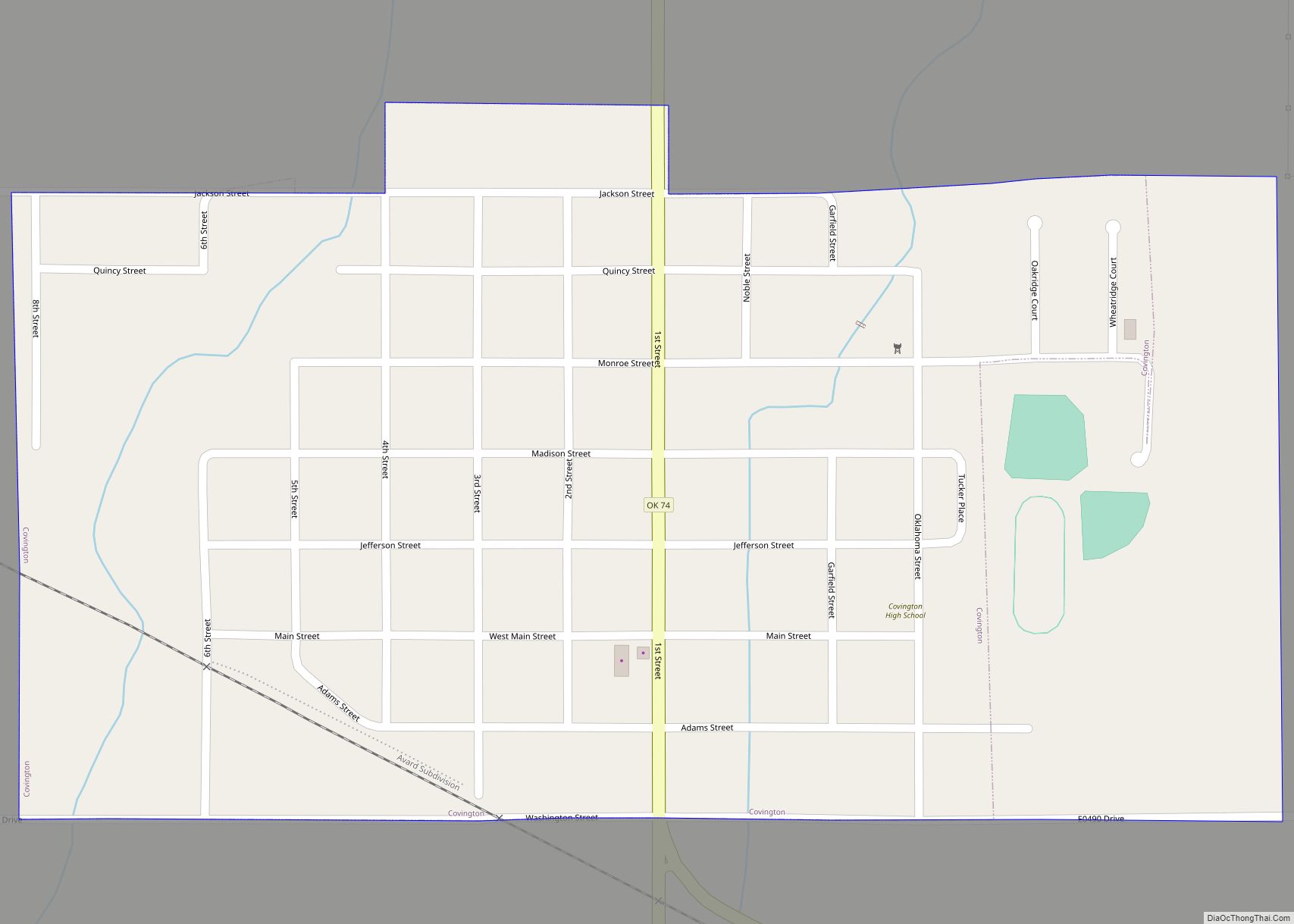
Garber is located in eastern Garfield County, 19 miles (31 km) east of Enid, the county seat. Oklahoma State Highways 15 and 74 pass together through the west side of the city, with Highway 74 leading north 18 miles (29 km) to Lamont and south 9 miles (14 km) to Covington. Highway 15 leads south and west to Enid, and north and east 15 miles (24 km) to Billings.
According to the United States Census Bureau, Garber has a total area of 0.50 square miles (1.3 km), all land.
See also
Map of Oklahoma State and its subdivision:- Adair
- Alfalfa
- Atoka
- Beaver
- Beckham
- Blaine
- Bryan
- Caddo
- Canadian
- Carter
- Cherokee
- Choctaw
- Cimarron
- Cleveland
- Coal
- Comanche
- Cotton
- Craig
- Creek
- Custer
- Delaware
- Dewey
- Ellis
- Garfield
- Garvin
- Grady
- Grant
- Greer
- Harmon
- Harper
- Haskell
- Hughes
- Jackson
- Jefferson
- Johnston
- Kay
- Kingfisher
- Kiowa
- Latimer
- Le Flore
- Lincoln
- Logan
- Love
- Major
- Marshall
- Mayes
- McClain
- McCurtain
- McIntosh
- Murray
- Muskogee
- Noble
- Nowata
- Okfuskee
- Oklahoma
- Okmulgee
- Osage
- Ottawa
- Pawnee
- Payne
- Pittsburg
- Pontotoc
- Pottawatomie
- Pushmataha
- Roger Mills
- Rogers
- Seminole
- Sequoyah
- Stephens
- Texas
- Tillman
- Tulsa
- Wagoner
- Washington
- Washita
- Woods
- Woodward
- Alabama
- Alaska
- Arizona
- Arkansas
- California
- Colorado
- Connecticut
- Delaware
- District of Columbia
- Florida
- Georgia
- Hawaii
- Idaho
- Illinois
- Indiana
- Iowa
- Kansas
- Kentucky
- Louisiana
- Maine
- Maryland
- Massachusetts
- Michigan
- Minnesota
- Mississippi
- Missouri
- Montana
- Nebraska
- Nevada
- New Hampshire
- New Jersey
- New Mexico
- New York
- North Carolina
- North Dakota
- Ohio
- Oklahoma
- Oregon
- Pennsylvania
- Rhode Island
- South Carolina
- South Dakota
- Tennessee
- Texas
- Utah
- Vermont
- Virginia
- Washington
- West Virginia
- Wisconsin
- Wyoming