Harrah is a city in Oklahoma County, Oklahoma, United States, and a part of the Oklahoma City metropolitan area. Located 25 miles (40 km) east of downtown Oklahoma City, Harrah had a population of 6,245 people as of the 2020 Census, a 22.6% increase from 2010.
The first settler of the area, who was Potawatomi, arrived in the 1870s, but the town was not incorporated until 1908. The town was settled by Americans, Polish immigrants, and other groups and had a cotton ginning center. The city is overseen by a city council and mayor and includes a police department and fire station.
| Name: | Harrah city |
|---|---|
| LSAD Code: | 25 |
| LSAD Description: | city (suffix) |
| State: | Oklahoma |
| County: | Oklahoma County |
| Elevation: | 1,106 ft (337 m) |
| Total Area: | 12.42 sq mi (32.16 km²) |
| Land Area: | 12.42 sq mi (32.16 km²) |
| Water Area: | 0.00 sq mi (0.00 km²) |
| Total Population: | 6,245 |
| Population Density: | 502.98/sq mi (194.20/km²) |
| ZIP code: | 73045 |
| Area code: | 405 |
| FIPS code: | 4032750 |
| GNISfeature ID: | 1093561 |
| Website: | cityofharrah.com |
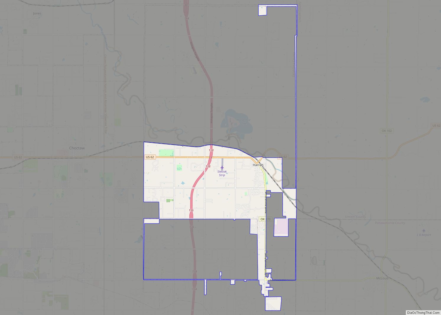
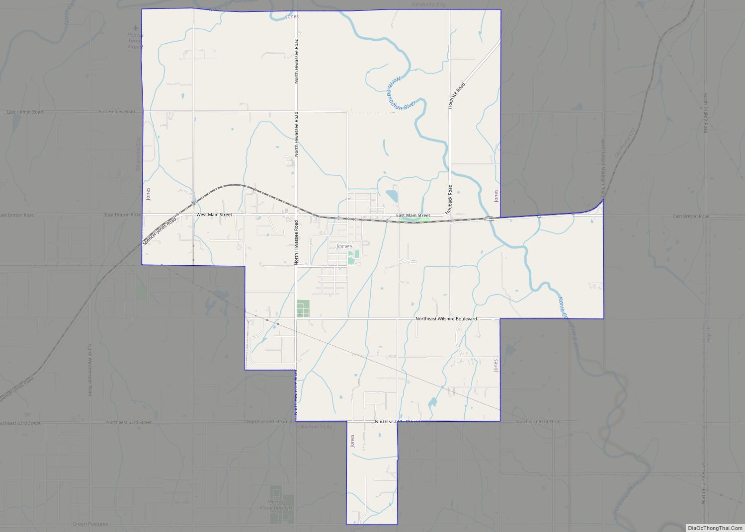
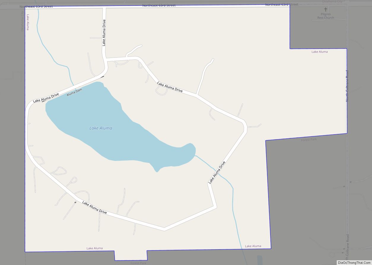
Online Interactive Map
Click on ![]() to view map in "full screen" mode.
to view map in "full screen" mode.
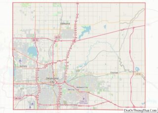
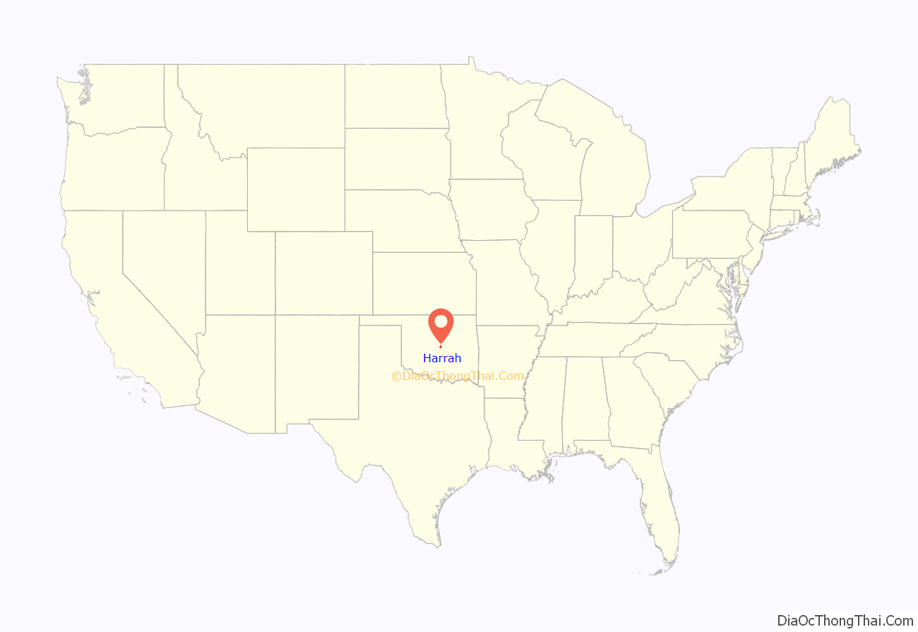
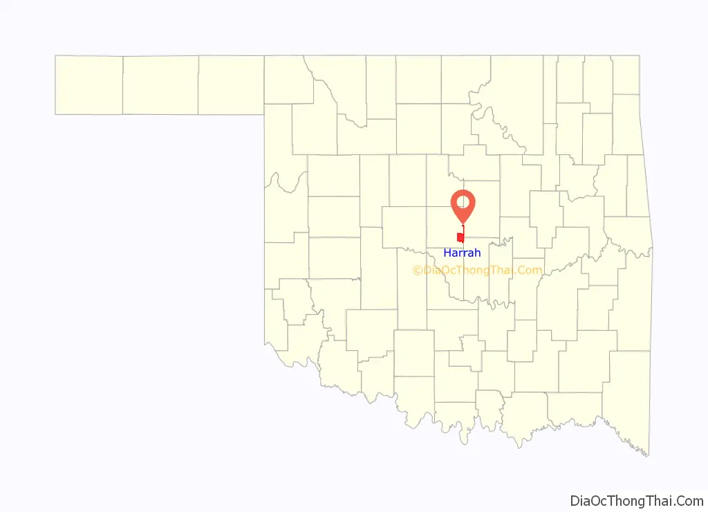
Harrah location map. Where is Harrah city?
History
The land that would become the town of Harrah had its first settler, Louis Navarre, in the 1870s. Navarre, was a member of the Potawatomi people who had signed an 1867 treaty to sell their Kansas lands in order to purchase lands in Native Territory with the proceeds. They also became citizens of the United States and thus became known as the Citizen Potawatomi.
In 1890, Navarre and the Citizen Potawatomi participated, unwillingly, in the allotment process implemented through the Dawes Act of 1887. With this Act, the Citizen Potawatomi people were forced to accept individual allotments. In the Land Run of 1891, the remainder of the Potawatomi reservation in Oklahoma was opened up to non-Indian settlement, with about 450 square miles (1,200 km) of the reservation given away by the government to settlers.
Frank Harrah, for whom the town is named, purchased 40 acres (160,000 m) from Louis Navarre’s allotment in April 1898 and early settlers included a large number of Polish immigrants. More than two million Poles entered American ports between 1897 and 1913, and the immigrants formed small communities around Choctaw Nation coal mines.
Originally named Sweeney, after E.W. Sweeney, who operated a ferry beginning in 1891, the town was renamed Harrah on December 22, 1898, and was incorporated in 1908. The town was almost renamed Clubb.
In the 1940s Harrah was a center of cotton ginning. Its population was 741 in 1950. By 1990 4,206 people lived in Harrah.
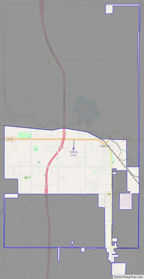
Harrah Road Map
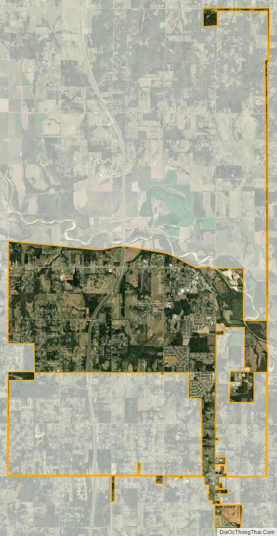
Harrah city Satellite Map
Geography
Harrah is a small city in Oklahoma with a total land area of 11.9 square miles (31 km), all land. The city’s elevation is 925 feet (282 m) above sea level. It lies partly in the Great Plains near the geographical center of the 48 contiguous states in the United States. It lies between the larger cities of Oklahoma City to the west and Shawnee, to the east, in Oklahoma County.
Harrah is located in the Crosstimbers ecoregion and the Frontier Country tourism region.
Climate
Oklahoma is located in a temperate region and experiences occasional extremes of temperature and precipitation typical of a continental climate. Harrah lies in an area known as Tornado Alley characterized by frequent interaction between cold and warm air masses producing severe weather. An average of 54 tornadoes strike the state per year.
The city frequently experiences temperatures above 100 °F (38 °C).
See also
Map of Oklahoma State and its subdivision:- Adair
- Alfalfa
- Atoka
- Beaver
- Beckham
- Blaine
- Bryan
- Caddo
- Canadian
- Carter
- Cherokee
- Choctaw
- Cimarron
- Cleveland
- Coal
- Comanche
- Cotton
- Craig
- Creek
- Custer
- Delaware
- Dewey
- Ellis
- Garfield
- Garvin
- Grady
- Grant
- Greer
- Harmon
- Harper
- Haskell
- Hughes
- Jackson
- Jefferson
- Johnston
- Kay
- Kingfisher
- Kiowa
- Latimer
- Le Flore
- Lincoln
- Logan
- Love
- Major
- Marshall
- Mayes
- McClain
- McCurtain
- McIntosh
- Murray
- Muskogee
- Noble
- Nowata
- Okfuskee
- Oklahoma
- Okmulgee
- Osage
- Ottawa
- Pawnee
- Payne
- Pittsburg
- Pontotoc
- Pottawatomie
- Pushmataha
- Roger Mills
- Rogers
- Seminole
- Sequoyah
- Stephens
- Texas
- Tillman
- Tulsa
- Wagoner
- Washington
- Washita
- Woods
- Woodward
- Alabama
- Alaska
- Arizona
- Arkansas
- California
- Colorado
- Connecticut
- Delaware
- District of Columbia
- Florida
- Georgia
- Hawaii
- Idaho
- Illinois
- Indiana
- Iowa
- Kansas
- Kentucky
- Louisiana
- Maine
- Maryland
- Massachusetts
- Michigan
- Minnesota
- Mississippi
- Missouri
- Montana
- Nebraska
- Nevada
- New Hampshire
- New Jersey
- New Mexico
- New York
- North Carolina
- North Dakota
- Ohio
- Oklahoma
- Oregon
- Pennsylvania
- Rhode Island
- South Carolina
- South Dakota
- Tennessee
- Texas
- Utah
- Vermont
- Virginia
- Washington
- West Virginia
- Wisconsin
- Wyoming