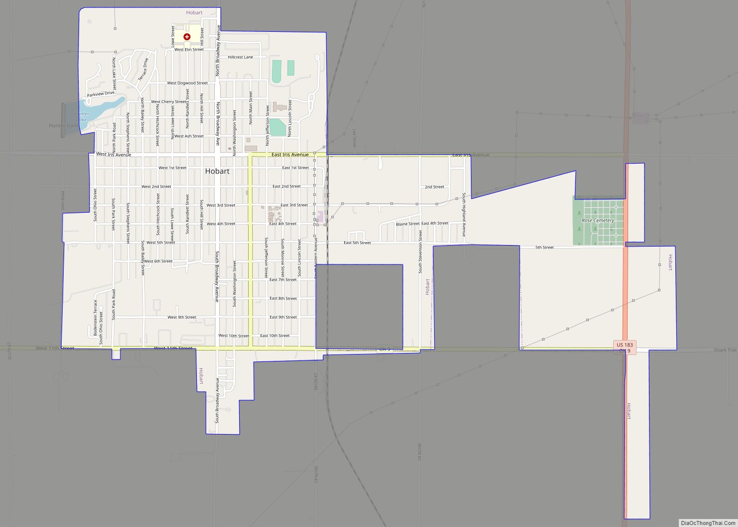
Hobart is a city in, and the county seat of, Kiowa County, Oklahoma, United States. It was named for Garret Hobart, the 24th Vice President of the United States. The population was 3,756 at the 2010 census, a decline of 6.0 percent from the figure of 3,997 in 2000. It is served by Hobart Regional Airport. It also has two museums: the General Tommy Franks Museum and the Kiowa County Museum.
| Name: | Hobart city |
|---|---|
| LSAD Code: | 25 |
| LSAD Description: | city (suffix) |
| State: | Oklahoma |
| County: | Kiowa County |
| Elevation: | 1,552 ft (473 m) |
| Total Area: | 3.36 sq mi (8.71 km²) |
| Land Area: | 3.36 sq mi (8.71 km²) |
| Water Area: | 0.00 sq mi (0.00 km²) |
| Total Population: | 3,413 |
| Population Density: | 1,015.17/sq mi (391.91/km²) |
| ZIP code: | 73651 |
| Area code: | 580 |
| FIPS code: | 4035000 |
| GNISfeature ID: | 1093806 |
| Website: | hobartok.gov |
Online Interactive Map
Click on ![]() to view map in "full screen" mode.
to view map in "full screen" mode.
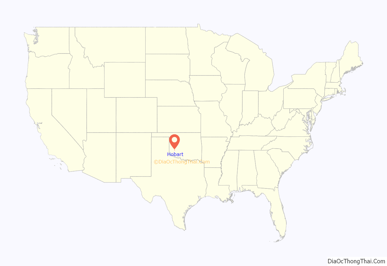
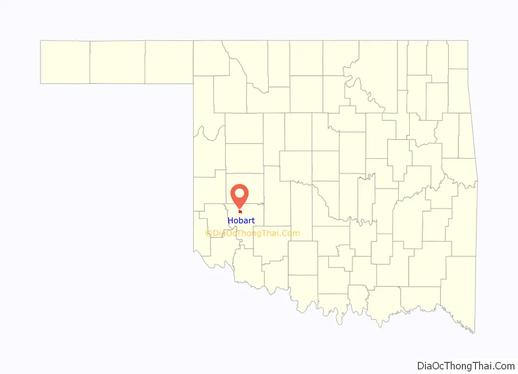
Hobart location map. Where is Hobart city?
History
The present town of Hobart began almost overnight on August 6, 1901, when lots on the former Kiowa-Apache-Comanche Reservation in southern Oklahoma Territory were put up for sale. It quickly became the residence of 2,936 people, mostly living in tents. Initially, the town was nicknamed “Ragtown.” Wooden structures replaced tents as fast as possible. By 1903, Hobart had electric lights, an ice plant, and some large wholesale businesses. It also had a wooden courthouse. It developed into a town whose economy was based on the production of cotton. At statehood in November 1907, Hobart had a population of 3,136.
Hobart’s population declined to 2,936 in 1920, but resumed growing for several years afterward. In 1930, the population was 4,982. In 1950, it reached a peak of 5,380. Thereafter, the town population went into a long-term decline that has continued to the present. In the 1950 water supply in the area was improved with a series of reservoirs; the town is connected by aqueduct to Lake Hobart several kilometers to the north.
Hobart Road Map
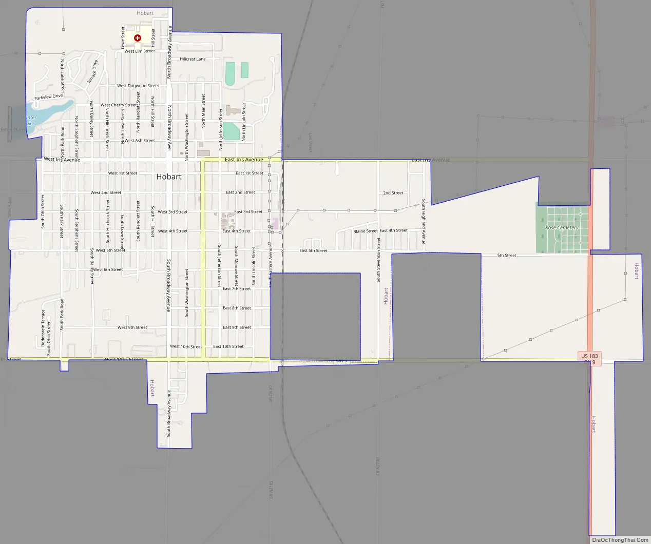
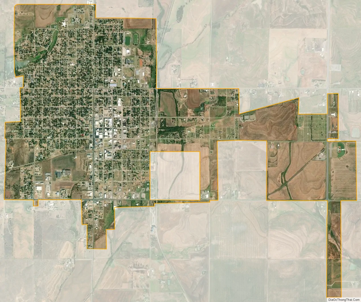
Hobart city Satellite Map
Geography
Hobart is located at 35°1′35″N 99°5′27″W / 35.02639°N 99.09083°W / 35.02639; -99.09083 (35.026276, -99.090876). It is 120 miles (190 km) southwest of Oklahoma City and 65 miles (105 km) northwest of Lawton
According to the United States Census Bureau, the city has a total area of 2.7 square miles (7.0 km), all land.
See also
Map of Oklahoma State and its subdivision:- Adair
- Alfalfa
- Atoka
- Beaver
- Beckham
- Blaine
- Bryan
- Caddo
- Canadian
- Carter
- Cherokee
- Choctaw
- Cimarron
- Cleveland
- Coal
- Comanche
- Cotton
- Craig
- Creek
- Custer
- Delaware
- Dewey
- Ellis
- Garfield
- Garvin
- Grady
- Grant
- Greer
- Harmon
- Harper
- Haskell
- Hughes
- Jackson
- Jefferson
- Johnston
- Kay
- Kingfisher
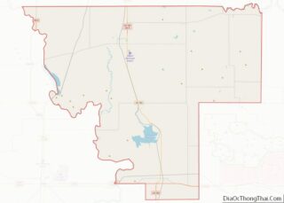
- Kiowa
- Latimer
- Le Flore
- Lincoln
- Logan
- Love
- Major
- Marshall
- Mayes
- McClain
- McCurtain
- McIntosh
- Murray
- Muskogee
- Noble
- Nowata
- Okfuskee
- Oklahoma
- Okmulgee
- Osage
- Ottawa
- Pawnee
- Payne
- Pittsburg
- Pontotoc
- Pottawatomie
- Pushmataha
- Roger Mills
- Rogers
- Seminole
- Sequoyah
- Stephens
- Texas
- Tillman
- Tulsa
- Wagoner
- Washington
- Washita
- Woods
- Woodward
- Alabama
- Alaska
- Arizona
- Arkansas
- California
- Colorado
- Connecticut
- Delaware
- District of Columbia
- Florida
- Georgia
- Hawaii
- Idaho
- Illinois
- Indiana
- Iowa
- Kansas
- Kentucky
- Louisiana
- Maine
- Maryland
- Massachusetts
- Michigan
- Minnesota
- Mississippi
- Missouri
- Montana
- Nebraska
- Nevada
- New Hampshire
- New Jersey
- New Mexico
- New York
- North Carolina
- North Dakota
- Ohio
- Oklahoma
- Oregon
- Pennsylvania
- Rhode Island
- South Carolina
- South Dakota
- Tennessee
- Texas
- Utah
- Vermont
- Virginia
- Washington
- West Virginia
- Wisconsin
- Wyoming