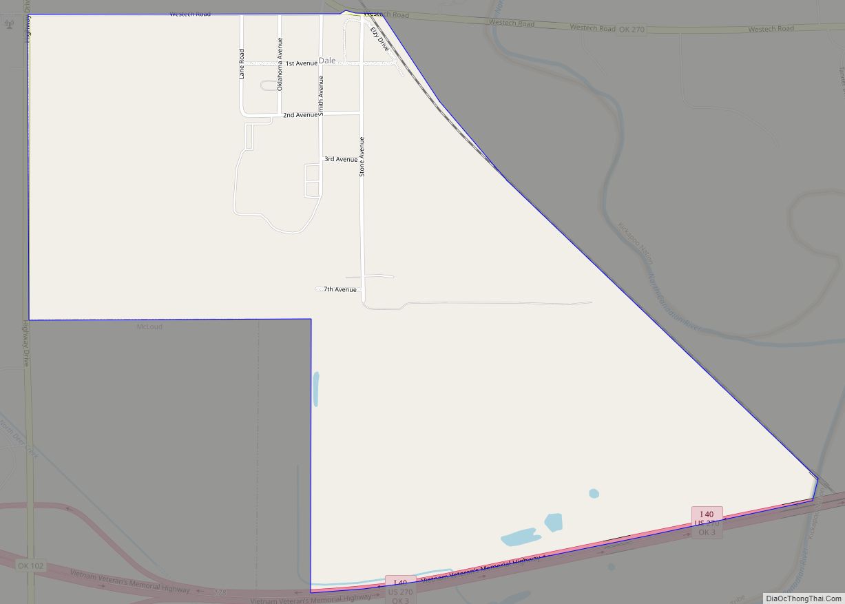
McLoud is a city in northwestern Pottawatomie County, Oklahoma, United States, and is part of the Oklahoma City Consolidated Metropolitan Area. The population was 4,044 at the 2010 census, a 14.0 percent increase from the figure of 3,548 in 2000. The city was founded in 1895 and named for John W. McLoud, attorney for the Choctaw, Oklahoma and Gulf Railroad.
| Name: | McLoud city |
|---|---|
| LSAD Code: | 25 |
| LSAD Description: | city (suffix) |
| State: | Oklahoma |
| County: | Pottawatomie County |
| Elevation: | 1,093 ft (333 m) |
| Total Area: | 18.10 sq mi (46.88 km²) |
| Land Area: | 18.02 sq mi (46.67 km²) |
| Water Area: | 0.08 sq mi (0.21 km²) |
| Total Population: | 4,351 |
| Population Density: | 241.47/sq mi (93.23/km²) |
| ZIP code: | 74851 |
| Area code: | 405/572 |
| FIPS code: | 4045350 |
| GNISfeature ID: | 1095268 |
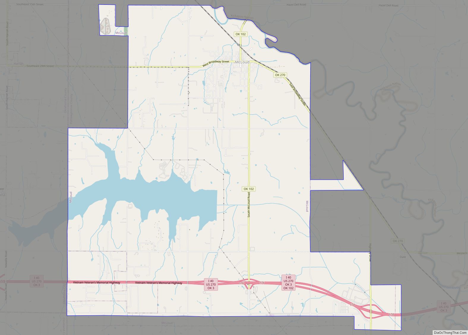
Online Interactive Map
Click on ![]() to view map in "full screen" mode.
to view map in "full screen" mode.
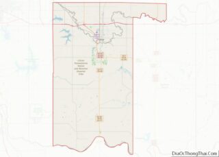
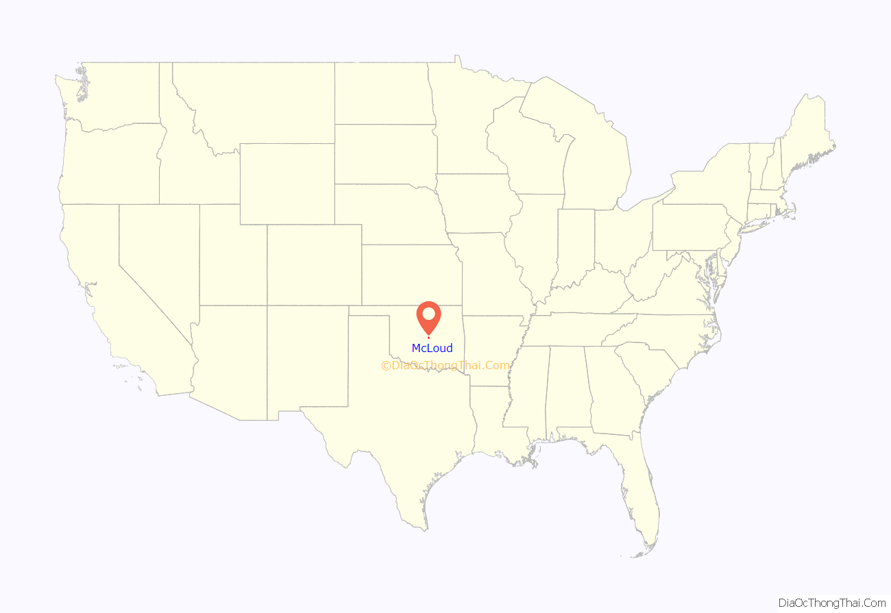
McLoud location map. Where is McLoud city?
History
Early day McLoud was known for manufacturing and selling whiskey to whites and American Indians in dry Indian Territory. Located on the North Canadian River, the original town was destroyed in a flood and was rebuilt on higher ground one mile south.
In June 1895, a post office named McCloud was established for the town, named after railroad attorney John William McLoud. The spelling of the post office name was corrected in October 1895. The town incorporated July 7, 1896. The town was an agricultural center for much of its history. By the start of the 21st Century, it had become a bedroom community, with many of its residents commuting to work in other towns.
In 1949, the city was recognized as the “Blackberry Capital of the World” when the Chamber of Commerce sent a crate of blackberries to President Harry S. Truman.
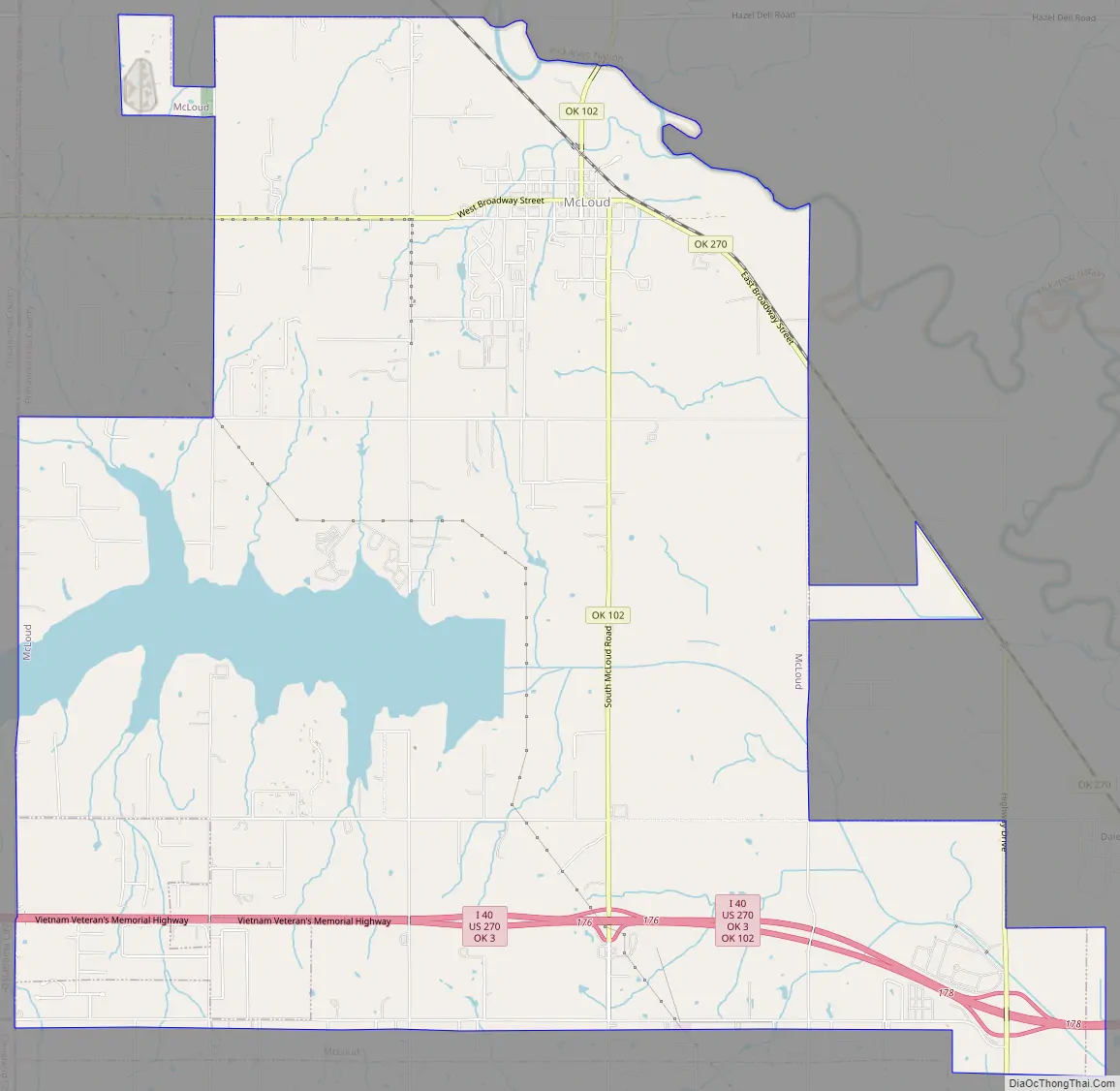
McLoud Road Map
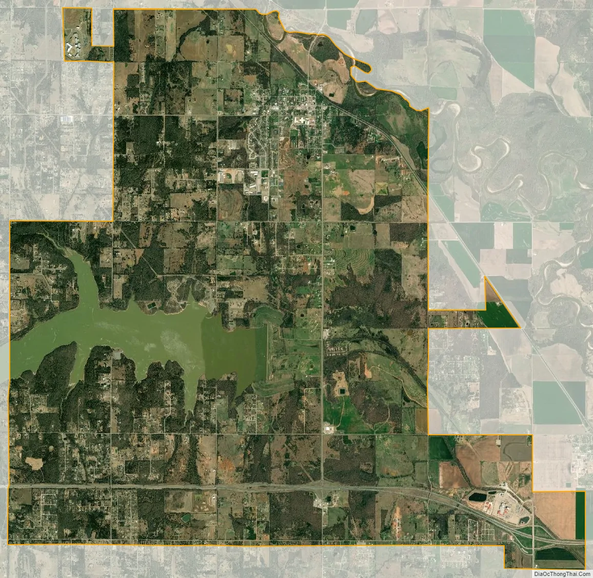
McLoud city Satellite Map
Geography
McLoud is located at 35°26′09″N 97°05′29″W / 35.43583°N 97.09139°W / 35.43583; -97.09139.
It is approximately 22 miles (35 km) east of Oklahoma City. The North Canadian River flows past the northeast side of the city. Oklahoma Route 270 and Route 102 intersect within the town.
According to the United States Census Bureau, the town has a total area of 18.4 square miles (48 km), of which 18.3 square miles (47 km) is land and 0.1 square miles (0.26 km) (0.43%) is water.
McLoud is located in the Crosstimbers ecoregion and the Frontier Country tourism region.
See also
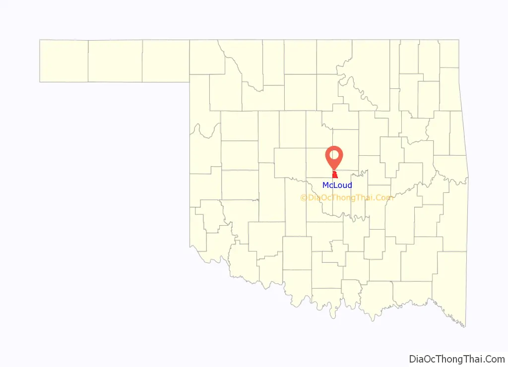
Map of Oklahoma State and its subdivision:- Adair
- Alfalfa
- Atoka
- Beaver
- Beckham
- Blaine
- Bryan
- Caddo
- Canadian
- Carter
- Cherokee
- Choctaw
- Cimarron
- Cleveland
- Coal
- Comanche
- Cotton
- Craig
- Creek
- Custer
- Delaware
- Dewey
- Ellis
- Garfield
- Garvin
- Grady
- Grant
- Greer
- Harmon
- Harper
- Haskell
- Hughes
- Jackson
- Jefferson
- Johnston
- Kay
- Kingfisher
- Kiowa
- Latimer
- Le Flore
- Lincoln
- Logan
- Love
- Major
- Marshall
- Mayes
- McClain
- McCurtain
- McIntosh
- Murray
- Muskogee
- Noble
- Nowata
- Okfuskee
- Oklahoma
- Okmulgee
- Osage
- Ottawa
- Pawnee
- Payne
- Pittsburg
- Pontotoc
- Pottawatomie
- Pushmataha
- Roger Mills
- Rogers
- Seminole
- Sequoyah
- Stephens
- Texas
- Tillman
- Tulsa
- Wagoner
- Washington
- Washita
- Woods
- Woodward
- Alabama
- Alaska
- Arizona
- Arkansas
- California
- Colorado
- Connecticut
- Delaware
- District of Columbia
- Florida
- Georgia
- Hawaii
- Idaho
- Illinois
- Indiana
- Iowa
- Kansas
- Kentucky
- Louisiana
- Maine
- Maryland
- Massachusetts
- Michigan
- Minnesota
- Mississippi
- Missouri
- Montana
- Nebraska
- Nevada
- New Hampshire
- New Jersey
- New Mexico
- New York
- North Carolina
- North Dakota
- Ohio
- Oklahoma
- Oregon
- Pennsylvania
- Rhode Island
- South Carolina
- South Dakota
- Tennessee
- Texas
- Utah
- Vermont
- Virginia
- Washington
- West Virginia
- Wisconsin
- Wyoming