Midwest City is a city in Oklahoma County, Oklahoma, United States, and a part of the Oklahoma City metropolitan area. As of the 2020 census, the population was 58,409, making it the eighth largest city in the state.
The city was developed in response to talk of an air field being located nearby and named for the Tinker Air Force Base’s original designation as the Midwest Air Depot. The city suffered damage during two tornadoes, the first in May 1999 and the second on May 8, 2003.
| Name: | Midwest City city |
|---|---|
| LSAD Code: | 25 |
| LSAD Description: | city (suffix) |
| State: | Oklahoma |
| County: | Oklahoma County |
| Incorporated: | March 11, 1943 |
| Elevation: | 1,253 ft (382 m) |
| Total Area: | 24.41 sq mi (63.23 km²) |
| Land Area: | 24.40 sq mi (63.19 km²) |
| Water Area: | 0.01 sq mi (0.04 km²) |
| Total Population: | 58,409 |
| Population Density: | 2,394.01/sq mi (924.33/km²) |
| ZIP code: | 73110, 73130, 73140 |
| Area code: | 405 |
| FIPS code: | 4048350 |
| GNISfeature ID: | 1095384 |
| Website: | midwestcityok.org |
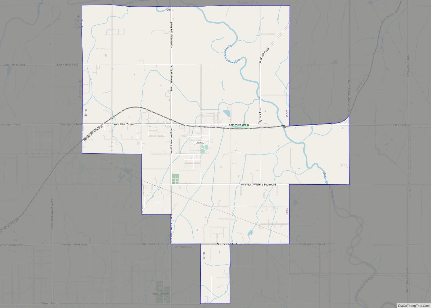
Online Interactive Map
Click on ![]() to view map in "full screen" mode.
to view map in "full screen" mode.
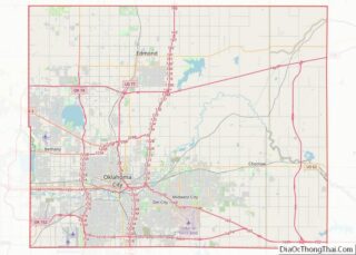
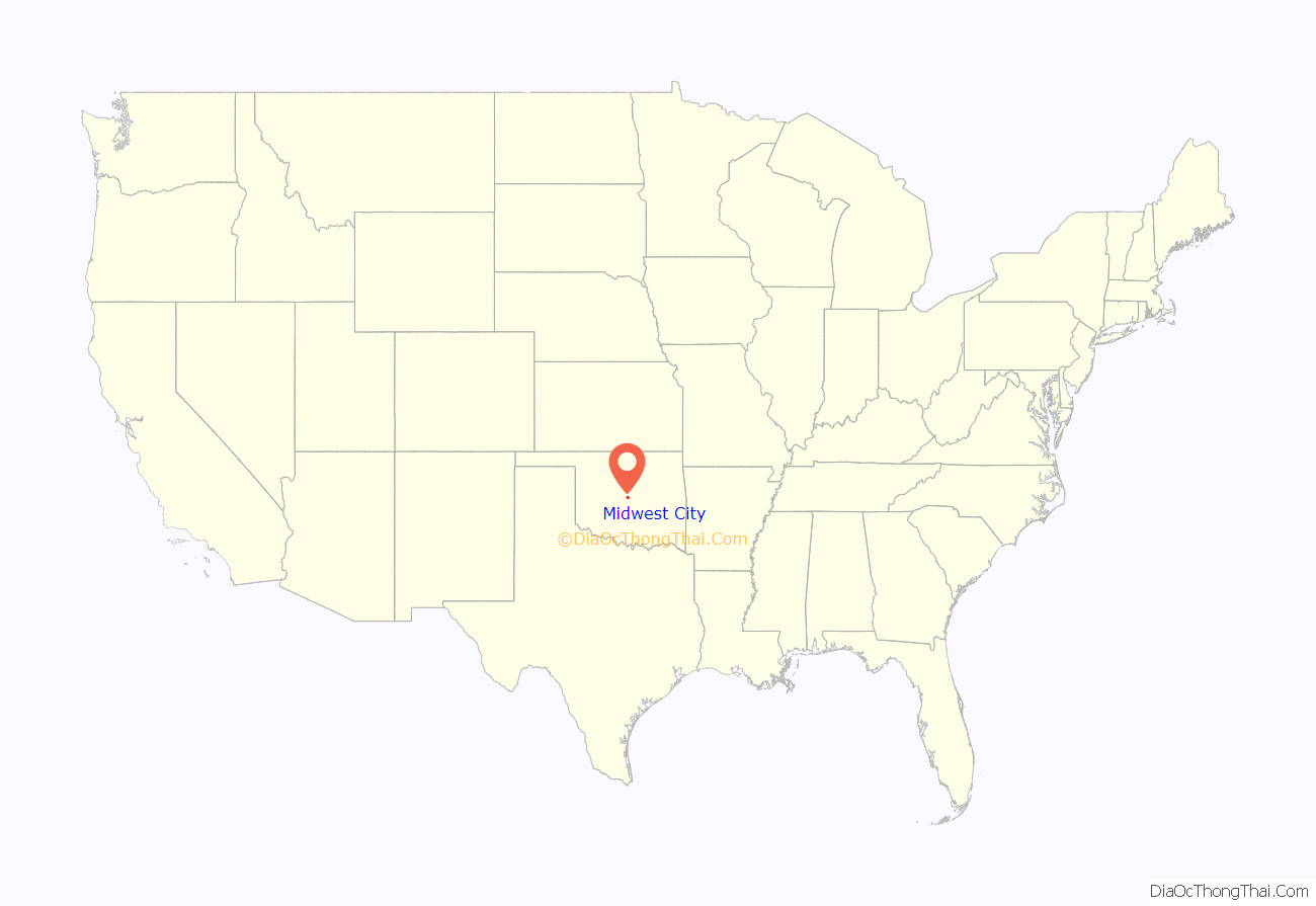
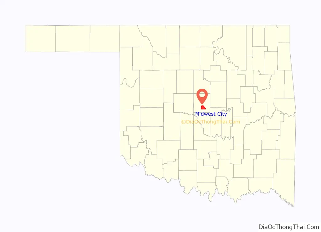
Midwest City location map. Where is Midwest City city?
History
W.P. “Bill” Atkinson bought land in the area that would become Midwest City after hearing speculation that an air field was going to be built nearby. The city, which was incorporated on March 11, 1943, was named for the air field’s original designation as the Midwest Air Depot. When Major General Clarence L. Tinker of Pawhuska, Oklahoma became the first American general killed in World War II (June 7, 1942) near Wake Island, the airfield was renamed in his honor.
Seward Mott, the director of the Federal Housing Administration’s Land Planning Division, helped design the city, gaining national print and broadcast attention, and it became a model for postwar community development. The city incorporated the Mishak community of Czech and German immigrants that had formed in what now is the southeast part of the city.
In 1947, returning veteran Nicholas Harroz opened Nick’s Brett Drive Grocery, which later became Crest Discount Foods, which is now one of the largest discount chains in the Oklahoma City metro area. Soon after its opening, Midwest City citizens opted for a charter-council-city manager form of government to better manage their rapid growth.
Midwest City’s regional hospital was dedicated October 6, 1962, built with the use of bond money. Voters also approved the creation of a junior college district in 1968. Oscar Rose Junior College opened its doors to students in 1970 and is now known as Rose State College. The Heritage Park Mall opened in 1978 on North Air Depot and was a prime shopping area in the city for several decades. The first Sam’s Club was opened in Midwest City on April 7, 1983.
In the early 1970s, the Glenwood Addition subdivision, just north of the TAFB runway, was purchased from individual owners with funds raised in a county-wide bond election after plane crashes in the area killed several civilians and military crewmen. 835 homes were moved and an elementary school was closed down. The former subdivision is fenced off and used as storage and training exercises for TAFB personnel.
Portions of Midwest City particularly northwest of Tinker Air Force Base sustained extreme damage from a violent tornado that swept through the southern and eastern areas of the Oklahoma City Metro on May 3, 1999. While it produced F5 damage in South Oklahoma City, damage in Midwest City was rated high-end F4 (although F5 was considered), with numerous destroyed homes and three fatalities. Another strong tornado struck almost exactly the same area four years later on May 8, 2003.
City officials worked to revitalize S.E. 29th Street in the early 21st century, leading to the development of a new Town Center Plaza shopping area that faces Interstate 40 and Tinker Air Force Base. The Town Center Plaza development replaced an aging, largely deserted Atkinson Plaza shopping center. In 2003, the Reed Center, a 60,000-square-foot (5,600 m) convention center, was built. Meanwhile, the Heritage Park Mall has slowly dwindled, becoming an issue of contention in the 2010 mayoral race.
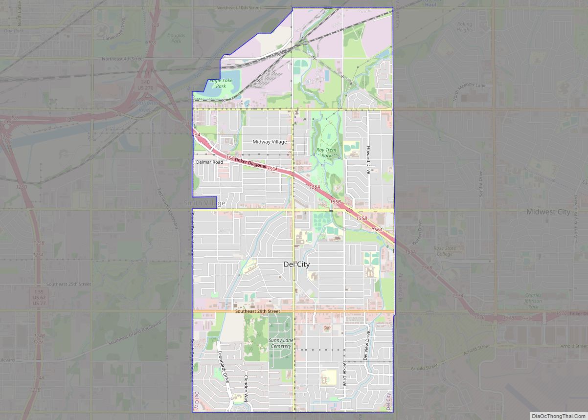
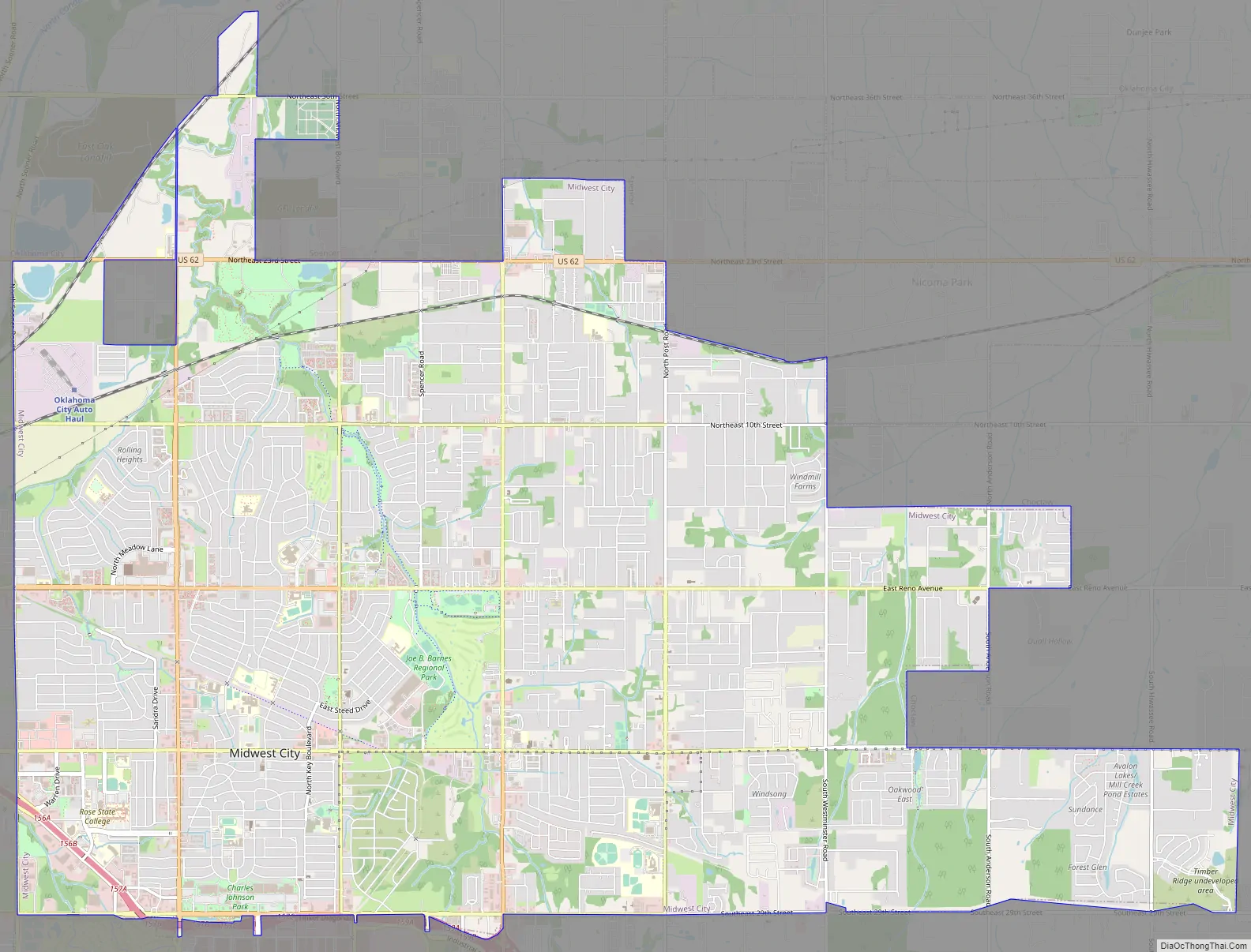
Midwest City Road Map
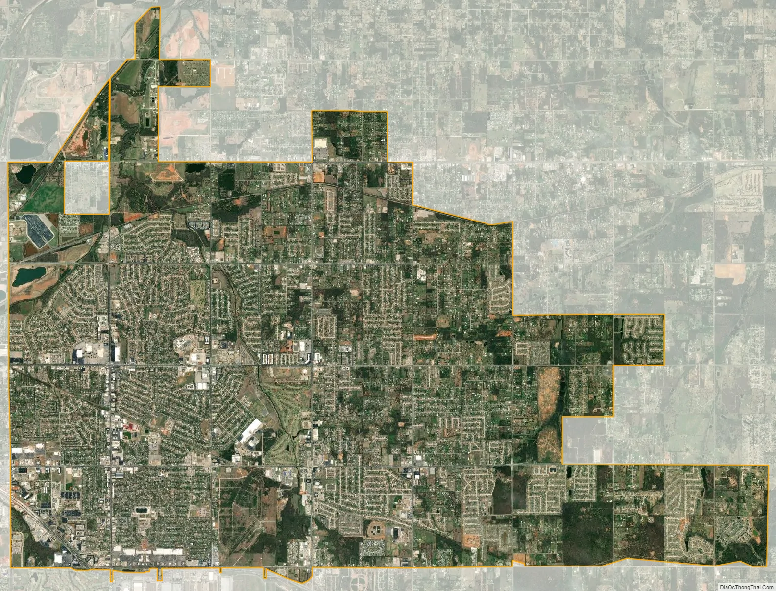
Midwest City city Satellite Map
Geography
Midwest City is located at 35°27′44″N 97°23′3″W / 35.46222°N 97.38417°W / 35.46222; -97.38417 (35.462244, -97.384292). According to the United States Census Bureau, the city has a total area of 24.6 square miles (64 km), all land. The city’s elevation is 1,157 feet above sea level.
The city is located in Oklahoma County and the area is known for low hills and two species of blackjack oak and post oak. Midwest City also falls into an ecological region known as the Cross Timbers, and the Frontier Country tourism region
Climate
Midwest City has a humid subtropical climate (Köppen climate classification Cfa).
See also
Map of Oklahoma State and its subdivision:- Adair
- Alfalfa
- Atoka
- Beaver
- Beckham
- Blaine
- Bryan
- Caddo
- Canadian
- Carter
- Cherokee
- Choctaw
- Cimarron
- Cleveland
- Coal
- Comanche
- Cotton
- Craig
- Creek
- Custer
- Delaware
- Dewey
- Ellis
- Garfield
- Garvin
- Grady
- Grant
- Greer
- Harmon
- Harper
- Haskell
- Hughes
- Jackson
- Jefferson
- Johnston
- Kay
- Kingfisher
- Kiowa
- Latimer
- Le Flore
- Lincoln
- Logan
- Love
- Major
- Marshall
- Mayes
- McClain
- McCurtain
- McIntosh
- Murray
- Muskogee
- Noble
- Nowata
- Okfuskee
- Oklahoma
- Okmulgee
- Osage
- Ottawa
- Pawnee
- Payne
- Pittsburg
- Pontotoc
- Pottawatomie
- Pushmataha
- Roger Mills
- Rogers
- Seminole
- Sequoyah
- Stephens
- Texas
- Tillman
- Tulsa
- Wagoner
- Washington
- Washita
- Woods
- Woodward
- Alabama
- Alaska
- Arizona
- Arkansas
- California
- Colorado
- Connecticut
- Delaware
- District of Columbia
- Florida
- Georgia
- Hawaii
- Idaho
- Illinois
- Indiana
- Iowa
- Kansas
- Kentucky
- Louisiana
- Maine
- Maryland
- Massachusetts
- Michigan
- Minnesota
- Mississippi
- Missouri
- Montana
- Nebraska
- Nevada
- New Hampshire
- New Jersey
- New Mexico
- New York
- North Carolina
- North Dakota
- Ohio
- Oklahoma
- Oregon
- Pennsylvania
- Rhode Island
- South Carolina
- South Dakota
- Tennessee
- Texas
- Utah
- Vermont
- Virginia
- Washington
- West Virginia
- Wisconsin
- Wyoming