Milburn is a town in Johnston County, Oklahoma, United States, along the Blue River. The population was 317 at the 2010 census, an increase of 1.6 percent from the figure of 312 in 2000. The town is notable as the location of the Chickasaw White House, the former home of Chickasaw Governor Douglas H. Johnston. This home is now a museum and is listed on the NRHP.
| Name: | Milburn town |
|---|---|
| LSAD Code: | 43 |
| LSAD Description: | town (suffix) |
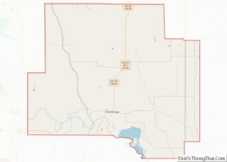
| State: | Oklahoma |
| County: | Johnston County |
| Elevation: | 705 ft (215 m) |
| Total Area: | 0.47 sq mi (1.22 km²) |
| Land Area: | 0.47 sq mi (1.22 km²) |
| Water Area: | 0.00 sq mi (0.00 km²) |
| Total Population: | 252 |
| Population Density: | 537.31/sq mi (207.33/km²) |
| ZIP code: | 73450 |
| Area code: | 580 |
| FIPS code: | 4048400 |
| GNISfeature ID: | 1095388 |
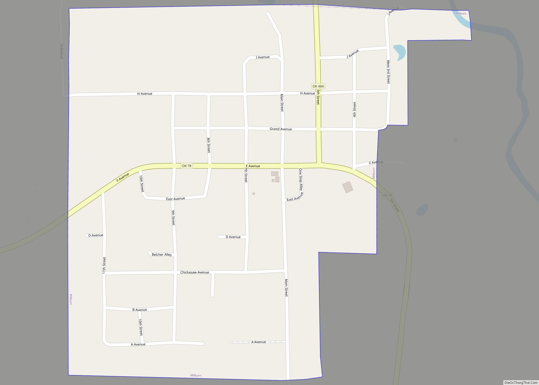
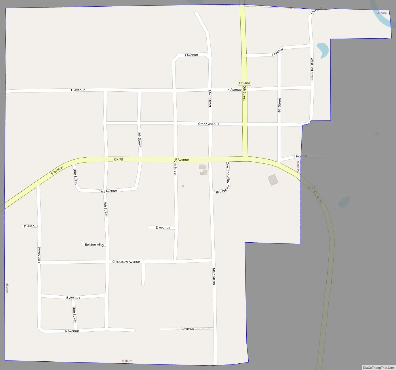
Online Interactive Map
Click on ![]() to view map in "full screen" mode.
to view map in "full screen" mode.
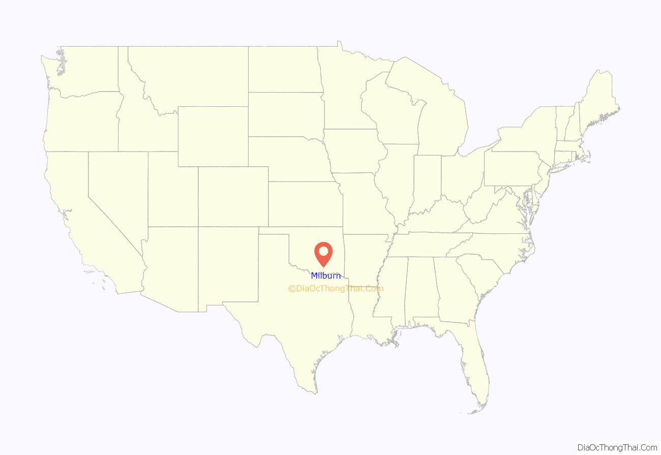
Milburn location map. Where is Milburn town?
History
A town named Ellen was formed in the Chickasaw Nation (Indian Territory) in 1856, approximately 3 miles (4.8 km) from the present town of Milburn. When the Western Oklahoma Railroad (later known as the Choctaw Oklahoma and Gulf Railroad) was built, W. J. Milburn, a druggist from Emet, Emet, persuaded the Chickasaw landowner, M. C. Condon, to give Milburn the power of attorney to negotiate a new townsite near the railroad. Milburn tried to persuade the postmaster at Ellen to move his location to the new site and rename it. He submitted the name Condon, which the Post Office rejected. Many names were proposed for the new town. Initially, the railroad wanted to name it Morris, then changed to McLish. Finally, the name Milburn was agreed upon in August, 1901.
By 1904, Milburn had sufficient population to incorporate as a Chickasaw town. After Oklahoma became a state in 1907, an election was held to choose the new Johnston County seat. Milburn lost to Tishomingo.
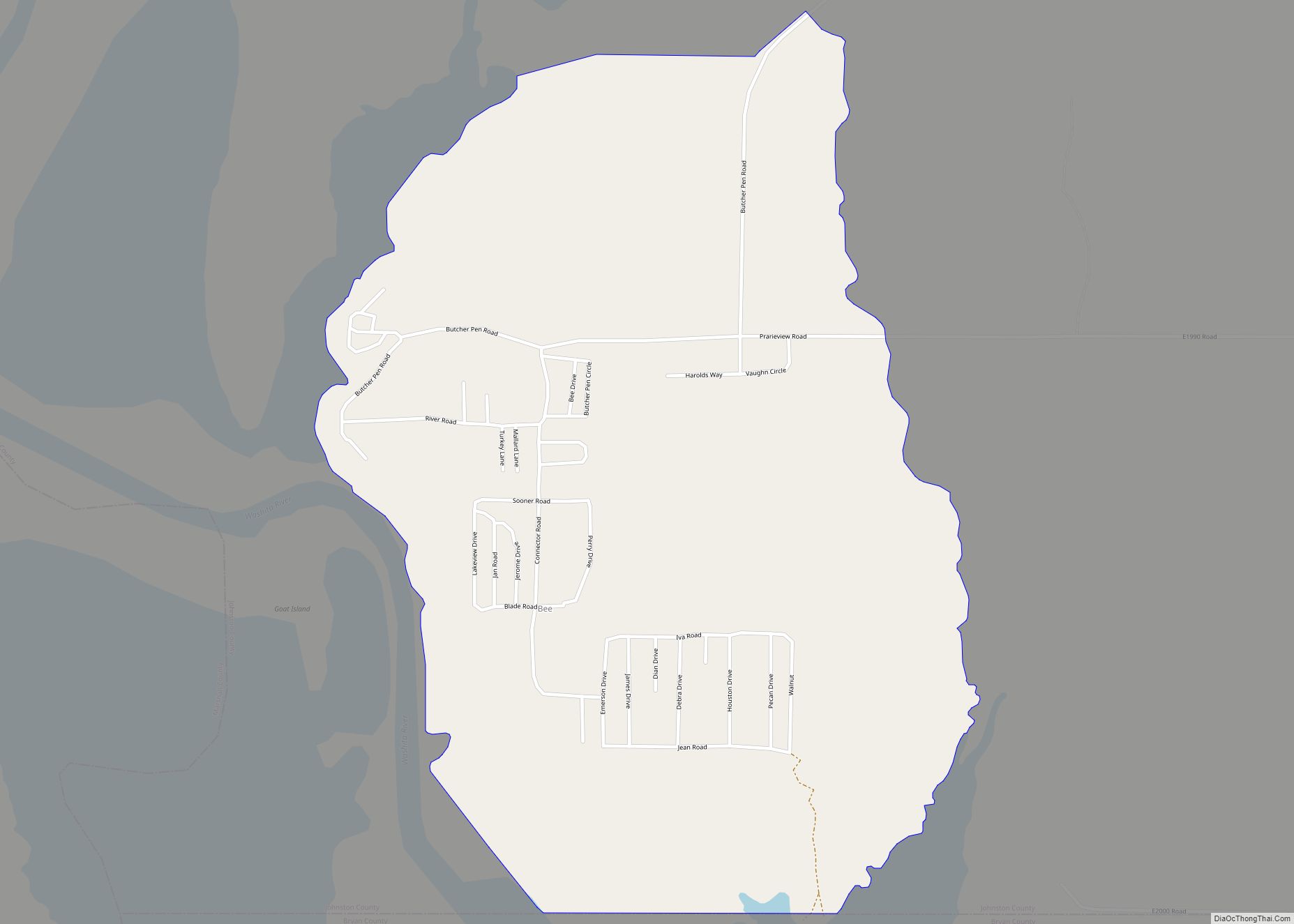
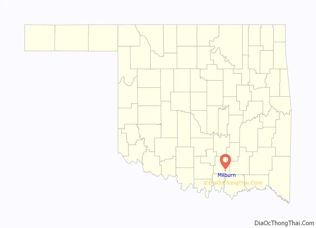
Milburn Road Map
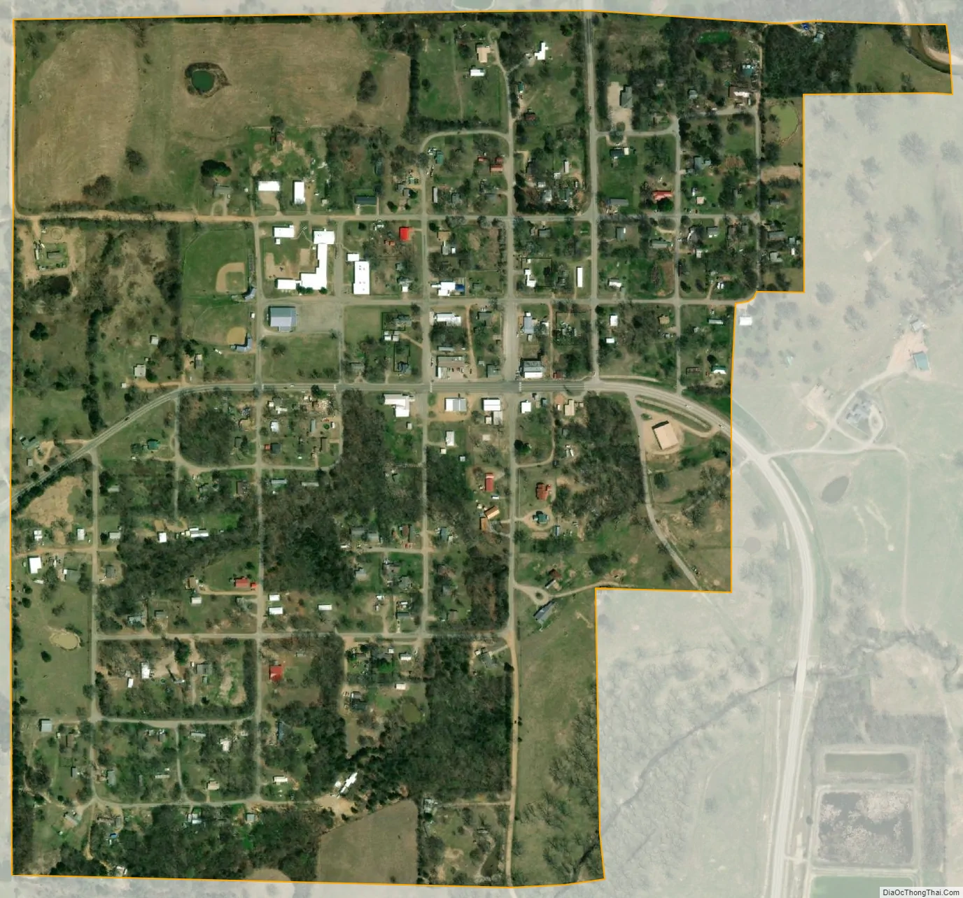
Milburn city Satellite Map
Geography
Milburn is located at 34°14′28″N 96°33′2″W / 34.24111°N 96.55056°W / 34.24111; -96.55056 (34.241030, -96.550601).
According to the United States Census Bureau, the town has a total area of 0.5 square miles (1.3 km), all land.
Milburn is at the junction of SH 48A and SH 78, 8 miles (13 km) east of Tishomingo, the seat of Johnston County.
See also
Map of Oklahoma State and its subdivision:- Adair
- Alfalfa
- Atoka
- Beaver
- Beckham
- Blaine
- Bryan
- Caddo
- Canadian
- Carter
- Cherokee
- Choctaw
- Cimarron
- Cleveland
- Coal
- Comanche
- Cotton
- Craig
- Creek
- Custer
- Delaware
- Dewey
- Ellis
- Garfield
- Garvin
- Grady
- Grant
- Greer
- Harmon
- Harper
- Haskell
- Hughes
- Jackson
- Jefferson
- Johnston
- Kay
- Kingfisher
- Kiowa
- Latimer
- Le Flore
- Lincoln
- Logan
- Love
- Major
- Marshall
- Mayes
- McClain
- McCurtain
- McIntosh
- Murray
- Muskogee
- Noble
- Nowata
- Okfuskee
- Oklahoma
- Okmulgee
- Osage
- Ottawa
- Pawnee
- Payne
- Pittsburg
- Pontotoc
- Pottawatomie
- Pushmataha
- Roger Mills
- Rogers
- Seminole
- Sequoyah
- Stephens
- Texas
- Tillman
- Tulsa
- Wagoner
- Washington
- Washita
- Woods
- Woodward
- Alabama
- Alaska
- Arizona
- Arkansas
- California
- Colorado
- Connecticut
- Delaware
- District of Columbia
- Florida
- Georgia
- Hawaii
- Idaho
- Illinois
- Indiana
- Iowa
- Kansas
- Kentucky
- Louisiana
- Maine
- Maryland
- Massachusetts
- Michigan
- Minnesota
- Mississippi
- Missouri
- Montana
- Nebraska
- Nevada
- New Hampshire
- New Jersey
- New Mexico
- New York
- North Carolina
- North Dakota
- Ohio
- Oklahoma
- Oregon
- Pennsylvania
- Rhode Island
- South Carolina
- South Dakota
- Tennessee
- Texas
- Utah
- Vermont
- Virginia
- Washington
- West Virginia
- Wisconsin
- Wyoming