Mustang is a city in the southeastern corner of Canadian County, Oklahoma, United States. It is part of the Oklahoma City metropolitan statistical area. Mustang’s population was 19,879 at the 2020 census, a 14.3% increase from 17,398 in 2010. The city is now primarily known as a bedroom community for Oklahoma City.
| Name: | Mustang city |
|---|---|
| LSAD Code: | 25 |
| LSAD Description: | city (suffix) |
| State: | Oklahoma |
| County: | Canadian County |
| Elevation: | 1,335 ft (407 m) |
| Total Area: | 12.01 sq mi (31.10 km²) |
| Land Area: | 11.98 sq mi (31.04 km²) |
| Water Area: | 0.03 sq mi (0.07 km²) |
| Total Population: | 19,879 |
| Population Density: | 1,658.80/sq mi (640.47/km²) |
| ZIP code: | 73064 |
| Area code: | 405 |
| FIPS code: | 4050100 |
| GNISfeature ID: | 1095723 |
Online Interactive Map
Click on ![]() to view map in "full screen" mode.
to view map in "full screen" mode.
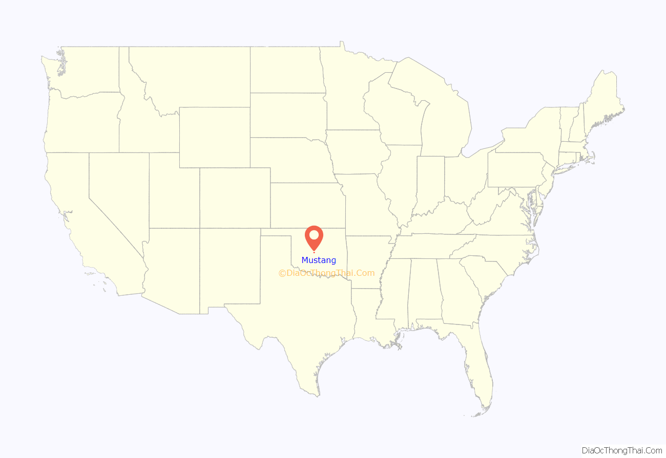
Mustang location map. Where is Mustang city?
History
The Mustang post office was established in 1895, but the town was not formally established until Charles G. Jones, former mayor of Oklahoma City, filed the plat in November, 1901. During that same year, the Oklahoma City and Western Railroad (acquired later by the St. Louis and San Francisco Railway (Frisco) built a line from Oklahoma City to Chickasha that passed through Mustang.
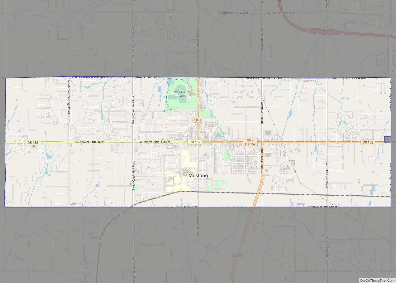
Mustang Road Map
Mustang city Satellite Map
Geography
Mustang is located at 35°23′34″N 97°43′22″W / 35.39278°N 97.72278°W / 35.39278; -97.72278 (35.392644, -97.722905).
According to the United States Census Bureau, the city has a total area of 12.0 square miles (31 km), of which 12.0 sq mi (31 km) are land and 0.04 sq mi (0.10 km) is water.
See also
Map of Oklahoma State and its subdivision:- Adair
- Alfalfa
- Atoka
- Beaver
- Beckham
- Blaine
- Bryan
- Caddo
- Canadian
- Carter
- Cherokee
- Choctaw
- Cimarron
- Cleveland
- Coal
- Comanche
- Cotton
- Craig
- Creek
- Custer
- Delaware
- Dewey
- Ellis
- Garfield
- Garvin
- Grady
- Grant
- Greer
- Harmon
- Harper
- Haskell
- Hughes
- Jackson
- Jefferson
- Johnston
- Kay
- Kingfisher
- Kiowa
- Latimer
- Le Flore
- Lincoln
- Logan
- Love
- Major
- Marshall
- Mayes
- McClain
- McCurtain
- McIntosh
- Murray
- Muskogee
- Noble
- Nowata
- Okfuskee
- Oklahoma
- Okmulgee
- Osage
- Ottawa
- Pawnee
- Payne
- Pittsburg
- Pontotoc
- Pottawatomie
- Pushmataha
- Roger Mills
- Rogers
- Seminole
- Sequoyah
- Stephens
- Texas
- Tillman
- Tulsa
- Wagoner
- Washington
- Washita
- Woods
- Woodward
- Alabama
- Alaska
- Arizona
- Arkansas
- California
- Colorado
- Connecticut
- Delaware
- District of Columbia
- Florida
- Georgia
- Hawaii
- Idaho
- Illinois
- Indiana
- Iowa
- Kansas
- Kentucky
- Louisiana
- Maine
- Maryland
- Massachusetts
- Michigan
- Minnesota
- Mississippi
- Missouri
- Montana
- Nebraska
- Nevada
- New Hampshire
- New Jersey
- New Mexico
- New York
- North Carolina
- North Dakota
- Ohio
- Oklahoma
- Oregon
- Pennsylvania
- Rhode Island
- South Carolina
- South Dakota
- Tennessee
- Texas
- Utah
- Vermont
- Virginia
- Washington
- West Virginia
- Wisconsin
- Wyoming
