Red Rock (Iowa-Oto: Chína Ino Šúje pronounced ĩꜜno suꜜdʒɛ, meaning “Rock Red town”) is a town in northern Noble County, Oklahoma, United States. The population was 283 at the 2010 census, a decline from 293 at the 2000 census. The headquarters of the Otoe-Missouria Tribe of Indians is located in Red Rock.
| Name: | Red Rock town |
|---|---|
| LSAD Code: | 43 |
| LSAD Description: | town (suffix) |
| State: | Oklahoma |
| County: | Noble County |
| Elevation: | 929 ft (283 m) |
| Total Area: | 0.25 sq mi (0.64 km²) |
| Land Area: | 0.25 sq mi (0.64 km²) |
| Water Area: | 0.00 sq mi (0.00 km²) |
| Total Population: | 245 |
| Population Density: | 987.90/sq mi (381.20/km²) |
| ZIP code: | 74651 |
| Area code: | 580 |
| FIPS code: | 4062650 |
| GNISfeature ID: | 1097121 |
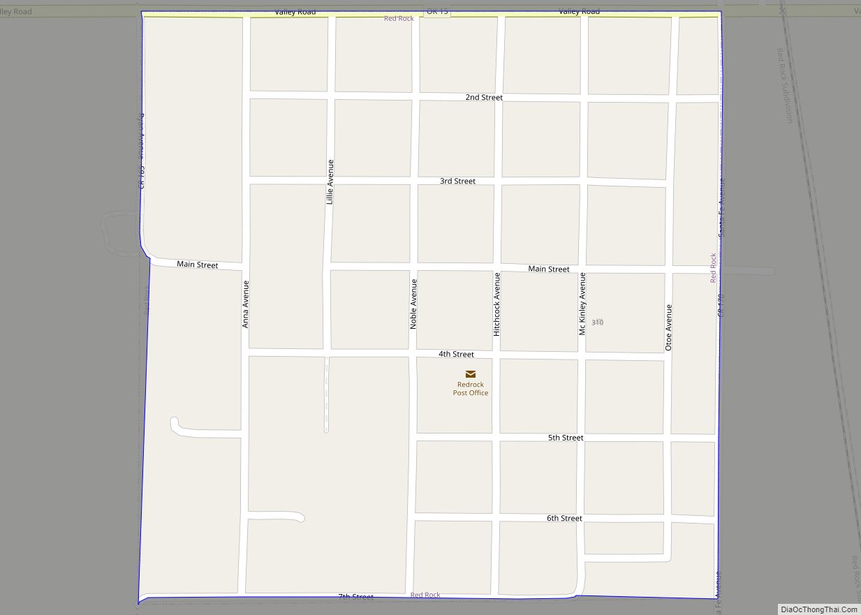
Online Interactive Map
Click on ![]() to view map in "full screen" mode.
to view map in "full screen" mode.
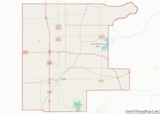
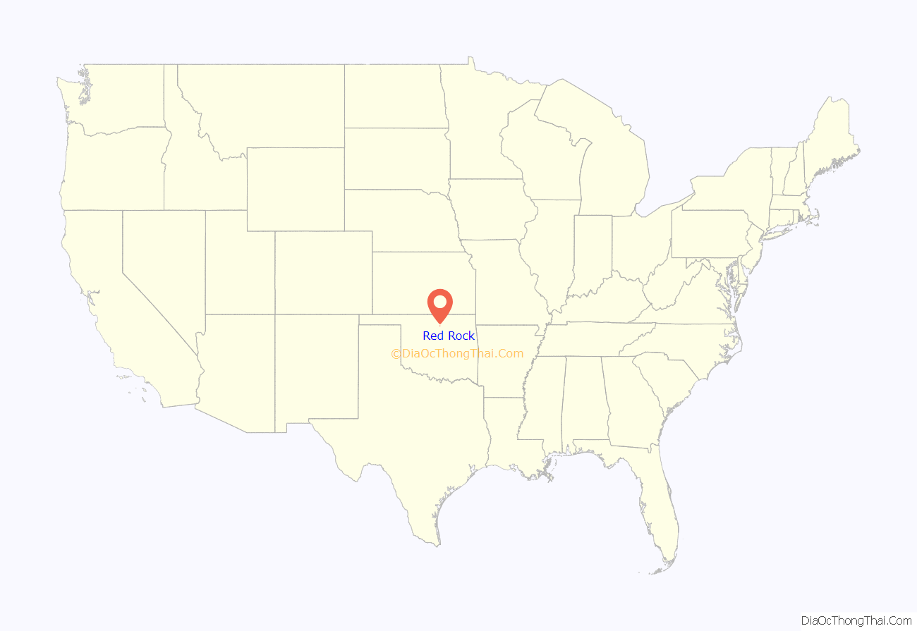
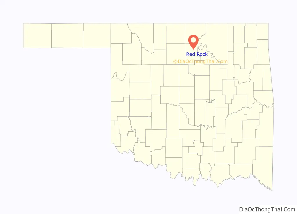
Red Rock location map. Where is Red Rock town?
History
In 1886, the Atchison, Topeka and Santa Fe Railroad built a line through what would become Noble County. The land around the railroad crossing of Red Rock Creek still belonged to the Otoe-Missouri reservation, but Rufus N. Dunagan operated a trading post there. A post office named “Magnolia” opened at the trading post in March 1890. The name was changed to Red Rock in June 1892. A Santa Fe train was robbed by the Dalton Gang in this locale on June 1, 1892.
On April 26, 1991, a large F4 tornado touched down within one mile of the town. The tornado was rated F4 because of the minimal damage that occurred. But the tornado held the record for the highest recorded wind speed of 270 mph until the Bridge Creek, Oklahoma tornado of May 3, 1999, in the 1999 Oklahoma tornado outbreak, which had a wind gust of 318 mph.
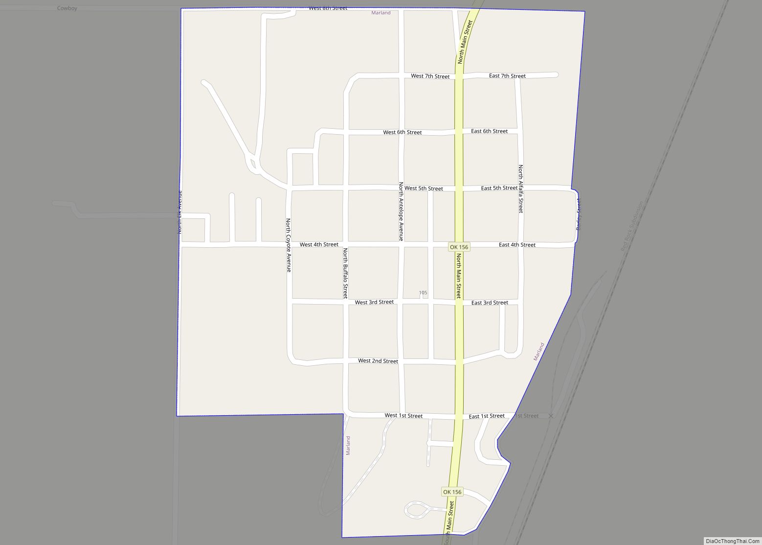
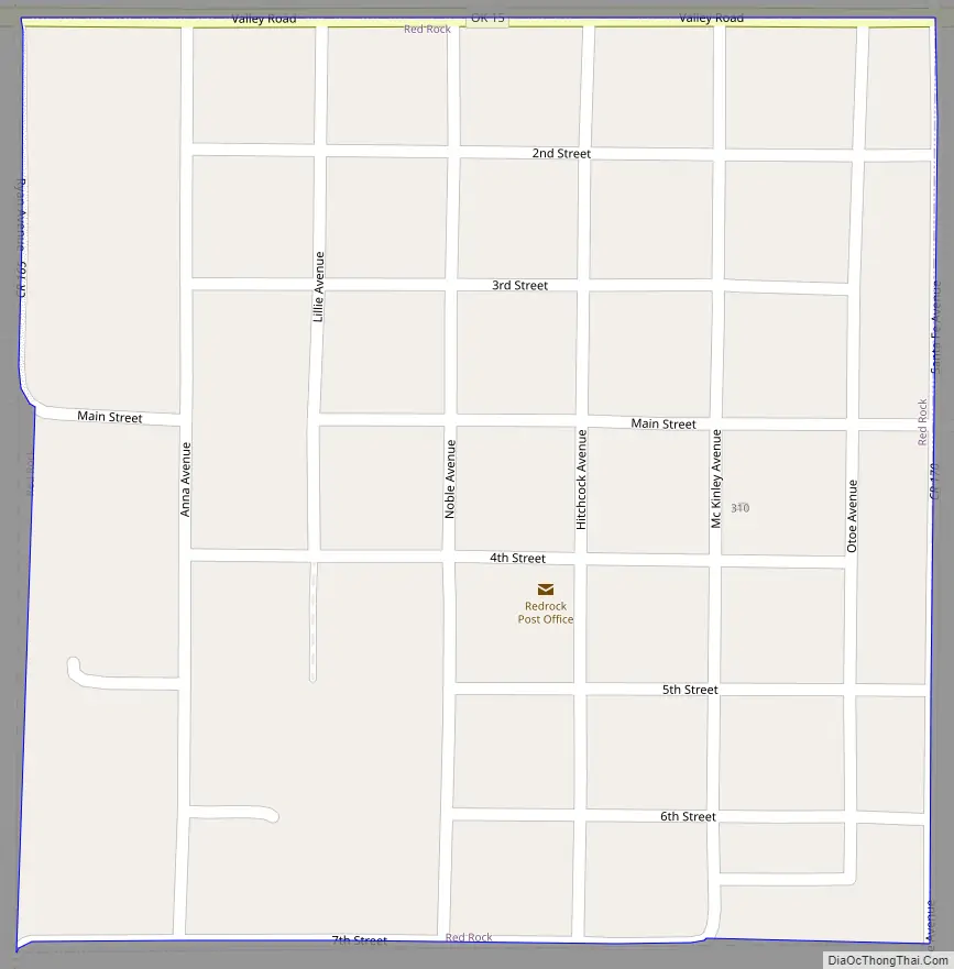
Red Rock Road Map
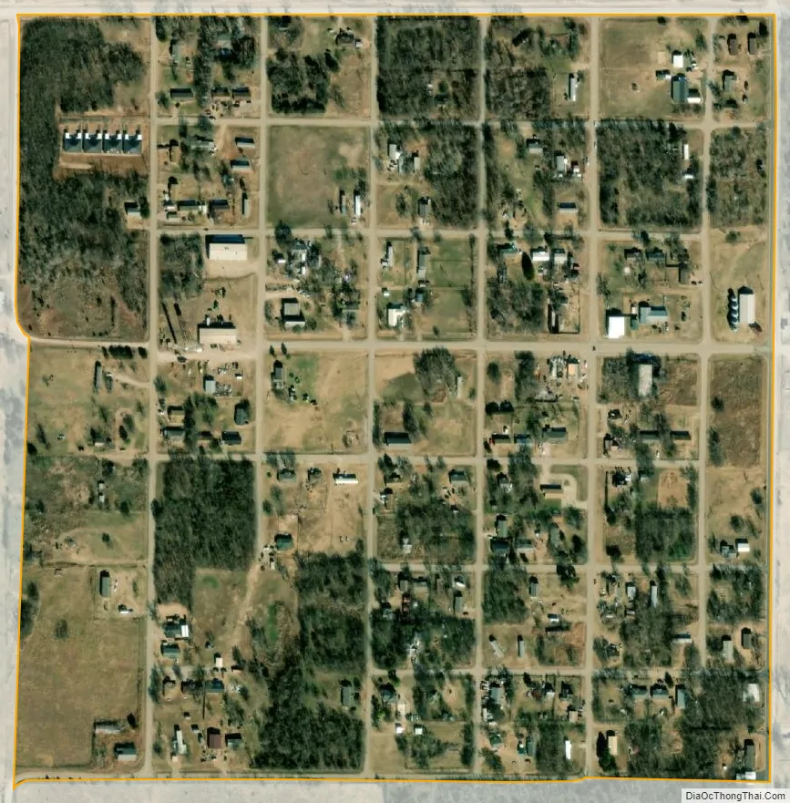
Red Rock city Satellite Map
Geography
Red Rock is located at 36°27′36″N 97°10′45″W / 36.46000°N 97.17917°W / 36.46000; -97.17917 (36.459934, -97.179226). According to the United States Census Bureau, the town has a total area of 0.2 square miles (0.52 km), all land.
See also
Map of Oklahoma State and its subdivision:- Adair
- Alfalfa
- Atoka
- Beaver
- Beckham
- Blaine
- Bryan
- Caddo
- Canadian
- Carter
- Cherokee
- Choctaw
- Cimarron
- Cleveland
- Coal
- Comanche
- Cotton
- Craig
- Creek
- Custer
- Delaware
- Dewey
- Ellis
- Garfield
- Garvin
- Grady
- Grant
- Greer
- Harmon
- Harper
- Haskell
- Hughes
- Jackson
- Jefferson
- Johnston
- Kay
- Kingfisher
- Kiowa
- Latimer
- Le Flore
- Lincoln
- Logan
- Love
- Major
- Marshall
- Mayes
- McClain
- McCurtain
- McIntosh
- Murray
- Muskogee
- Noble
- Nowata
- Okfuskee
- Oklahoma
- Okmulgee
- Osage
- Ottawa
- Pawnee
- Payne
- Pittsburg
- Pontotoc
- Pottawatomie
- Pushmataha
- Roger Mills
- Rogers
- Seminole
- Sequoyah
- Stephens
- Texas
- Tillman
- Tulsa
- Wagoner
- Washington
- Washita
- Woods
- Woodward
- Alabama
- Alaska
- Arizona
- Arkansas
- California
- Colorado
- Connecticut
- Delaware
- District of Columbia
- Florida
- Georgia
- Hawaii
- Idaho
- Illinois
- Indiana
- Iowa
- Kansas
- Kentucky
- Louisiana
- Maine
- Maryland
- Massachusetts
- Michigan
- Minnesota
- Mississippi
- Missouri
- Montana
- Nebraska
- Nevada
- New Hampshire
- New Jersey
- New Mexico
- New York
- North Carolina
- North Dakota
- Ohio
- Oklahoma
- Oregon
- Pennsylvania
- Rhode Island
- South Carolina
- South Dakota
- Tennessee
- Texas
- Utah
- Vermont
- Virginia
- Washington
- West Virginia
- Wisconsin
- Wyoming