Perry is a city in, and county seat of, Noble County, Oklahoma, United States. As of the 2010 census, the city population was 5,126, a 2.0 percent decrease from the figure of 5,230 in 2000. The city is home of Ditch Witch construction equipment.
| Name: | Perry city |
|---|---|
| LSAD Code: | 25 |
| LSAD Description: | city (suffix) |
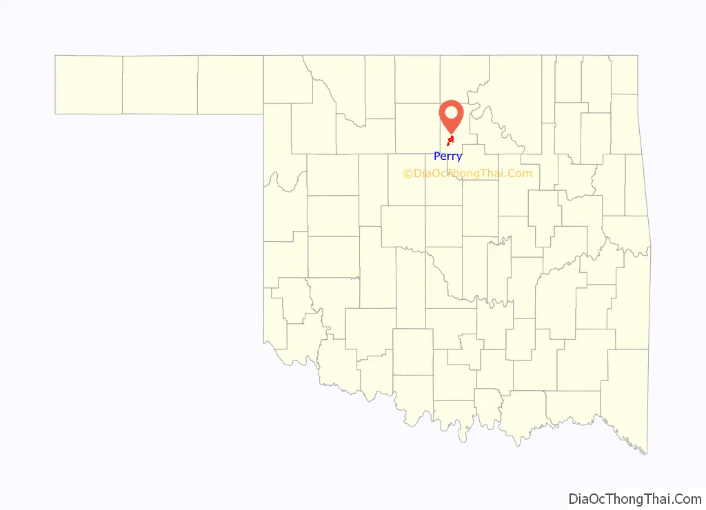
| State: | Oklahoma |
| County: | Noble County |
| Elevation: | 1,010 ft (308 m) |
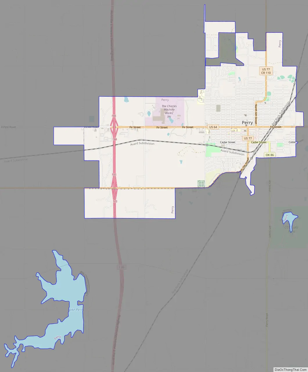
| Total Area: | 7.78 sq mi (20.14 km²) |
| Land Area: | 6.82 sq mi (17.66 km²) |
| Water Area: | 0.96 sq mi (2.48 km²) |
| Total Population: | 4,484 |
| Population Density: | 657.77/sq mi (253.95/km²) |
| ZIP code: | 73077 |
| Area code: | 580 |
| FIPS code: | 4058250 |
| GNISfeature ID: | 1096555 |
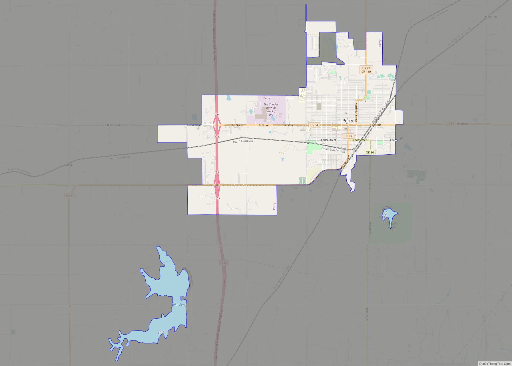
Online Interactive Map
Click on ![]() to view map in "full screen" mode.
to view map in "full screen" mode.
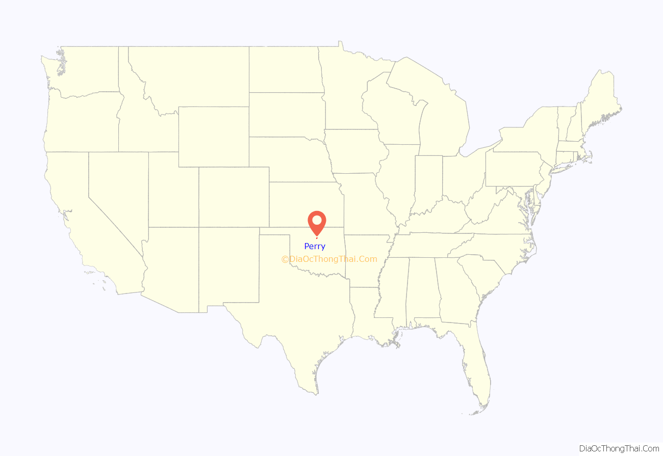
Perry location map. Where is Perry city?
History
19th century
The Treaty of New Echota, May 23, 1836, assigned the Cherokee Outlet to the Cherokees as a perpetual outlet to use for passage to travel and hunt in the West from their reservation in the eastern part of what became Oklahoma. This was in addition to the land given to the Cherokees for settlement after their arrival from their home in Georgia.
Perry’s original name was Wharton, the name of a train station built in 1886 by the Southern Kansas Railway (part of the Atchison, Topeka and Santa Fe Railway system) about 1 mile south of the present city and it was located within the Outlet. Before the 1893 Cherokee Outlet Opening, the U.S. government selected a site a mile north of Wharton for a land office. A town around the office was named after J.A. Perry, a man sent by the government to lay out land office towns. Perry later became one of the township location commissioners. Noble County, then known as “County P”, was named after John Willock Noble of St. Louis, the Interior Secretary for President William Henry Harrison.
The Dalton Gang, which at that time included Bob Dalton, Emmett Dalton, Charlie Bryant and George Newcomb entered Wharton to rob a train in May 1891 earning $1745. Shortly after the robbery, Bryant fell ill and was taken to Hennessey to see a doctor. After being spotted and arrested by Deputy Marshal Ed Short. During an escape attempt Bryant and Short would kill each other. Among those within the boundary of the Strip prior to the opening, were the notorious Bill Doolin gang. A Santa Fe train was robbed at Wharton before the opening, and the gang escaped into Osage County. U.S. Marshall E.D. Nix and 100 deputies were commissioned to police the area and keep order.
At noon on September 16, 1893, “a run” for land within “the Strip” was opened. An estimated 90,000 men, women, and children took part and by nightfall 40,000 had erected tents in Perry. Jack Tearney started at the county line and reached Perry within 31 minutes. By 4:00 p.m. he had erected and opened the “Blue Bell” saloon selling beer the first day for $1.00 a bottle, due to the scarcity of water. He would sell 38,000 glasses.
Named “Hell’s Half Acre”, the original town’s perimeter included A & F streets and 1st and 9th streets. About 110 saloons and gambling houses were in operation with many of them set up 1/2 block east of the west side of the now existing square.
Perry incorporated on September 20, 1893.
20th century
In 1902, Carl Malzahn, a German immigrant, moved to Perry and opened the Malzahn Blacksmith Shop with his sons, Charles (Charlie and Gus). The sons took over the business in 1913 and renamed it Malzahn Brothers’ General Blacksmithing, specializing in repairing equipment for the nearby oil fields. After Gus died in 1928, the surviving brother renamed the business, Charlie’s Machine Shop. Charlie’s son, Ed, a mechanical engineer, joined the business in 1944. Ed noticed a need for a machine to replace hand digging trenches for the installation of residential utility lines, and set to work developing such a device. By 1948, he had a successful device, a compact trencher, which he called the Ditch Witch. Soon, Ditch Witch became a successful company, wholly owned by the now-renamed Charles Machine Works Company, since 2019 a subsidiary of The Toro Company. It has grown into the largest employer in Perry and in Noble County, employing approximately 1,300 people.
Timothy McVeigh was stopped on April 19, 1995, along Interstate 35 outside of Perry by Oklahoma Highway Patrol Trooper Charlie Hanger. Trooper Hanger had passed McVeigh’s yellow 1977 Mercury Marquis and noticed it had no license plate. He arrested McVeigh for carrying a loaded firearm. Three days later, while still in jail, McVeigh was identified as the subject of a nationwide manhunt for the perpetrator of the Oklahoma City bombing, which had happened on the day of McVeigh’s arrest.
21st century
Perry moved from a strong mayor form of government to a Home Rule Charter. The town is in the process of transitioning to a City Manager.
Operating under the Home Rule Charter form of government, the City of Perry divides its responsibilities between the city council and the city manager. The city council acts as the legislative branch, establishing ordinances, setting policy, authorizing budgets, and directing the city manager when appropriate. The city manager oversees day-to- day operations and administration of the city. Together with city staff, the city manager and city council work to make the most efficient use of the limited resources available to the City of Perry.
It is the smallest town in Oklahoma with a daily newspaper.
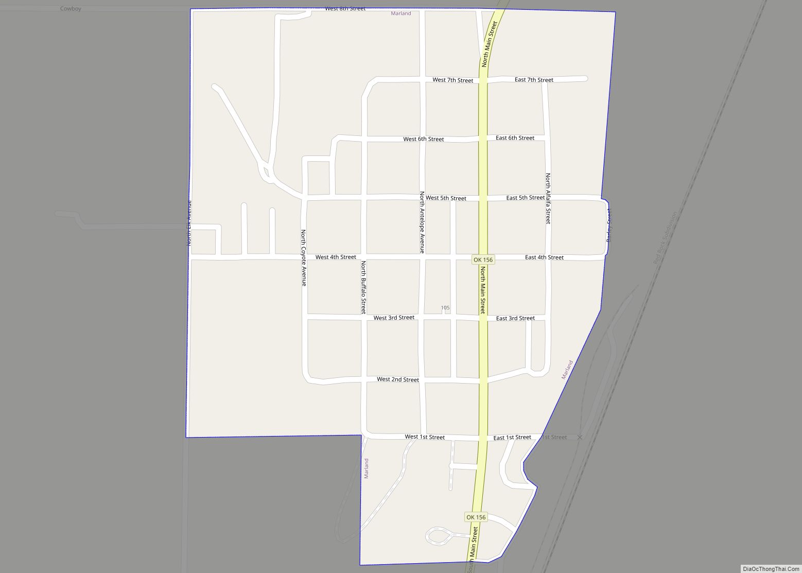
Perry Road Map
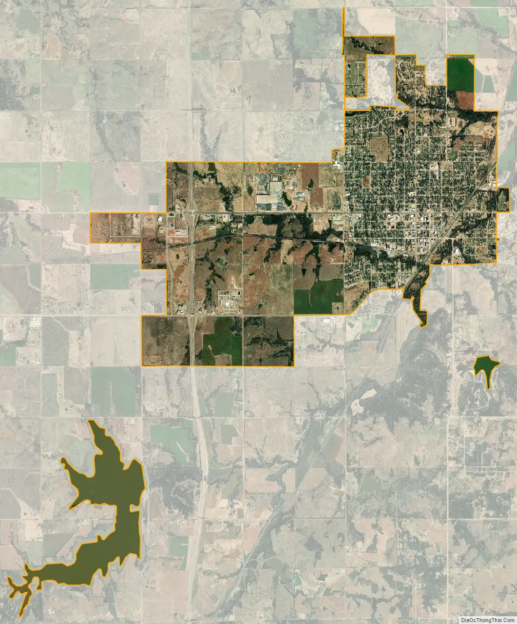
Perry city Satellite Map
Geography
Perry is located at 36°17′29″N 97°17′28″W / 36.29139°N 97.29111°W / 36.29139; -97.29111 (36.291424, -97.291144). It is 60 miles (97 km) north of Oklahoma City, and 100 miles (160 km) south of Wichita, Kansas. According to the United States Census Bureau, the city has a total area of 6.8 square miles (18 km), of which 6.1 square miles (16 km) is land and 0.8 square miles (2.1 km) (10.98%) is water.
See also
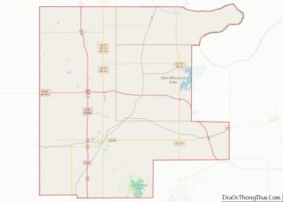
Map of Oklahoma State and its subdivision:- Adair
- Alfalfa
- Atoka
- Beaver
- Beckham
- Blaine
- Bryan
- Caddo
- Canadian
- Carter
- Cherokee
- Choctaw
- Cimarron
- Cleveland
- Coal
- Comanche
- Cotton
- Craig
- Creek
- Custer
- Delaware
- Dewey
- Ellis
- Garfield
- Garvin
- Grady
- Grant
- Greer
- Harmon
- Harper
- Haskell
- Hughes
- Jackson
- Jefferson
- Johnston
- Kay
- Kingfisher
- Kiowa
- Latimer
- Le Flore
- Lincoln
- Logan
- Love
- Major
- Marshall
- Mayes
- McClain
- McCurtain
- McIntosh
- Murray
- Muskogee
- Noble
- Nowata
- Okfuskee
- Oklahoma
- Okmulgee
- Osage
- Ottawa
- Pawnee
- Payne
- Pittsburg
- Pontotoc
- Pottawatomie
- Pushmataha
- Roger Mills
- Rogers
- Seminole
- Sequoyah
- Stephens
- Texas
- Tillman
- Tulsa
- Wagoner
- Washington
- Washita
- Woods
- Woodward
- Alabama
- Alaska
- Arizona
- Arkansas
- California
- Colorado
- Connecticut
- Delaware
- District of Columbia
- Florida
- Georgia
- Hawaii
- Idaho
- Illinois
- Indiana
- Iowa
- Kansas
- Kentucky
- Louisiana
- Maine
- Maryland
- Massachusetts
- Michigan
- Minnesota
- Mississippi
- Missouri
- Montana
- Nebraska
- Nevada
- New Hampshire
- New Jersey
- New Mexico
- New York
- North Carolina
- North Dakota
- Ohio
- Oklahoma
- Oregon
- Pennsylvania
- Rhode Island
- South Carolina
- South Dakota
- Tennessee
- Texas
- Utah
- Vermont
- Virginia
- Washington
- West Virginia
- Wisconsin
- Wyoming