Roosevelt is a town in Kiowa County, Oklahoma, United States. The population was 248 at the 2010 census, a decline of 11.4 percent from 283 in 2000. The town was named for President Theodore Roosevelt.
| Name: | Roosevelt town |
|---|---|
| LSAD Code: | 43 |
| LSAD Description: | town (suffix) |
| State: | Oklahoma |
| County: | Kiowa County |
| Elevation: | 1,463 ft (446 m) |
| Total Area: | 0.49 sq mi (1.27 km²) |
| Land Area: | 0.49 sq mi (1.27 km²) |
| Water Area: | 0.00 sq mi (0.00 km²) |
| Total Population: | 254 |
| Population Density: | 516.26/sq mi (199.48/km²) |
| ZIP code: | 73564 |
| Area code: | 580 |
| FIPS code: | 4063900 |
| GNISfeature ID: | 1097408 |
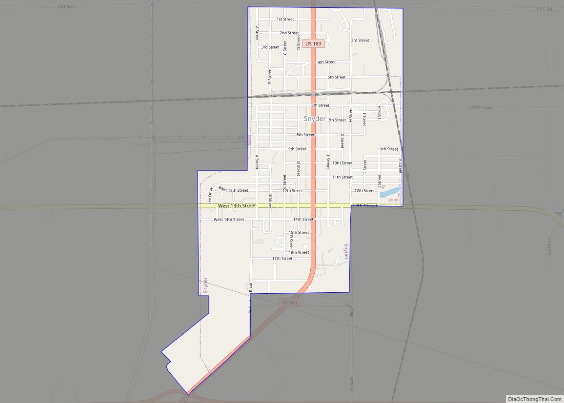
Online Interactive Map
Click on ![]() to view map in "full screen" mode.
to view map in "full screen" mode.
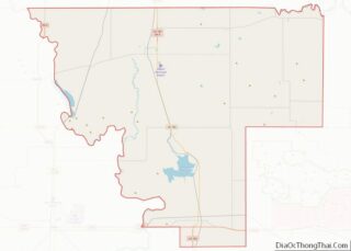
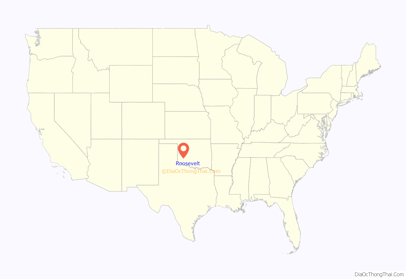
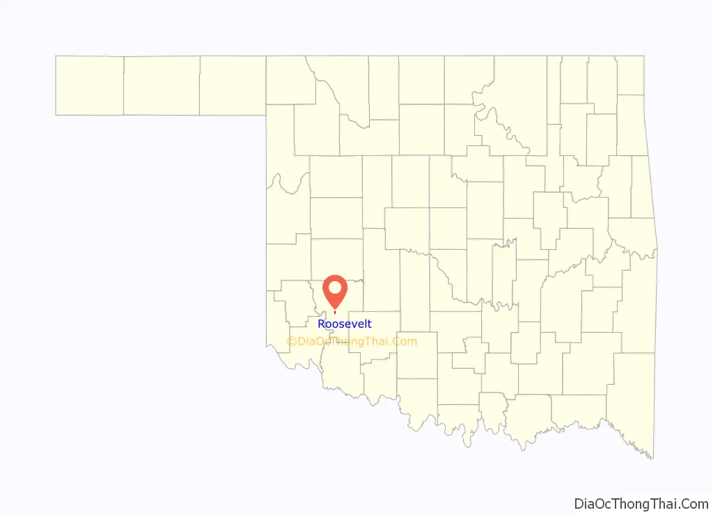
Roosevelt location map. Where is Roosevelt town?
History
According to the Encyclopedia of Oklahoma History and Culture, the present town of Roosevelt was originally planned by Parkersburg Development Company before the opening of the Kiowa, Comanche, and Apache Reservation in 1901. At that time, the town was known as Parkersburg. However, another town by the same name already existed. Thus, the name was changed to Roosevelt by a townsite organizer, Charlie Parker, who had served under Theodore Roosevelt in the Spanish–American War. A post office named Roosevelt was established October 31, 1901. President Theodore Roosevelt actually visited the town in 1903.
By 1907, the town population had grown to 173. The population was 298 in 1910, 744 in 1940, and 679 in 1950. The population then declined to 280 in 2000.
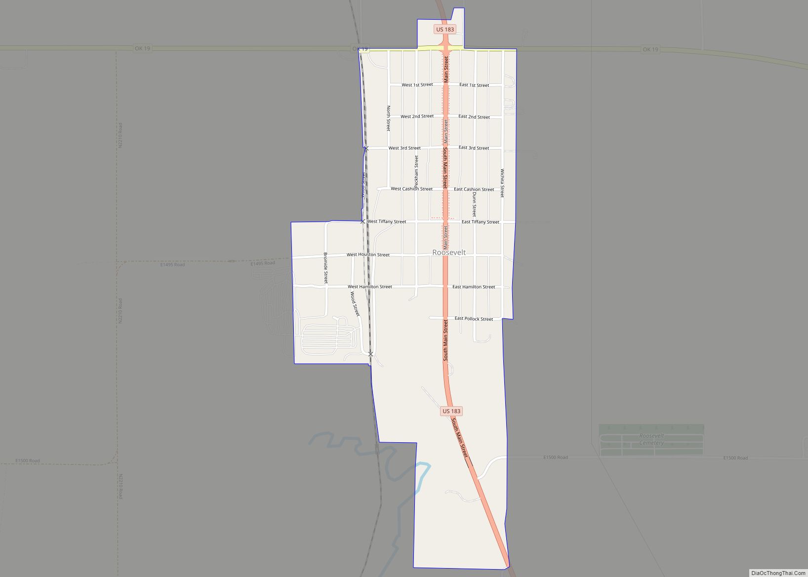
Roosevelt Road Map
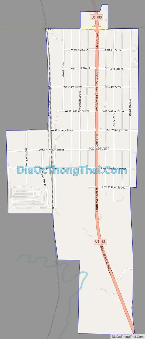
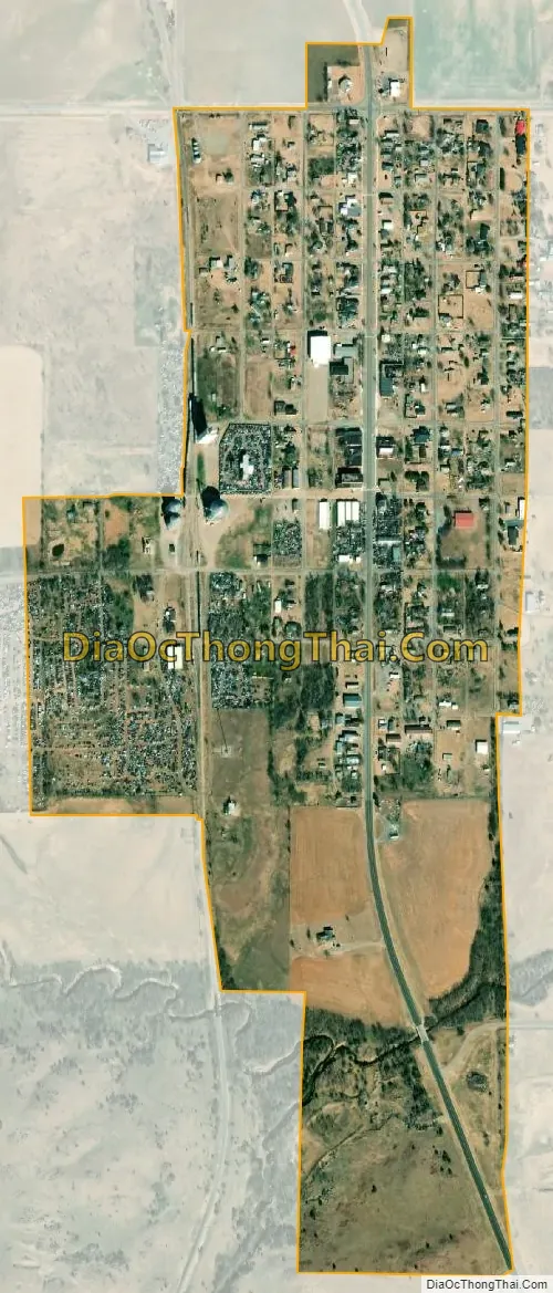
Roosevelt city Satellite Map
Geography
Roosevelt is located at 34°51′2″N 99°1′20″W / 34.85056°N 99.02222°W / 34.85056; -99.02222 (34.850457, -99.022302).
According to the United States Census Bureau, the town has a total area of 0.5 square miles (1.3 km), all land.
Roosevelt is at the intersection of US Route 183 and Oklahoma State Highway 19. Great Plains State Park and Tom Steed Reservoir are to the southeast.
See also
Map of Oklahoma State and its subdivision:- Adair
- Alfalfa
- Atoka
- Beaver
- Beckham
- Blaine
- Bryan
- Caddo
- Canadian
- Carter
- Cherokee
- Choctaw
- Cimarron
- Cleveland
- Coal
- Comanche
- Cotton
- Craig
- Creek
- Custer
- Delaware
- Dewey
- Ellis
- Garfield
- Garvin
- Grady
- Grant
- Greer
- Harmon
- Harper
- Haskell
- Hughes
- Jackson
- Jefferson
- Johnston
- Kay
- Kingfisher
- Kiowa
- Latimer
- Le Flore
- Lincoln
- Logan
- Love
- Major
- Marshall
- Mayes
- McClain
- McCurtain
- McIntosh
- Murray
- Muskogee
- Noble
- Nowata
- Okfuskee
- Oklahoma
- Okmulgee
- Osage
- Ottawa
- Pawnee
- Payne
- Pittsburg
- Pontotoc
- Pottawatomie
- Pushmataha
- Roger Mills
- Rogers
- Seminole
- Sequoyah
- Stephens
- Texas
- Tillman
- Tulsa
- Wagoner
- Washington
- Washita
- Woods
- Woodward
- Alabama
- Alaska
- Arizona
- Arkansas
- California
- Colorado
- Connecticut
- Delaware
- District of Columbia
- Florida
- Georgia
- Hawaii
- Idaho
- Illinois
- Indiana
- Iowa
- Kansas
- Kentucky
- Louisiana
- Maine
- Maryland
- Massachusetts
- Michigan
- Minnesota
- Mississippi
- Missouri
- Montana
- Nebraska
- Nevada
- New Hampshire
- New Jersey
- New Mexico
- New York
- North Carolina
- North Dakota
- Ohio
- Oklahoma
- Oregon
- Pennsylvania
- Rhode Island
- South Carolina
- South Dakota
- Tennessee
- Texas
- Utah
- Vermont
- Virginia
- Washington
- West Virginia
- Wisconsin
- Wyoming