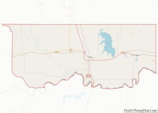
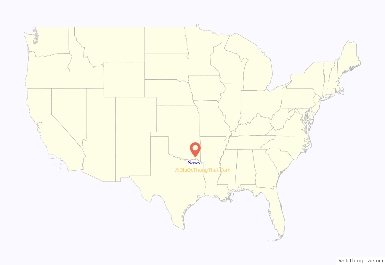
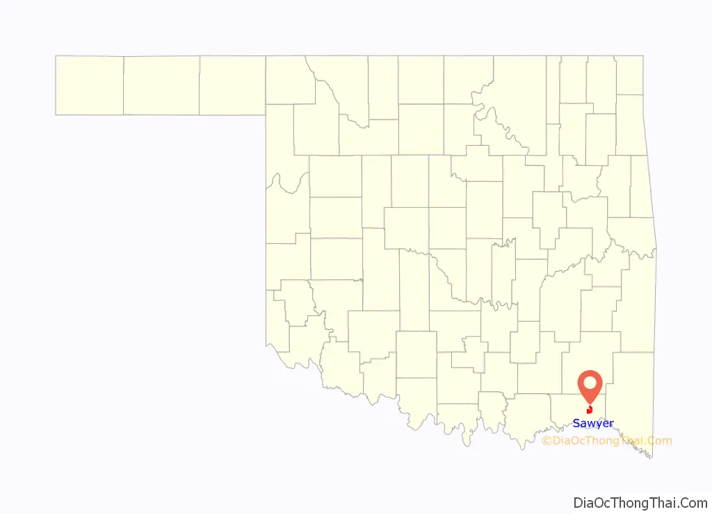
Sawyer is a town in Choctaw County, Oklahoma, United States. The population was 321 at the 2010 census.
| Name: | Sawyer town |
|---|---|
| LSAD Code: | 43 |
| LSAD Description: | town (suffix) |
| State: | Oklahoma |
| County: | Choctaw County |
| Elevation: | 423 ft (129 m) |
| Total Area: | 8.66 sq mi (22.43 km²) |
| Land Area: | 8.57 sq mi (22.20 km²) |
| Water Area: | 0.09 sq mi (0.23 km²) |
| Total Population: | 340 |
| Population Density: | 39.66/sq mi (15.31/km²) |
| ZIP code: | 74756 |
| Area code: | 580 |
| FIPS code: | 4065650 |
| GNISfeature ID: | 1097856 |
Online Interactive Map
Click on ![]() to view map in "full screen" mode.
to view map in "full screen" mode.
Sawyer location map. Where is Sawyer town?
History
Sawyer was located in Kiamitia County, one of the constituent counties comprising the Apukshunnubbee District of the Choctaw Nation. On November 4, 2022, a violent EF4 tornado passed just east of Sawyer.
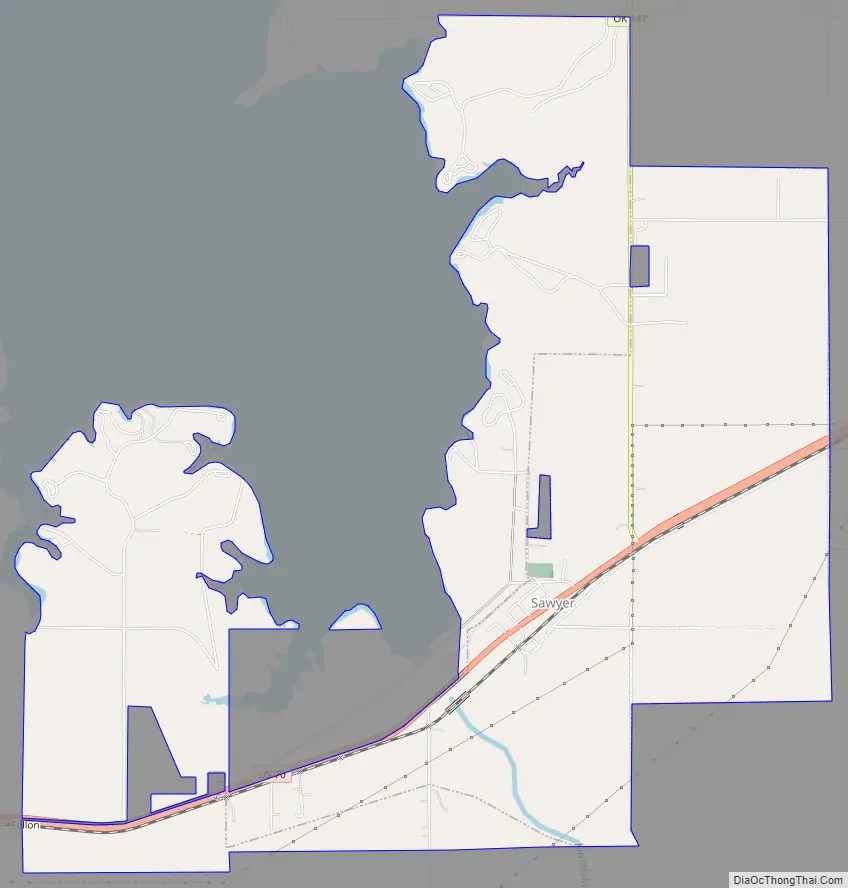
Sawyer Road Map
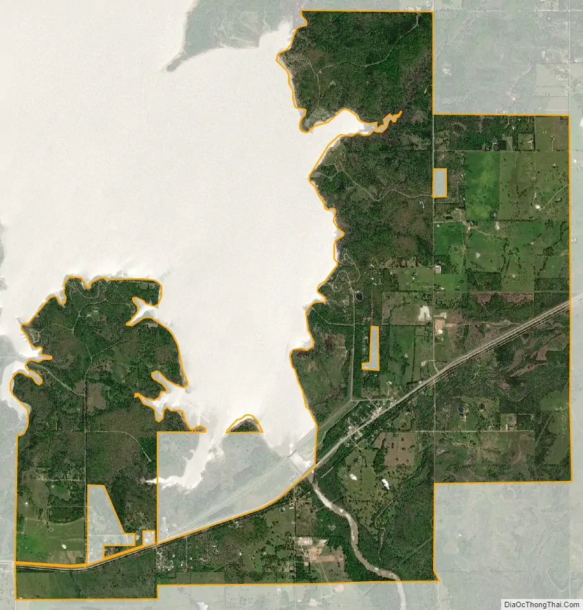
Sawyer city Satellite Map
Geography
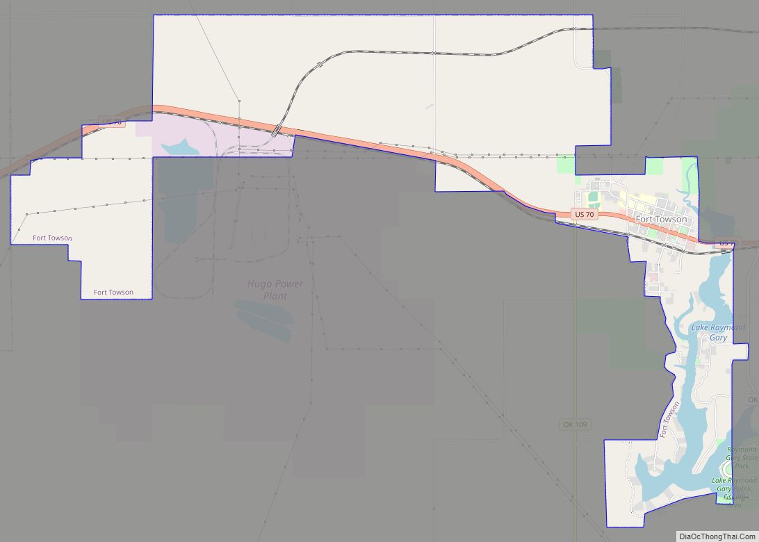
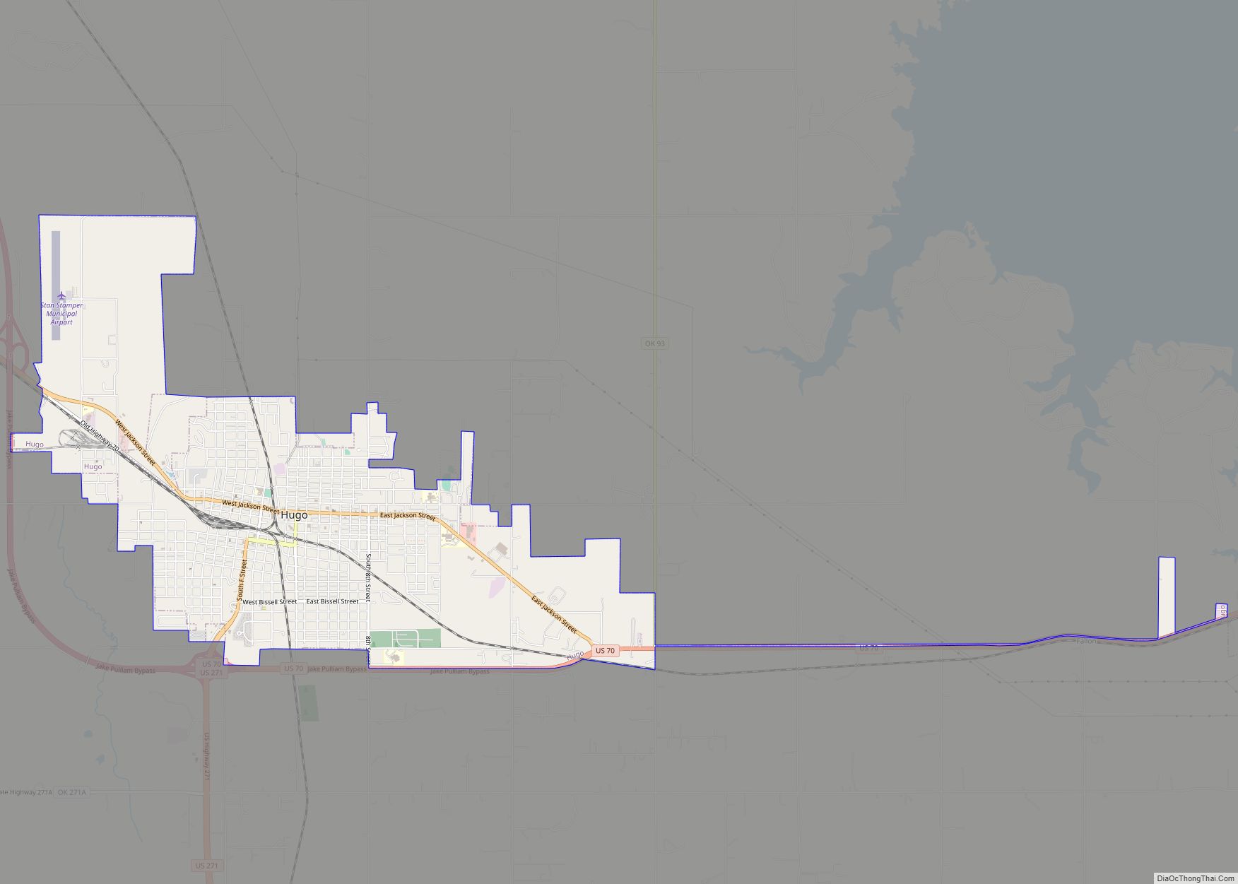
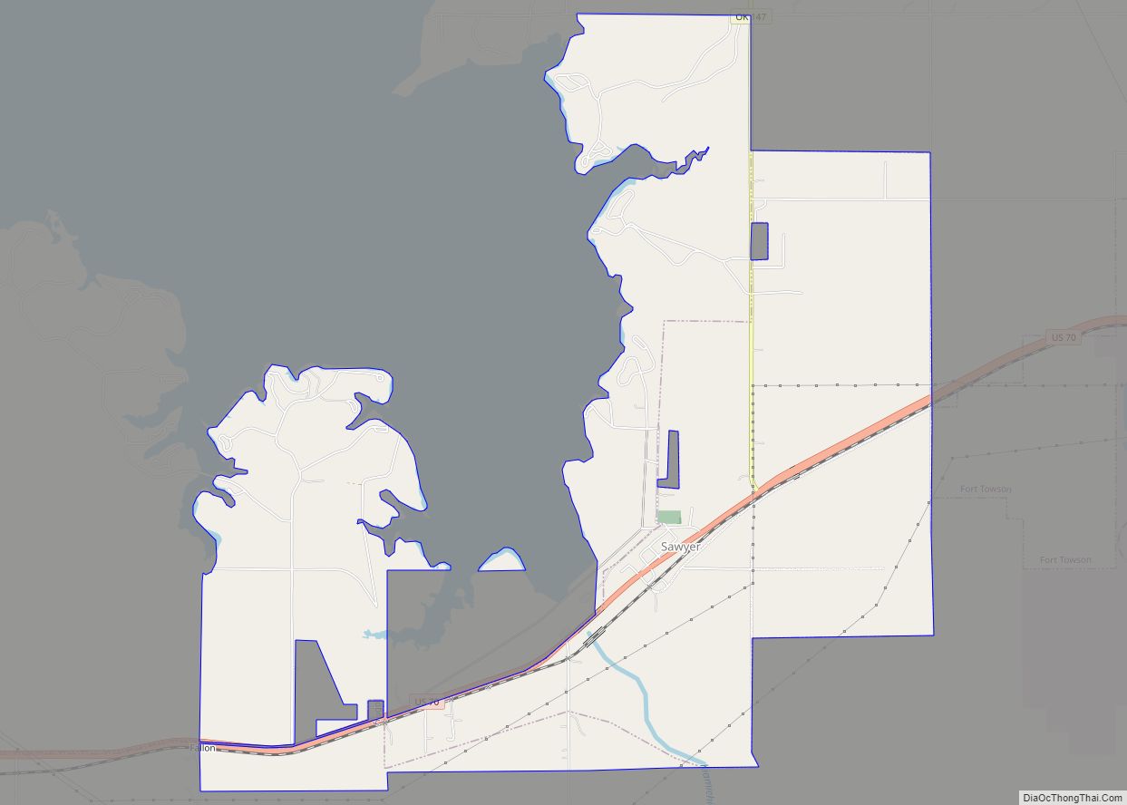
Sawyer is located in eastern Choctaw County at 34°0′46″N 95°22′20″W / 34.01278°N 95.37222°W / 34.01278; -95.37222 (34.012880, -95.372138). The town center is on the east side of the Kiamichi River at Hugo Dam. The town limits extend north up the east side of Hugo Lake and west to touch the southwest side of the lake.
U.S. Route 70 passes through the town, leading west 8 miles (13 km) to the city of Hugo, the Choctaw County seat, and east 6 miles (10 km) to Fort Towson.
According to the United States Census Bureau, the town of Sawyer has a total area of 8.8 square miles (22.7 km), of which 8.6 square miles (22.4 km) is land and 0.12 square miles (0.3 km), or 1.13%, is water.
See also
Map of Oklahoma State and its subdivision:- Adair
- Alfalfa
- Atoka
- Beaver
- Beckham
- Blaine
- Bryan
- Caddo
- Canadian
- Carter
- Cherokee
- Choctaw
- Cimarron
- Cleveland
- Coal
- Comanche
- Cotton
- Craig
- Creek
- Custer
- Delaware
- Dewey
- Ellis
- Garfield
- Garvin
- Grady
- Grant
- Greer
- Harmon
- Harper
- Haskell
- Hughes
- Jackson
- Jefferson
- Johnston
- Kay
- Kingfisher
- Kiowa
- Latimer
- Le Flore
- Lincoln
- Logan
- Love
- Major
- Marshall
- Mayes
- McClain
- McCurtain
- McIntosh
- Murray
- Muskogee
- Noble
- Nowata
- Okfuskee
- Oklahoma
- Okmulgee
- Osage
- Ottawa
- Pawnee
- Payne
- Pittsburg
- Pontotoc
- Pottawatomie
- Pushmataha
- Roger Mills
- Rogers
- Seminole
- Sequoyah
- Stephens
- Texas
- Tillman
- Tulsa
- Wagoner
- Washington
- Washita
- Woods
- Woodward
- Alabama
- Alaska
- Arizona
- Arkansas
- California
- Colorado
- Connecticut
- Delaware
- District of Columbia
- Florida
- Georgia
- Hawaii
- Idaho
- Illinois
- Indiana
- Iowa
- Kansas
- Kentucky
- Louisiana
- Maine
- Maryland
- Massachusetts
- Michigan
- Minnesota
- Mississippi
- Missouri
- Montana
- Nebraska
- Nevada
- New Hampshire
- New Jersey
- New Mexico
- New York
- North Carolina
- North Dakota
- Ohio
- Oklahoma
- Oregon
- Pennsylvania
- Rhode Island
- South Carolina
- South Dakota
- Tennessee
- Texas
- Utah
- Vermont
- Virginia
- Washington
- West Virginia
- Wisconsin
- Wyoming