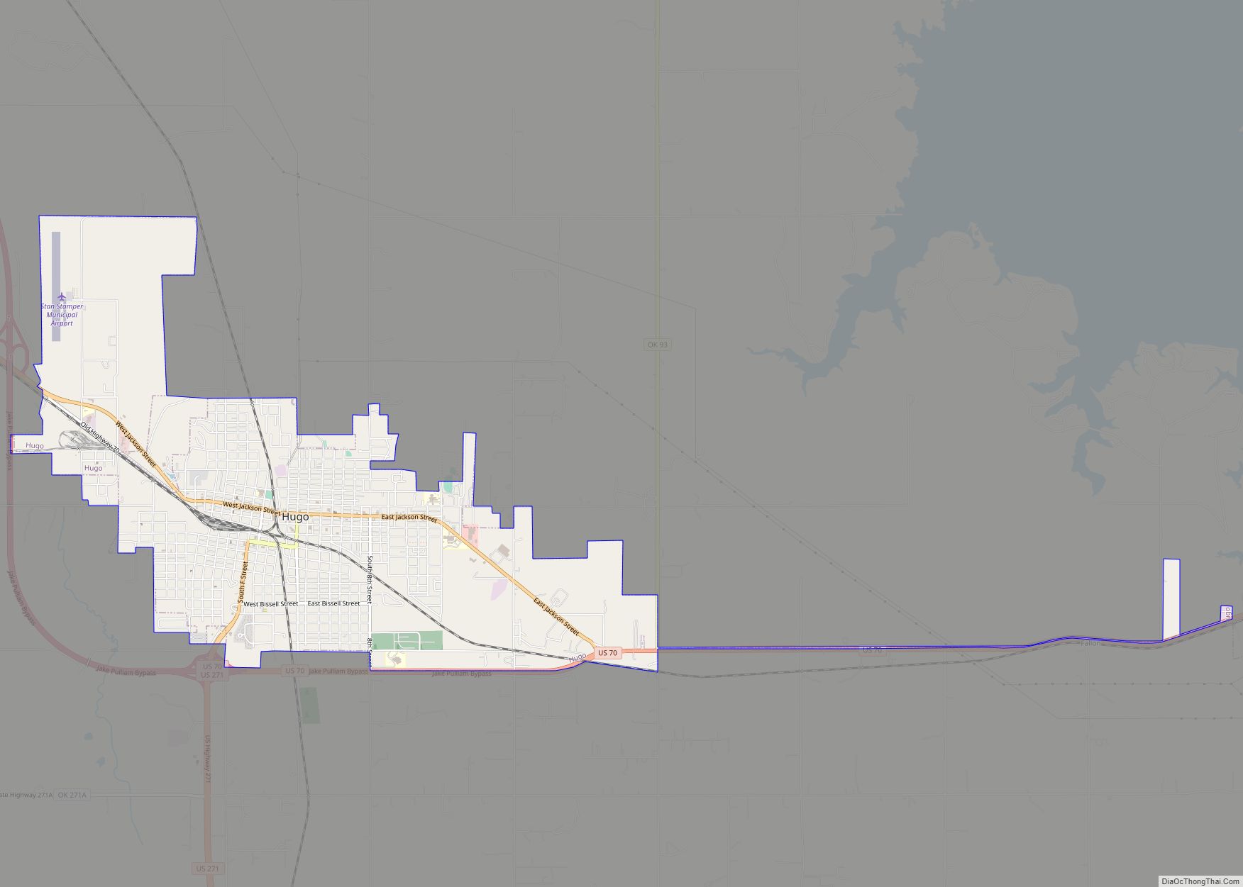
Hugo is a city in and the county seat of Choctaw County, Oklahoma, United States. It is located in southeastern Oklahoma, approximately 9 miles (14 km) north of the Texas state line. As of the 2010 census, the city population was 5,310.
The city was founded in 1901 and named for the French novelist Victor Hugo. In the postwar 20th century, the city served as winter quarters for some circus companies and performers. A cemetery has a section for circus personnel. Nearby is one of the oldest boarding schools west of the Mississippi: Goodland Academy, begun in 1848 as a Presbyterian mission, school and orphanage for Native American children.
The town is located in a cultural area of the state known as Little Dixie, as it was settled by Native American tribes, African Americans and European Americans from the southeastern United States. It is within the tourist area designated as Choctaw Country by the Oklahoma Department of Tourism.
| Name: | Hugo city |
|---|---|
| LSAD Code: | 25 |
| LSAD Description: | city (suffix) |
| State: | Oklahoma |
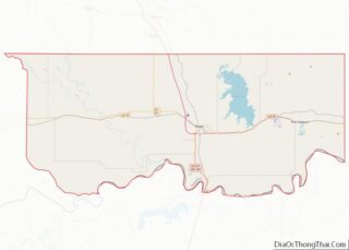
| County: | Choctaw County |
| Elevation: | 545 ft (166 m) |
| Total Area: | 6.33 sq mi (16.39 km²) |
| Land Area: | 6.31 sq mi (16.34 km²) |
| Water Area: | 0.02 sq mi (0.05 km²) |
| Total Population: | 5,166 |
| Population Density: | 818.83/sq mi (316.13/km²) |
| ZIP code: | 74743 |
| Area code: | 580 |
| FIPS code: | 4036300 |
| GNISfeature ID: | 1094002 |
| Website: | hugook.com |
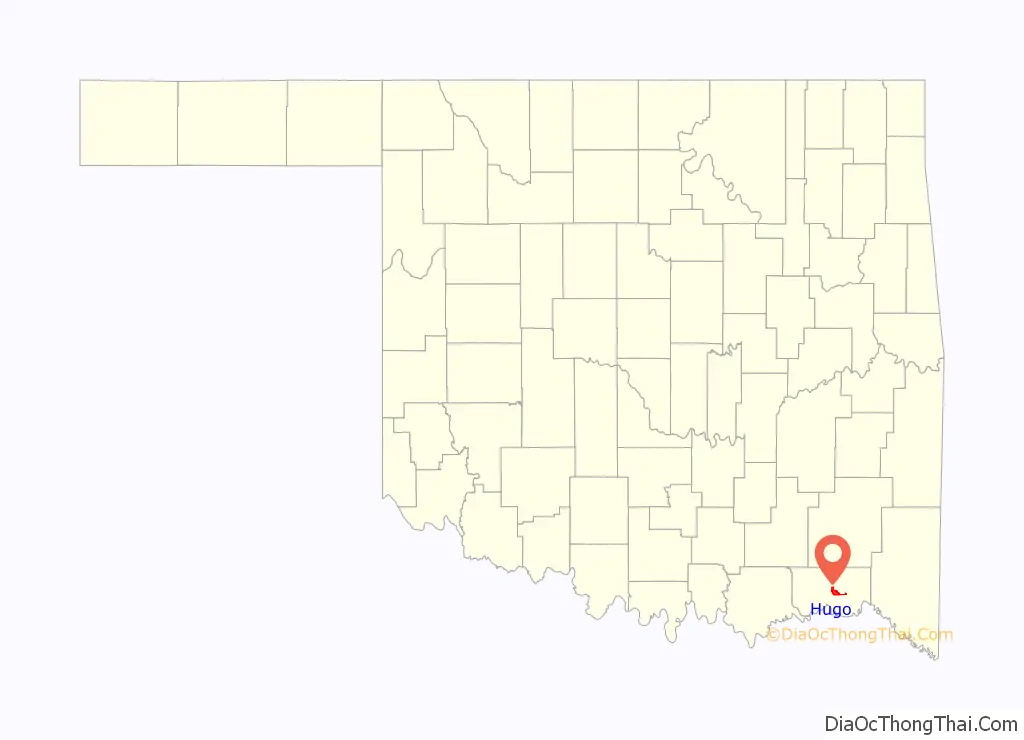
Online Interactive Map
Click on ![]() to view map in "full screen" mode.
to view map in "full screen" mode.
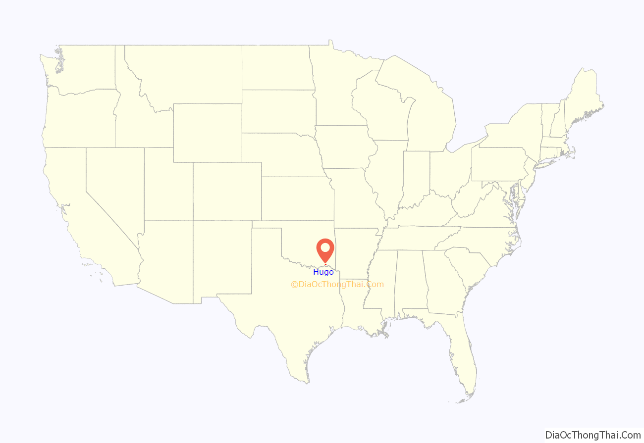
Hugo location map. Where is Hugo city?
History
This was part of the Indian Territory to which the United States government relocated Native American tribes from east of the Mississippi River in the 1830s under its Indian Removal policy. Among the nations relocated here were the Choctaw, for whom the county is named. They were one of what were called the “Five Civilized Tribes” of the southeastern United States, as some of their people had adopted many elements of European-American culture. When they relocated, they brought with them the numerous enslaved African-Americans whom they held as workers and property.
As the majority of the Choctaw allied with the Confederate South during the American Civil War, the United States government insisted on a new peace treaty with them after its end. A condition was the Choctaws’ emancipation of their slaves and granting to the freedmen of rights of full citizenship in the Choctaw nation, as the US was granting citizenship to former slaves of the South.
In 1902 the St. Louis, San Francisco and New Orleans Railroad (later the St. Louis–San Francisco Railway or “Frisco”) built a line from Hope, Arkansas, to Ardmore, Oklahoma. It crossed the north-south line Frisco had built in 1887 to connect Monett, Missouri, to Paris, Texas. The territorial town that sprang up at the crossing would soon be named Hugo. The town’s name was recommended by the wife of local surveyor W.H. Darrough, a fan of French writer Victor Hugo. At the time of its founding, Hugo was located in Kiamitia County, a part of the Pushmataha District of the Choctaw Nation.
As the end of the Indian Territory drew near, tribal citizens and other inhabitants organized an effort for the territory to be admitted to the Union as a state. The State of Sequoyah, which they proposed, divided the territories of the five tribes into counties. Hugo was designated as the county seat of Hitchcock County. Although neither Congress nor the president were interested in admitting Sequoyah as a state, the county boundaries proposed for Sequoyah were in some cases adopted for counties in the future state of Oklahoma.
In southeastern Oklahoma, the future Choctaw County’s boundaries were generally those of Hitchcock County, Sequoyah. Similarly, boundaries proposed for Pushmataha County, Sequoyah served, in general, as the boundaries for Pushmataha County, Oklahoma. And McCurtain County, Oklahoma generally follows the boundaries proposed for McCurtain County, Sequoyah. Both counties are adjacent to and share boundaries with Choctaw County.
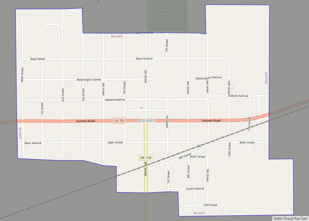
Hugo Road Map

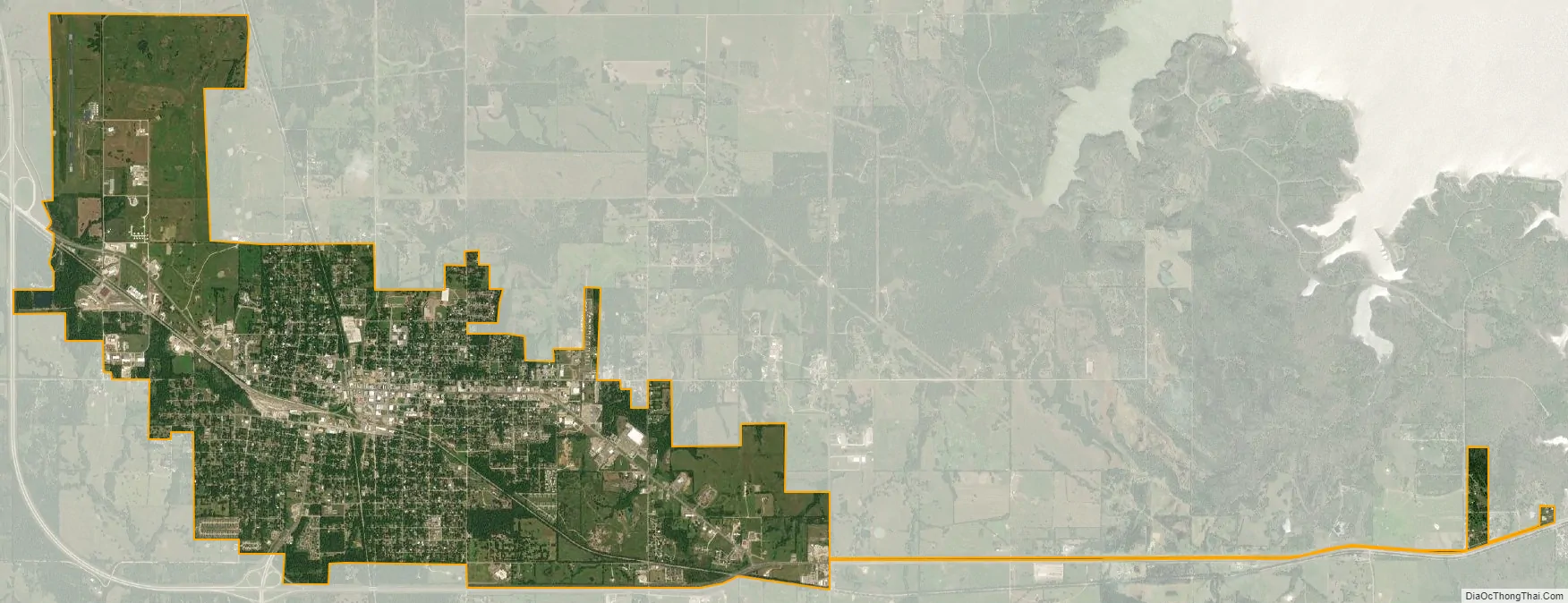
Hugo city Satellite Map
Geography
Hugo is located at the center of Choctaw County. According to the United States Census Bureau, the city has a total area of 6.42 square miles (16.64 km), of which 6.40 square miles (16.58 km) is land and 0.02 square miles (0.06 km), or 0.36%, is water. Hugo Lake on the Kiamichi River lies northeast of town, and Roebuck Lake, an oxbow former channel of the Red River, lies south of town.
Hugo is the southern terminus of the Indian Nation Turnpike, a 105-mile (169 km) four-lane highway that runs northwest to Interstate 40 in Henryetta. It provides a vital transportation link from southeastern Oklahoma to the state’s largest cities, Oklahoma City and Tulsa.
Climate
See also
Map of Oklahoma State and its subdivision:- Adair
- Alfalfa
- Atoka
- Beaver
- Beckham
- Blaine
- Bryan
- Caddo
- Canadian
- Carter
- Cherokee
- Choctaw
- Cimarron
- Cleveland
- Coal
- Comanche
- Cotton
- Craig
- Creek
- Custer
- Delaware
- Dewey
- Ellis
- Garfield
- Garvin
- Grady
- Grant
- Greer
- Harmon
- Harper
- Haskell
- Hughes
- Jackson
- Jefferson
- Johnston
- Kay
- Kingfisher
- Kiowa
- Latimer
- Le Flore
- Lincoln
- Logan
- Love
- Major
- Marshall
- Mayes
- McClain
- McCurtain
- McIntosh
- Murray
- Muskogee
- Noble
- Nowata
- Okfuskee
- Oklahoma
- Okmulgee
- Osage
- Ottawa
- Pawnee
- Payne
- Pittsburg
- Pontotoc
- Pottawatomie
- Pushmataha
- Roger Mills
- Rogers
- Seminole
- Sequoyah
- Stephens
- Texas
- Tillman
- Tulsa
- Wagoner
- Washington
- Washita
- Woods
- Woodward
- Alabama
- Alaska
- Arizona
- Arkansas
- California
- Colorado
- Connecticut
- Delaware
- District of Columbia
- Florida
- Georgia
- Hawaii
- Idaho
- Illinois
- Indiana
- Iowa
- Kansas
- Kentucky
- Louisiana
- Maine
- Maryland
- Massachusetts
- Michigan
- Minnesota
- Mississippi
- Missouri
- Montana
- Nebraska
- Nevada
- New Hampshire
- New Jersey
- New Mexico
- New York
- North Carolina
- North Dakota
- Ohio
- Oklahoma
- Oregon
- Pennsylvania
- Rhode Island
- South Carolina
- South Dakota
- Tennessee
- Texas
- Utah
- Vermont
- Virginia
- Washington
- West Virginia
- Wisconsin
- Wyoming