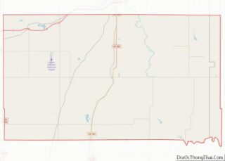
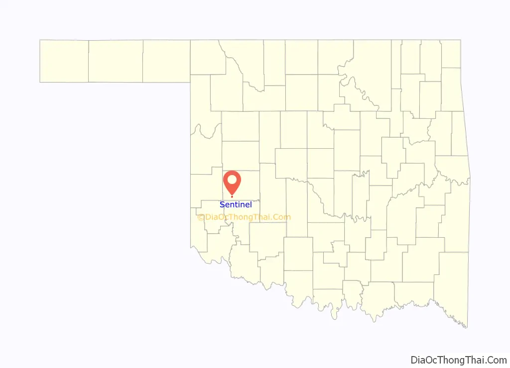
Sentinel is a town in Washita County, in the U.S. state of Oklahoma. The population was 901 in the 2010 census, an increase of 4.9 percent from the figure of 859 residents in 2000. Towns near Sentinel are Rocky, Cordell, Canute, and Burnsflat.
| Name: | Sentinel town |
|---|---|
| LSAD Code: | 43 |
| LSAD Description: | town (suffix) |
| State: | Oklahoma |
| County: | Washita County |
| Elevation: | 1,640 ft (500 m) |
| Total Area: | 0.62 sq mi (1.61 km²) |
| Land Area: | 0.62 sq mi (1.61 km²) |
| Water Area: | 0.00 sq mi (0.00 km²) |
| Total Population: | 763 |
| Population Density: | 1,226.69/sq mi (473.27/km²) |
| ZIP code: | 73664 |
| Area code: | 580 |
| FIPS code: | 4066400 |
| GNISfeature ID: | 1097916 |
Online Interactive Map
Click on ![]() to view map in "full screen" mode.
to view map in "full screen" mode.
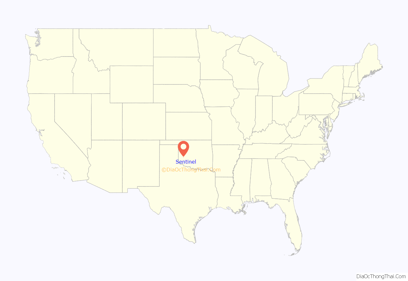
Sentinel location map. Where is Sentinel town?
History
Located in southwestern Washita County, Sentinel lies at the intersection of State Highways 44 and 55. The town is primarily an agriculture-based community. The 1892 Cheyenne and Arapaho Opening brought non-Indians into the region. In 1898, R. B. Gore, a pioneer of Old Greer County, established a small general merchandise store in the area and applied for a post office. On March 6, 1899, the Post Office Department approved the application and designated the locale as Sentinel, Oklahoma Territory. The name originated from Cloud Chief’s Herald-Sentinel newspaper. This store was approximately one mile east of the present town.
In 1901, the Kansas City, Mexico and Orient Railway, later bought by the Atchison, Topeka, and Santa Fe Railway, began purchasing rights-of-way and designating new townsites for a proposed railroad. The newly formed Orient Townsite Company chose the site of present Sentinel and received a donation of eighty acres from L. N. Whitmer. They named the new town “Barton” and filed a plat on September 23, 1901. The new residents asked Gore to relocate his store and post office to the new location. This caused confusion, as the town and post office had different names. In 1904, Will Hornbeck established the Sentinel News-Boy. Determined to correct the name problem, he started a petition to incorporate the town as Sentinel. In 1906, the voters approved this measure in an election. In August 1907, the town officially became Sentinel. At the 1907 statehood, it had 351 residents.
By 1908, the Orient had built their tracks through the village. In 1910 the population stood at 857, climbing to 1,269 by 1930. In 1911 residents supported two banks, a newspaper, electricity and telephone service, four grocers, two hotels, four general stores, among many other businesses and professionals. In 1935, a Civilian Conservation Corps camp was located just west of Sentinel. The population held above one thousand until 1970 when it registered 984. In 1967, the Rocky school consolidated into Sentinel School District. In 1961, the chamber of commerce began hosting an annual, large July Fourth celebration. In 2000, the population stood at 859.
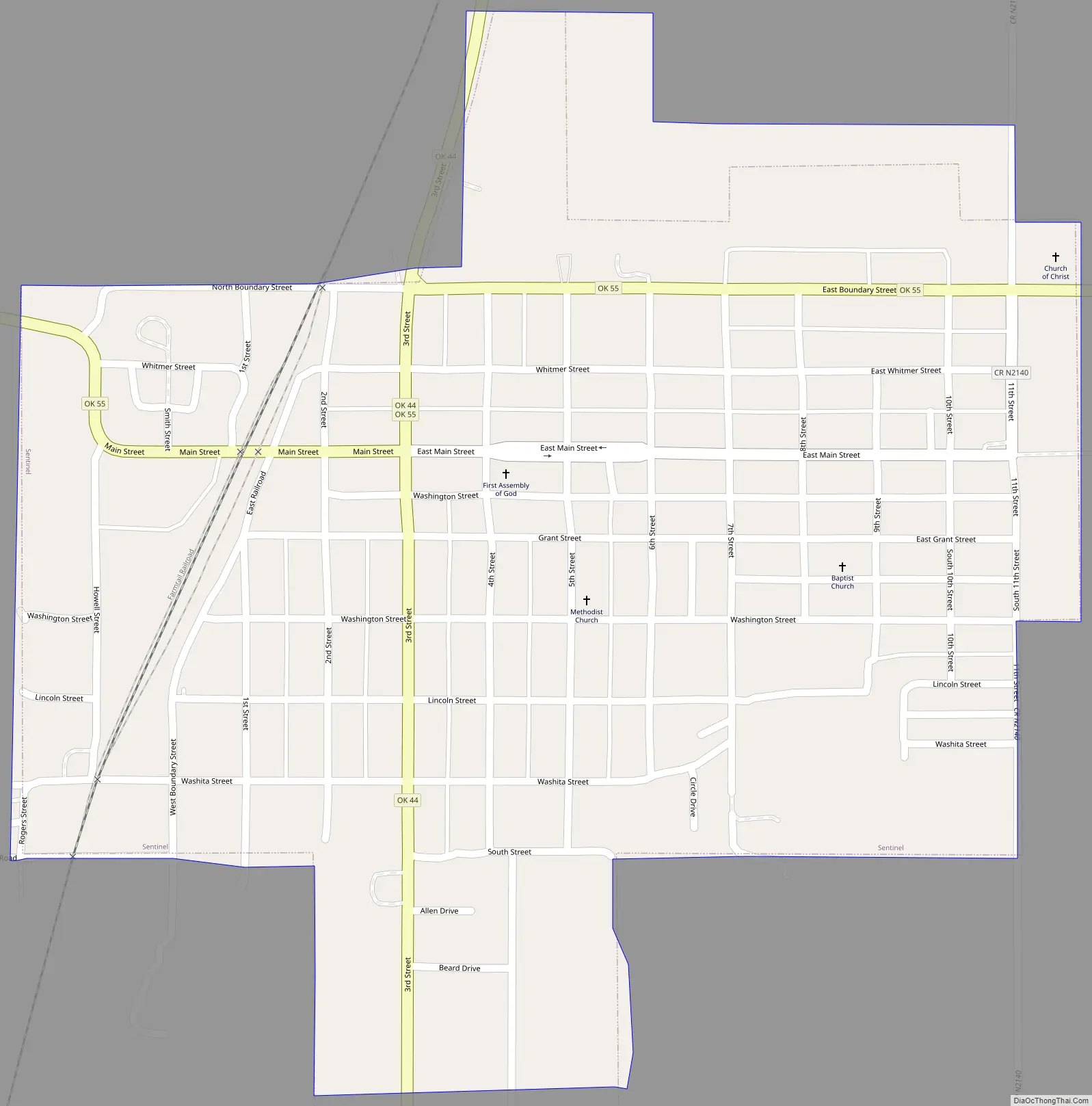
Sentinel Road Map
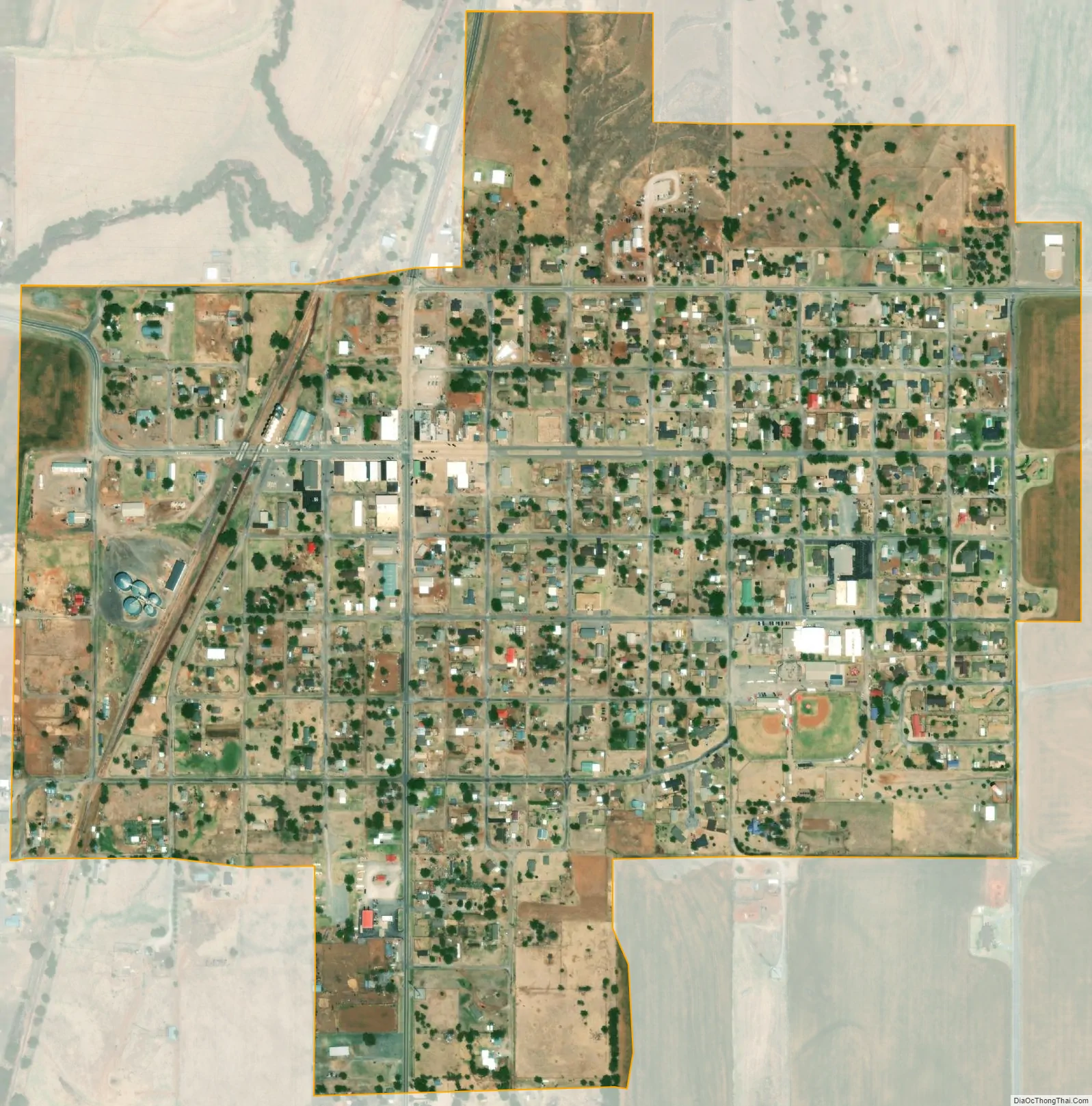
Sentinel city Satellite Map
Geography
Sentinel is located at 35°9′24″N 99°10′26″W / 35.15667°N 99.17389°W / 35.15667; -99.17389 (35.156659, -99.173829).
According to the United States Census Bureau, the town has a total area of 0.6 square miles (1.6 km), all land.
Sentinel is located in western Oklahoma’s Washita County at the intersection of Highway 44 and Highway 55.
See also
Map of Oklahoma State and its subdivision:- Adair
- Alfalfa
- Atoka
- Beaver
- Beckham
- Blaine
- Bryan
- Caddo
- Canadian
- Carter
- Cherokee
- Choctaw
- Cimarron
- Cleveland
- Coal
- Comanche
- Cotton
- Craig
- Creek
- Custer
- Delaware
- Dewey
- Ellis
- Garfield
- Garvin
- Grady
- Grant
- Greer
- Harmon
- Harper
- Haskell
- Hughes
- Jackson
- Jefferson
- Johnston
- Kay
- Kingfisher
- Kiowa
- Latimer
- Le Flore
- Lincoln
- Logan
- Love
- Major
- Marshall
- Mayes
- McClain
- McCurtain
- McIntosh
- Murray
- Muskogee
- Noble
- Nowata
- Okfuskee
- Oklahoma
- Okmulgee
- Osage
- Ottawa
- Pawnee
- Payne
- Pittsburg
- Pontotoc
- Pottawatomie
- Pushmataha
- Roger Mills
- Rogers
- Seminole
- Sequoyah
- Stephens
- Texas
- Tillman
- Tulsa
- Wagoner
- Washington
- Washita
- Woods
- Woodward
- Alabama
- Alaska
- Arizona
- Arkansas
- California
- Colorado
- Connecticut
- Delaware
- District of Columbia
- Florida
- Georgia
- Hawaii
- Idaho
- Illinois
- Indiana
- Iowa
- Kansas
- Kentucky
- Louisiana
- Maine
- Maryland
- Massachusetts
- Michigan
- Minnesota
- Mississippi
- Missouri
- Montana
- Nebraska
- Nevada
- New Hampshire
- New Jersey
- New Mexico
- New York
- North Carolina
- North Dakota
- Ohio
- Oklahoma
- Oregon
- Pennsylvania
- Rhode Island
- South Carolina
- South Dakota
- Tennessee
- Texas
- Utah
- Vermont
- Virginia
- Washington
- West Virginia
- Wisconsin
- Wyoming