Snyder is a city in Kiowa County, Oklahoma, United States. The population was 1,394 at the 2010 census. This figure represented a decline of 7.6 percent from 1,509 persons in 2000.
| Name: | Snyder city |
|---|---|
| LSAD Code: | 25 |
| LSAD Description: | city (suffix) |
| State: | Oklahoma |
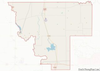
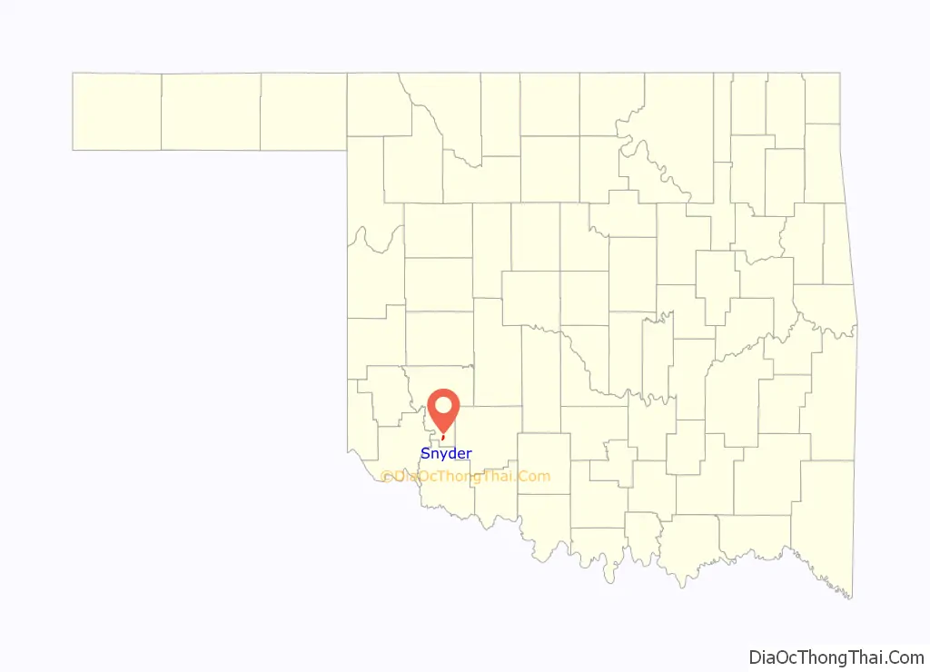
| County: | Kiowa County |
| Elevation: | 1,355 ft (413 m) |
| Total Area: | 1.21 sq mi (3.12 km²) |
| Land Area: | 1.21 sq mi (3.12 km²) |
| Water Area: | 0.00 sq mi (0.00 km²) |
| Total Population: | 1,301 |
| Population Density: | 1,079.67/sq mi (416.76/km²) |
| ZIP code: | 73566 |
| Area code: | 580 |
| FIPS code: | 4068400 |
| GNISfeature ID: | 1098175 |
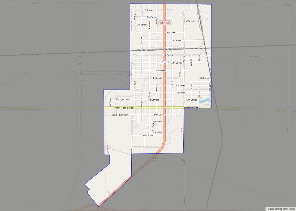
Online Interactive Map
Click on ![]() to view map in "full screen" mode.
to view map in "full screen" mode.
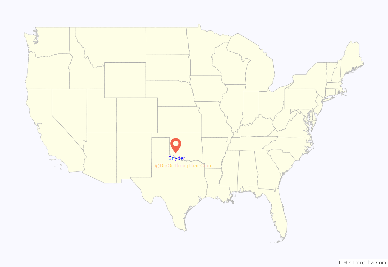
Snyder location map. Where is Snyder city?
History
The community of Snyder was established in Oklahoma Territory, just 2 miles (3.2 km) south of Mountain Park in 1902. The founder was Charles G. Jones of Oklahoma City, president of the Oklahoma City and Western Railroad, who had a dispute with that municipality. Jones named the new town for Bryan Snyder, an employee of the St. Louis and San Francisco Railway (Frisco), which ran north and south through the townsite.
In 1905, a tornado hit Snyder and killed 113 people, including the superintendent of public schools. Fires in 1906 and 1909 destroyed most of the wooden buildings along Main Street. These were quickly replaced by brick buildings. By the time of statehood in 1907, Snyder had a population of 607 residents. The number grew to 1,122 in 1910.
Snyder Road Map
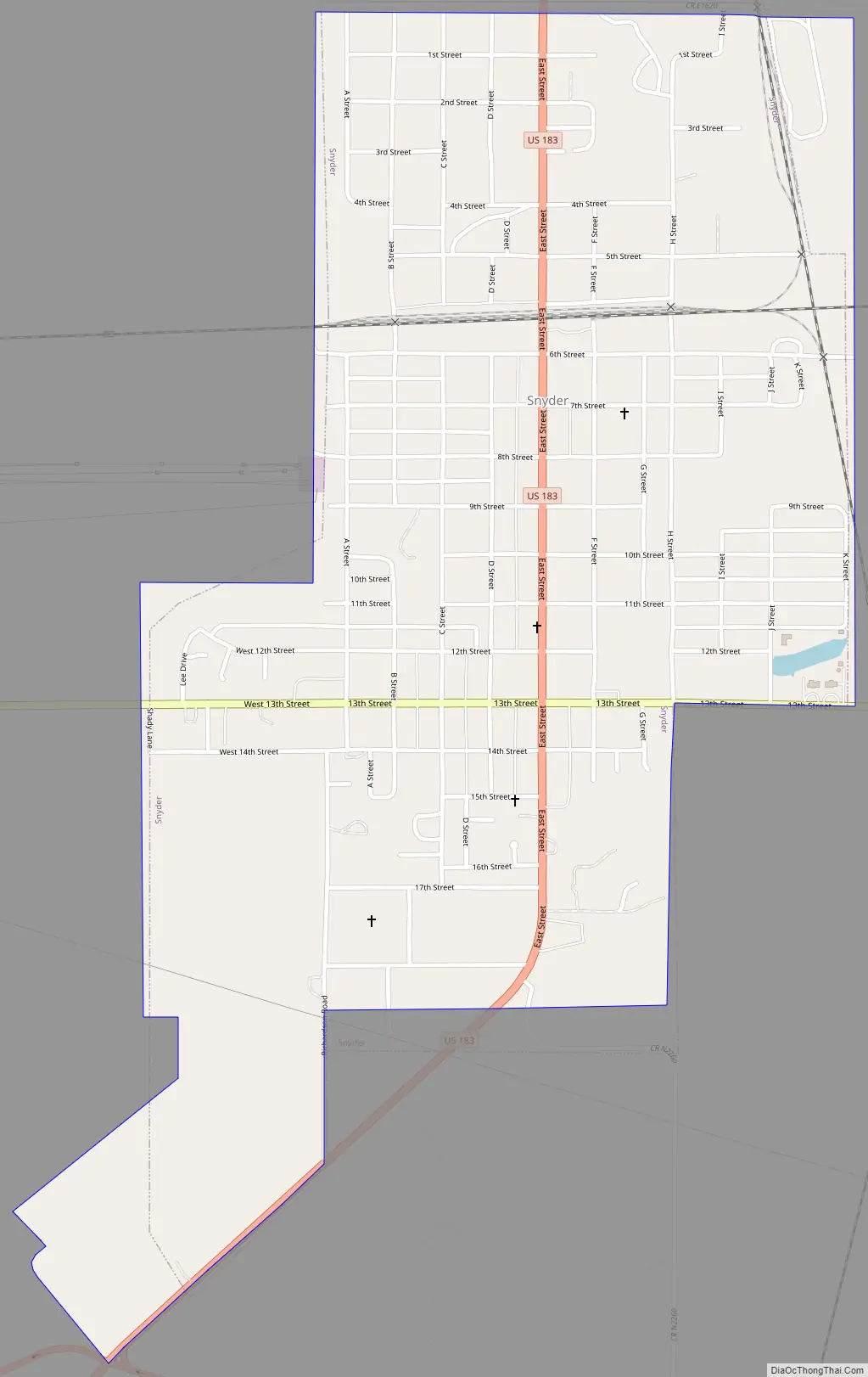
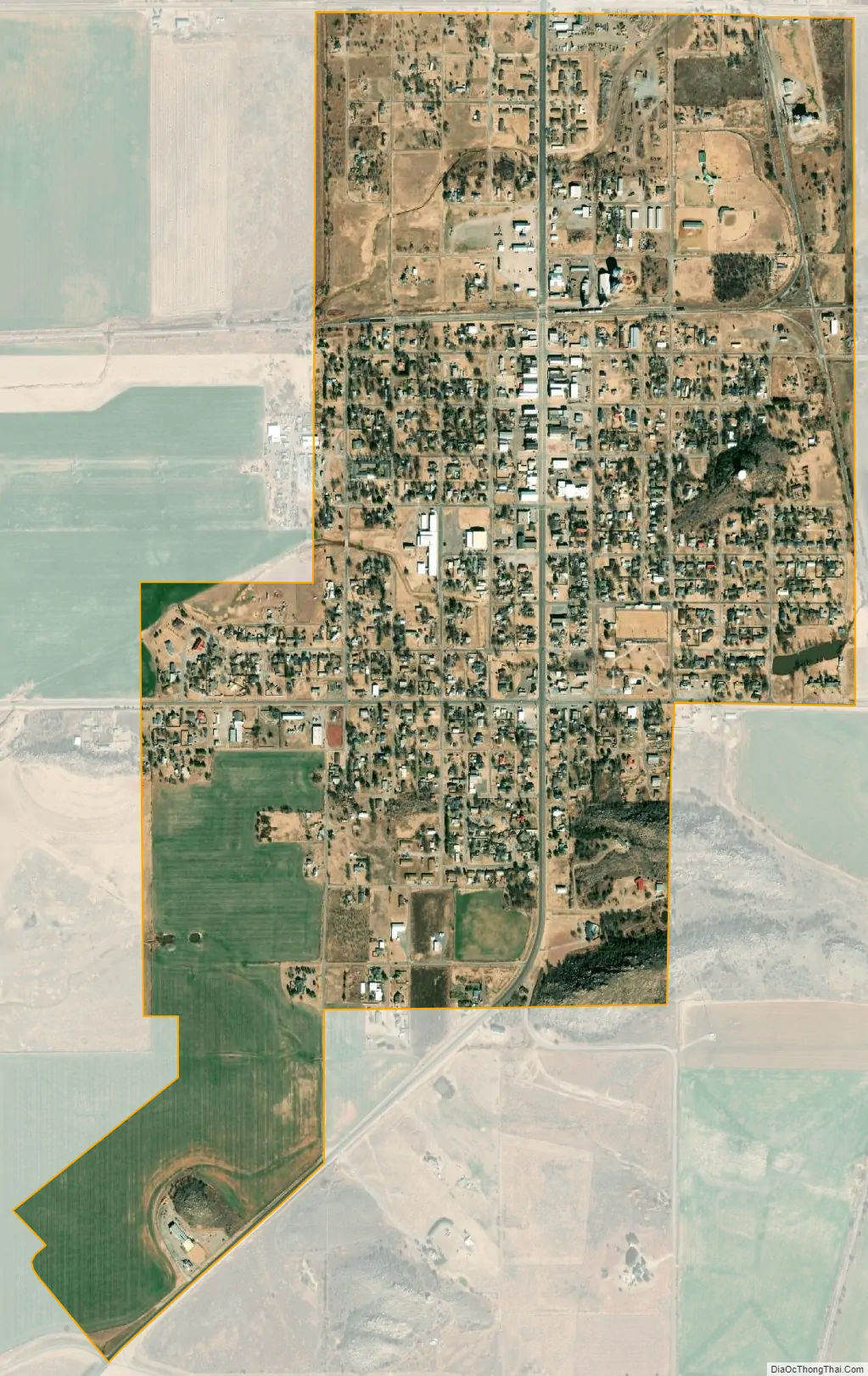
Snyder city Satellite Map
Geography
Snyder is located at 34°39′26″N 98°57′9″W / 34.65722°N 98.95250°W / 34.65722; -98.95250 (34.657246, -98.952535). The city is at the junction of U.S. routes 62 and 183. It is also 28 miles (45 km) south of Hobart, 22 miles (35 km) east of Altus and 36 miles (58 km) west of Lawton.
According to the United States Census Bureau, Snyder has a total area of 1.3 square miles (3.4 km), all land.
See also
Map of Oklahoma State and its subdivision:- Adair
- Alfalfa
- Atoka
- Beaver
- Beckham
- Blaine
- Bryan
- Caddo
- Canadian
- Carter
- Cherokee
- Choctaw
- Cimarron
- Cleveland
- Coal
- Comanche
- Cotton
- Craig
- Creek
- Custer
- Delaware
- Dewey
- Ellis
- Garfield
- Garvin
- Grady
- Grant
- Greer
- Harmon
- Harper
- Haskell
- Hughes
- Jackson
- Jefferson
- Johnston
- Kay
- Kingfisher
- Kiowa
- Latimer
- Le Flore
- Lincoln
- Logan
- Love
- Major
- Marshall
- Mayes
- McClain
- McCurtain
- McIntosh
- Murray
- Muskogee
- Noble
- Nowata
- Okfuskee
- Oklahoma
- Okmulgee
- Osage
- Ottawa
- Pawnee
- Payne
- Pittsburg
- Pontotoc
- Pottawatomie
- Pushmataha
- Roger Mills
- Rogers
- Seminole
- Sequoyah
- Stephens
- Texas
- Tillman
- Tulsa
- Wagoner
- Washington
- Washita
- Woods
- Woodward
- Alabama
- Alaska
- Arizona
- Arkansas
- California
- Colorado
- Connecticut
- Delaware
- District of Columbia
- Florida
- Georgia
- Hawaii
- Idaho
- Illinois
- Indiana
- Iowa
- Kansas
- Kentucky
- Louisiana
- Maine
- Maryland
- Massachusetts
- Michigan
- Minnesota
- Mississippi
- Missouri
- Montana
- Nebraska
- Nevada
- New Hampshire
- New Jersey
- New Mexico
- New York
- North Carolina
- North Dakota
- Ohio
- Oklahoma
- Oregon
- Pennsylvania
- Rhode Island
- South Carolina
- South Dakota
- Tennessee
- Texas
- Utah
- Vermont
- Virginia
- Washington
- West Virginia
- Wisconsin
- Wyoming