Wapanucka (pronounced Wop´-uh-nuck´-uh) is a town in northeastern Johnston County, Oklahoma, United States. The population was 438 at the 2010 census, a 1.6 percent decrease from the figure of 445 in 2000. It is about 20 miles (32 km) northeast of Tishomingo. The town name refers to the Delaware Nation and means “Eastern Land People.”
| Name: | Wapanucka town |
|---|---|
| LSAD Code: | 43 |
| LSAD Description: | town (suffix) |
| State: | Oklahoma |
| County: | Johnston County |
| Elevation: | 633 ft (193 m) |
| Total Area: | 0.66 sq mi (1.70 km²) |
| Land Area: | 0.65 sq mi (1.68 km²) |
| Water Area: | 0.01 sq mi (0.02 km²) |
| Total Population: | 386 |
| Population Density: | 593.85/sq mi (229.25/km²) |
| ZIP code: | 73461 |
| Area code: | 580 |
| FIPS code: | 4078300 |
| GNISfeature ID: | 1099353 |
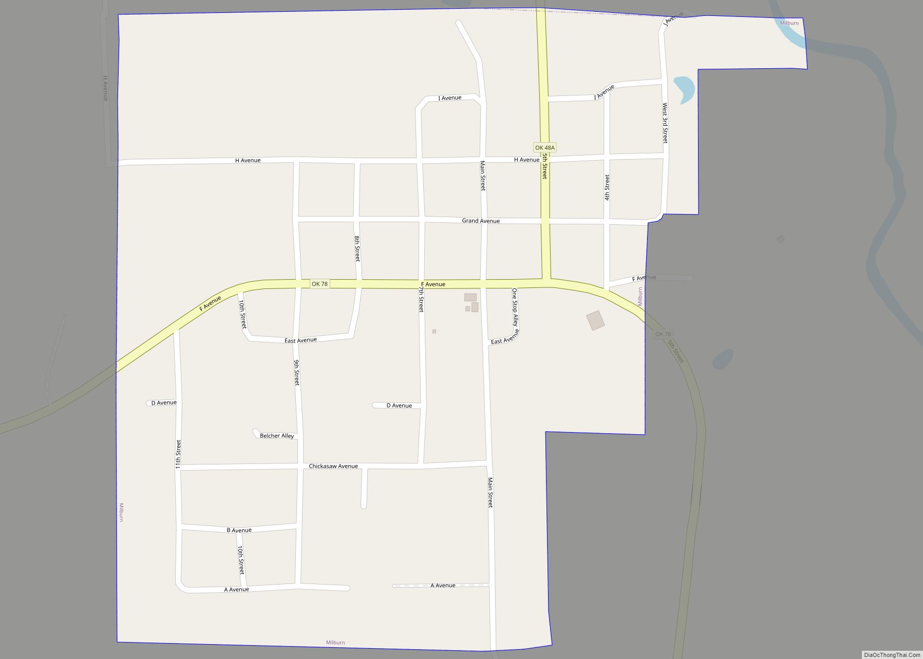
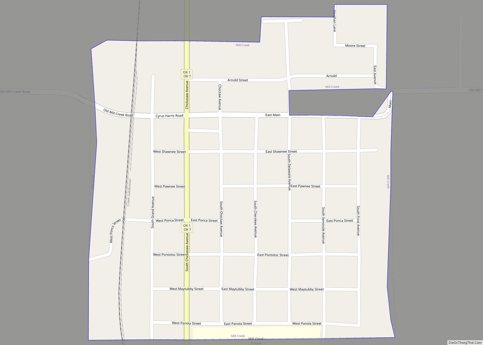
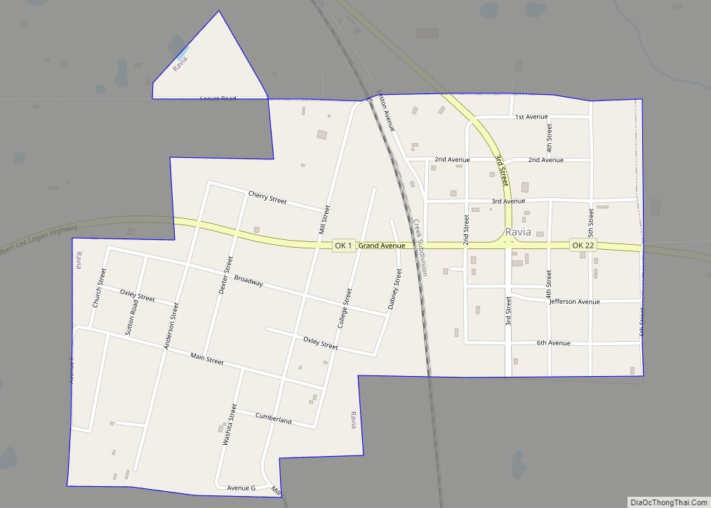
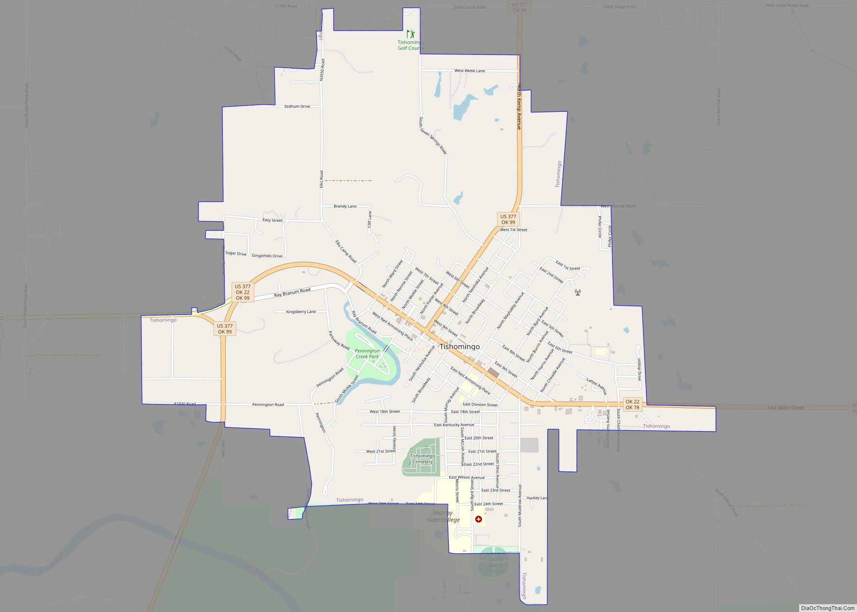
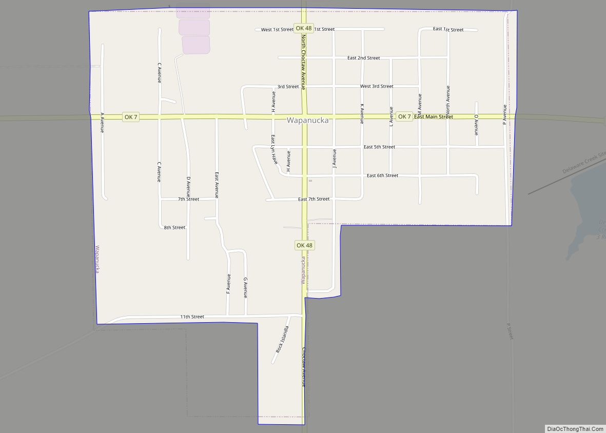
Online Interactive Map
Click on ![]() to view map in "full screen" mode.
to view map in "full screen" mode.
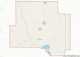
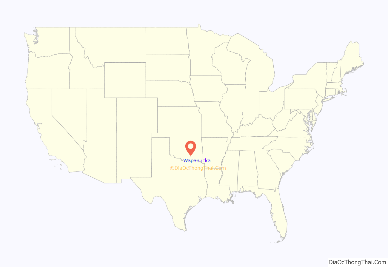
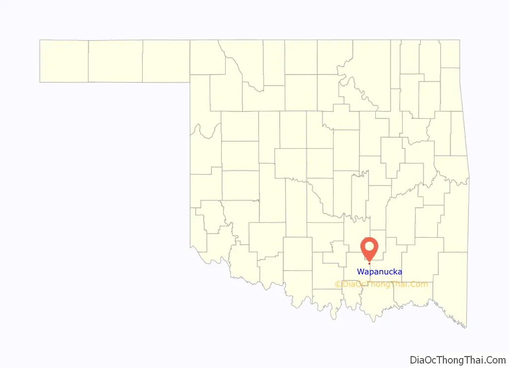
Wapanucka location map. Where is Wapanucka town?
History
The Board of Foreign Missions of the Presbyterian Church built the Wapanucka Female Manual Labour School in 1851–2. The school, which opened in 1852, was named for a nearby creek. Local residents often called it Allen’s Academy, for James S. Allen, who supervised it. Later many dubbed it Rock Academy for its impressive stone building. The school closed in 1860 after the Presbyterian Board withdrew its financial support. The Confederate forces used the building during the Civil War as a hospital and a prison. After the war the academy reopened, serving male and female students. In 1890 it became a boys’ school. In 1911 it was permanently closed and the property sold. The Wapanucka Academy site was listed in the National Register of Historic Places (NR 72001065) in 1972.
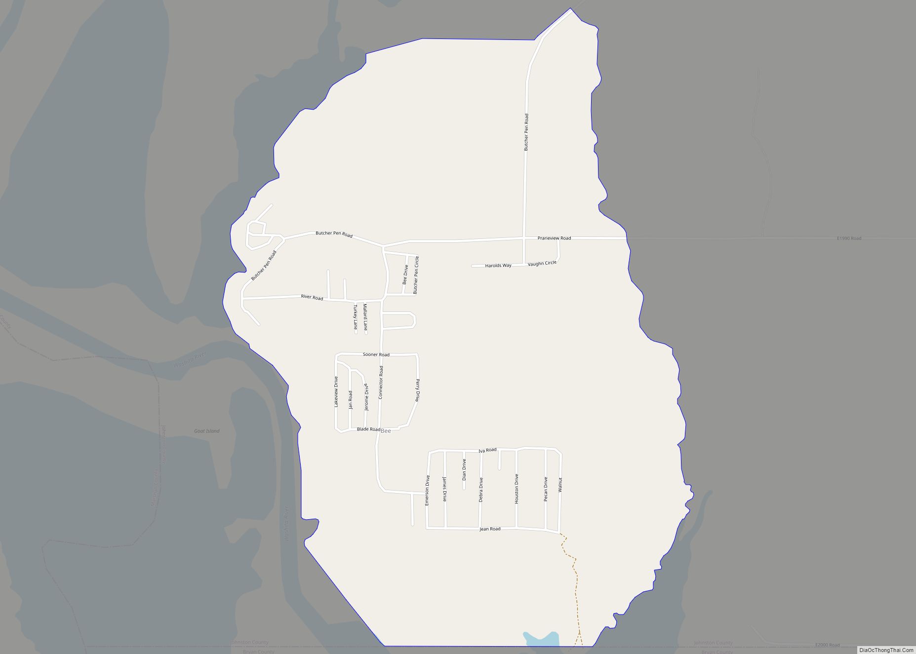
Wapanucka Road Map
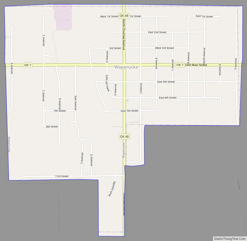
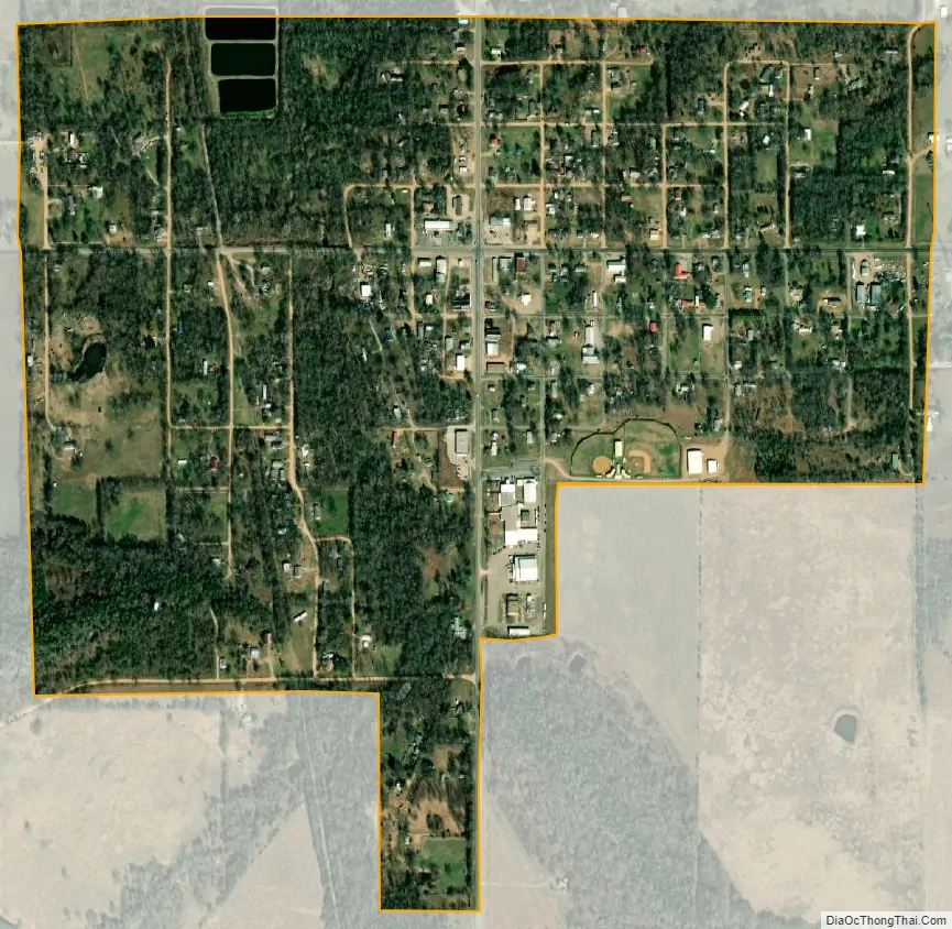
Wapanucka city Satellite Map
Geography
Wapanucka is located at 34°22′28″N 96°25′21″W / 34.374412°N 96.422559°W / 34.374412; -96.422559. It is 20 miles (32 km) northeast of Tishomingo, the county seat.
According to the United States Census Bureau, the town has a total area of 0.7 square miles (1.8 km), of which 0.7 square miles (1.8 km) is land and 1.49% is water.
See also
Map of Oklahoma State and its subdivision:- Adair
- Alfalfa
- Atoka
- Beaver
- Beckham
- Blaine
- Bryan
- Caddo
- Canadian
- Carter
- Cherokee
- Choctaw
- Cimarron
- Cleveland
- Coal
- Comanche
- Cotton
- Craig
- Creek
- Custer
- Delaware
- Dewey
- Ellis
- Garfield
- Garvin
- Grady
- Grant
- Greer
- Harmon
- Harper
- Haskell
- Hughes
- Jackson
- Jefferson
- Johnston
- Kay
- Kingfisher
- Kiowa
- Latimer
- Le Flore
- Lincoln
- Logan
- Love
- Major
- Marshall
- Mayes
- McClain
- McCurtain
- McIntosh
- Murray
- Muskogee
- Noble
- Nowata
- Okfuskee
- Oklahoma
- Okmulgee
- Osage
- Ottawa
- Pawnee
- Payne
- Pittsburg
- Pontotoc
- Pottawatomie
- Pushmataha
- Roger Mills
- Rogers
- Seminole
- Sequoyah
- Stephens
- Texas
- Tillman
- Tulsa
- Wagoner
- Washington
- Washita
- Woods
- Woodward
- Alabama
- Alaska
- Arizona
- Arkansas
- California
- Colorado
- Connecticut
- Delaware
- District of Columbia
- Florida
- Georgia
- Hawaii
- Idaho
- Illinois
- Indiana
- Iowa
- Kansas
- Kentucky
- Louisiana
- Maine
- Maryland
- Massachusetts
- Michigan
- Minnesota
- Mississippi
- Missouri
- Montana
- Nebraska
- Nevada
- New Hampshire
- New Jersey
- New Mexico
- New York
- North Carolina
- North Dakota
- Ohio
- Oklahoma
- Oregon
- Pennsylvania
- Rhode Island
- South Carolina
- South Dakota
- Tennessee
- Texas
- Utah
- Vermont
- Virginia
- Washington
- West Virginia
- Wisconsin
- Wyoming