Waukomis is a town in Garfield County, Oklahoma, United States. The population was 1,286 at the 2010 census, an increase of 2.0 percent from 1,261 in 2000.
| Name: | Waukomis town |
|---|---|
| LSAD Code: | 43 |
| LSAD Description: | town (suffix) |
| State: | Oklahoma |
| County: | Garfield County |
| Elevation: | 1,250 ft (381 m) |
| Total Area: | 2.99 sq mi (7.73 km²) |
| Land Area: | 2.97 sq mi (7.70 km²) |
| Water Area: | 0.01 sq mi (0.03 km²) |
| Total Population: | 1,349 |
| Population Density: | 453.60/sq mi (175.14/km²) |
| ZIP code: | 73773 |
| Area code: | 580 |
| FIPS code: | 4079200 |
| GNISfeature ID: | 1099437 |
Online Interactive Map
Click on ![]() to view map in "full screen" mode.
to view map in "full screen" mode.
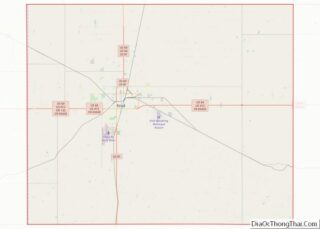
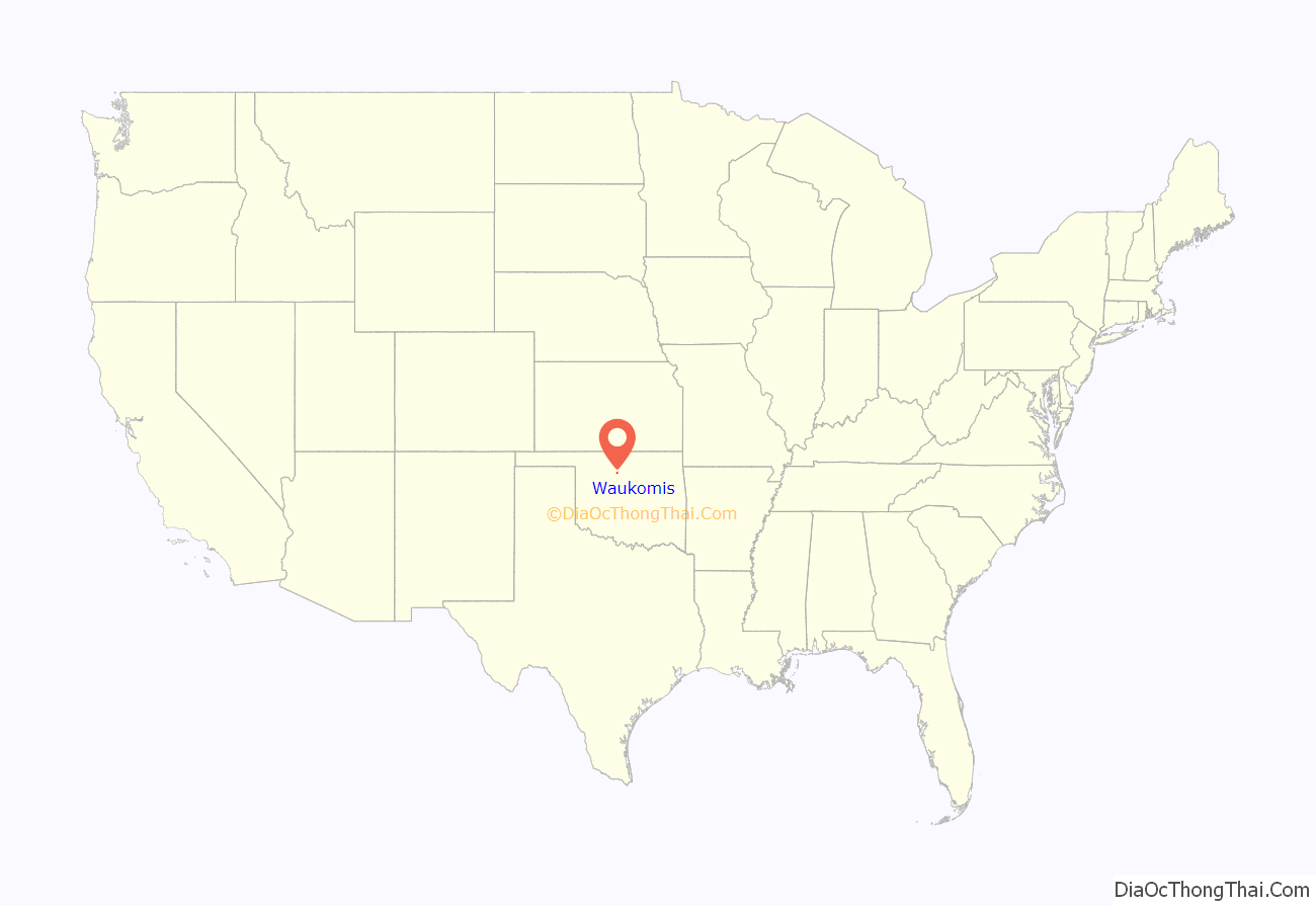
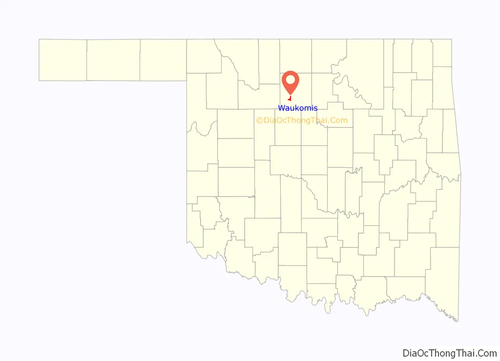
Waukomis location map. Where is Waukomis town?
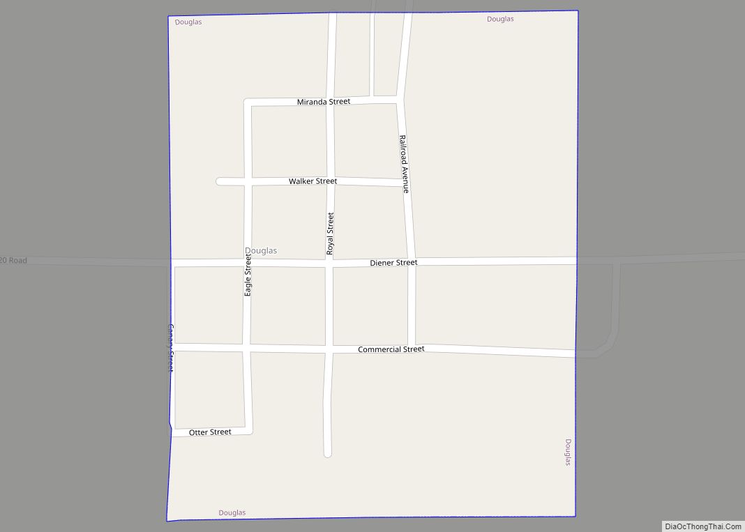
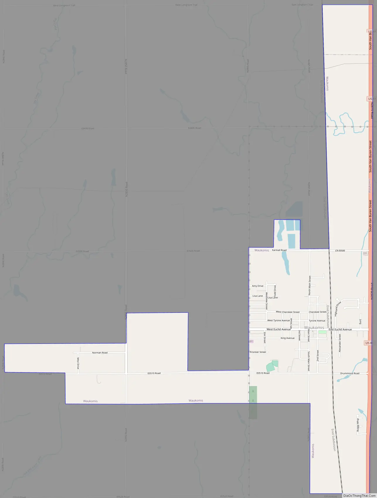
Waukomis Road Map
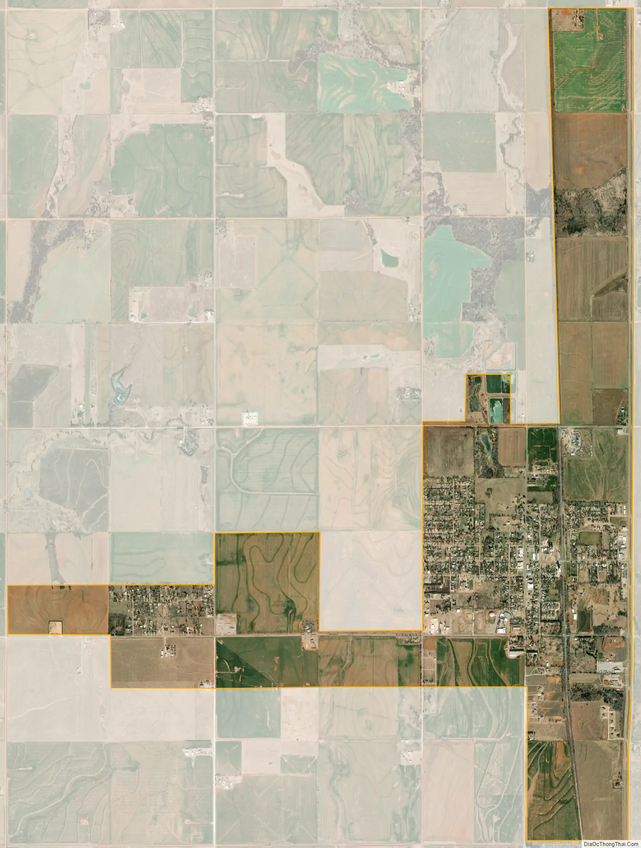
Waukomis city Satellite Map
Geography
Waukomis is located south of the center of Garfield County at 36°16′50″N 97°54′8″W / 36.28056°N 97.90222°W / 36.28056; -97.90222 (36.280604, -97.902189). U.S. Route 81 forms the eastern border of the town; the highway leads north 8 miles (13 km) to Enid, the county seat, and south 11 miles (18 km) to Hennessey.
According to the United States Census Bureau, the town has a total area of 3.3 square miles (8.6 km), of which 0.01 square miles (0.03 km), or 0.37%, is water.
See also
Map of Oklahoma State and its subdivision:- Adair
- Alfalfa
- Atoka
- Beaver
- Beckham
- Blaine
- Bryan
- Caddo
- Canadian
- Carter
- Cherokee
- Choctaw
- Cimarron
- Cleveland
- Coal
- Comanche
- Cotton
- Craig
- Creek
- Custer
- Delaware
- Dewey
- Ellis
- Garfield
- Garvin
- Grady
- Grant
- Greer
- Harmon
- Harper
- Haskell
- Hughes
- Jackson
- Jefferson
- Johnston
- Kay
- Kingfisher
- Kiowa
- Latimer
- Le Flore
- Lincoln
- Logan
- Love
- Major
- Marshall
- Mayes
- McClain
- McCurtain
- McIntosh
- Murray
- Muskogee
- Noble
- Nowata
- Okfuskee
- Oklahoma
- Okmulgee
- Osage
- Ottawa
- Pawnee
- Payne
- Pittsburg
- Pontotoc
- Pottawatomie
- Pushmataha
- Roger Mills
- Rogers
- Seminole
- Sequoyah
- Stephens
- Texas
- Tillman
- Tulsa
- Wagoner
- Washington
- Washita
- Woods
- Woodward
- Alabama
- Alaska
- Arizona
- Arkansas
- California
- Colorado
- Connecticut
- Delaware
- District of Columbia
- Florida
- Georgia
- Hawaii
- Idaho
- Illinois
- Indiana
- Iowa
- Kansas
- Kentucky
- Louisiana
- Maine
- Maryland
- Massachusetts
- Michigan
- Minnesota
- Mississippi
- Missouri
- Montana
- Nebraska
- Nevada
- New Hampshire
- New Jersey
- New Mexico
- New York
- North Carolina
- North Dakota
- Ohio
- Oklahoma
- Oregon
- Pennsylvania
- Rhode Island
- South Carolina
- South Dakota
- Tennessee
- Texas
- Utah
- Vermont
- Virginia
- Washington
- West Virginia
- Wisconsin
- Wyoming