Yukon is a city in eastern Canadian County, Oklahoma, United States. It is part of the Oklahoma City Metropolitan Area. The population was 22,709 at the 2010 census. Founded in the 1890s, the town was named in reference to a gold rush in Yukon Territory, Canada, at the time. Historically, Yukon served as an urban center for area farmers and the site of a large milling operation. It is now considered primarily a residential community for people who work in Oklahoma City.
| Name: | Yukon city |
|---|---|
| LSAD Code: | 25 |
| LSAD Description: | city (suffix) |
| State: | Oklahoma |
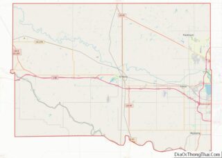
| County: | Canadian County |
| Elevation: | 1,293 ft (394 m) |
| Total Area: | 26.60 sq mi (68.89 km²) |
| Land Area: | 26.54 sq mi (68.74 km²) |
| Water Area: | 0.06 sq mi (0.15 km²) |
| Total Population: | 23,630 |
| Population Density: | 890.35/sq mi (343.76/km²) |
| ZIP code: | 73085, 73099 |
| Area code: | 405 |
| FIPS code: | 4082950 |
| GNISfeature ID: | 1100067 |
| Website: | www.cityofyukonok.gov |
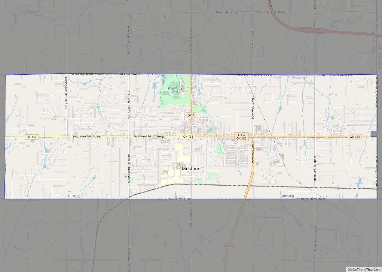
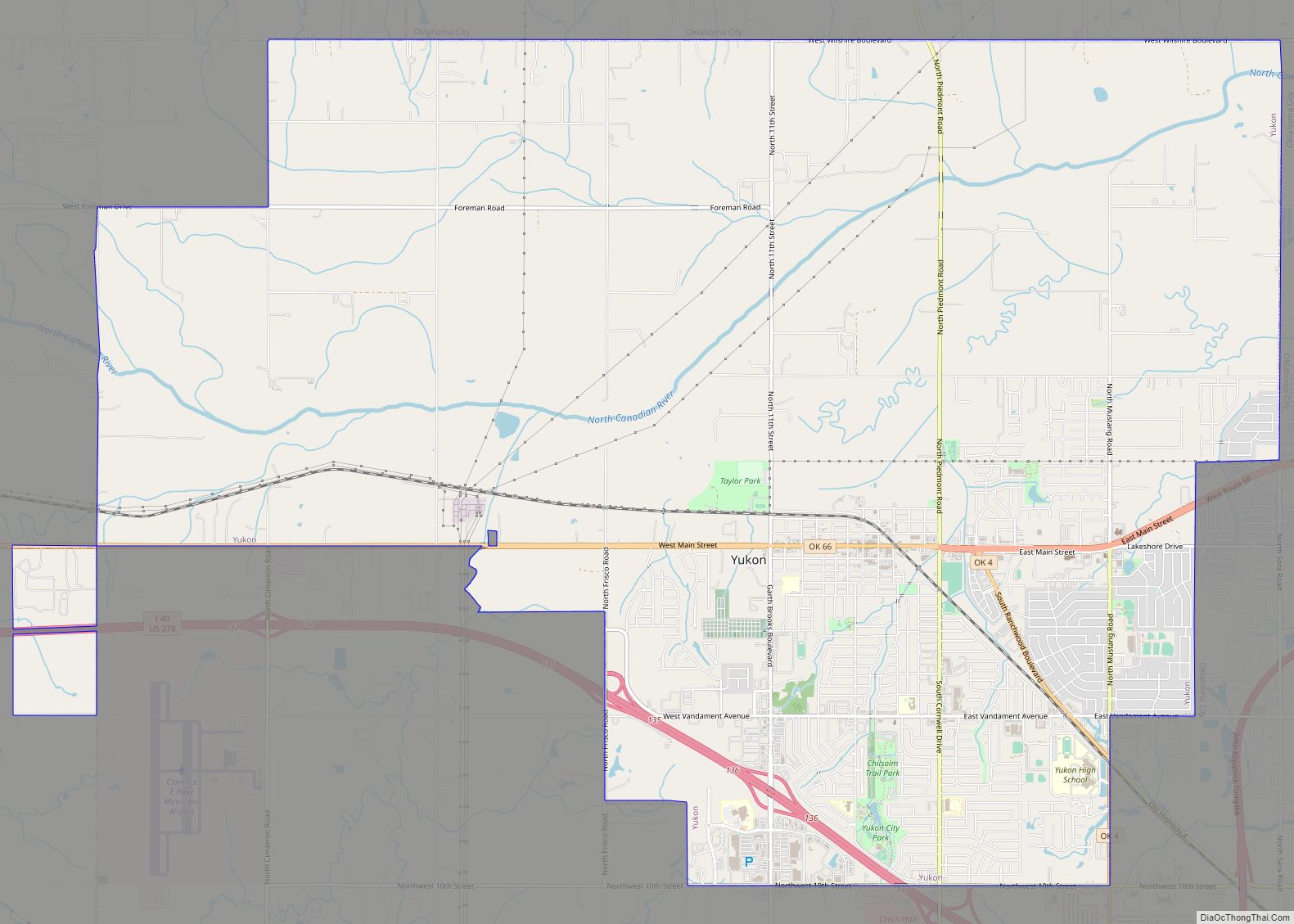
Online Interactive Map
Click on ![]() to view map in "full screen" mode.
to view map in "full screen" mode.
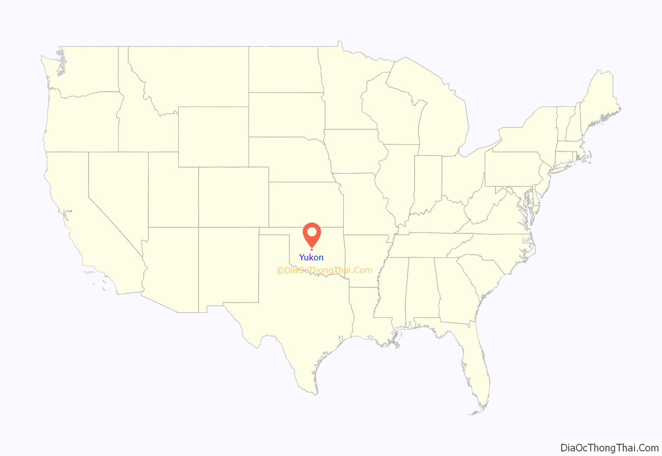
Yukon location map. Where is Yukon city?

History
Yukon was founded by A.N. Spencer in 1891 and was named for the Yukon River which flows from British Columbia, across the Yukon, and into Alaska.
Spencer, a cattleman from Texas turned railroad builder, was working on a line from El Reno to Arkansas when he decided to build the town. Spencer filed the plat on the townsite on February 14, 1891. He had agreed to do so and lay the train tracks through the town in exchange for half of the lots, which were owned by Minnie Taylor and Luther S. Morrison. Taylor and Morrison had acquired the land in the 1889 land run. Spencer also bought two quarter sections south of Main Street from Joseph Carson and his sister, Josephine. Spencer and his brother, Lewis, named the town after the Yukon Territory of Canada, where a gold rush was booming at the time.
The first houses and businesses were located on the north side of Spencer Avenue (now Main Street) and present Fourth and Fifth streets. The Canadian County Courier reported on April 1, 1891, that the city had 25 homes, one bank, two real estate offices, two restaurants, a lumber yard, a hardware store, a grocery, a livery stable, two saloons, a blacksmith shop, a printing office, a barber shop, and a second barber shop “about completed.”
The Choctaw, Oklahoma and Gulf Railway Company laid its track, causing the abandonment of Frisco, which had a population of 1,000 at the time. Beginning in about 1898, Yukon began to attract immigrants from Bohemia. Following World War I and the dissolution of Bohemia into Czechoslovakia and Moravia, the immigrants became known as “Czechs.” Yukon is known as the “Czech Capital of Oklahoma”.
The town voted to incorporate in 1901 and voted to add water works, sewer, and electricity from the mill in 1910. Businesses remained clustered on Main Street between Fourth and Fifth, until the 1920s, when they began to locate in other parts of the town. The interurban was built from Oklahoma City to El Reno in 1911. It closed in 1940. Paved roads didn’t arrive until the construction of State Highway 66 in 1926.
Yukon thrived as the urban center for area farmers and had an organized library by 1905 and a dedicated library building in 1927. A small milling operation, the Yukon Mill and Grain Company, opened in 1893 and grew to shipping flour and feeds throughout the south and exporting them overseas by 1915. The milling operation was owned by the Kroutil and Dobry families, but the Dobry family built their own mill and parted ways with the Kroutils in the 1930s. The mills were sold to larger corporations; Shawnee Mills purchased the Yukon Mill and Grain Company and Mid-Continent purchased the Dobry Mills. Paying homage to that history, the students of Yukon High School are known as “Millers”, and their mascot is “The Miller Man”.
In 1949, Yukon garnered national media attention because of the plight of Grady the Cow, who was stuck inside a silo for four days.
From a population of 830 in 1907, Yukon grew to 1,990 by 1950. By 1960, the population registered at 3,076. Oklahoma City annexed nearly all of the land around Yukon during the 1960s. This brought a boom in residential construction and commercial development. The town had grown to approximately 22,000 residents in 2005.
Yukon Road Map
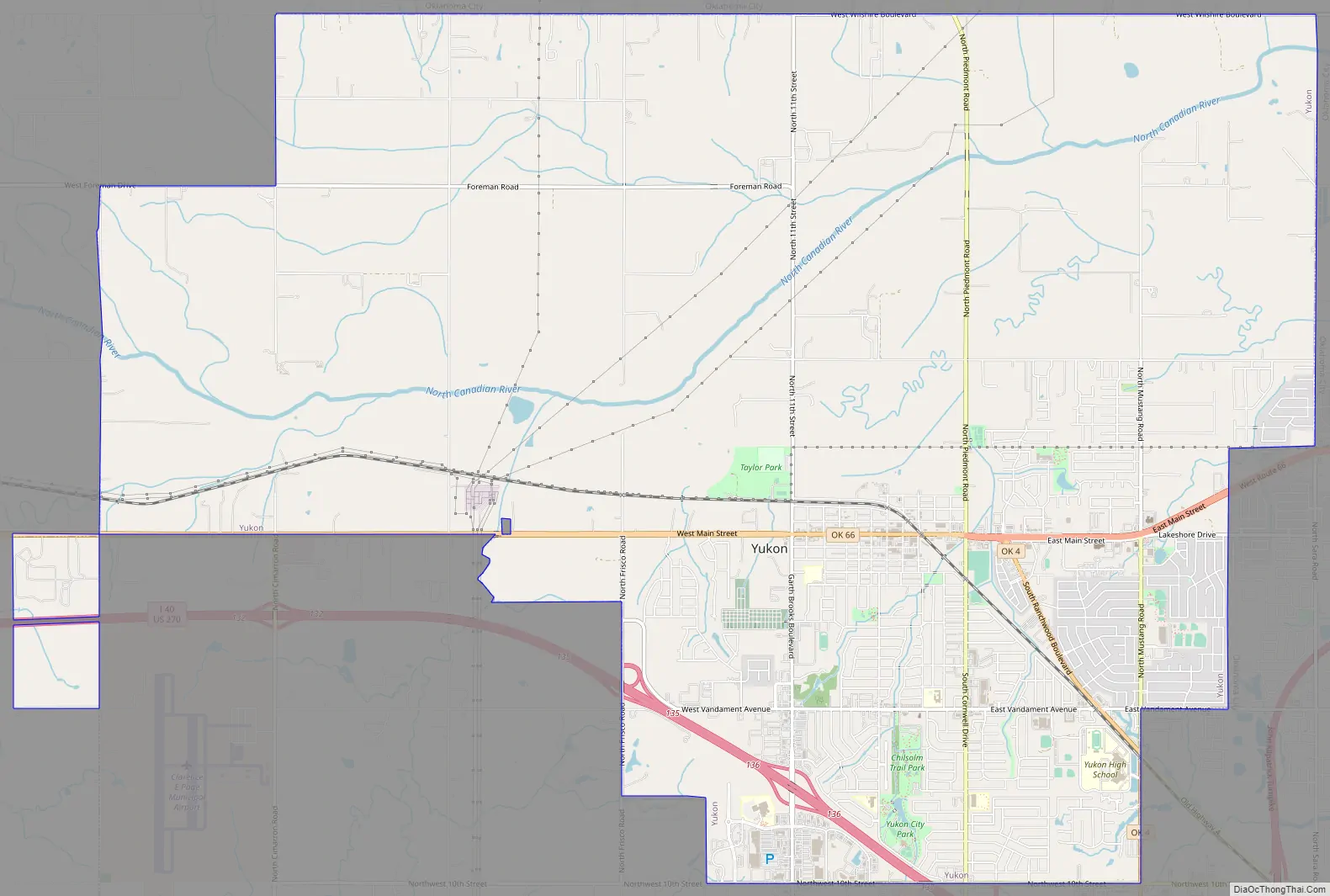
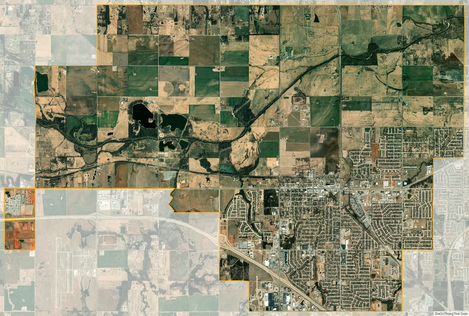
Yukon city Satellite Map
Geography
Yukon is located in east central Canadian County. The western boundary of Oklahoma City is at the county line 3.5 miles east of the center of Yukon. The town is traversed by Route 66 and state highways 4 and 92. It lies just north of Interstate 40. Downtown Oklahoma City is 16 miles (26 km) to the east.
According to the United States Census Bureau, the city has a total area of 26.3 square miles (68.1 km), of which 26.2 square miles (67.9 km) is land and 0.04 square miles (0.1 km), or 0.21%, is water.
See also
Map of Oklahoma State and its subdivision:- Adair
- Alfalfa
- Atoka
- Beaver
- Beckham
- Blaine
- Bryan
- Caddo
- Canadian
- Carter
- Cherokee
- Choctaw
- Cimarron
- Cleveland
- Coal
- Comanche
- Cotton
- Craig
- Creek
- Custer
- Delaware
- Dewey
- Ellis
- Garfield
- Garvin
- Grady
- Grant
- Greer
- Harmon
- Harper
- Haskell
- Hughes
- Jackson
- Jefferson
- Johnston
- Kay
- Kingfisher
- Kiowa
- Latimer
- Le Flore
- Lincoln
- Logan
- Love
- Major
- Marshall
- Mayes
- McClain
- McCurtain
- McIntosh
- Murray
- Muskogee
- Noble
- Nowata
- Okfuskee
- Oklahoma
- Okmulgee
- Osage
- Ottawa
- Pawnee
- Payne
- Pittsburg
- Pontotoc
- Pottawatomie
- Pushmataha
- Roger Mills
- Rogers
- Seminole
- Sequoyah
- Stephens
- Texas
- Tillman
- Tulsa
- Wagoner
- Washington
- Washita
- Woods
- Woodward
- Alabama
- Alaska
- Arizona
- Arkansas
- California
- Colorado
- Connecticut
- Delaware
- District of Columbia
- Florida
- Georgia
- Hawaii
- Idaho
- Illinois
- Indiana
- Iowa
- Kansas
- Kentucky
- Louisiana
- Maine
- Maryland
- Massachusetts
- Michigan
- Minnesota
- Mississippi
- Missouri
- Montana
- Nebraska
- Nevada
- New Hampshire
- New Jersey
- New Mexico
- New York
- North Carolina
- North Dakota
- Ohio
- Oklahoma
- Oregon
- Pennsylvania
- Rhode Island
- South Carolina
- South Dakota
- Tennessee
- Texas
- Utah
- Vermont
- Virginia
- Washington
- West Virginia
- Wisconsin
- Wyoming