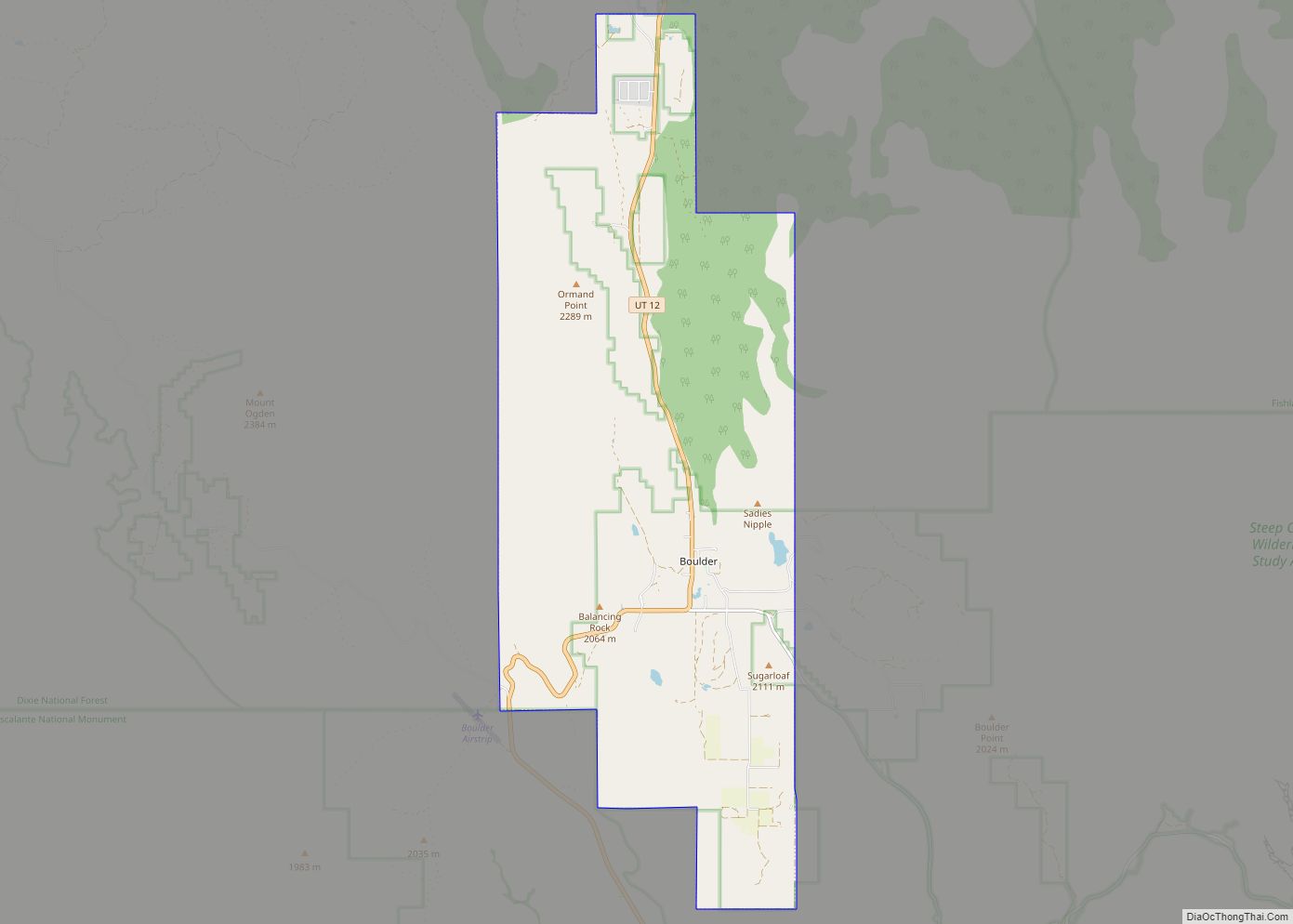
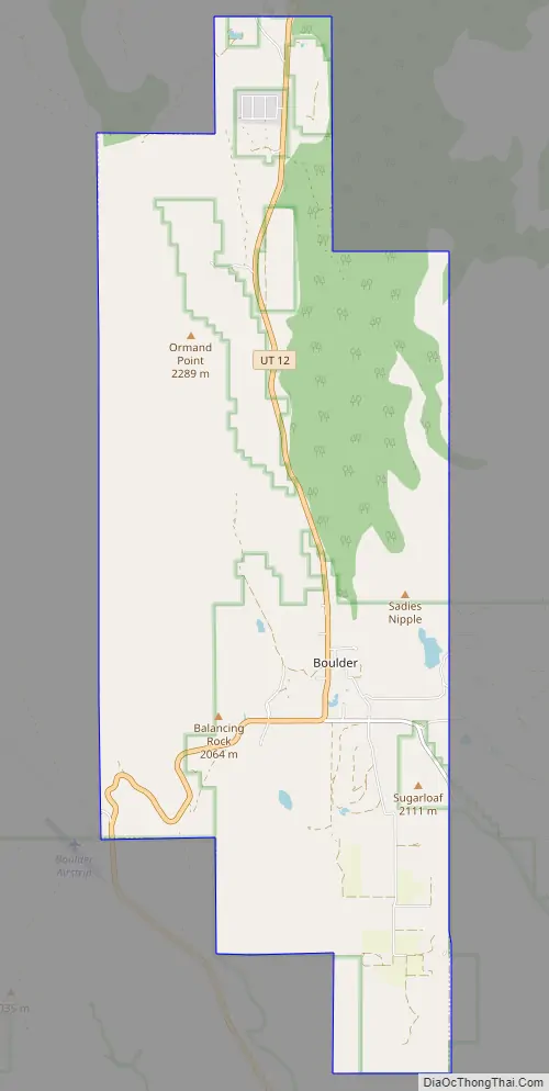
Boulder is a town in Garfield County, Utah, United States, 27 miles (44 km) northeast of Escalante on Utah Scenic Byway 12 at its intersection with the Burr Trail. As of the 2010 census, the town population was 226, an increase of nearly 26% over the 2000 figure of 180.
Boulder, quite isolated until the Civilian Conservation Corps built a road from Escalante, did not get electric power until 1947. The town marks the western terminus of Burr Trail, a mostly paved road that runs eastward through spectacular red rock country to the Waterpocket Fold in Capitol Reef National Park. Boulder is the home of Anasazi Indian State Park.
| Name: | Boulder town |
|---|---|
| LSAD Code: | 43 |
| LSAD Description: | town (suffix) |
| State: | Utah |
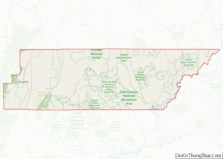
| County: | Garfield County |
| Elevation: | 6,700 ft (2,000 m) |
| Total Area: | 20.93 sq mi (54.22 km²) |
| Land Area: | 20.93 sq mi (54.22 km²) |
| Water Area: | 0.00 sq mi (0.00 km²) |
| Total Population: | 226 |
| Population Density: | 11.51/sq mi (4.44/km²) |
| ZIP code: | 84716 |
| Area code: | 435 |
| FIPS code: | 4907470 |
| GNISfeature ID: | 1437510 |
Online Interactive Map
Click on ![]() to view map in "full screen" mode.
to view map in "full screen" mode.
Boulder location map. Where is Boulder town?
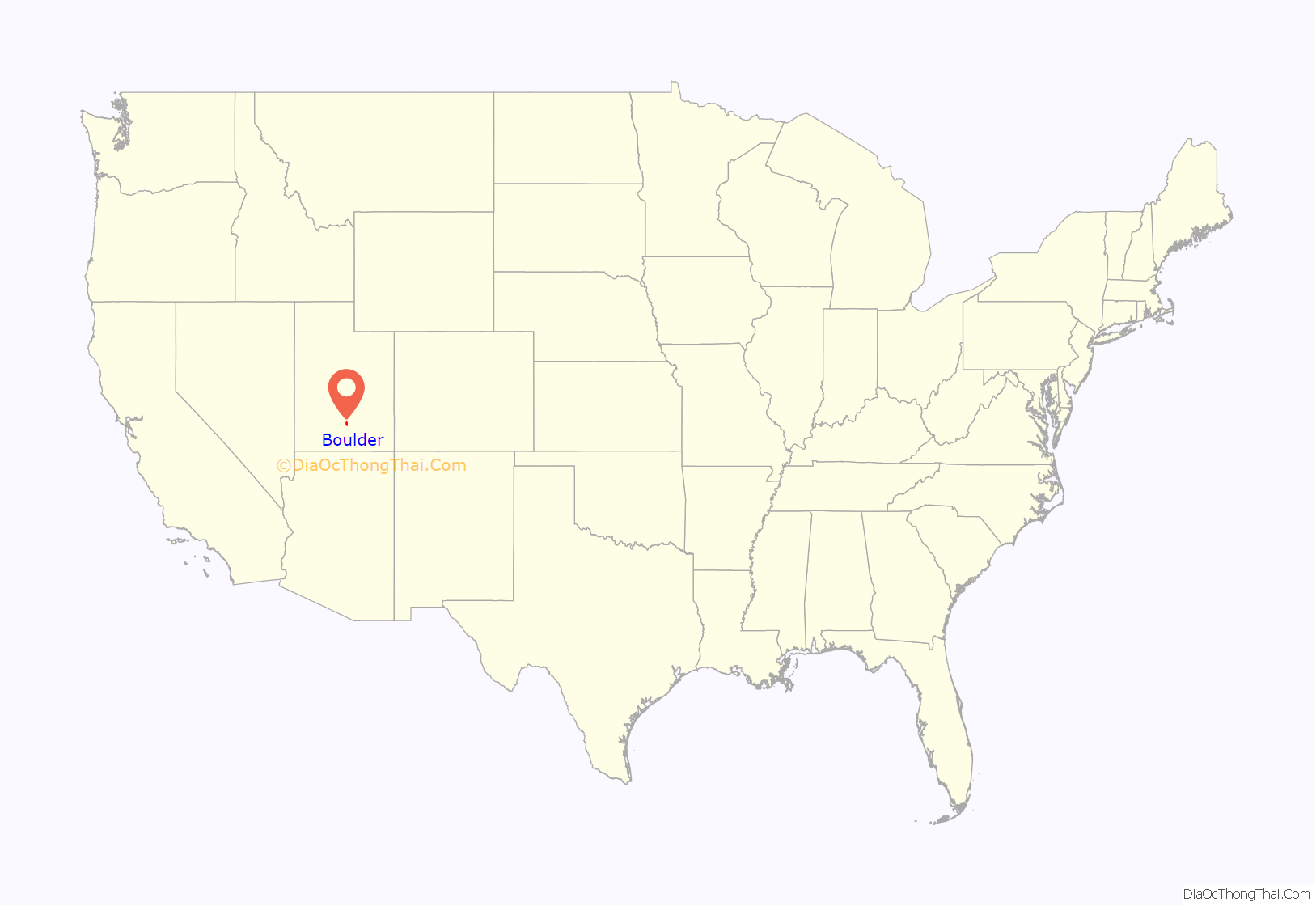
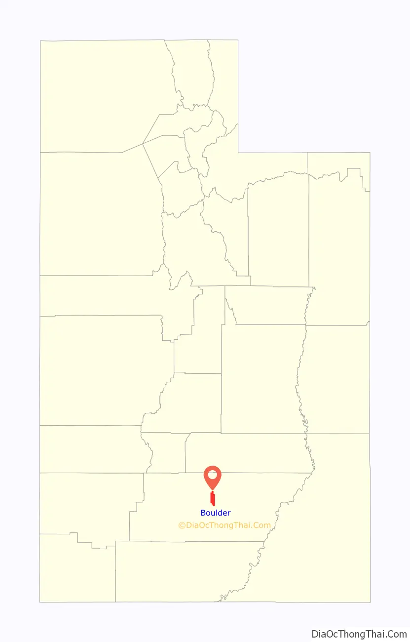
Boulder Road Map
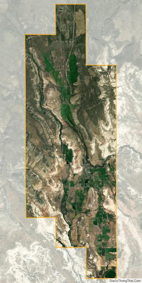
Boulder city Satellite Map
Geography
Boulder is near Grand Staircase–Escalante National Monument and Capitol Reef National Park.
According to the United States Census Bureau, the town has a total area of 20.9 square miles (54.2 km), all land. Boulder also has many sandstone formations, such as small mountains and slopes.
Trails and byways
The American Discovery Trail bicycle alternate route runs through Boulder.
Climate
According to the Köppen Climate Classification system, Boulder has a semi-arid climate, abbreviated “BSk” on climate maps. The hottest temperature recorded in Boulder was 97 °F (36.1 °C) on June 16, 2021, while the coldest temperature recorded was −17 °F (−27.2 °C) on February 6, 1989.
See also
Map of Utah State and its subdivision: Map of other states:- Alabama
- Alaska
- Arizona
- Arkansas
- California
- Colorado
- Connecticut
- Delaware
- District of Columbia
- Florida
- Georgia
- Hawaii
- Idaho
- Illinois
- Indiana
- Iowa
- Kansas
- Kentucky
- Louisiana
- Maine
- Maryland
- Massachusetts
- Michigan
- Minnesota
- Mississippi
- Missouri
- Montana
- Nebraska
- Nevada
- New Hampshire
- New Jersey
- New Mexico
- New York
- North Carolina
- North Dakota
- Ohio
- Oklahoma
- Oregon
- Pennsylvania
- Rhode Island
- South Carolina
- South Dakota
- Tennessee
- Texas
- Utah
- Vermont
- Virginia
- Washington
- West Virginia
- Wisconsin
- Wyoming