Daniel is a town in Wasatch County, Utah, United States. The population was 938 at the 2010 census, at which time it was a township and census-designated place (CDP). Daniel incorporated as a town in February 2006. Daniel was first settled in 1874.
| Name: | Daniel town |
|---|---|
| LSAD Code: | 43 |
| LSAD Description: | town (suffix) |
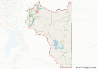
| State: | Utah |
| County: | Wasatch County |
| Incorporated: | February 28, 2006 |
| Elevation: | 5,715 ft (1,742 m) |
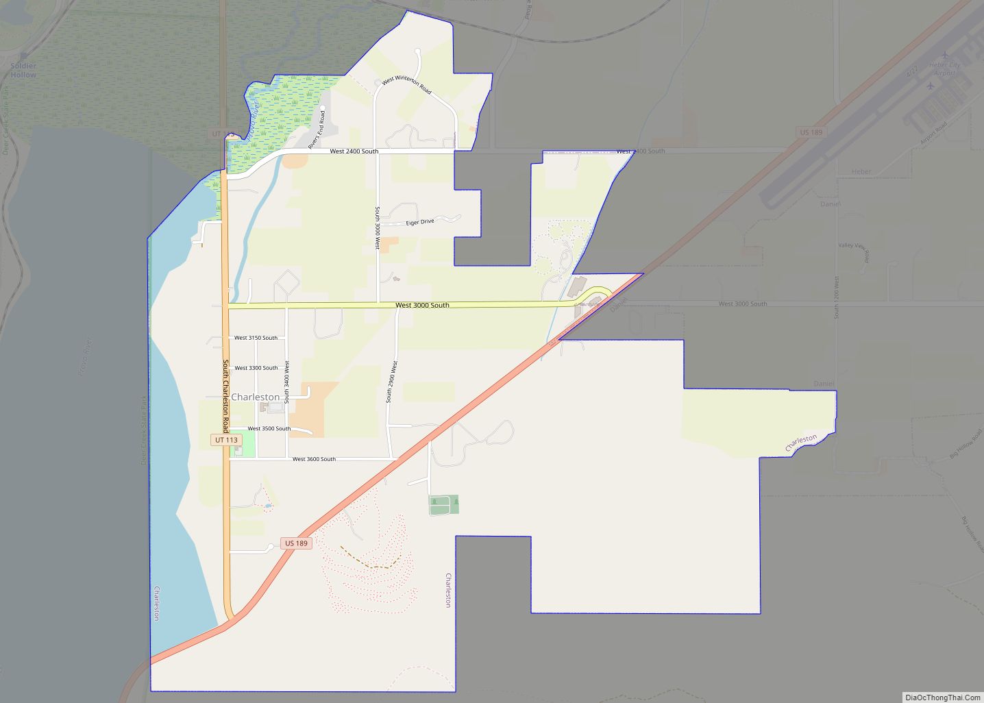
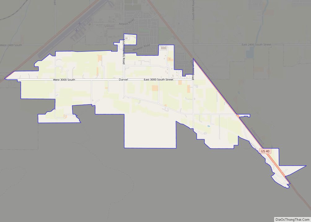
| Total Area: | 3.29 sq mi (8.53 km²) |
| Land Area: | 3.29 sq mi (8.53 km²) |
| Water Area: | 0.00 sq mi (0.00 km²) |
| Total Population: | 938 |
| Population Density: | 327.16/sq mi (126.32/km²) |
| FIPS code: | 4918140 |
| GNISfeature ID: | 1455872 |
| Website: | http://danielutah.org/ |
Online Interactive Map
Click on ![]() to view map in "full screen" mode.
to view map in "full screen" mode.
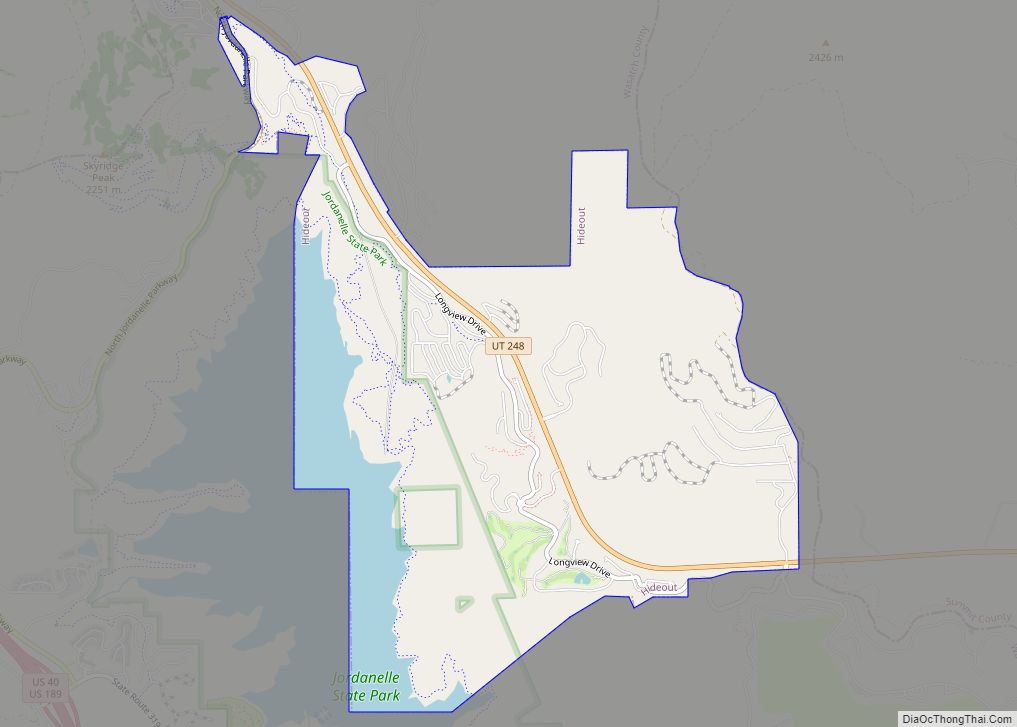
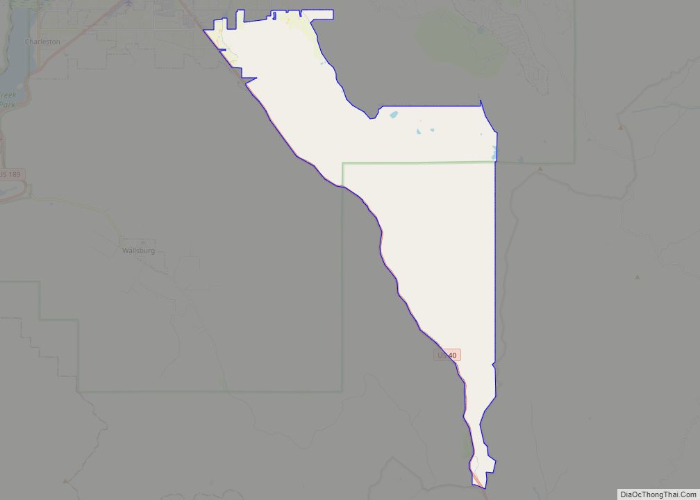
Daniel location map. Where is Daniel town?
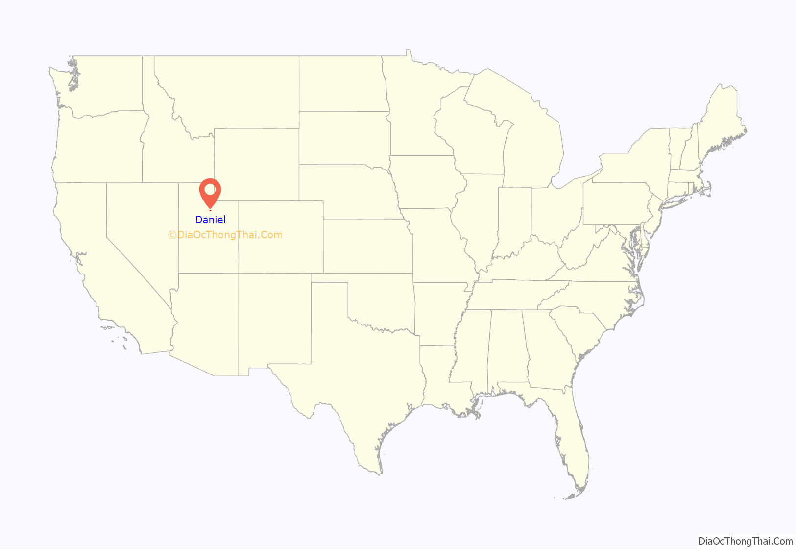
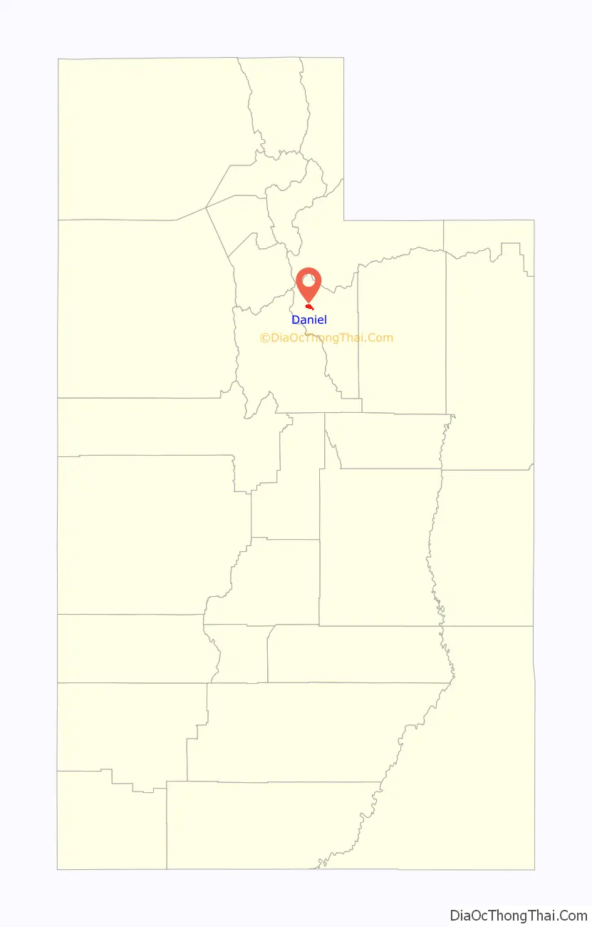
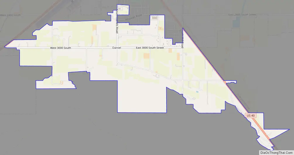
Daniel Road Map
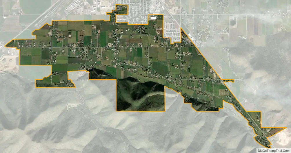
Daniel city Satellite Map
Geography
According to the United States Census Bureau, the CDP had a total area of 3.8 square miles (9.8 km), all land.
See also
Map of Utah State and its subdivision: Map of other states:- Alabama
- Alaska
- Arizona
- Arkansas
- California
- Colorado
- Connecticut
- Delaware
- District of Columbia
- Florida
- Georgia
- Hawaii
- Idaho
- Illinois
- Indiana
- Iowa
- Kansas
- Kentucky
- Louisiana
- Maine
- Maryland
- Massachusetts
- Michigan
- Minnesota
- Mississippi
- Missouri
- Montana
- Nebraska
- Nevada
- New Hampshire
- New Jersey
- New Mexico
- New York
- North Carolina
- North Dakota
- Ohio
- Oklahoma
- Oregon
- Pennsylvania
- Rhode Island
- South Carolina
- South Dakota
- Tennessee
- Texas
- Utah
- Vermont
- Virginia
- Washington
- West Virginia
- Wisconsin
- Wyoming