Enterprise is a census-designated place (CDP) in northwestern Morgan County, Utah, United States. The population was 605 at the 2010 census.
| Name: | Enterprise CDP |
|---|---|
| LSAD Code: | 57 |
| LSAD Description: | CDP (suffix) |
| State: | Utah |
| County: | Morgan County |
| Elevation: | 5,246 ft (1,599 m) |
| Total Area: | 3.8 sq mi (10 km²) |
| Land Area: | 3.8 sq mi (10 km²) |
| Water Area: | 0.0 sq mi (0 km²) |
| Total Population: | 605 |
| Population Density: | 160/sq mi (61/km²) |
| ZIP code: | 84050 |
| Area code: | 385, 801 |
| FIPS code: | 4923310 |
| GNISfeature ID: | 2584766 |
Online Interactive Map
Click on ![]() to view map in "full screen" mode.
to view map in "full screen" mode.
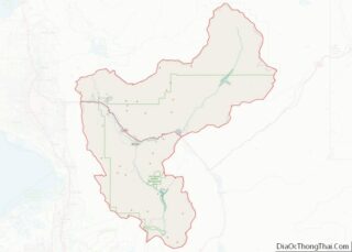
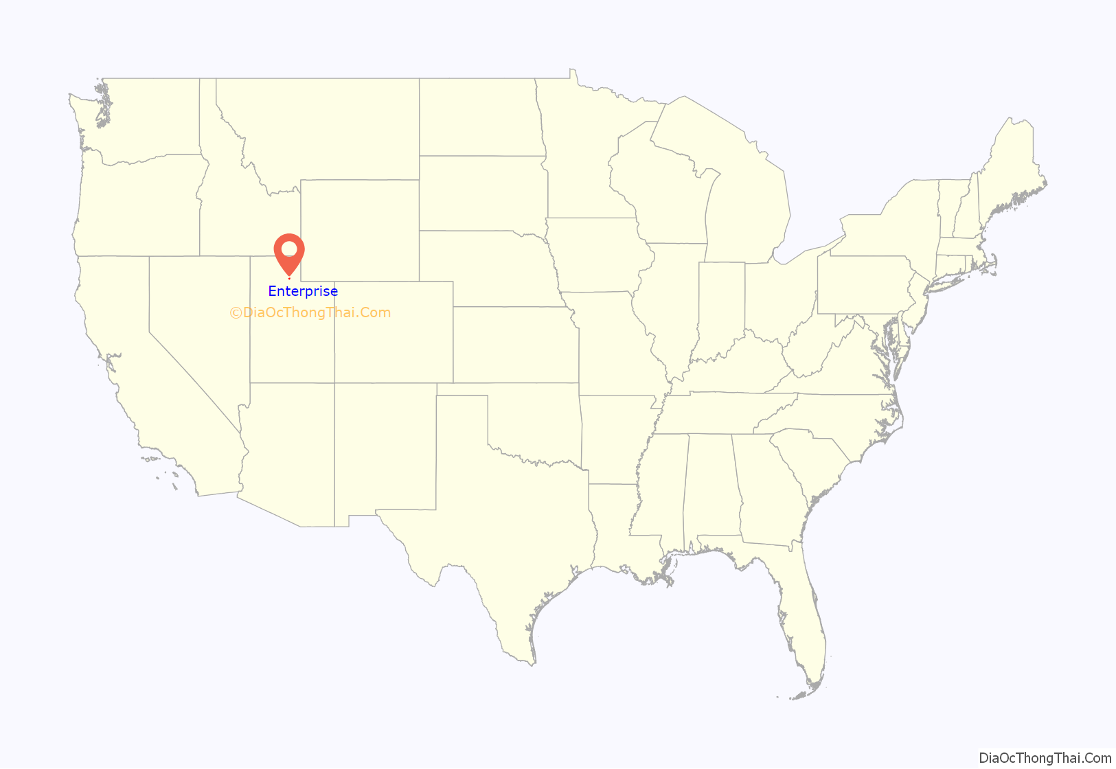
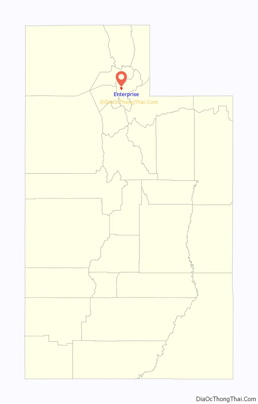
Enterprise location map. Where is Enterprise CDP?
History
The first settlers in Enterprise were Henry and Stephen Hales, who arrived in 1861. They found fertile land on the bench, but little water for irrigation. They dug a 2-mile (3.2 km) ditch from the Weber River to water their farmland. A canal company was organized in 1863 to irrigate the whole area, but Enterprise was short on water for many years as thieves diverted water upstream. The first schoolhouse was built in 1863. A townsite with official blocks was surveyed and laid out in 1865. A sawmill operated in Roswell Canyon in the 1870s. Although it was not an official census precinct, the 1880 census enumerated 81 residents in Enterprise.
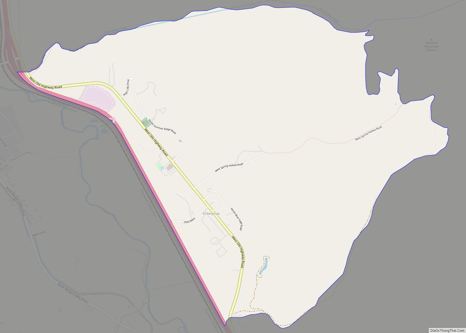
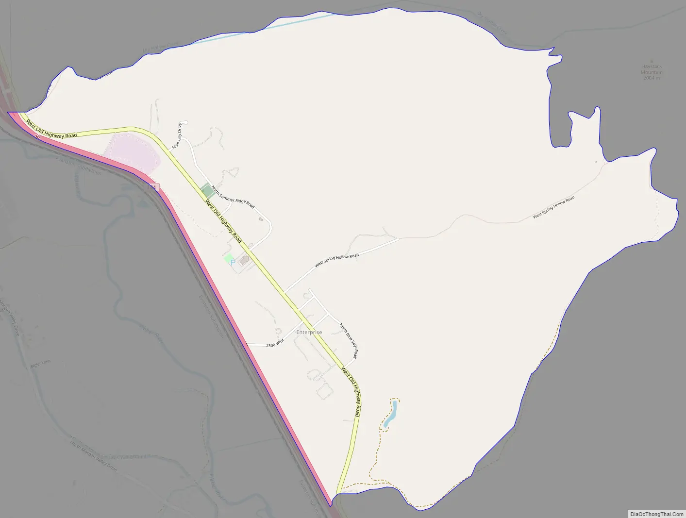
Enterprise Road Map
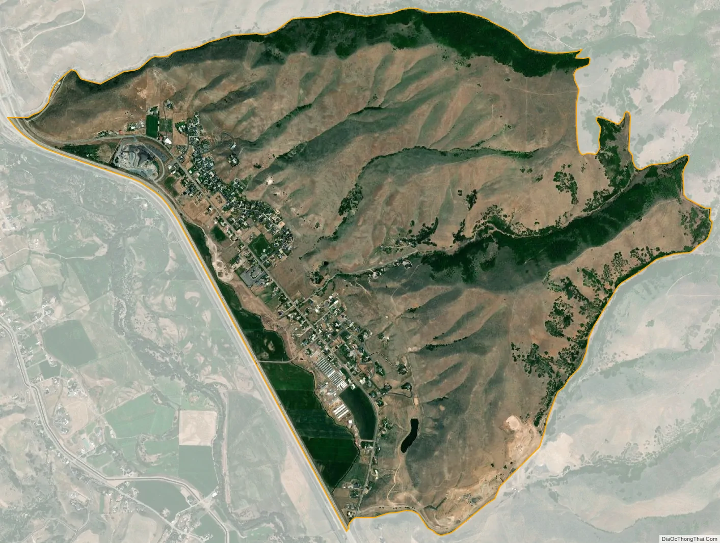
Enterprise city Satellite Map
Geography
Enterprise is located in the western part of Morgan Valley, along Interstate 84. Peterson is just to the west, across I-84 and the Weber River. Mountain Green is about 4 miles (6.4 km) to the northwest, and Morgan, the county seat, is some 6 miles (9.7 km) southeast. Most of the homes in Enterprise are clustered along the main street, Old Highway Road (part of the former Highway 30), which roughly parallels I-84 to the north on the benchland between Morgan and Mountain Green. The community’s northern boundary is the crescent of foothills from Dry Hollow on the north to Roswell Canyon on the south. According to the United States Census Bureau, the CDP has a total area of 3.8 square miles (9.8 km), all land.
See also
Map of Utah State and its subdivision: Map of other states:- Alabama
- Alaska
- Arizona
- Arkansas
- California
- Colorado
- Connecticut
- Delaware
- District of Columbia
- Florida
- Georgia
- Hawaii
- Idaho
- Illinois
- Indiana
- Iowa
- Kansas
- Kentucky
- Louisiana
- Maine
- Maryland
- Massachusetts
- Michigan
- Minnesota
- Mississippi
- Missouri
- Montana
- Nebraska
- Nevada
- New Hampshire
- New Jersey
- New Mexico
- New York
- North Carolina
- North Dakota
- Ohio
- Oklahoma
- Oregon
- Pennsylvania
- Rhode Island
- South Carolina
- South Dakota
- Tennessee
- Texas
- Utah
- Vermont
- Virginia
- Washington
- West Virginia
- Wisconsin
- Wyoming