Alburgh (formerly Alburg) is a town in Grand Isle County, Vermont, United States, founded in 1781 by Ira Allen. The population was 2,106 at the 2020 United States Census. Alburgh is on the Alburgh Tongue, a peninsula extending from Canada into Lake Champlain, and lies on the only road-based route across Lake Champlain to New York state north of Addison, Vermont.
| Name: | Alburgh village |
|---|---|
| LSAD Code: | 47 |
| LSAD Description: | village (suffix) |
| State: | Vermont |
| County: | Grand Isle County |
| Elevation: | 124 ft (38 m) |
| Total Area: | 48.8 sq mi (126.4 km²) |
| Land Area: | 29.2 sq mi (75.5 km²) |
| Water Area: | 19.7 sq mi (51.0 km²) |
| Total Population: | 2,106 |
| Population Density: | 66.6/sq mi (25.7/km²) |
| ZIP code: | 05440 |
| Area code: | 802 |
| FIPS code: | 5000850 |
| GNISfeature ID: | 1456120 |
| Website: | alburghvt.org |
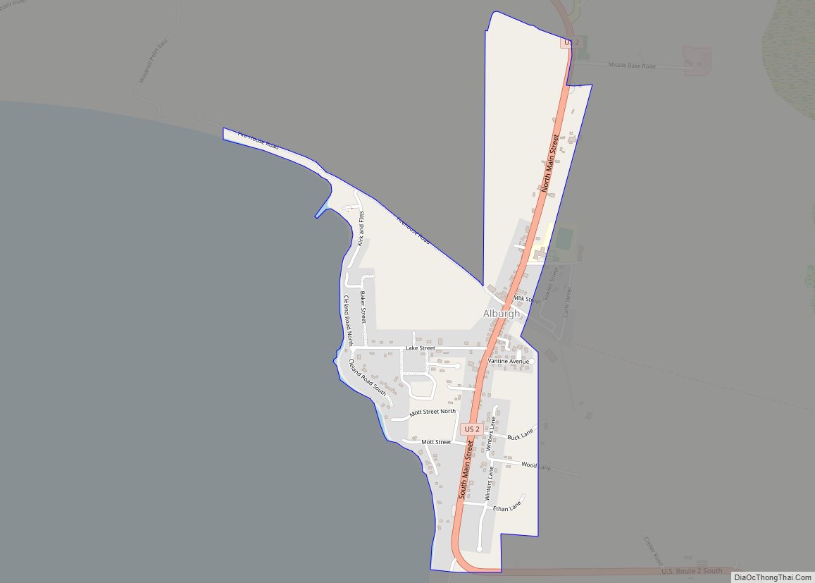
Online Interactive Map
Click on ![]() to view map in "full screen" mode.
to view map in "full screen" mode.
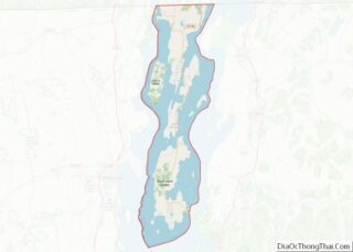
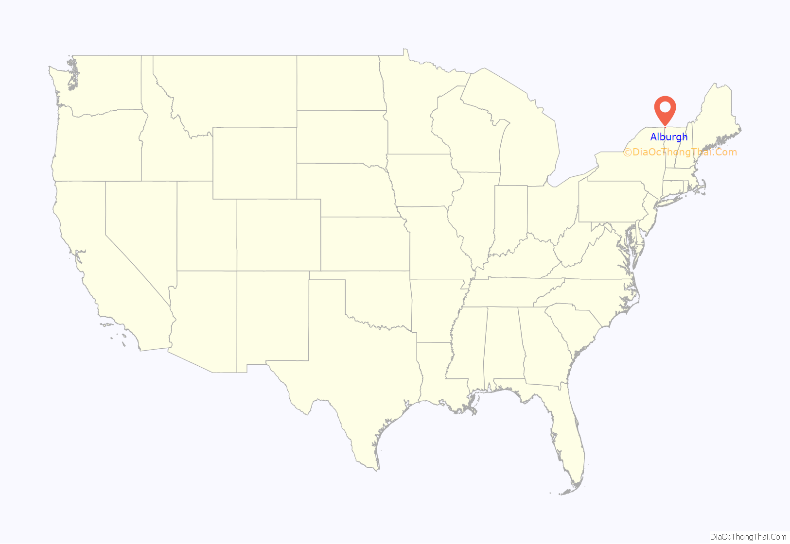
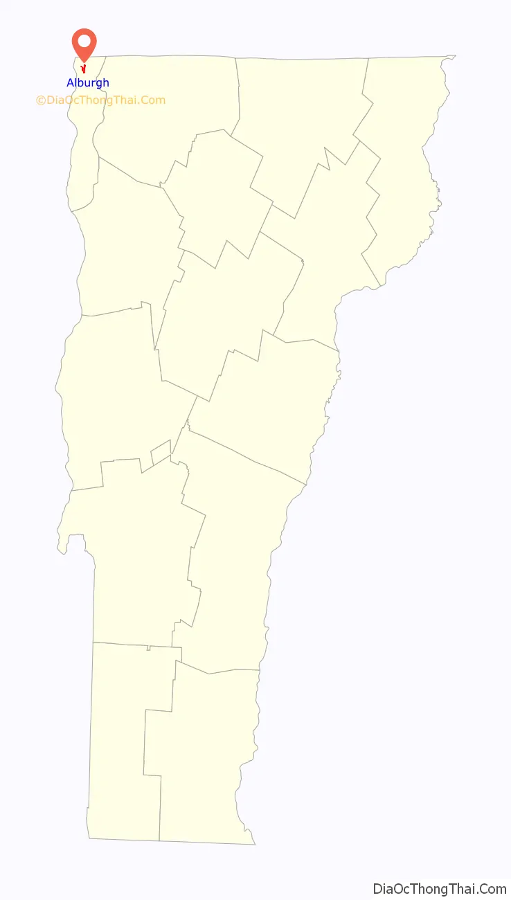
Alburgh location map. Where is Alburgh village?
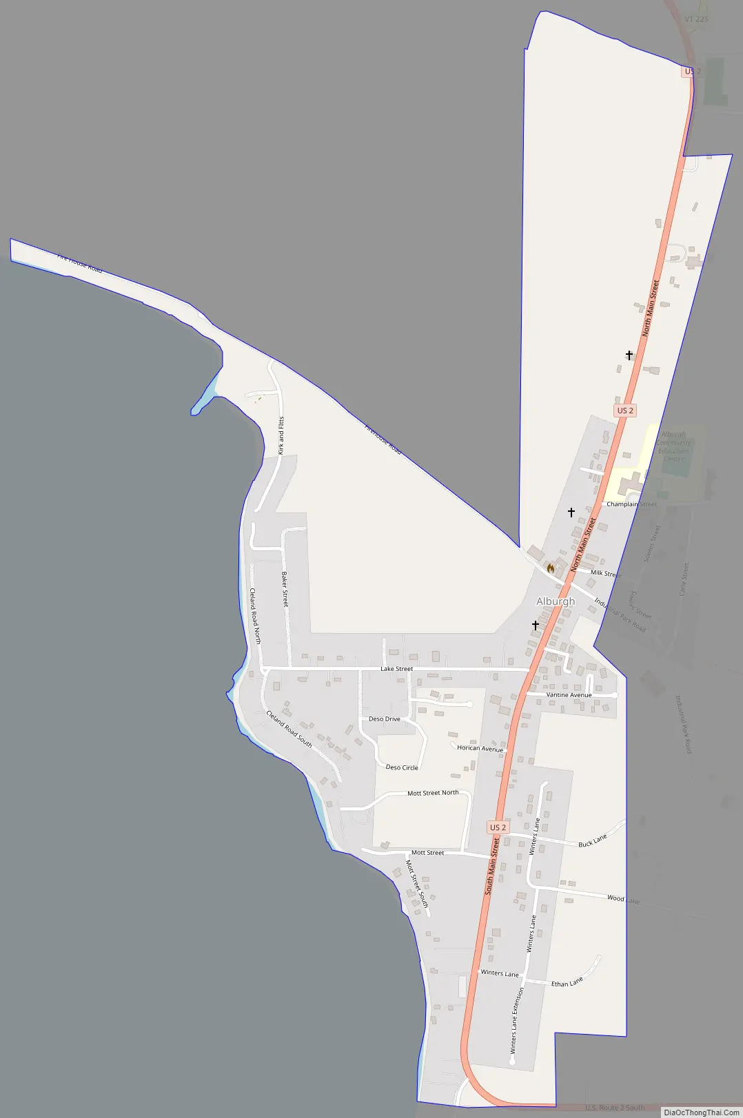
Alburgh Road Map
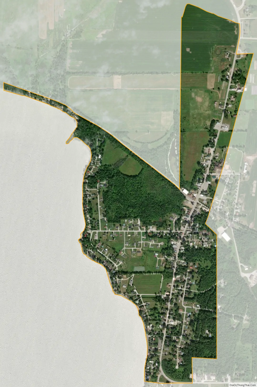
Alburgh city Satellite Map
Geography
According to the United States Census Bureau, the town has a total area of 48.8 square miles (126.4 km), of which 29.2 square miles (75.5 km) are land and 19.7 square miles (51.0 km), or 40.31%, are water.
Alburgh is one of only six non-island locations in the 48 contiguous states not directly connected to them by land, the others being nearby Province Point, Vermont; Point Roberts, Washington; Elm Point, Minnesota; the Northwest Angle in Minnesota; and an unnamed point in North Dakota. However, there are bridges to Rouses Point, New York, (U.S. Route 2) and Swanton, Vermont, as well as to North Hero island to the southeast. This makes Alburgh not practically an exclave, unlike the other locations not connected to the United States by land. Isle La Motte lies to the southwest. Alburgh Dunes State Park has one of the most natural and longest beaches on Lake Champlain.
See also
Map of Vermont State and its subdivision: Map of other states:- Alabama
- Alaska
- Arizona
- Arkansas
- California
- Colorado
- Connecticut
- Delaware
- District of Columbia
- Florida
- Georgia
- Hawaii
- Idaho
- Illinois
- Indiana
- Iowa
- Kansas
- Kentucky
- Louisiana
- Maine
- Maryland
- Massachusetts
- Michigan
- Minnesota
- Mississippi
- Missouri
- Montana
- Nebraska
- Nevada
- New Hampshire
- New Jersey
- New Mexico
- New York
- North Carolina
- North Dakota
- Ohio
- Oklahoma
- Oregon
- Pennsylvania
- Rhode Island
- South Carolina
- South Dakota
- Tennessee
- Texas
- Utah
- Vermont
- Virginia
- Washington
- West Virginia
- Wisconsin
- Wyoming