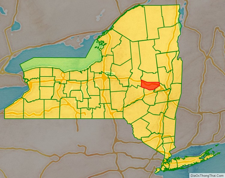
Montgomery County is a county in the U.S. state of New York. As of the 2020 census, the population was 49,532. The county seat is Fonda. The county was named in honor of Richard Montgomery, an American Revolutionary War general killed in 1775 at the Battle of Quebec.
Historically occupied by the Mohawk people, one of the original Five Nations of the Iroquois Confederacy, the county was created in 1772 during the period of British colonial rule as Tryon County. In 1784, after the Americans gained independence in the War, it was renamed Montgomery County for one of the heroes.
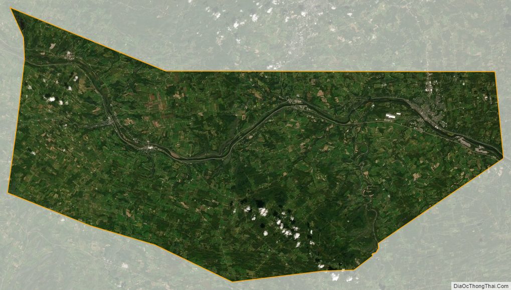
Montgomery County comprises the Amsterdam, NY Micropolitan Statistical Area. The county borders the north and south banks of the Mohawk River.
| Name: | Montgomery County |
|---|---|
| FIPS code: | 36-057 |
| State: | New York |
| Founded: | March 12, 1772 |
| Named for: | Richard Montgomery |
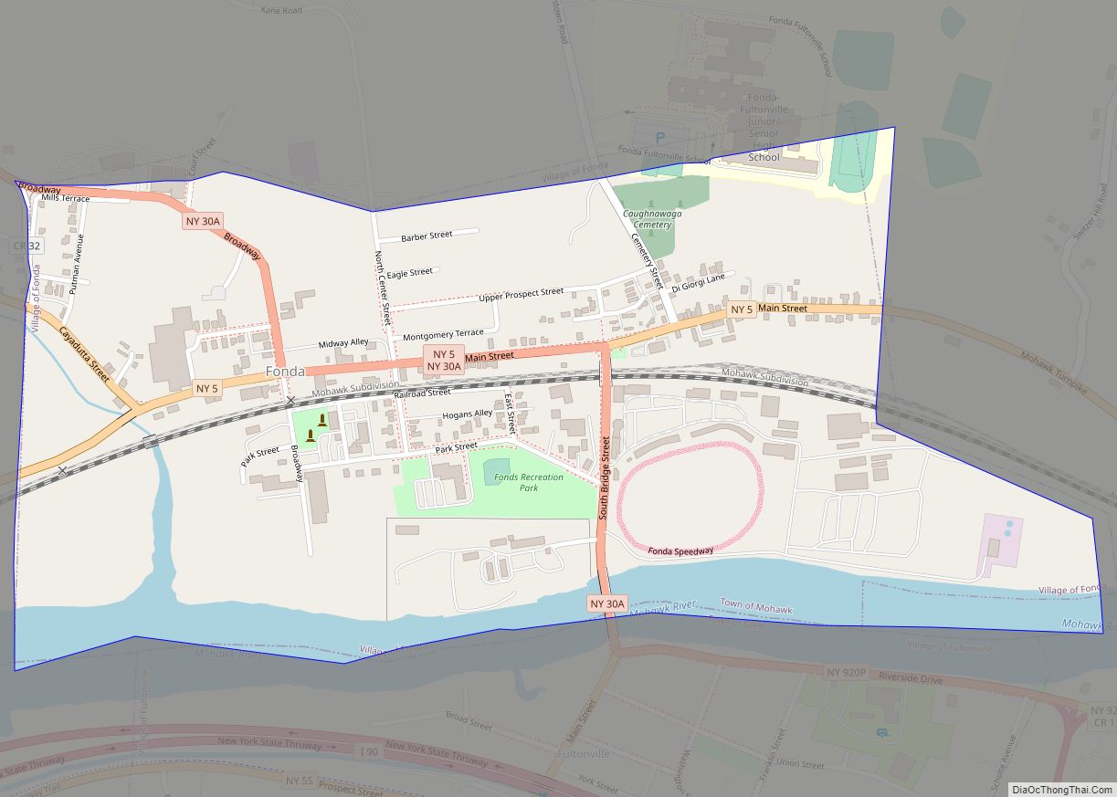
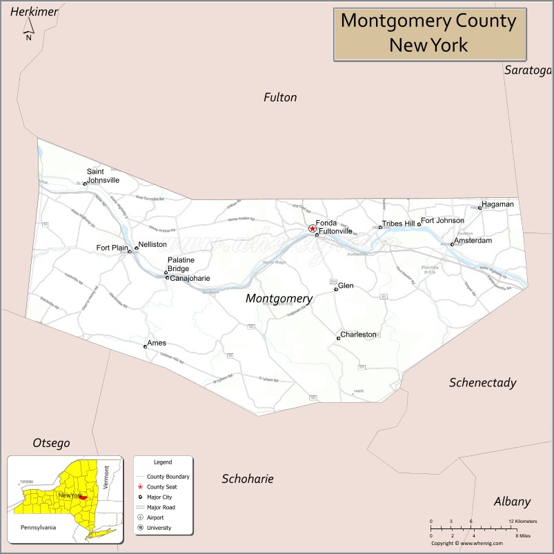
| Seat: | Fonda |
| Largest city: | Amsterdam |
| Total Area: | 410 sq mi (1,100 km²) |
| Land Area: | 403 sq mi (1,040 km²) |
| Total Population: | 49,532 |
| Population Density: | 122.9/sq mi (47.5/km²) |
| Time zone: | UTC−5 (Eastern) |
| Summer Time Zone (DST): | UTC−4 (EDT) |
| Website: | www.co.montgomery.ny.us |
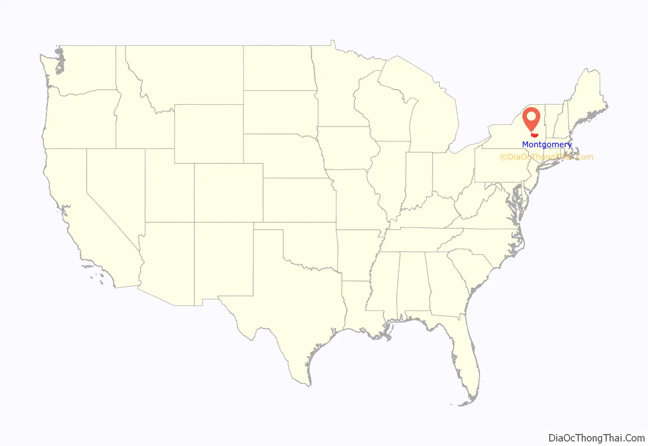
Montgomery County location map. Where is Montgomery County?
History
This area was occupied by the Mohawk for hundreds of years prior to European colonization. Many warriors allied with the British during the war. When the British lost, they ceded all the Iroquois territory of the Six Nations (the Tuscarora had joined the confederacy in the 18th century) to the United States, without consulting the tribes or bringing them into negotiation.
In 1784, following end of the American Revolutionary War, the European-American settlers renamed Tryon County as Montgomery County. This change was to honor the general, Richard Montgomery, who had captured several places in Canada and died in 1775 attempting to capture the city of Quebec during the Revolutionary War. It replaced the name that formerly honored the last provincial governor of New York.
In 1789, Ontario County was split off from Montgomery. The area of the new county was much larger than the present Ontario County, as it included the present Allegany, Cattaraugus, Chautauqua, Erie, Genesee, Livingston, Monroe, Niagara, Orleans, Steuben, Wyoming, Yates, and part of Schuyler and Wayne counties.
In 1791, Herkimer, Otsego, and Tioga counties were split off from Montgomery. In 1802, portions of Clinton, Herkimer, and Montgomery counties were combined to form St. Lawrence County. In 1816, Hamilton County was split off from Montgomery, but it did not have enough taxable inhabitants to be separately organized until 1847. In 1838, Fulton County was split off, with former county seat Johnstown no longer in Montgomery County’s boundaries. Fonda would be the new county seat, with Johnstown maintaining that rank for the new Fulton County.
In 2012, Montgomery County voters approved a charter for government, making it the 21st county in New York state to do so. In 2013, Matthew L. Ossenfort was elected at-large as the first County Executive in the county’s history. Ossenfort took office in 2014, the same year the charter went into effect. Under the terms of the charter, the Board of Supervisors was replaced by a nine-member County Legislature, with members elected from single-member districts. Thomas L. Quackenbush, one of the members, was elected as the first Chairman of the new legislative body, which will be a circulating position.
Congressional districts
- 1789-1797 – None
- 1797-1803 – NY9
- 1803-1809 – NY13
- 1809-1813 – NY9
- 1813-1823 – NY14
- 1823-1833 – NY16
- 1833-1843 – NY15
- 1843-1853 – NY17
- 1853-1873 – NY18
- 1873-1875 – NY19
- 1875-1893 – NY20
- 1893-1913 – ?
- 1913-1945 – NY30
- 1945-1953 – NY31
- 1953-1963 – NY32
- 1963-1971 – NY35
- 1971-1973 – NY28 & NY29
- 1973-1983 – NY28 & NY31
- 1983-1993 – NY23 & ?
- 1993-2003 – NY21 & NY23
- 2003-2012- NY21
- 2013–present – NY19 & NY20
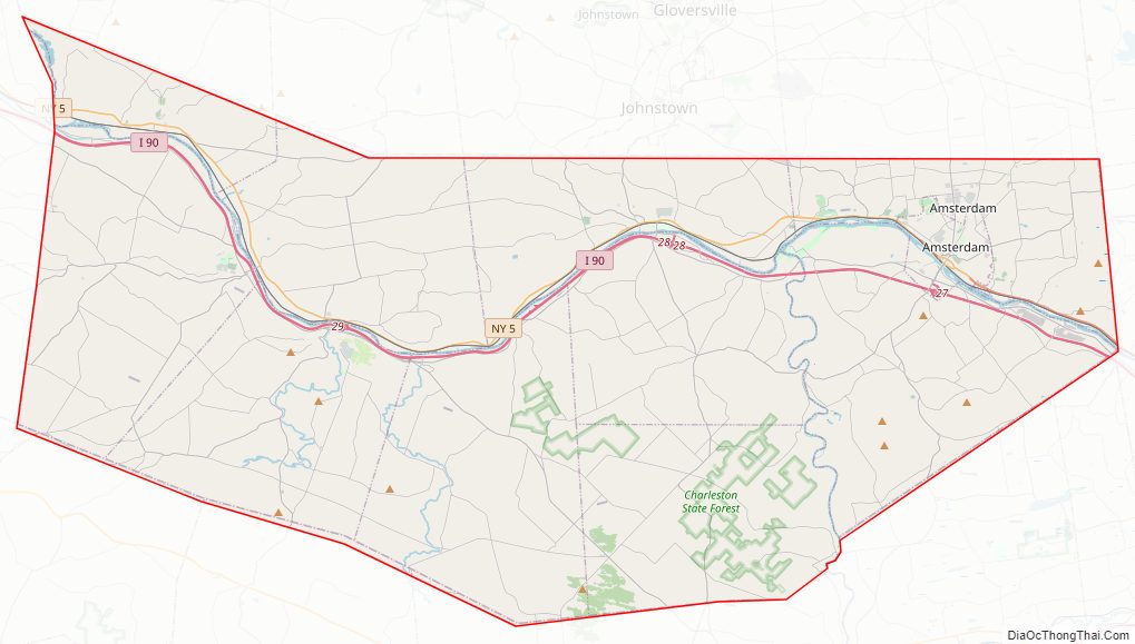
Montgomery County Road Map
Geography
According to the U.S. Census Bureau, the county has a total area of 410 square miles (1,100 km), of which 403 square miles (1,040 km) is land and 7.3 square miles (19 km) (1.8%) is water.
Montgomery County is located in the central part of the state, west of the city of Schenectady and northwest of Albany.
Adjacent counties
- Fulton County – north
- Saratoga County – east
- Schenectady County – east
- Schoharie County – south
- Otsego County – southwest
- Herkimer County – west
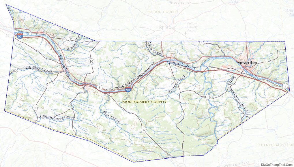
The Erie Canal runs through Montgomery County parallel to the Mohawk River, connecting to the Wood River to the west, which leads to Lake Ontario. Overall, the canal connected Great Lakes shipping with the Hudson River and the port of New York on the Atlantic Ocean. Several towns and villages developed along the canal, as it carried much trade and passenger traffic during its peak years. After the railroad was built through the state, along the same river plain, it superseded the canal, which was filled in some areas.
At the time of the canal’s construction, Montgomery County was the only place where there was a break in the Appalachian Mountains. Called ‘The Noses’ because of canal construction, it became known as “the gateway to the West”. In the mid-twentieth century, the NYS Thruway was constructed parallel to the former east–west routes of the canal and railroad. Today the Erie Canal and its lock system is used primarily for recreational boat use among locals and tourists.
Montgomery County is located in the heart of the state’s Mohawk Valley region. Foothills of the Catskill Mountains dot the southern part of the county, while foothills of the Adirondack Mountains dot the north.
Montgomery County Topographic Map
Montgomery County Satellite Map
Montgomery County Outline Map