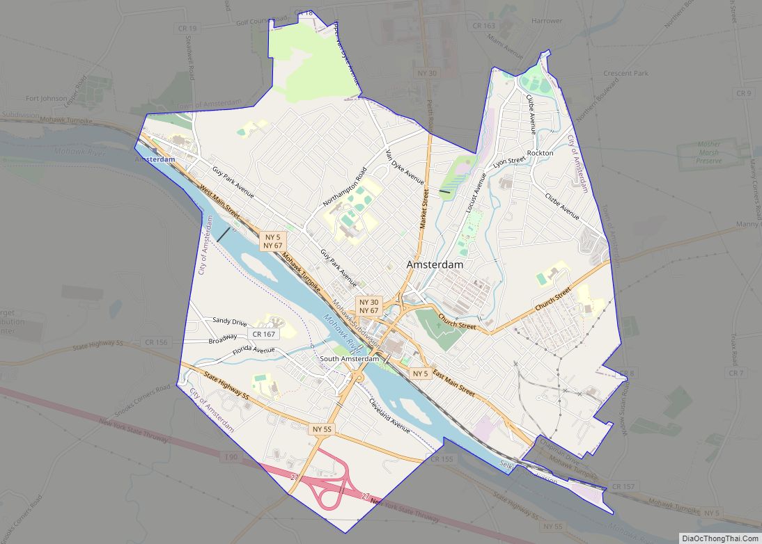
Amsterdam is a city in Montgomery County, New York, United States. As of the 2020 census, the city had a population of 18,219. The city is named after Amsterdam in the Netherlands.
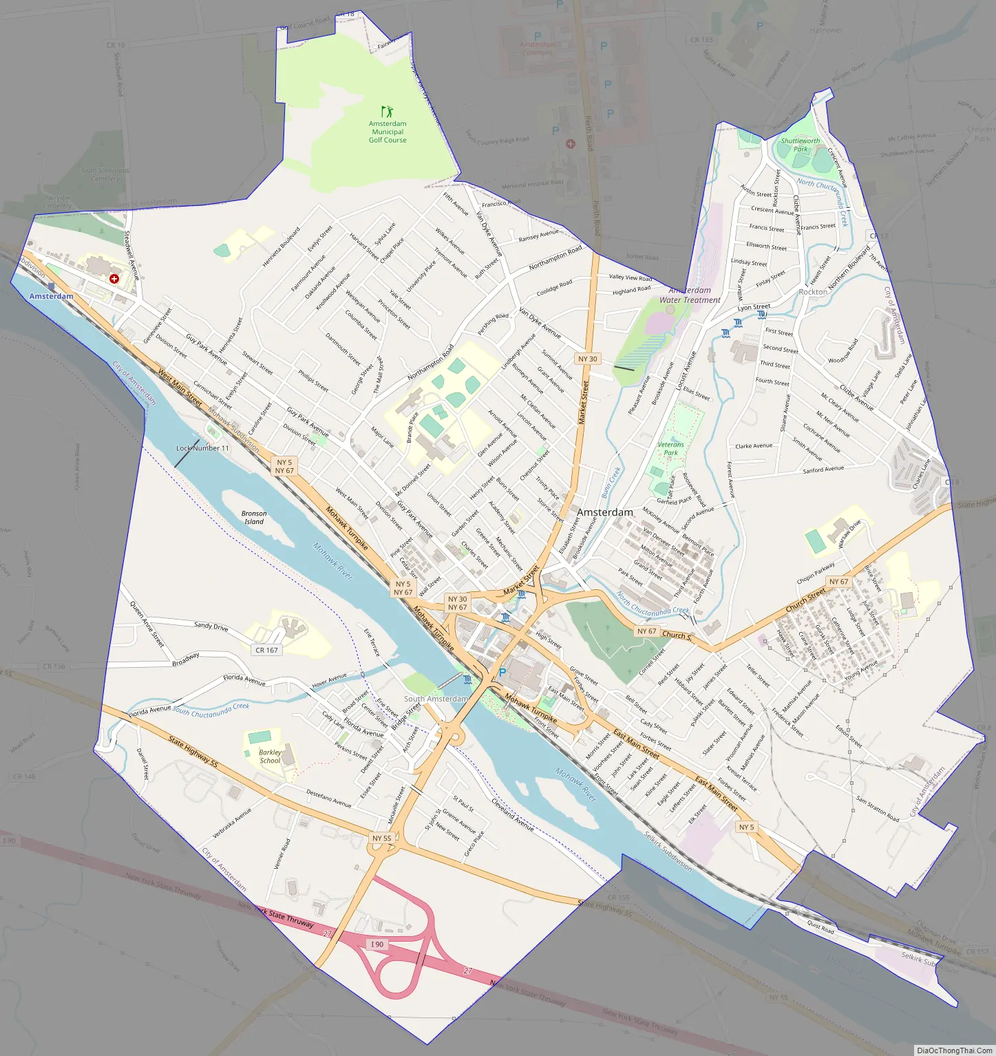
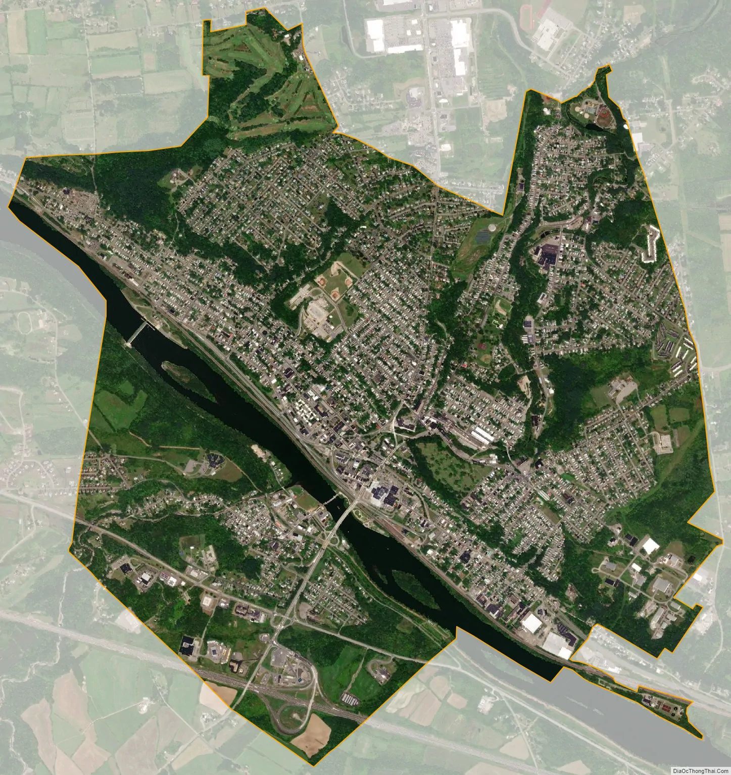
The City of Amsterdam is surrounded on the northern, eastern and western sides by the town of Amsterdam. The city developed on both sides of the Mohawk River, with the majority located on the north bank. The Port Jackson area on the south side is also part of the city.
| Name: | Amsterdam city |
|---|---|
| LSAD Code: | 25 |
| LSAD Description: | city (suffix) |
| State: | New York |
| County: | Montgomery County |
| Elevation: | 361 ft (110 m) |
| Total Area: | 6.26 sq mi (16.21 km²) |
| Land Area: | 5.87 sq mi (15.21 km²) |
| Water Area: | 0.39 sq mi (1.00 km²) |
| Total Population: | 18,219 |
| Population Density: | 3,102.16/sq mi (1,197.82/km²) |
| ZIP code: | 12010 |
| Area code: | 518 |
| FIPS code: | 3602066 |
| GNISfeature ID: | 0942450 |
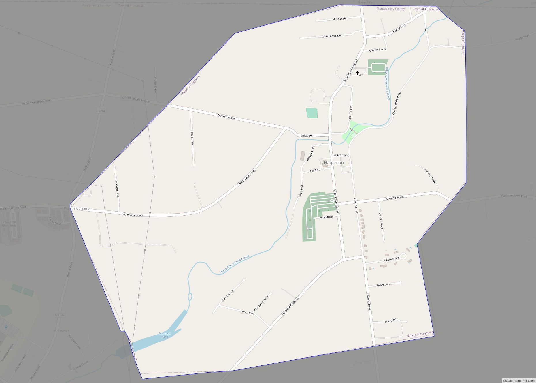
Online Interactive Map
Click on ![]() to view map in "full screen" mode.
to view map in "full screen" mode.
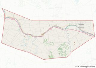
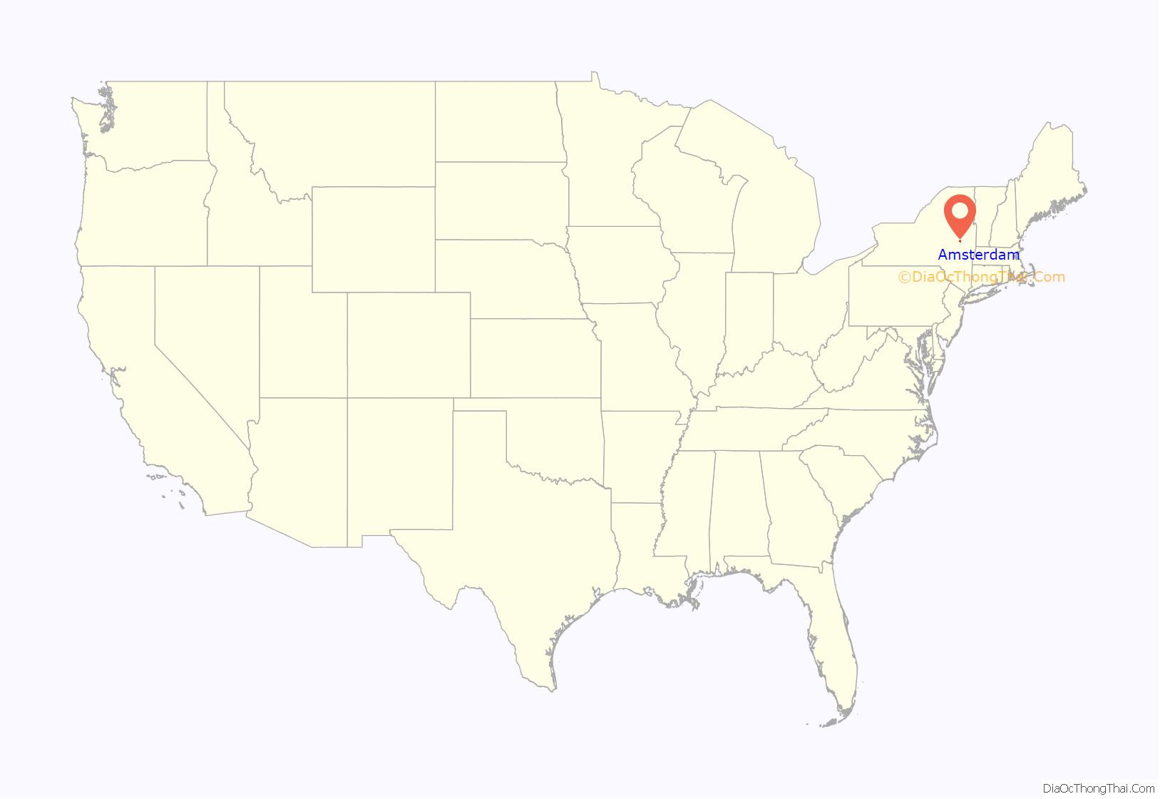
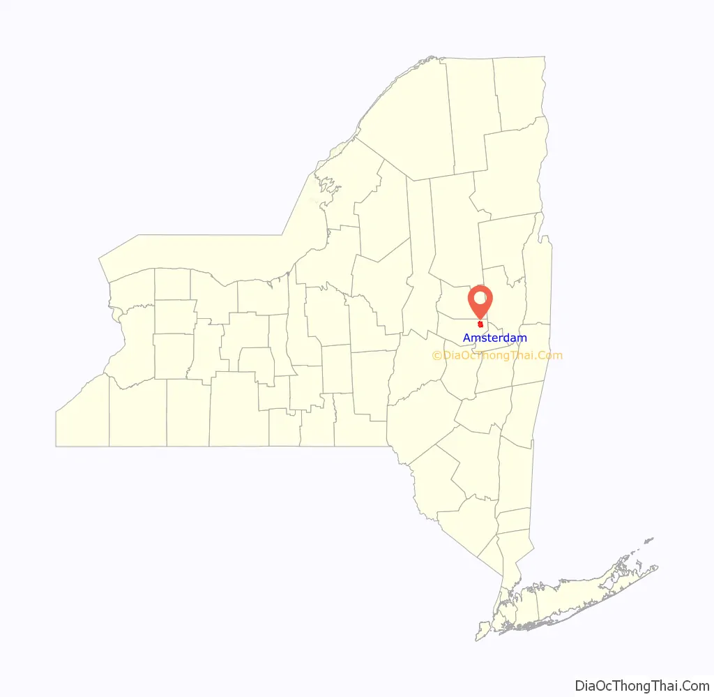
Amsterdam location map. Where is Amsterdam city?
History
Prior to settlement by Europeans, the region which includes Amsterdam was inhabited for centuries by the Mohawk tribe of the Iroquois Confederacy, which dominated most of the Mohawk Valley. They had pushed the Algonquin Mohican tribe to the east of the Hudson River.
Dutch settlers began to arrive in the area in the 1660s, founding Schenectady in 1664. They had previously been based in Albany, along the Hudson River to the east. They reached what would later be Amsterdam c.1710. They called the community Veeders Mills and Veedersburgh after Albert Veeder, an early mill owner. By the second decade of the 1700s, Scotch-Irish and German Palatinate immigrants began to arrive in the Mohawk Valley region, but few settled in Amsterdam. The governor of the colony granted a group of 100 Palatine German households land in the area that developed as Little Falls, New York to the west, where the English planned they could serve as a buffer to French and Native American incursions.
The American Revolutionary War had little effect on the Amsterdam region. No major battles were fought there or in the surrounding region. The Battle of Johnstown was essentially the repelling of a raid by British forces and their Native American, mostly Iroquois, allies.
Amsterdam grew slowly after the war, primarily providing the services needed for the farming communities which surrounded it. It was located in the now-defunct Town of Caughnawaga. When the Town of Amsterdam was created, the city changed its name to Amsterdam in 1803, possibly to encourage its selection as the seat of the town’s government.
After the War, Loyalists such as the powerful Johnson family fled to Canada. Sir William Johnson had long been the British agent of Indian Affairs for this region. Many new land-hungry settlers came from New England as the state sold off former Iroquois lands for development. The settlement was incorporated as a village on April 20, 1830, from a section of the Town of Amsterdam.
This was a period of rapid growth for the village, influenced by major transportation developments. In turn, the Mohawk Turnpike, the Erie Canal, and construction of the railroad across the valley improved trade. The steeply descending creeks in the region, which flowed from the foothills of the Adirondacks, were used to power an increasing number of mills. These manufactured goods that were shipped from the region by land, canal and rail. Products such as linseed oil, brooms, knit ware, buttons, and iron goods were produced in the growing village, which became an important manufacturing center. It was best known, however, for its carpets, eventually becoming the carpet and rug manufacturing center of the U.S.
Through the late 19th and early 20th centuries, Amsterdam was a destination for immigrants from Europe: Irish, Italian, Polish, and Lithuanian peoples, among others, who found work in the factories.
In 1865, the population of Amsterdam was 5,135. New charters in 1854, 1865, and 1875 increased the size of the village. In 1885, Amsterdam incorporated as a city; it expanded by annexing Rockton to the north, and the former village of Port Jackson on the south side of the Mohawk River was annexed to become the fifth ward of the city. By 1920, the city’s population was 33,524.
In the Great Depression, the mills slowed down their output, but did not close. The city survived the two world wars without significant effect. Shortly after World War II, however, manufacturing in general began to move to the southern United States, where labor costs and taxes were lower. The mills of Amsterdam also shifted their jobs to the South. After a period in the South, that region lost industrial jobs to overseas locations.
Additionally, the second and third generations of the city’s immigrant families often left to go to college and did not return, as there were few jobs to attract college-educated citizens. The city attempted to re-create its industrial base, but these efforts were not particularly successful.
Subsequent city and State projects intended for improved commuting and urban renewal resulted in eroding the local character of the city. As the city’s website expresses it:
In the early 21st century, post-industrial Amsterdam is still trying to re-invent itself. The city suffered serious flood damage in late August 2011, in the aftermath of Hurricane Irene. The flooding threatened properties at the river’s edge due to erosion and water damage.
Amsterdam Road Map
Amsterdam city Satellite Map
Geography
According to the United States Census Bureau, the city has a total area of 6.3 square miles (16.3 km), of which 5.9 square miles (15.4 km) is land and 0.3 square miles (0.9 km) is water, with the total area being 5.41% water. The city developed on both sides of the Mohawk River and Erie Canal, and both North Chuctanunda Creek and South Chuctanunda Creek flow into the Mohawk at Amsterdam.
New York State Route 30, a north-south highway called Market Street in part, crosses the Mohawk River to link the main part of Amsterdam to the New York State Thruway. NY-30 also intersects east-west highways New York State Route 5 and New York State Route 67 in the city. New York State Route 5S passes along the south side of the Mohawk River.
Amsterdam is currently within New York’s 20th congressional district.
See also
Map of New York State and its subdivision:- Albany
- Allegany
- Bronx
- Broome
- Cattaraugus
- Cayuga
- Chautauqua
- Chemung
- Chenango
- Clinton
- Columbia
- Cortland
- Delaware
- Dutchess
- Erie
- Essex
- Franklin
- Fulton
- Genesee
- Greene
- Hamilton
- Herkimer
- Jefferson
- Kings
- Lake Ontario
- Lewis
- Livingston
- Madison
- Monroe
- Montgomery
- Nassau
- New York
- Niagara
- Oneida
- Onondaga
- Ontario
- Orange
- Orleans
- Oswego
- Otsego
- Putnam
- Queens
- Rensselaer
- Richmond
- Rockland
- Saint Lawrence
- Saratoga
- Schenectady
- Schoharie
- Schuyler
- Seneca
- Steuben
- Suffolk
- Sullivan
- Tioga
- Tompkins
- Ulster
- Warren
- Washington
- Wayne
- Westchester
- Wyoming
- Yates
- Alabama
- Alaska
- Arizona
- Arkansas
- California
- Colorado
- Connecticut
- Delaware
- District of Columbia
- Florida
- Georgia
- Hawaii
- Idaho
- Illinois
- Indiana
- Iowa
- Kansas
- Kentucky
- Louisiana
- Maine
- Maryland
- Massachusetts
- Michigan
- Minnesota
- Mississippi
- Missouri
- Montana
- Nebraska
- Nevada
- New Hampshire
- New Jersey
- New Mexico
- New York
- North Carolina
- North Dakota
- Ohio
- Oklahoma
- Oregon
- Pennsylvania
- Rhode Island
- South Carolina
- South Dakota
- Tennessee
- Texas
- Utah
- Vermont
- Virginia
- Washington
- West Virginia
- Wisconsin
- Wyoming