Canajoharie (/ˌkænədʒəˈhɛəri/) is a village in the Town of Canajoharie in Montgomery County, New York, United States. As of the 2010 census, the village had a population of 2,229. The name is said to be a Mohawk language term meaning “the pot that washes itself,” referring to the “Canajoharie Boiling Pot,” a circular gorge in the Canajoharie Creek, just south of the village.
The village of Canajoharie is at the north border of the Town of Canajoharie; it is west of Amsterdam and east of Utica. The village and town name also refer to Canajoharie, a historic Mohawk town that was located west of here, referred to by the English colonists as the “Upper Castle.” A church stands at that site from the pre-revolutionary era; the Mohawk Upper Castle Historic District is a National Historic Landmark.
The village of Canajoharie is home to one of a handful of operating “dummy lights” in the United States, located downtown at the intersection of Church, Mohawk and Montgomery Streets. It is a traffic signal on a pedestal located in the middle of an intersection; it was first installed in 1926. Two others are located in New York State, in Beacon and Croton-on-Hudson.
The Erie Canal passes the north side of the village.
The village was the headquarters for the manufacturing operations of the Beech-Nut baby food company from its founding in 1891 until the plant was closed in March 2011 with production moving to the town of Florida in the same county, on the south side of the river.
In 2015 most of the village (and a small area to its south) was listed on the National Register of Historic Places as the Canajoharie Historic District, due to its importance as a transportation hub over its existence and the well-preserved architecture from different eras. In addition, the Bragdon-Lipe House, the Van Alstyne Homestead, the West Hill School, and the United States Post Office are individually listed on the National Register of Historic Places.
| Name: | Canajoharie village |
|---|---|
| LSAD Code: | 47 |
| LSAD Description: | village (suffix) |
| State: | New York |
| County: | Montgomery County |
| Elevation: | 305 ft (93 m) |
| Total Area: | 1.40 sq mi (3.62 km²) |
| Land Area: | 1.33 sq mi (3.45 km²) |
| Water Area: | 0.07 sq mi (0.18 km²) |
| Total Population: | 2,037 |
| Population Density: | 1,530.43/sq mi (590.99/km²) |
| ZIP code: | 13317 |
| Area code: | 518 |
| FIPS code: | 3612111 |
| GNISfeature ID: | 0945734 |
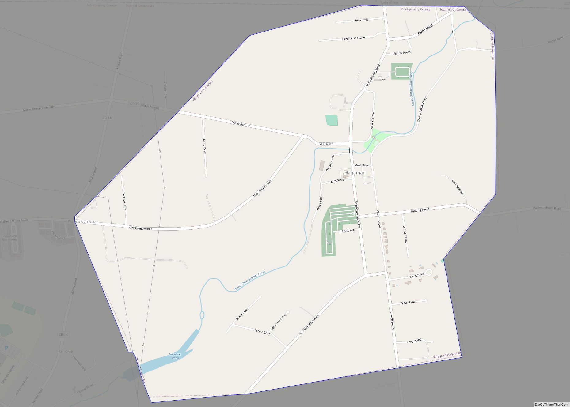
Online Interactive Map
Click on ![]() to view map in "full screen" mode.
to view map in "full screen" mode.
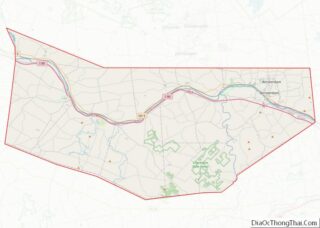
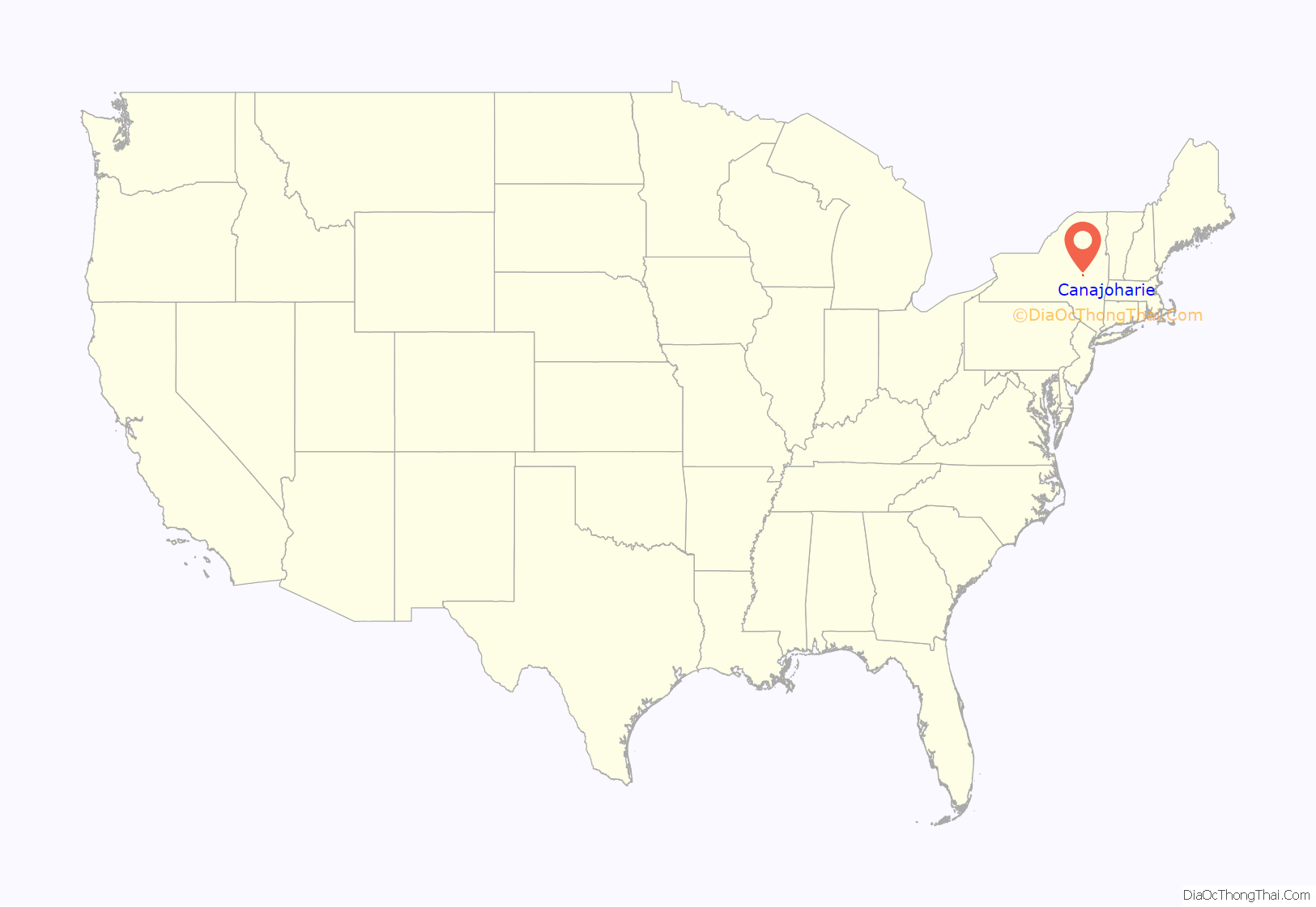
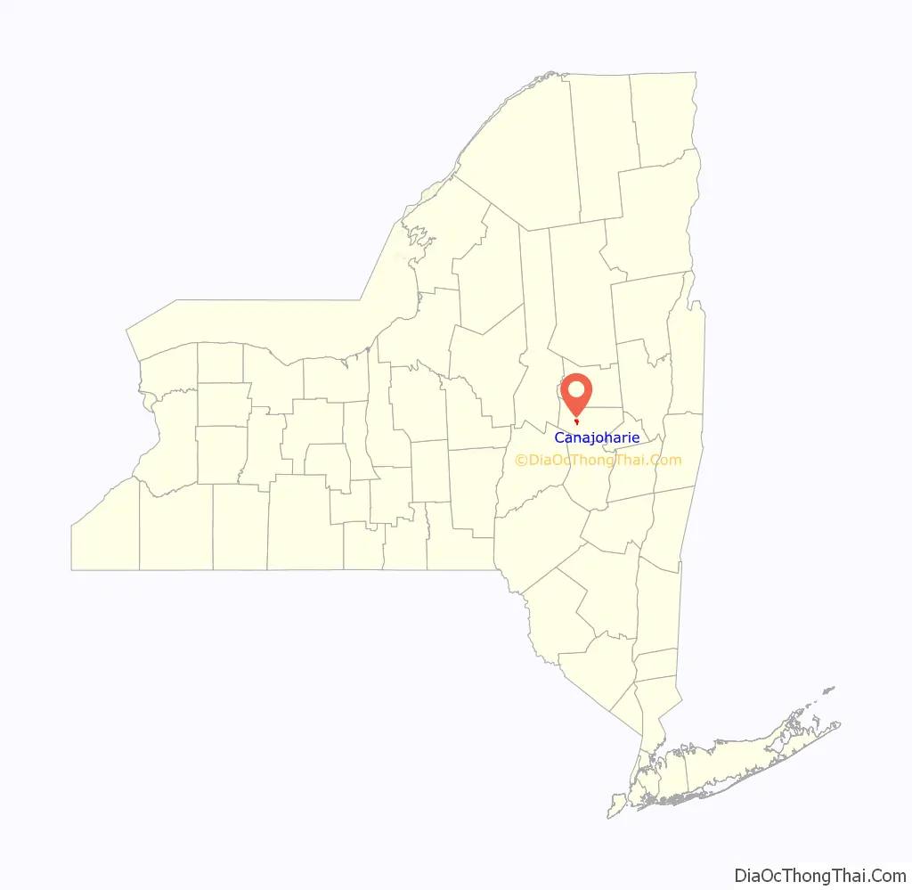
Canajoharie location map. Where is Canajoharie village?
History
The current village is located east of the historic Canajoharie, one of two major towns of the Mohawk nation in the late 17th and 18th centuries. The Mohawk Upper Castle Historic District in the former area contains the Upper Castle Church (1769) and archeological sites related to Mohawk and Iroquois history; it is a National Historic Landmark.
Palatine German settlers, Protestant refugees from religious wars in Europe, were allowed to establish a community in this area in the 1730s. They had earlier lived in work camps along the Hudson River in Dutchess County, to pay off their passage from England, which was paid by Queen Anne’s government. Their community was called “Roofville” (according to anglicized spelling) after early inhabitant Johannes Rueff. The village was incorporated in 1829.
During the middle of the 19th century, three fires almost destroyed the village. It was renamed Canajoharie. Because of the losses due to the fires, the village passed an ordinance prohibiting houses to be constructed of wood. Many of the older houses in the town are made of brick or locally quarried stone.
After the Revolutionary War, George Washington visited Canajoharie. He had been in the region to survey damage done to nearby Cherry Valley from a destructive raid by Joseph Brant, a noted Mohawk chief allied with the British, and his forces. Washington stayed the night at Van Alstyne Homestead (sometimes referred to as Fort Rensselaer), a common meeting place.
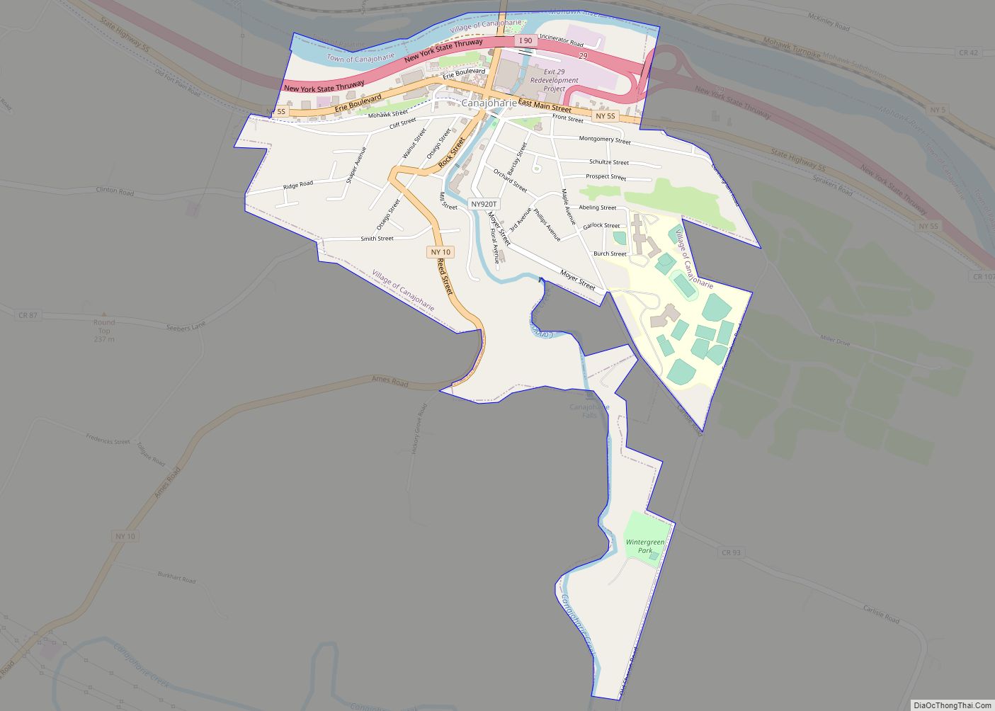
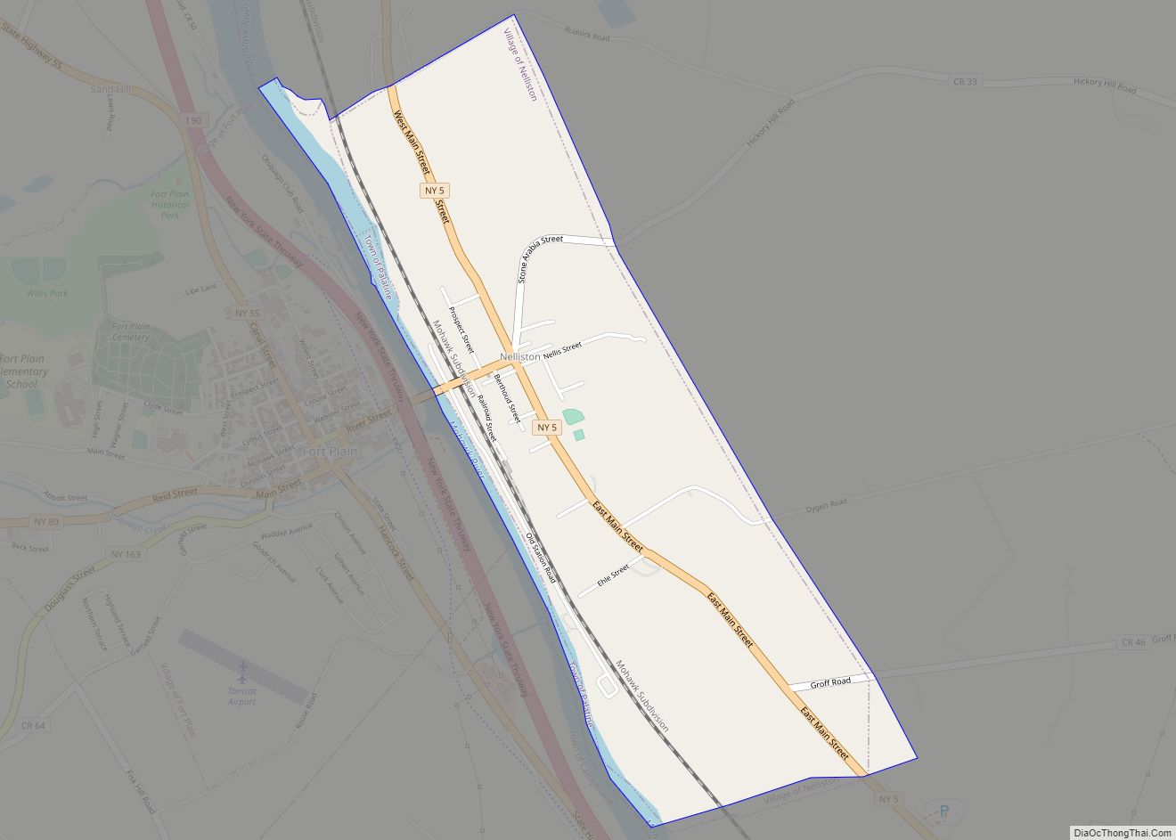
Canajoharie Road Map

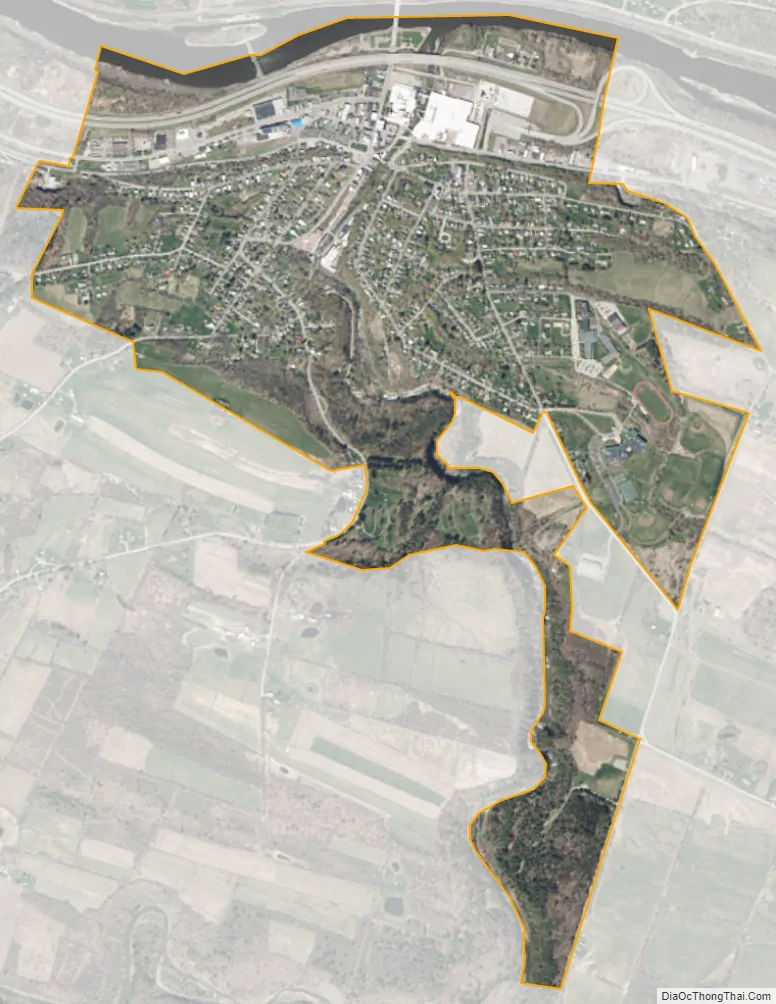
Canajoharie city Satellite Map
Geography
According to the United States Census Bureau, the village has a total area of 1.3 square miles (3.5 km), of which 1.3 square miles (3.4 km) is land and 0.04 square mile (0.1 km) (2.99%) is water.
The village is on the south bank of the Mohawk River.
The New York State Thruway, New York State Route 5S (Erie Boulevard/East Main Street), and New York State Route 10 (Rock Street/Reed Street) pass through the village. On the opposite bank of the Mohawk is the community of Palatine Bridge in the Town of Palatine; both names refer to the colonial German settlers.
Wintergreen Park is one mile from the village downtown and offers views of the Canajoharie Gorge and the Canajoharie Falls.
See also
Map of New York State and its subdivision:- Albany
- Allegany
- Bronx
- Broome
- Cattaraugus
- Cayuga
- Chautauqua
- Chemung
- Chenango
- Clinton
- Columbia
- Cortland
- Delaware
- Dutchess
- Erie
- Essex
- Franklin
- Fulton
- Genesee
- Greene
- Hamilton
- Herkimer
- Jefferson
- Kings
- Lake Ontario
- Lewis
- Livingston
- Madison
- Monroe
- Montgomery
- Nassau
- New York
- Niagara
- Oneida
- Onondaga
- Ontario
- Orange
- Orleans
- Oswego
- Otsego
- Putnam
- Queens
- Rensselaer
- Richmond
- Rockland
- Saint Lawrence
- Saratoga
- Schenectady
- Schoharie
- Schuyler
- Seneca
- Steuben
- Suffolk
- Sullivan
- Tioga
- Tompkins
- Ulster
- Warren
- Washington
- Wayne
- Westchester
- Wyoming
- Yates
- Alabama
- Alaska
- Arizona
- Arkansas
- California
- Colorado
- Connecticut
- Delaware
- District of Columbia
- Florida
- Georgia
- Hawaii
- Idaho
- Illinois
- Indiana
- Iowa
- Kansas
- Kentucky
- Louisiana
- Maine
- Maryland
- Massachusetts
- Michigan
- Minnesota
- Mississippi
- Missouri
- Montana
- Nebraska
- Nevada
- New Hampshire
- New Jersey
- New Mexico
- New York
- North Carolina
- North Dakota
- Ohio
- Oklahoma
- Oregon
- Pennsylvania
- Rhode Island
- South Carolina
- South Dakota
- Tennessee
- Texas
- Utah
- Vermont
- Virginia
- Washington
- West Virginia
- Wisconsin
- Wyoming