Alatna /əˈlætnə/ (Alaasuq in Iñupiaq [ɐˈlaːsoq]) is a census-designated place (CDP) in the Yukon-Koyukuk Census Area of the Unorganized Borough in the U.S. state of Alaska. The population was 37 at the 2010 census.
| Name: | Alatna CDP |
|---|---|
| LSAD Code: | 57 |
| LSAD Description: | CDP (suffix) |
| State: | Alaska |
| County: | Yukon-Koyukuk Census Area |
| Total Area: | 36.48 sq mi (94.49 km²) |
| Land Area: | 36.48 sq mi (94.49 km²) |
| Water Area: | 0.00 sq mi (0.00 km²) |
| Total Population: | 15 |
| Population Density: | 0.41/sq mi (0.16/km²) |
| ZIP code: | 99720 |
| Area code: | 907 |
| FIPS code: | 0201305 |
Online Interactive Map
Click on ![]() to view map in "full screen" mode.
to view map in "full screen" mode.
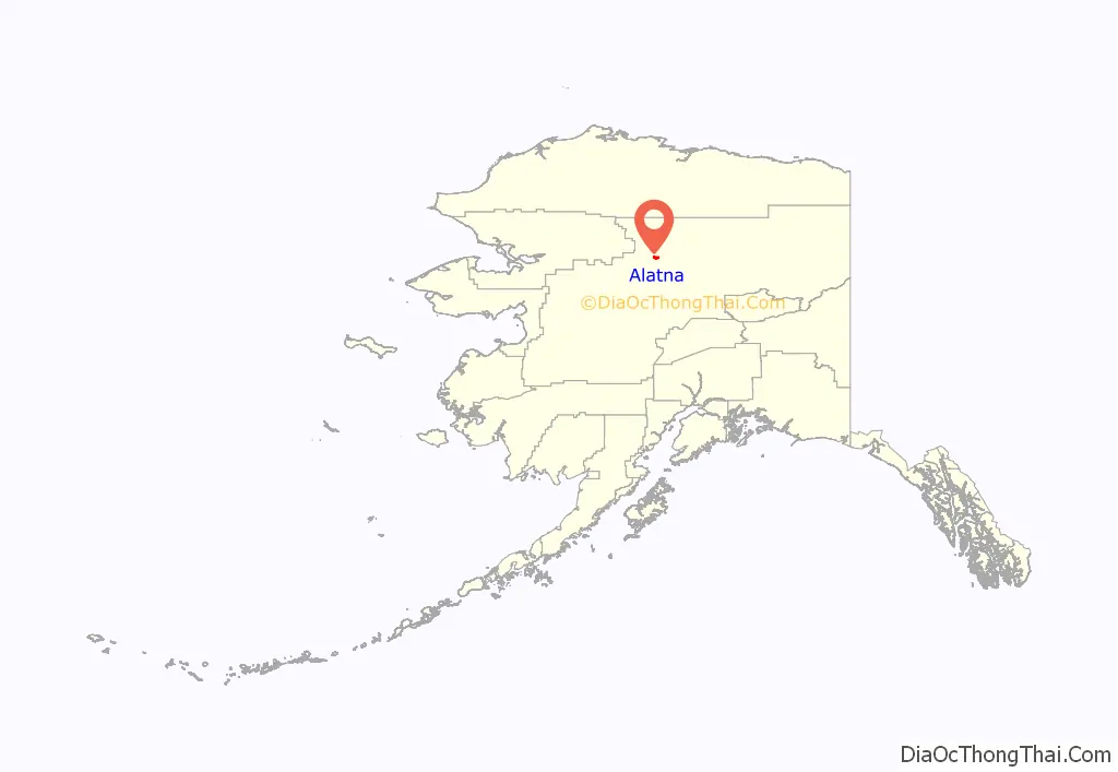
Alatna location map. Where is Alatna CDP?
History
Several Alaska Native groups have lived in the area, including Koyukon Athabascans and Kobuk, Selawik, and Nunamiut from the north and northwest. The Koyukon lived in several camps throughout the year, moving as the seasons changed, following the wild game and fish. The various bands established joint settlements after 1851. The old site of Alatna was a trading center for Athabascans and Inuit. The first mission on the Koyukuk River, St. John’s-in-the-Wilderness Episcopal Mission, was established in 1906. A post office was opened in 1925. In 1938, the community’s name was changed to Allakaket (the old name for the mission), and the name Alatna was assumed by the small Eskimo community across the river. The first public school was established in 1957. A flood caused by ice jamming inundated 85% of the community in the Spring of 1964. In 1975, the community incorporated as a city, including both settlements of Allakaket and Alatna. A clinic and airport were built in 1978. A school and community roads were built in 1979. In September 1994, flood waters destroyed nearly all of the community’s buildings, homes, and food caches for the winter. Residents have rebuilt near the old city site, but Alatna is no longer within the incorporated city boundaries.
A federally recognized Alaskan village is in the community—the Alatna Village. The population of the community consists of 97.1% Alaska Native or part Native. The Alatna population consists largely of descendants of Kobuk Eskimos; Athabascans predominantly live in Allakaket. Subsistence activities are prevalent.
Alatna Road Map

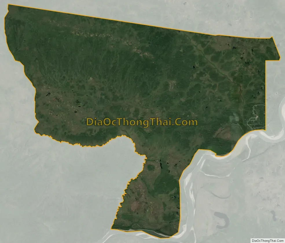
Alatna city Satellite Map
Geography
Alatna is at 66°34′01″N 152°39′59″W / 66.56694°N 152.66639°W / 66.56694; -152.66639 (66.548906, -152.844806) (Sec. 33, T021N, R024W, Fairbanks Meridian) in the Fairbanks Recording District.
Alatna is on the north bank of the Koyukuk River, southwest of its junction with the Alatna River, approximately 190 miles (310 km) northwest of Fairbanks and 57 miles (92 km) upriver from Hughes. Alatna lies just west of the municipal boundaries of the city of Allakaket.
The area experiences a cold, continental climate with extreme temperature differences. The average high temperature during July is 70 °F (21 °C). The average low during January is well below 0 °F (-18 °C), and extended periods of -40 °F/C are common. The highest temperature ever recorded was 94 °F (34 °C); the lowest, -75 °F (-59 °C). Average annual precipitation is 13 inches (33 cm) and average annual snowfall is 72 inches (183 cm). The Koyukuk River is ice-free from June through October.
According to the United States Census Bureau, the CDP has an area of 36.5 square miles (95 km), all of it land.
See also
Map of Alaska State and its subdivision:- Aleutians East
- Aleutians West
- Anchorage
- Bethel
- Bristol Bay
- Denali
- Dillingham
- Fairbanks North Star
- Haines
- Juneau
- Kenai Peninsula
- Ketchikan Gateway
- Kodiak Island
- Lake and Peninsula
- Matanuska-Susitna
- Nome
- North Slope
- Northwest Arctic
- Prince of Wales-Outer Ketchi
- Sitka
- Skagway-Yakutat-Angoon
- Southeast Fairbanks
- Valdez-Cordova
- Wade Hampton
- Wrangell-Petersburg
- Yukon-Koyukuk
- Alabama
- Alaska
- Arizona
- Arkansas
- California
- Colorado
- Connecticut
- Delaware
- District of Columbia
- Florida
- Georgia
- Hawaii
- Idaho
- Illinois
- Indiana
- Iowa
- Kansas
- Kentucky
- Louisiana
- Maine
- Maryland
- Massachusetts
- Michigan
- Minnesota
- Mississippi
- Missouri
- Montana
- Nebraska
- Nevada
- New Hampshire
- New Jersey
- New Mexico
- New York
- North Carolina
- North Dakota
- Ohio
- Oklahoma
- Oregon
- Pennsylvania
- Rhode Island
- South Carolina
- South Dakota
- Tennessee
- Texas
- Utah
- Vermont
- Virginia
- Washington
- West Virginia
- Wisconsin
- Wyoming


