Arctic Village (Vashrąįį K’ǫǫ in Gwich’in) is an unincorporated Native American village and a census-designated place (CDP) in Yukon-Koyukuk Census Area, Alaska, United States. As of the 2010 census, the population of the CDP was 152. This was unchanged from 2000. The village is located in the large Gwitch’in speaking region of Alaska, and the local dialect is known as Di’haii Gwitch’in or shahanh. As of 1999, over 95% of the community speaks and understands the language. (Kraus, 1999) As of 2019, the second village chief was against oil drilling because of the impact on caribou
| Name: | Arctic Village CDP |
|---|---|
| LSAD Code: | 57 |
| LSAD Description: | CDP (suffix) |
| State: | Alaska |
| County: | Yukon-Koyukuk Census Area |
| Total Area: | 69.97 sq mi (181.23 km²) |
| Land Area: | 63.78 sq mi (165.20 km²) |
| Water Area: | 6.19 sq mi (16.03 km²) |
| Total Population: | 151 |
| Population Density: | 2.37/sq mi (0.91/km²) |
| ZIP code: | 99722 |
| Area code: | 907 |
| FIPS code: | 0203990 |
Online Interactive Map
Click on ![]() to view map in "full screen" mode.
to view map in "full screen" mode.
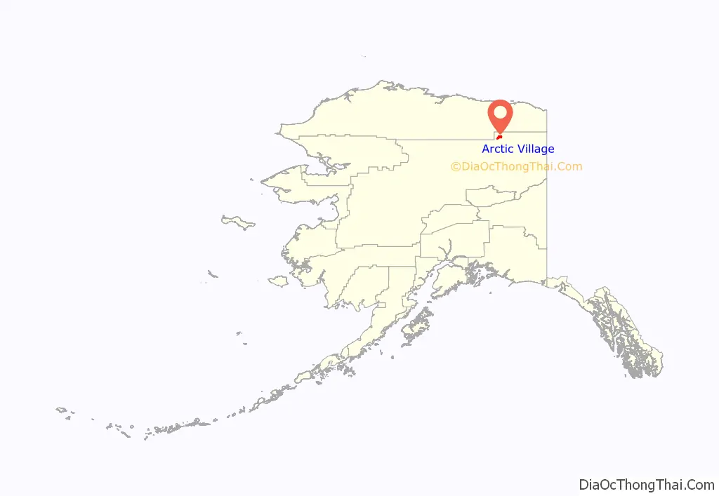
Arctic Village location map. Where is Arctic Village CDP?
History
Evidence from archaeological investigations indicate that the Arctic Village area may have been settled as early as 4500 BC. Around 500 AD the Athabascan speaking Gwich’in people (often called Neets’aii Gwich’in or “those who dwell to the north”) came into the area with seasonal hunting and fishing camps. About 1900, the village became a permanent settlement.
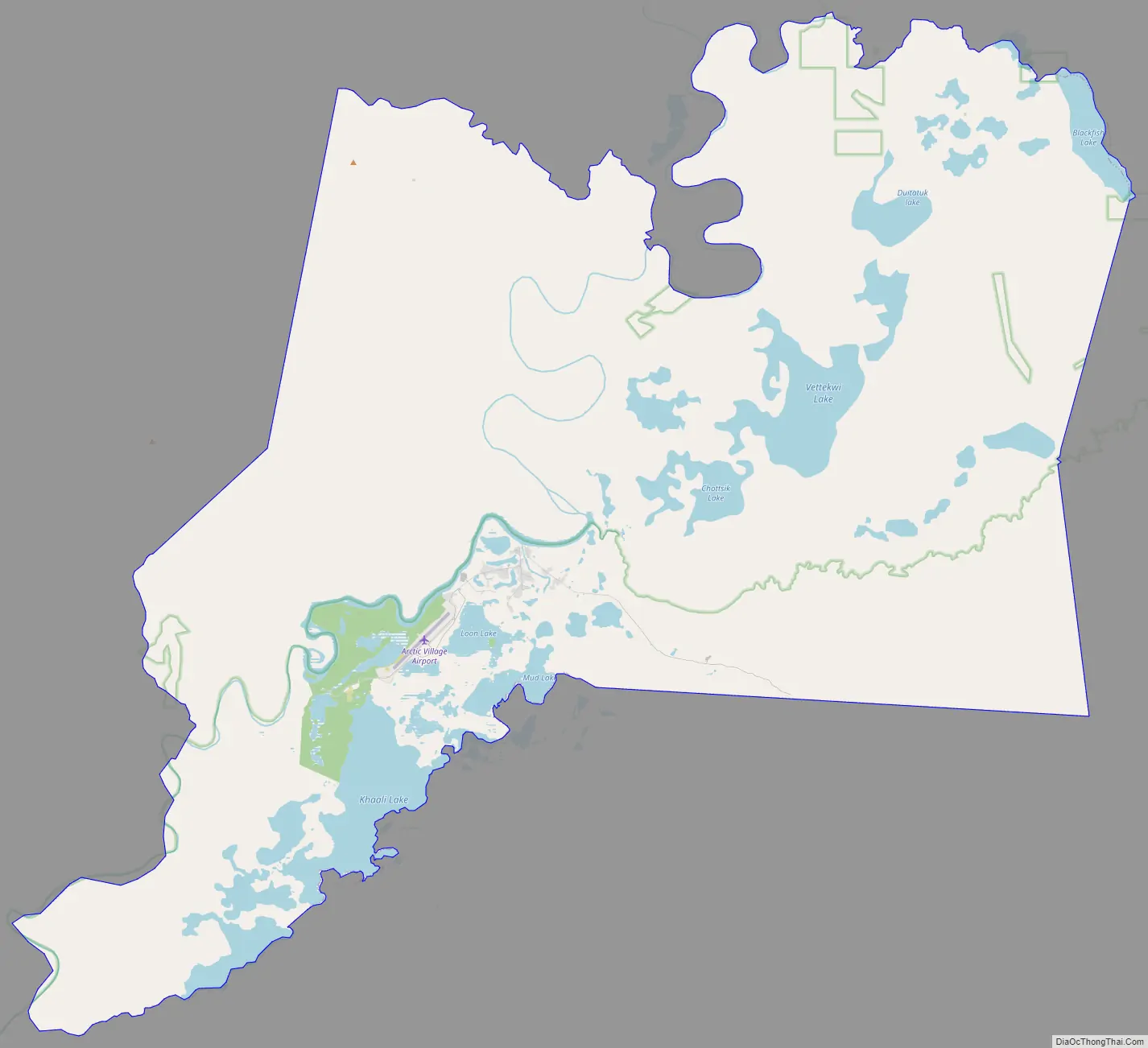
Arctic Village Road Map
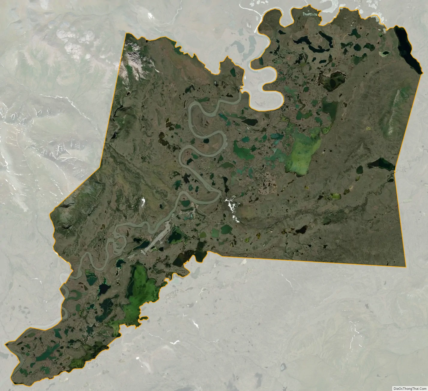
Arctic Village city Satellite Map
Geography
Arctic Village is located at 68°7′19″N 145°31′40″W / 68.12194°N 145.52778°W / 68.12194; -145.52778 (68.121828, -145.527686), on the east fork of the Chandalar River, about a hundred miles north of Fort Yukon. The area consists of flat floodlands near the river, but is mostly wooded hills.
The CDP has a total area of 69.9 square miles (181 km), of which, 61.71 square miles (159.8 km) is land and 8.12 square miles (21.0 km) (11.63%) is water.
See also
Map of Alaska State and its subdivision:- Aleutians East
- Aleutians West
- Anchorage
- Bethel
- Bristol Bay
- Denali
- Dillingham
- Fairbanks North Star
- Haines
- Juneau
- Kenai Peninsula
- Ketchikan Gateway
- Kodiak Island
- Lake and Peninsula
- Matanuska-Susitna
- Nome
- North Slope
- Northwest Arctic
- Prince of Wales-Outer Ketchi
- Sitka
- Skagway-Yakutat-Angoon
- Southeast Fairbanks
- Valdez-Cordova
- Wade Hampton
- Wrangell-Petersburg
- Yukon-Koyukuk
- Alabama
- Alaska
- Arizona
- Arkansas
- California
- Colorado
- Connecticut
- Delaware
- District of Columbia
- Florida
- Georgia
- Hawaii
- Idaho
- Illinois
- Indiana
- Iowa
- Kansas
- Kentucky
- Louisiana
- Maine
- Maryland
- Massachusetts
- Michigan
- Minnesota
- Mississippi
- Missouri
- Montana
- Nebraska
- Nevada
- New Hampshire
- New Jersey
- New Mexico
- New York
- North Carolina
- North Dakota
- Ohio
- Oklahoma
- Oregon
- Pennsylvania
- Rhode Island
- South Carolina
- South Dakota
- Tennessee
- Texas
- Utah
- Vermont
- Virginia
- Washington
- West Virginia
- Wisconsin
- Wyoming


