Bettles (Kk’odlel T’odegheelenh Denh in Koyukon; Atchiiniq in Iñupiaq) is a city in Yukon-Koyukuk Census Area, Alaska, United States. It is near Gates of the Arctic National Park and Preserve. The population was 23 at the 2020 census, up from 12 in 2010. It is the second smallest incorporated city in the state.
| Name: | Bettles city |
|---|---|
| LSAD Code: | 25 |
| LSAD Description: | city (suffix) |
| State: | Alaska |
| County: | Yukon-Koyukuk Census Area |
| Incorporated: | December 20, 1985 |
| Elevation: | 630 ft (200 m) |
| Total Area: | 1.59 sq mi (4.12 km²) |
| Land Area: | 1.56 sq mi (4.05 km²) |
| Water Area: | 0.03 sq mi (0.07 km²) 0% |
| Total Population: | 23 |
| Population Density: | 14.70/sq mi (5.67/km²) |
| ZIP code: | 99726 |
| Area code: | 907 |
| FIPS code: | 0206630 |
| GNISfeature ID: | 1926949 |
Online Interactive Map
Click on ![]() to view map in "full screen" mode.
to view map in "full screen" mode.
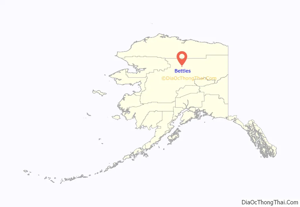
Bettles location map. Where is Bettles city?
History
The original village was founded a mile southwest of the junction of the John & Koyukuk Rivers in the late 1890s during the Alaska Gold Rush and was named for Gordon C. Bettles, a newspaper man, Montana Silver prospector, and trader who established the trading post and community in 1898. A post office was established in 1901 and continued intermittently until 1956. Residents began relocating 5 miles (8.0 km) east to Evansville, where the airstrip that serves the community today was built in World War II and is now used for commercial air service. The Hickel Highway was used to transport equipment and supplies to the North Slope for oil exploration, and to build the Dalton Highway, which is now used as a truck route to the oilfields. The old village was largely abandoned and the New Bettles was carved out of Evansville and was incorporated in 1985.
Bettles Trading Post on the Koyukuk River at Old Bettles, Alaska
Bettles and the Koyukuk River at (New) Bettles, Alaska, 2003
Bettles community from air, (New) Bettles, Alaska, c2013
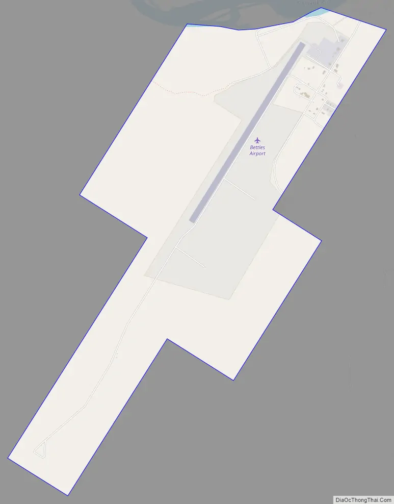
Bettles Road Map
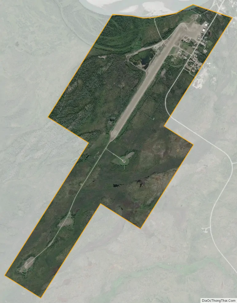
Bettles city Satellite Map
Geography
Bettles is located on the southeast bank of the Koyukuk River at 66°54′48″N 151°31′21″W / 66.91333°N 151.52250°W / 66.91333; -151.52250 (66.913419, −151.522374). The city is on the former Hickel Highway, that now connects to the Dalton Highway as a winter ice road only and crosses the Jim River. Bettles is 35 miles (56 km) north of the Arctic Circle, just south of the Brooks Range. The city is also served by a 5,190-foot (1,580 m) gravel airstrip built by the military.
According to the United States Census Bureau, the city has a total area of 1.6 square miles (4.1 km), all of it land.
Climate
As is typical of the Alaska Interior, Bettles experiences a subarctic climate (Köppen Dfc) with very long, frigid winters and short, warm summers, and is located in USDA Plant Hardiness Zone 1, indicating the coldest temperature of the year is typically at or below −50 °F (−46 °C). Temperatures usually remain consistently below freezing from late October to late March, and the bulk of the year’s snow occurs from October to April, with generally light accumulations in May and September; the average annual snowfall stands at 91 inches (2.31 m). In summer, temperatures reach 70 °F (21 °C) on 37 days and 80 °F (27 °C) on 6.4, with an average of 1 night not falling below 60 °F (16 °C). The threat of frost usually begins in late August, but sometimes it can happen during the first half of that month. A majority of the annual precipitation of 14.9 inches (378 mm) occurs during summer as well. Extreme temperatures have ranged from −70 °F (−57 °C), recorded on January 4, 1975, up to 93 °F (34 °C), set on July 6, 1986.
- ^ Mean monthly maxima and minima (i.e. the highest and lowest temperature readings during an entire month or year) calculated based on data at said location from 1991 to 2020.
See also
Map of Alaska State and its subdivision:- Aleutians East
- Aleutians West
- Anchorage
- Bethel
- Bristol Bay
- Denali
- Dillingham
- Fairbanks North Star
- Haines
- Juneau
- Kenai Peninsula
- Ketchikan Gateway
- Kodiak Island
- Lake and Peninsula
- Matanuska-Susitna
- Nome
- North Slope
- Northwest Arctic
- Prince of Wales-Outer Ketchi
- Sitka
- Skagway-Yakutat-Angoon
- Southeast Fairbanks
- Valdez-Cordova
- Wade Hampton
- Wrangell-Petersburg
- Yukon-Koyukuk
- Alabama
- Alaska
- Arizona
- Arkansas
- California
- Colorado
- Connecticut
- Delaware
- District of Columbia
- Florida
- Georgia
- Hawaii
- Idaho
- Illinois
- Indiana
- Iowa
- Kansas
- Kentucky
- Louisiana
- Maine
- Maryland
- Massachusetts
- Michigan
- Minnesota
- Mississippi
- Missouri
- Montana
- Nebraska
- Nevada
- New Hampshire
- New Jersey
- New Mexico
- New York
- North Carolina
- North Dakota
- Ohio
- Oklahoma
- Oregon
- Pennsylvania
- Rhode Island
- South Carolina
- South Dakota
- Tennessee
- Texas
- Utah
- Vermont
- Virginia
- Washington
- West Virginia
- Wisconsin
- Wyoming


