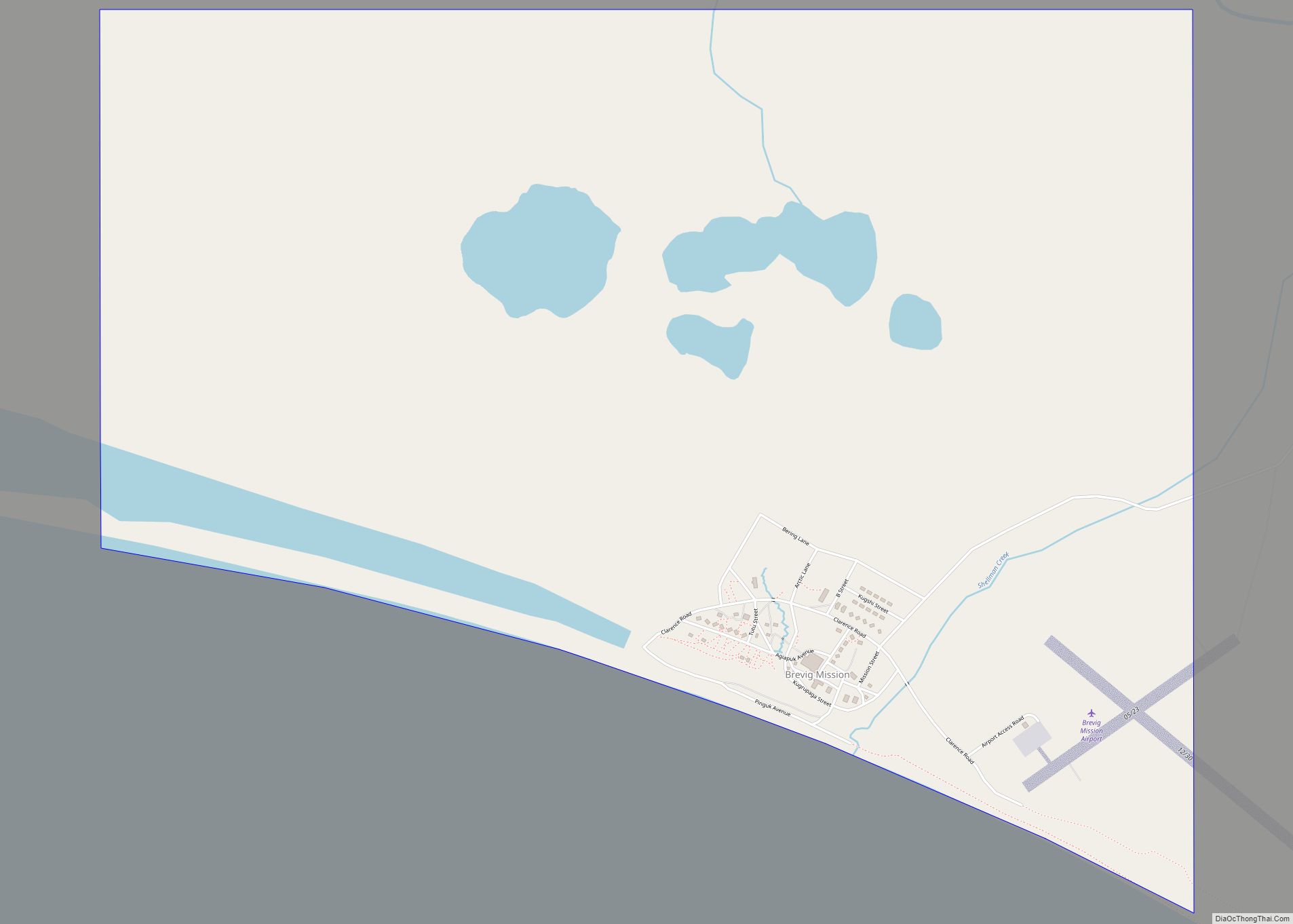
Brevig Mission (Inupiaq: Sitaisaq, Sitaisat, or Sinauraq) is a city in Nome Census Area, Alaska. The population was 388 at the 2010 census, up from 276 in 2000. It is named for the Norwegian Lutheran pastor Tollef L. Brevig, who served at the mission that would later bear his name. First settled in 1900, the mission became known as Teller Mission before receiving its current name. The mostly Inupiat Eskimo population continues to practice subsistence. Brevig Mission is a dry village, which means the sale or possession of alcohol is illegal.
| Name: | Brevig Mission city |
|---|---|
| LSAD Code: | 25 |
| LSAD Description: | city (suffix) |
| State: | Alaska |
| County: | Nome Census Area |
| Incorporated: | October 6, 1969 |
| Elevation: | 16 ft (5 m) |
| Total Area: | 2.51 sq mi (6.51 km²) |
| Land Area: | 2.43 sq mi (6.30 km²) |
| Water Area: | 0.08 sq mi (0.21 km²) |
| ZIP code: | 99785 |
| Area code: | 907 |
| FIPS code: | 0208740 |
| GNISfeature ID: | 1420670 |
Online Interactive Map
Click on ![]() to view map in "full screen" mode.
to view map in "full screen" mode.
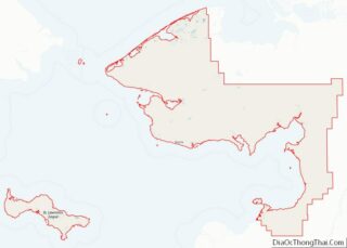
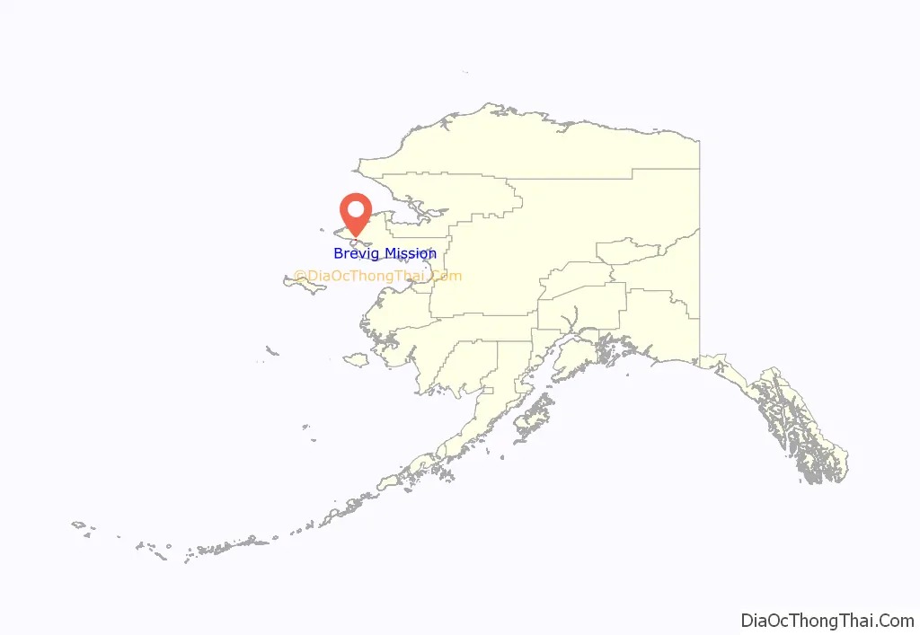
Brevig Mission location map. Where is Brevig Mission city?
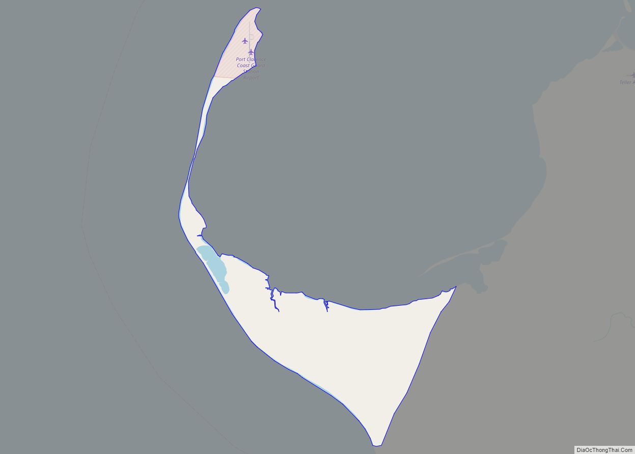
Brevig Mission Road Map
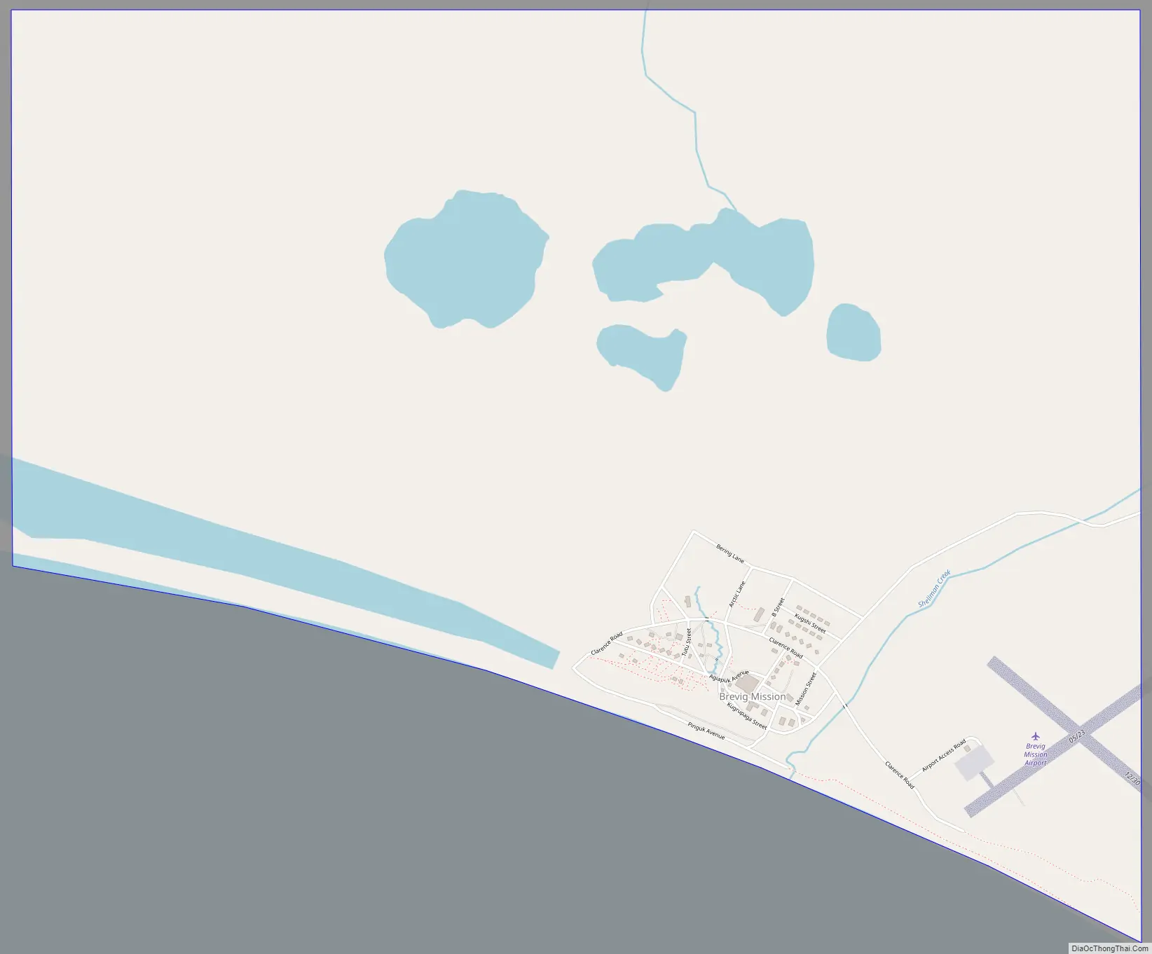
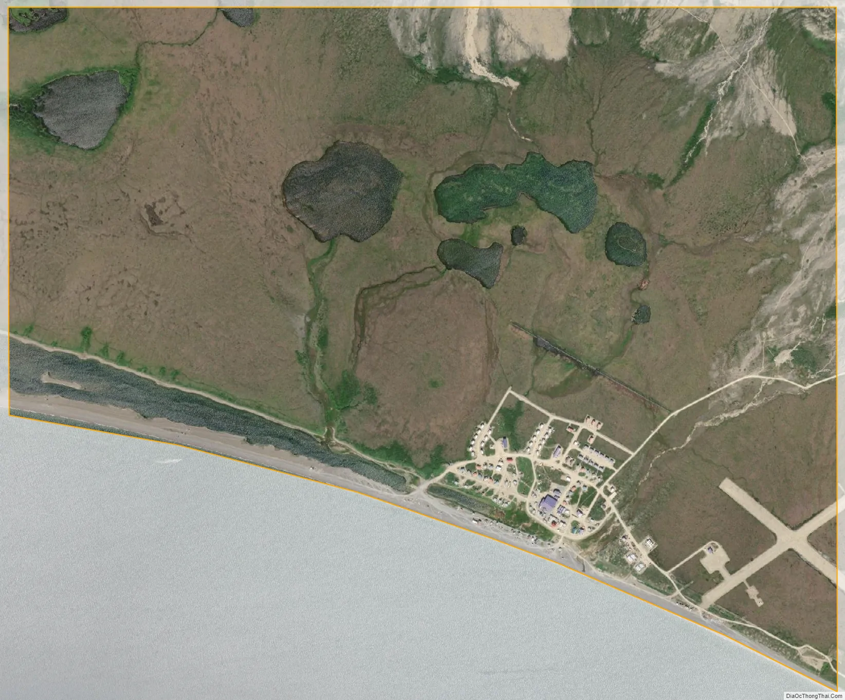
Brevig Mission city Satellite Map
Geography
Brevig Mission is located at 65°20′3″N 166°29′35″W / 65.33417°N 166.49306°W / 65.33417; -166.49306 (65.334235, -166.492952).
According to the United States Census Bureau, the city has a total area of 2.6 square miles (6.7 km), of which, 2.6 square miles (6.7 km) of it is land and 0.1 square miles (0.26 km) of it (1.89%) is water.
See also
Map of Alaska State and its subdivision:- Aleutians East
- Aleutians West
- Anchorage
- Bethel
- Bristol Bay
- Denali
- Dillingham
- Fairbanks North Star
- Haines
- Juneau
- Kenai Peninsula
- Ketchikan Gateway
- Kodiak Island
- Lake and Peninsula
- Matanuska-Susitna
- Nome
- North Slope
- Northwest Arctic
- Prince of Wales-Outer Ketchi
- Sitka
- Skagway-Yakutat-Angoon
- Southeast Fairbanks
- Valdez-Cordova
- Wade Hampton
- Wrangell-Petersburg
- Yukon-Koyukuk
- Alabama
- Alaska
- Arizona
- Arkansas
- California
- Colorado
- Connecticut
- Delaware
- District of Columbia
- Florida
- Georgia
- Hawaii
- Idaho
- Illinois
- Indiana
- Iowa
- Kansas
- Kentucky
- Louisiana
- Maine
- Maryland
- Massachusetts
- Michigan
- Minnesota
- Mississippi
- Missouri
- Montana
- Nebraska
- Nevada
- New Hampshire
- New Jersey
- New Mexico
- New York
- North Carolina
- North Dakota
- Ohio
- Oklahoma
- Oregon
- Pennsylvania
- Rhode Island
- South Carolina
- South Dakota
- Tennessee
- Texas
- Utah
- Vermont
- Virginia
- Washington
- West Virginia
- Wisconsin
- Wyoming