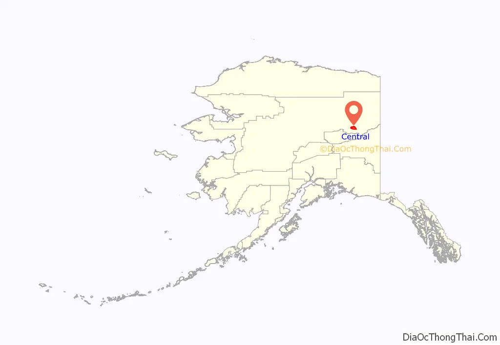
Central is a census-designated place (CDP) in Yukon-Koyukuk Census Area, Alaska, United States. At the 2010 census the population was 96, down from 134 in 2000. Every February, Central hosts a checkpoint for the long-distance Yukon Quest sled dog race.
| Name: | Central CDP |
|---|---|
| LSAD Code: | 57 |
| LSAD Description: | CDP (suffix) |
| State: | Alaska |
| County: | Yukon-Koyukuk Census Area |
| Elevation: | 942 ft (287 m) |
| Total Area: | 249.38 sq mi (645.91 km²) |
| Land Area: | 247.92 sq mi (642.11 km²) |
| Water Area: | 1.46 sq mi (3.79 km²) |
| Total Population: | 66 |
| Population Density: | 0.27/sq mi (0.10/km²) |
| ZIP code: | 99730 |
| Area code: | 907 |
| FIPS code: | 0211690 |
| GNISfeature ID: | 1400106 |
Online Interactive Map
Click on ![]() to view map in "full screen" mode.
to view map in "full screen" mode.
Central location map. Where is Central CDP?
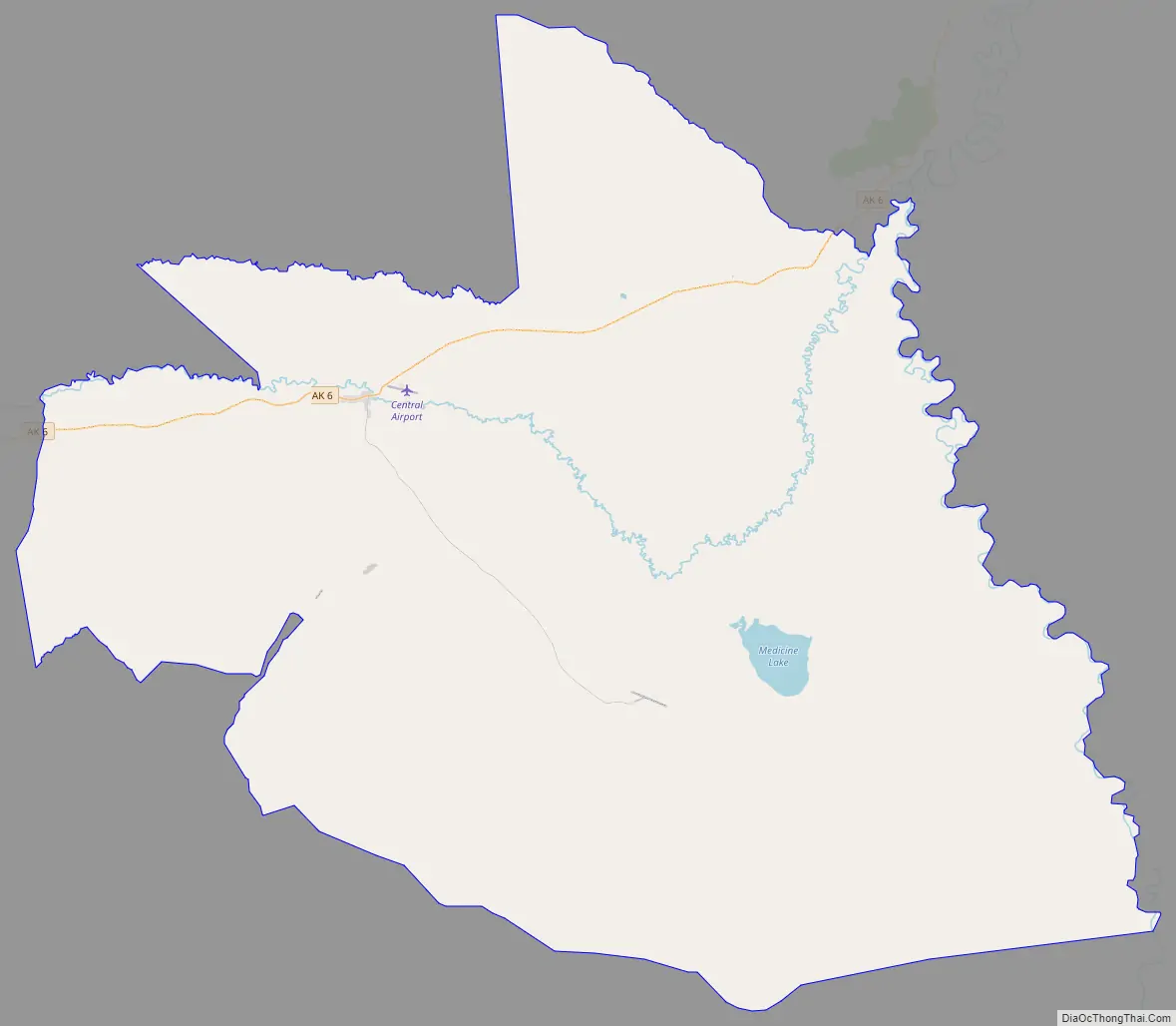
Central Road Map
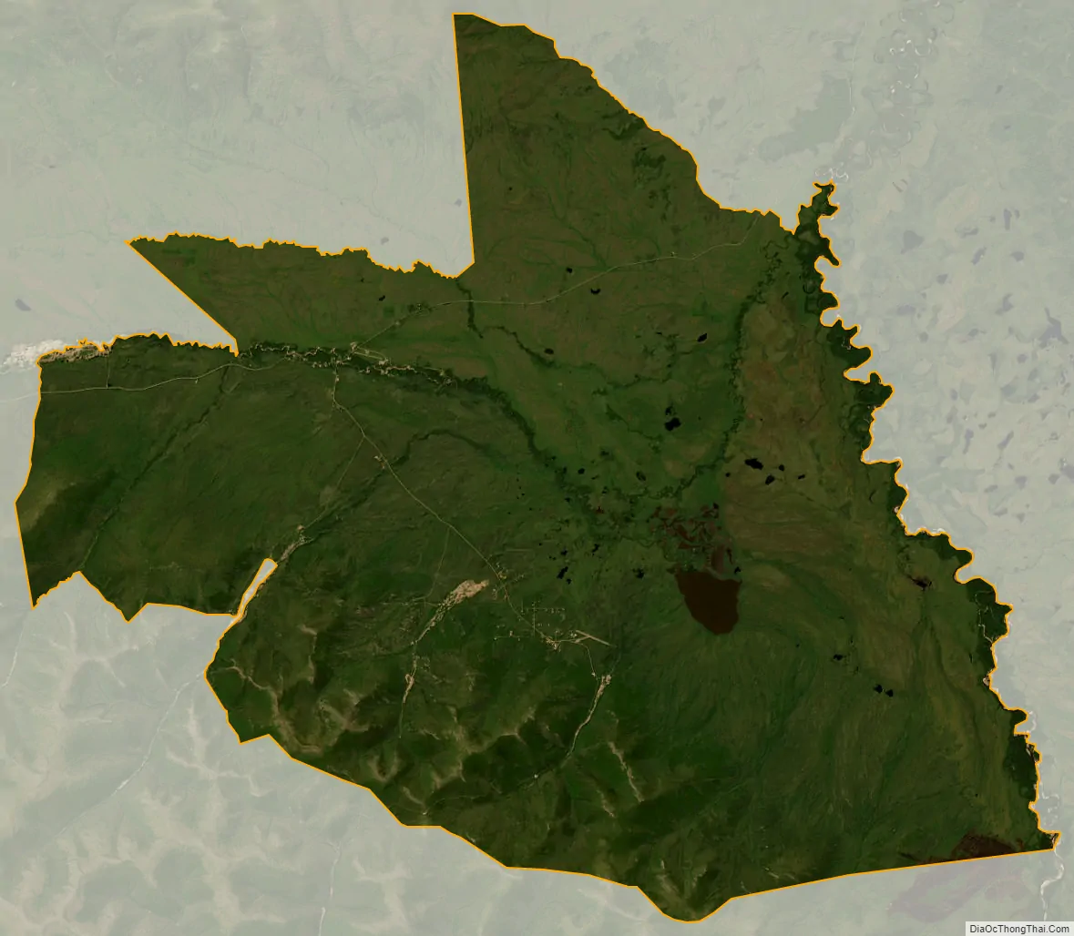
Central city Satellite Map
Geography
Central is located at 65°32′0″N 144°41′44″W / 65.53333°N 144.69556°W / 65.53333; -144.69556 (65.533461, -144.695650). The elevation is 942 feet. The Steese Highway (Alaska Route 6) does pass through Central.
According to the United States Census Bureau, the CDP has a total area of 249.4 square miles (646 km), of which, 247.9 square miles (642 km) of it is land and 1.5 square miles (3.9 km) of it (0.60%) is water.
See also
Map of Alaska State and its subdivision:- Aleutians East
- Aleutians West
- Anchorage
- Bethel
- Bristol Bay
- Denali
- Dillingham
- Fairbanks North Star
- Haines
- Juneau
- Kenai Peninsula
- Ketchikan Gateway
- Kodiak Island
- Lake and Peninsula
- Matanuska-Susitna
- Nome
- North Slope
- Northwest Arctic
- Prince of Wales-Outer Ketchi
- Sitka
- Skagway-Yakutat-Angoon
- Southeast Fairbanks
- Valdez-Cordova
- Wade Hampton
- Wrangell-Petersburg
- Yukon-Koyukuk
- Alabama
- Alaska
- Arizona
- Arkansas
- California
- Colorado
- Connecticut
- Delaware
- District of Columbia
- Florida
- Georgia
- Hawaii
- Idaho
- Illinois
- Indiana
- Iowa
- Kansas
- Kentucky
- Louisiana
- Maine
- Maryland
- Massachusetts
- Michigan
- Minnesota
- Mississippi
- Missouri
- Montana
- Nebraska
- Nevada
- New Hampshire
- New Jersey
- New Mexico
- New York
- North Carolina
- North Dakota
- Ohio
- Oklahoma
- Oregon
- Pennsylvania
- Rhode Island
- South Carolina
- South Dakota
- Tennessee
- Texas
- Utah
- Vermont
- Virginia
- Washington
- West Virginia
- Wisconsin
- Wyoming


