Evansville is a census-designated place (CDP) in Yukon-Koyukuk Census Area, Alaska, United States. The population was 15 at the 2010 census, down from 28 in 2000. The community is adjacent to Bettles. The community is named after Wilford Evans, Sr, who took part in the founding of Bettles Lodge.
| Name: | Evansville CDP |
|---|---|
| LSAD Code: | 57 |
| LSAD Description: | CDP (suffix) |
| State: | Alaska |
| County: | Yukon-Koyukuk Census Area |
| Total Area: | 23.17 sq mi (60.01 km²) |
| Land Area: | 22.98 sq mi (59.51 km²) |
| Water Area: | 0.20 sq mi (0.50 km²) |
| Total Population: | 12 |
| Population Density: | 0.52/sq mi (0.20/km²) |
| ZIP code: | 99726 |
| Area code: | 907 |
| FIPS code: | 0223790 |
Online Interactive Map
Click on ![]() to view map in "full screen" mode.
to view map in "full screen" mode.
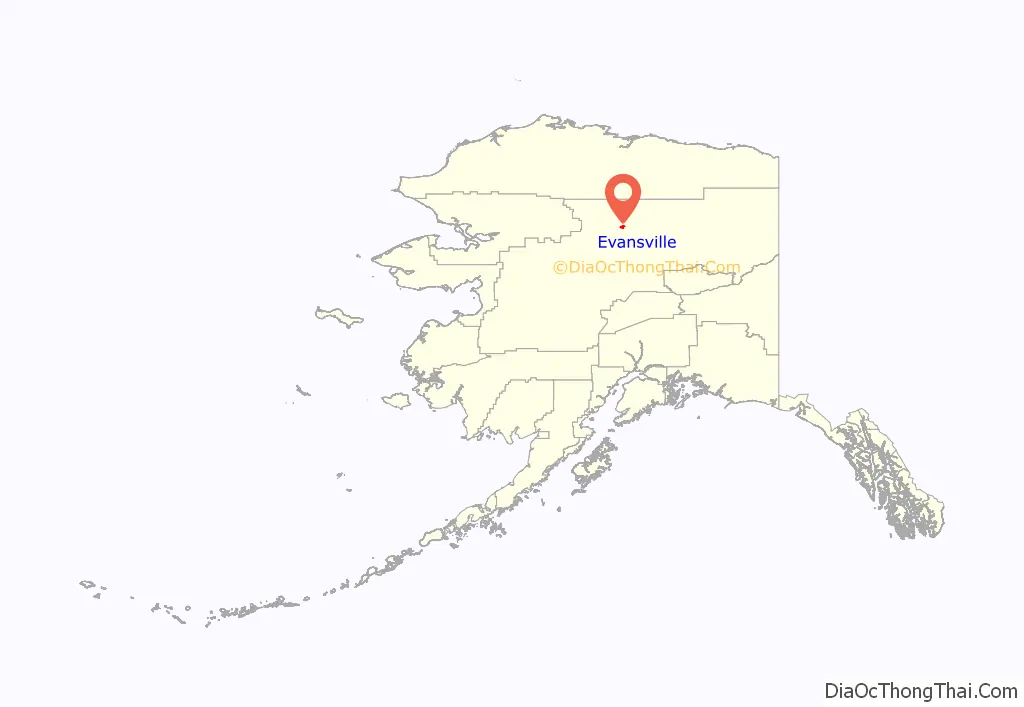
Evansville location map. Where is Evansville CDP?
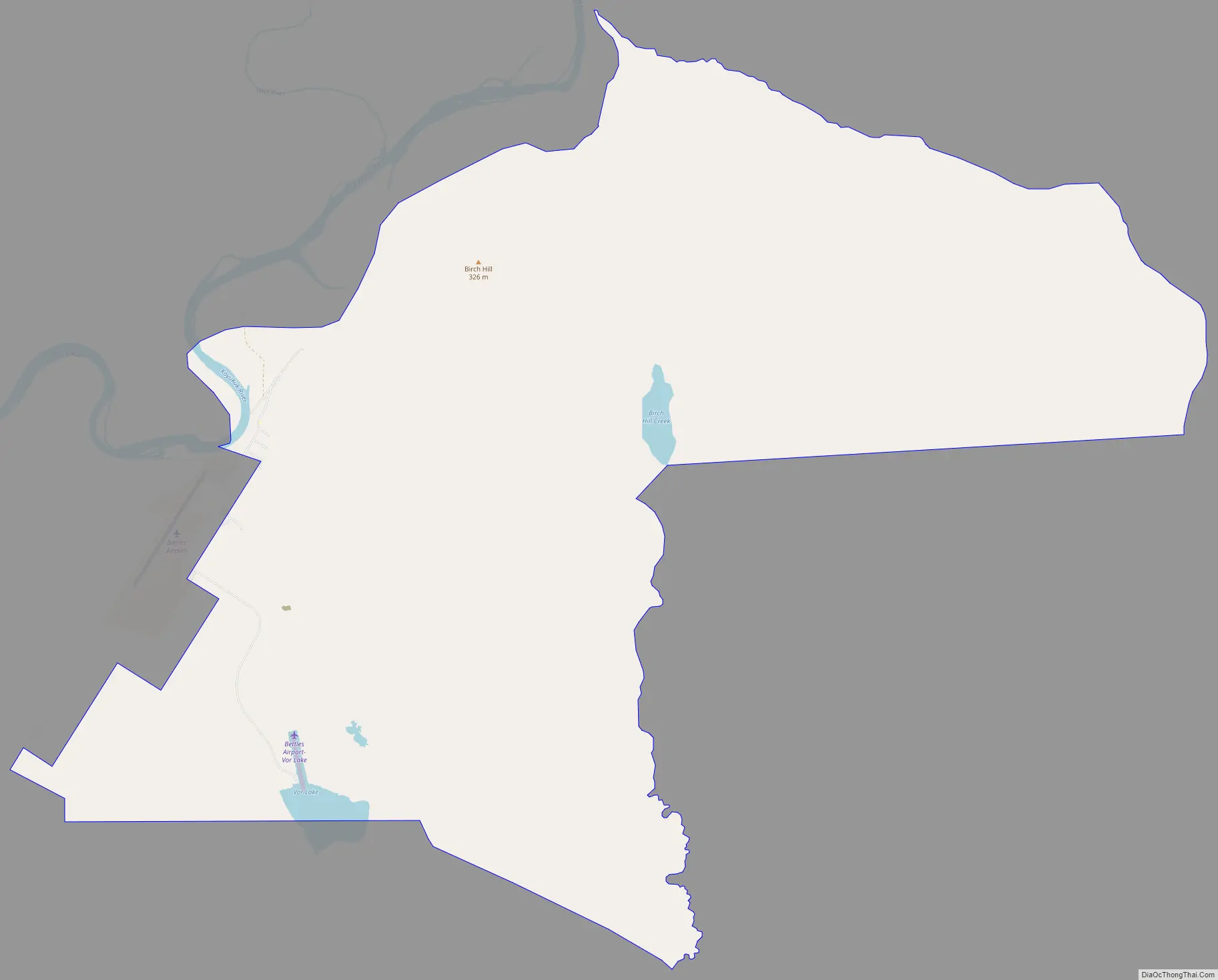
Evansville Road Map
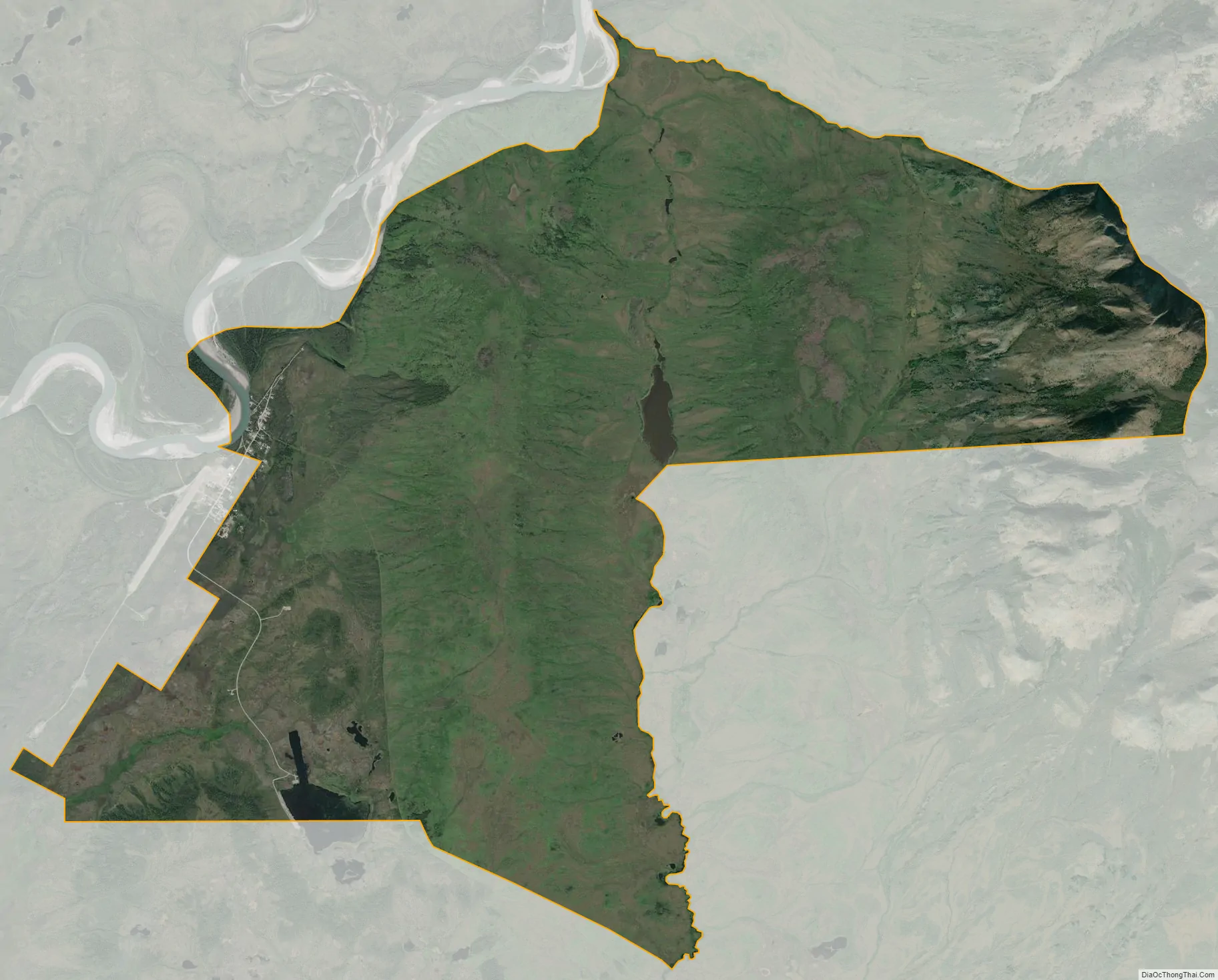
Evansville city Satellite Map
Geography
Evansville is located on the southeast bank of the Koyukuk River at 66°54′11″N 151°29′57″W / 66.90306°N 151.49917°W / 66.90306; -151.49917 (66.902950, -151.499190). The community is on the former Hickel Highway, that now connects to the Dalton Highway as a winter ice road only and crosses the Jim River. Evansville is 35 miles (56 km) north of the Arctic Circle, just south of the Brooks Range, home of the Gates of the Arctic National Park and Preserve.
According to the United States Census Bureau, the CDP has a total area of 22.4 square miles (58 km), of which, 22.2 square miles (57 km) of it is land and 0.2 square miles (0.52 km) of it (0.85%) is water.
Climate
As with much of Interior Alaska, Evansville experiences a subarctic climate (Köppen Dfc) with very long, frigid winters and short, warm summers, and is located in USDA Plant Hardiness Zone 1, indicating the coldest temperature of the year is typically at or below −50 °F (−46 °C). Temperatures usually remain consistently below freezing from late October to late March, and the majority of the year’s snow occurs from October to April, with lighter amounts in May and September; the average annual snowfall stands at 91 inches (2.31 m). In summer, temperatures reach 70 °F (21 °C) on 37 days and 80 °F (27 °C) on 6.4, with an average of 1 night not falling below 60 °F (16 °C). The first frost of the season usually begins in late August, but sometimes it can happen during the first half of that month. A majority of the annual precipitation of 14.9 inches (378 mm) occurs during summer as well. Extreme temperatures have ranged from −70 °F (−57 °C), recorded on January 4, 1975, up to 93 °F (34 °C), set on July 6, 1986.
- ^ Mean monthly maxima and minima (i.e. the highest and lowest temperature readings during an entire month or year) calculated based on data at said location from 1991 to 2020.
See also
Map of Alaska State and its subdivision:- Aleutians East
- Aleutians West
- Anchorage
- Bethel
- Bristol Bay
- Denali
- Dillingham
- Fairbanks North Star
- Haines
- Juneau
- Kenai Peninsula
- Ketchikan Gateway
- Kodiak Island
- Lake and Peninsula
- Matanuska-Susitna
- Nome
- North Slope
- Northwest Arctic
- Prince of Wales-Outer Ketchi
- Sitka
- Skagway-Yakutat-Angoon
- Southeast Fairbanks
- Valdez-Cordova
- Wade Hampton
- Wrangell-Petersburg
- Yukon-Koyukuk
- Alabama
- Alaska
- Arizona
- Arkansas
- California
- Colorado
- Connecticut
- Delaware
- District of Columbia
- Florida
- Georgia
- Hawaii
- Idaho
- Illinois
- Indiana
- Iowa
- Kansas
- Kentucky
- Louisiana
- Maine
- Maryland
- Massachusetts
- Michigan
- Minnesota
- Mississippi
- Missouri
- Montana
- Nebraska
- Nevada
- New Hampshire
- New Jersey
- New Mexico
- New York
- North Carolina
- North Dakota
- Ohio
- Oklahoma
- Oregon
- Pennsylvania
- Rhode Island
- South Carolina
- South Dakota
- Tennessee
- Texas
- Utah
- Vermont
- Virginia
- Washington
- West Virginia
- Wisconsin
- Wyoming


