Flat is a census-designated place (CDP) in Yukon-Koyukuk Census Area, Alaska, United States. As of the 2010 Census, the population of the CDP was 0, down from 4 residents in 2000. Its post office closed in January 2004.
| Name: | Flat CDP |
|---|---|
| LSAD Code: | 57 |
| LSAD Description: | CDP (suffix) |
| State: | Alaska |
| County: | Yukon-Koyukuk Census Area |
| Elevation: | 292 ft (89 m) |
| Total Area: | 160.27 sq mi (415.09 km²) |
| Land Area: | 160.27 sq mi (415.09 km²) |
| Water Area: | 0.00 sq mi (0.00 km²) |
| Total Population: | 0 |
| Population Density: | 0.00/sq mi (0.00/km²) |
| ZIP code: | 99584 |
| Area code: | 907 |
| FIPS code: | 0225880 |
| GNISfeature ID: | 1402165 |
Online Interactive Map
Click on ![]() to view map in "full screen" mode.
to view map in "full screen" mode.
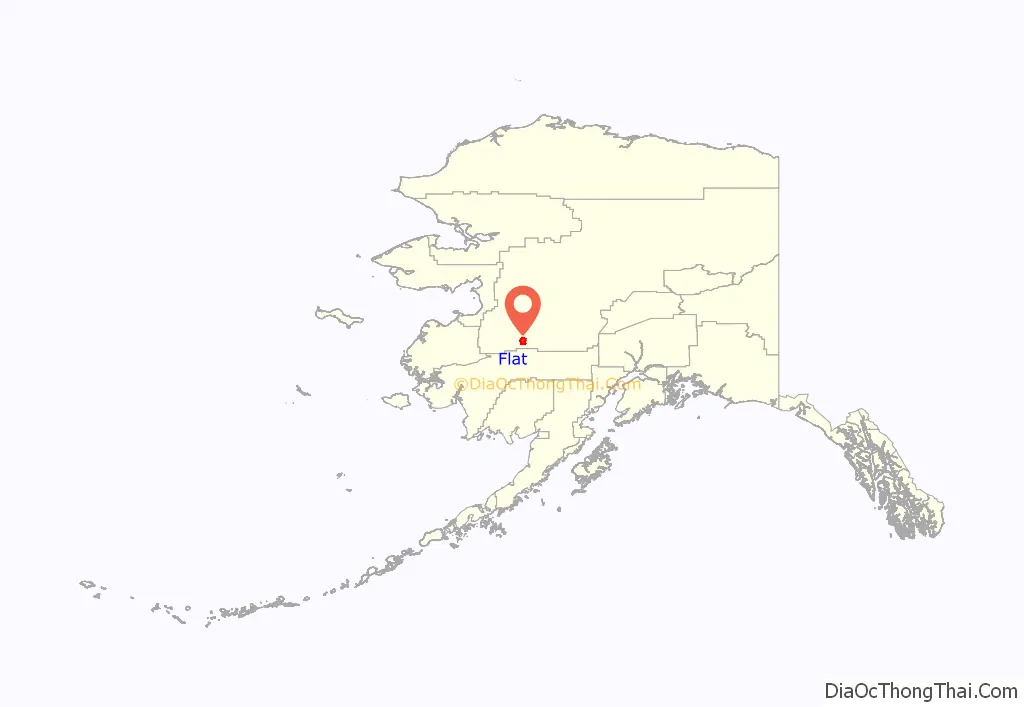
Flat location map. Where is Flat CDP?
History
Prospectors John Beaton and W.A. Dikeman discovered gold on Otter Creek on 25 December 1908. News of the discovery spread slowly, but some miners arrived in the summer of 1909 and built a small camp they called Flat City. More gold was discovered on nearby Flat Creek and more miners arrived in 1910. Beaton, Peter Miscovich, Lars Ostnes, and David Strandberg were prominent early arrivals who mined successfully long after the initial “boomtown” faded. By 1914, the community had grown to about 6,000 people, complete with an elementary school, a telephone system, two stores, a hotel, restaurant, pool hall, laundry and jail. However, a fire started by the “Durand Café” in 1924 caused the majority of the town to burn, thus starting a decline. By 1930, the population had declined to 124. No plat was filed for Flat, and the town site rests on mining claims, so the existence of Flat may contravene the law, but the U.S. Post Office acknowledged the community and served its few residents with an office until the year 2000.
Between 1986 and 2000, the primary year-round residents were a family of five who worked together to maintain the area in the winter for mining in the summer.
Wiley Post 1933 airplane crash
In July 1933, pioneering aviator Wiley Post undertook the first solo flight around the world. On July 20, en route to Fairbanks from a stop in Khabarovsk, Siberia, Post nosed over his high-wing, single-engine Lockheed Vega, the Winnie Mae, in Flat. Local residents helped him right the aircraft. The only damage was a broken propeller. A replacement propeller was brought to Flat by pioneer Alaska flier Joe Crosson and the airplane was repaired by John Miscovich. Post continued to Fairbanks, then on to Edmonton and New York, completing his solo flight around the world in under 8 days. 50 years later, Miscovich constructed a monument to commemorate Post’s first solo flight around the world.
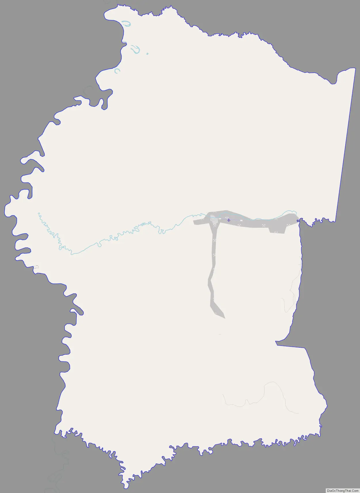
Flat Road Map
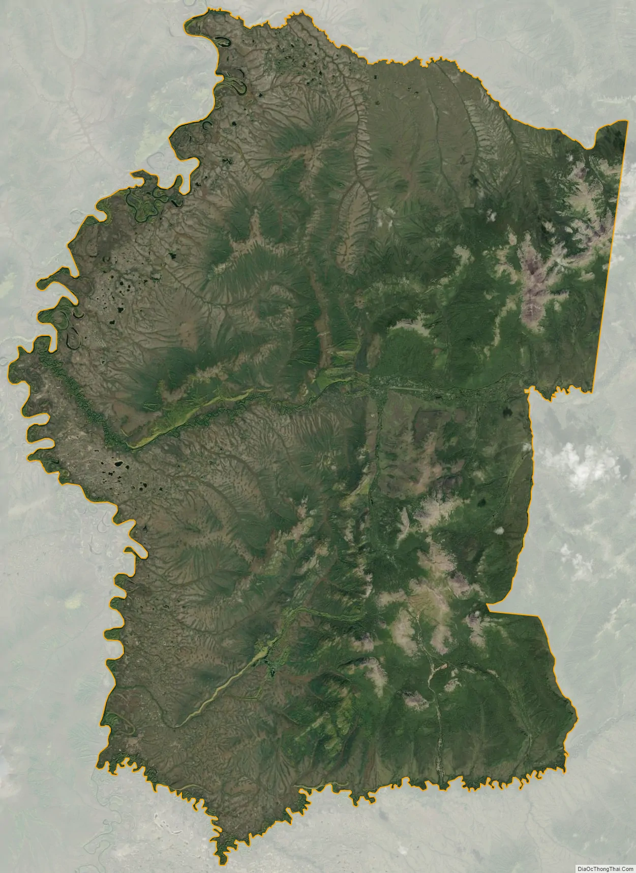
Flat city Satellite Map
Geography
Flat is located at 62°27′15″N 158°0′30″W / 62.45417°N 158.00833°W / 62.45417; -158.00833 (62.454135, -158.008284), 7 miles southeast of Iditarod.
According to the United States Census Bureau, the CDP has a total area of 161.1 square miles (417 km), all of which of is land and none of it is covered by water.
Climate
See also
Map of Alaska State and its subdivision:- Aleutians East
- Aleutians West
- Anchorage
- Bethel
- Bristol Bay
- Denali
- Dillingham
- Fairbanks North Star
- Haines
- Juneau
- Kenai Peninsula
- Ketchikan Gateway
- Kodiak Island
- Lake and Peninsula
- Matanuska-Susitna
- Nome
- North Slope
- Northwest Arctic
- Prince of Wales-Outer Ketchi
- Sitka
- Skagway-Yakutat-Angoon
- Southeast Fairbanks
- Valdez-Cordova
- Wade Hampton
- Wrangell-Petersburg
- Yukon-Koyukuk
- Alabama
- Alaska
- Arizona
- Arkansas
- California
- Colorado
- Connecticut
- Delaware
- District of Columbia
- Florida
- Georgia
- Hawaii
- Idaho
- Illinois
- Indiana
- Iowa
- Kansas
- Kentucky
- Louisiana
- Maine
- Maryland
- Massachusetts
- Michigan
- Minnesota
- Mississippi
- Missouri
- Montana
- Nebraska
- Nevada
- New Hampshire
- New Jersey
- New Mexico
- New York
- North Carolina
- North Dakota
- Ohio
- Oklahoma
- Oregon
- Pennsylvania
- Rhode Island
- South Carolina
- South Dakota
- Tennessee
- Texas
- Utah
- Vermont
- Virginia
- Washington
- West Virginia
- Wisconsin
- Wyoming


