Grayling (Sixno’ Xidakagg in Holikachuk language) is a city in Yukon-Koyukuk Census Area, Alaska, United States. At the 2010 census the population was 194, unchanged from 2000. Since 1977, the Athabaskan village has seen a surge of interest on odd-numbered years, when it is the site of a checkpoint during the Iditarod Trail Sled Dog Race. It is situated after the checkpoint at Anvik and before Eagle Island.
| Name: | Grayling city |
|---|---|
| LSAD Code: | 25 |
| LSAD Description: | city (suffix) |
| State: | Alaska |
| County: | Yukon-Koyukuk Census Area |
| Incorporated: | June 9, 1969 |
| Elevation: | 69 ft (21 m) |
| Total Area: | 11.23 sq mi (29.10 km²) |
| Land Area: | 11.23 sq mi (29.08 km²) |
| Water Area: | 0.01 sq mi (0.02 km²) |
| Total Population: | 210 |
| Population Density: | 18.70/sq mi (7.22/km²) |
| Area code: | 907 |
| FIPS code: | 0230060 |
| GNISfeature ID: | 1402921 |
Online Interactive Map
Click on ![]() to view map in "full screen" mode.
to view map in "full screen" mode.
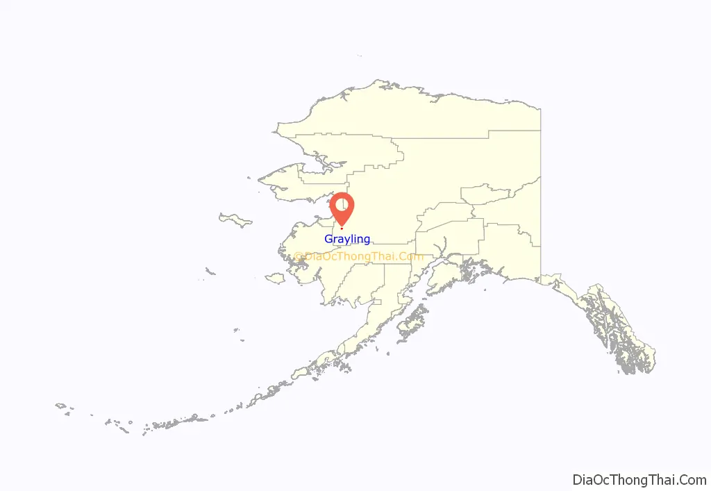
Grayling location map. Where is Grayling city?
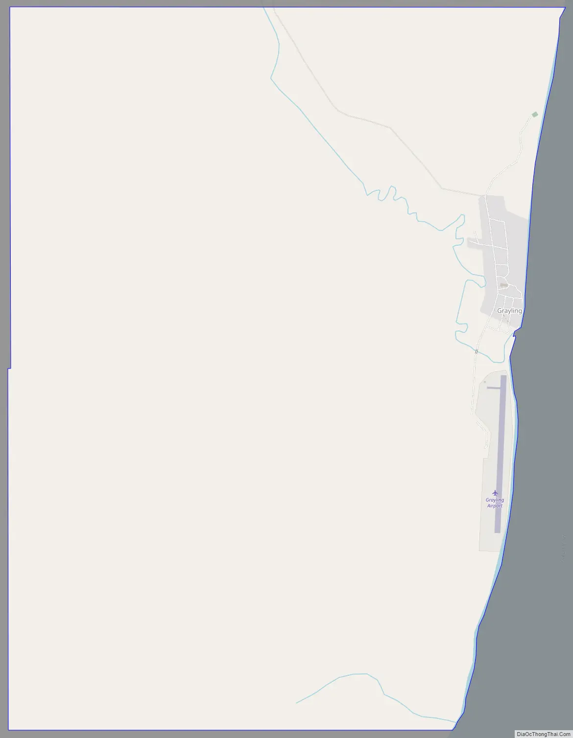
Grayling Road Map
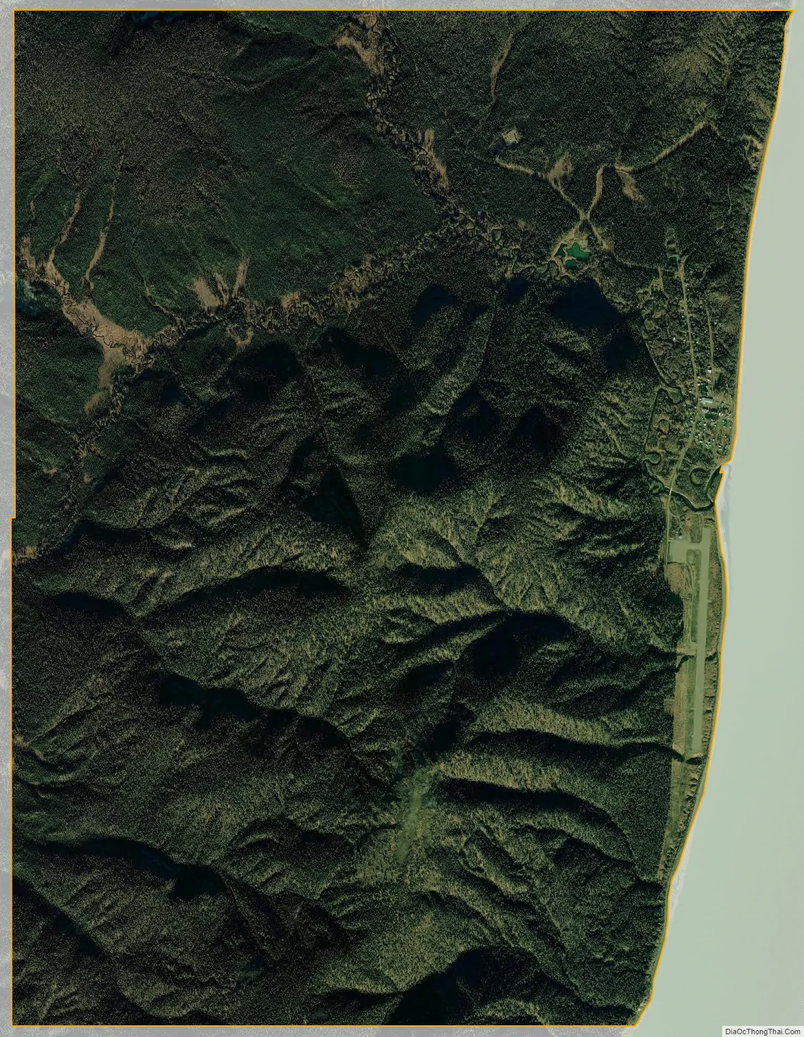
Grayling city Satellite Map
Geography
Grayling is located at 62°54′38″N 160°4′2″W / 62.91056°N 160.06722°W / 62.91056; -160.06722 (62.910472, -160.067250).
According to the United States Census Bureau, the city has a total area of 10.9 square miles (28 km), of which, 10.9 square miles (28 km) of it is land and 0.09% is water.
See also
Map of Alaska State and its subdivision:- Aleutians East
- Aleutians West
- Anchorage
- Bethel
- Bristol Bay
- Denali
- Dillingham
- Fairbanks North Star
- Haines
- Juneau
- Kenai Peninsula
- Ketchikan Gateway
- Kodiak Island
- Lake and Peninsula
- Matanuska-Susitna
- Nome
- North Slope
- Northwest Arctic
- Prince of Wales-Outer Ketchi
- Sitka
- Skagway-Yakutat-Angoon
- Southeast Fairbanks
- Valdez-Cordova
- Wade Hampton
- Wrangell-Petersburg
- Yukon-Koyukuk
- Alabama
- Alaska
- Arizona
- Arkansas
- California
- Colorado
- Connecticut
- Delaware
- District of Columbia
- Florida
- Georgia
- Hawaii
- Idaho
- Illinois
- Indiana
- Iowa
- Kansas
- Kentucky
- Louisiana
- Maine
- Maryland
- Massachusetts
- Michigan
- Minnesota
- Mississippi
- Missouri
- Montana
- Nebraska
- Nevada
- New Hampshire
- New Jersey
- New Mexico
- New York
- North Carolina
- North Dakota
- Ohio
- Oklahoma
- Oregon
- Pennsylvania
- Rhode Island
- South Carolina
- South Dakota
- Tennessee
- Texas
- Utah
- Vermont
- Virginia
- Washington
- West Virginia
- Wisconsin
- Wyoming


