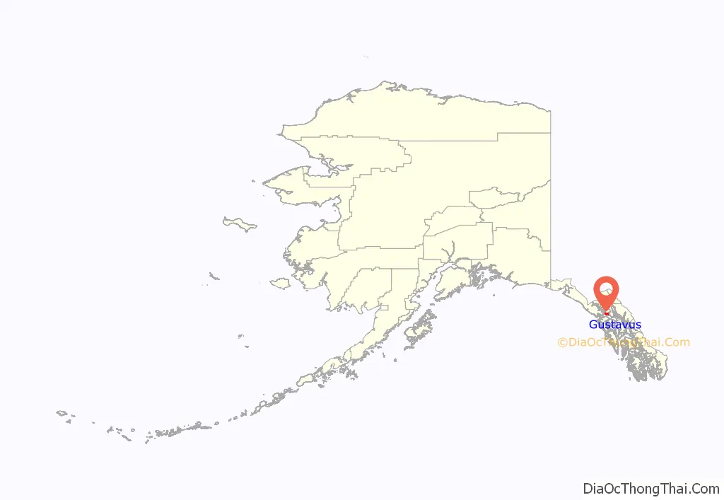
Gustavus (Lingít: Wanachích T’aak Héen) (gus-TAY-vəs) is a second-class city in Hoonah-Angoon Census Area in the U.S. state of Alaska. The 2020 census population was 655, which represents a 48% increase over the 2010 census of 442 and is one of the fastest growing communities in Alaska.
| Name: | Gustavus city |
|---|---|
| LSAD Code: | 25 |
| LSAD Description: | city (suffix) |
| State: | Alaska |
| County: | Hoonah-Angoon Census Area |
| Incorporated: | 2004 |
| Elevation: | 10 ft (3 m) |
| Total Area: | 56.96 sq mi (147.53 km²) |
| Land Area: | 36.36 sq mi (94.17 km²) |
| Water Area: | 20.61 sq mi (53.37 km²) |
| Total Population: | 655 |
| Population Density: | 18.02/sq mi (6.96/km²) |
| ZIP code: | 99826 |
| Area code: | 907 |
| FIPS code: | 0230940 |
| GNISfeature ID: | 1403078 |
| Website: | www.gustavus-ak.gov |
Online Interactive Map
Click on ![]() to view map in "full screen" mode.
to view map in "full screen" mode.
Gustavus location map. Where is Gustavus city?
History
Gustavus, formerly known as “Strawberry Point”, lies on the outwash plain created by the glaciers that once filled Glacier Bay. Two hundred years ago, it was primarily a single large “beach”. The native Tlingit people and others used the area for fishing, berry picking, and other similar uses. The town itself is less than one hundred years old. The first settlers arrived in 1914, but left shortly afterward. The first permanent homestead was established in 1917, when Abraham Lincoln Parker moved his family to Strawberry Point. Many Gustavus residents are descendants and relatives of the original Parker homesteaders.
In 1925 the name became “Gustavus”, when the U.S. Post Office required a change for its new post office, although locals continued calling it “Strawberry Point” long afterwards. The new name came from Point Gustavus at the mouth of Glacier Bay.
In 1793 George Vancouver named Point Adolphus (at the northern tip of Chichagof Island, and today a well-known humpback whale feeding area) after Adolphus Frederick, seventh son of King George III. In 1878, W.H. Dall, while working on a coastal survey, saw “Adolphus” on the map and assumed it was for Swedish king Gustavus Adolphus. The point across Icy Strait from Point Adolphus at the mouth of Glacier Bay was not named on the map, so Dall called it “Gustavus”. Another possibility is that Dall named Gustavus for Gustavus C. Hanus, a U.S. Naval Academy graduate who had extensive experience throughout southeast Alaska, and both Dall and Hanus served with the Coast Survey in Alaska. Hanus laid out the first streets in Juneau and helped quell the trouble in Klukwan in 1881.
There is still a large beach at Gustavus, with many strawberries. The city is surrounded on three sides by Glacier Bay National Park and Preserve, and on the fourth side by water. The area is a temperate rain forest; spruce and hemlock trees reach heights of 60 metres (200 ft), and alders, balsam poplar, fern, mosses, fireweed, lupine, and other plants are also common. Gustavus’s coastal location gives it a relatively mild winter. Summer temperatures range from 11 to 17 °C (52 to 63 °F); winter temperatures from −3 to 4 °C (27 to 39 °F).
Gustavus Road Map
Gustavus city Satellite Map
Geography
Gustavus is located at 58°24′59″N 135°44′44″W / 58.41639°N 135.74556°W / 58.41639; -135.74556 (58.416327, -135.745549).
According to the United States Census Bureau, the city has a total area of 36.9 square miles (95.7 km), of which 32.8 square miles (85.0 km) are land and 4.1 square miles (10.7 km), or 11.16%, are water.
Gustavus is split by the Salmon River, a small waterway crossed by a bridge for the paved road running out to Glacier Bay National Park. Coho salmon, Dolly Varden, and other fish are commonly caught in this river. Within the city limits, the river is affected by tides.
See also
Map of Alaska State and its subdivision:- Aleutians East
- Aleutians West
- Anchorage
- Bethel
- Bristol Bay
- Denali
- Dillingham
- Fairbanks North Star
- Haines
- Juneau
- Kenai Peninsula
- Ketchikan Gateway
- Kodiak Island
- Lake and Peninsula
- Matanuska-Susitna
- Nome
- North Slope
- Northwest Arctic
- Prince of Wales-Outer Ketchi
- Sitka
- Skagway-Yakutat-Angoon
- Southeast Fairbanks
- Valdez-Cordova
- Wade Hampton
- Wrangell-Petersburg
- Yukon-Koyukuk
- Alabama
- Alaska
- Arizona
- Arkansas
- California
- Colorado
- Connecticut
- Delaware
- District of Columbia
- Florida
- Georgia
- Hawaii
- Idaho
- Illinois
- Indiana
- Iowa
- Kansas
- Kentucky
- Louisiana
- Maine
- Maryland
- Massachusetts
- Michigan
- Minnesota
- Mississippi
- Missouri
- Montana
- Nebraska
- Nevada
- New Hampshire
- New Jersey
- New Mexico
- New York
- North Carolina
- North Dakota
- Ohio
- Oklahoma
- Oregon
- Pennsylvania
- Rhode Island
- South Carolina
- South Dakota
- Tennessee
- Texas
- Utah
- Vermont
- Virginia
- Washington
- West Virginia
- Wisconsin
- Wyoming


