Kaktovik (/kækˈtoʊvɪk/; Inupiaq: Qaaktuġvik, IPA: [qaːktoʁvik]) is a city in North Slope Borough, Alaska, United States. The population was 283 at the 2020 census.
| Name: | Kaktovik city |
|---|---|
| LSAD Code: | 25 |
| LSAD Description: | city (suffix) |
| State: | Alaska |
| County: | North Slope Borough |
| Incorporated: | March 26, 1971 |
| Elevation: | 36 ft (11 m) |
| Total Area: | 1.05 sq mi (2.71 km²) |
| Land Area: | 0.77 sq mi (2.01 km²) |
| Water Area: | 0.27 sq mi (0.70 km²) |
| Total Population: | 283 |
| Population Density: | 365.63/sq mi (141.12/km²) |
| ZIP code: | 99747 |
| Area code: | 907 |
| FIPS code: | 0236990 |
| GNISfeature ID: | 1404349 |
Online Interactive Map
Click on ![]() to view map in "full screen" mode.
to view map in "full screen" mode.
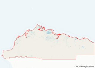
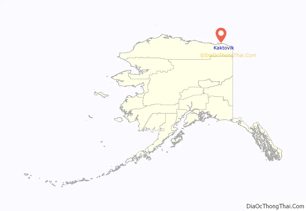
Kaktovik location map. Where is Kaktovik city?
History
Until the late nineteenth century, Barter Island was a major trade center for the Inupiat and was especially important as a bartering place for Inupiat from Alaska and Inuit from Canada.
Kaktovik was a traditional fishing place—Kaktovik means “Seining Place”—that has a large pond of good fresh water on high ground. It had no permanent settlers until people from other parts of Barter Island and northern Alaska moved to the area around the construction of a runway and Distant Early Warning Line station in the 1950s. The area was incorporated as the City of Kaktovik in 1971.
Due to Kaktovik’s isolation, the village has maintained its Inupiat Eskimo traditions. Subsistence is highly dependent upon the hunting of caribou and whale.
In the early twenty-first century Kaktovik became a tourist destination to view polar bears. This is in part due to the native Inupiat, who are permitted to kill three bowhead whales a year, and after flensing the bodies of the whales, they leave the carcasses on the beach at the edge of town.
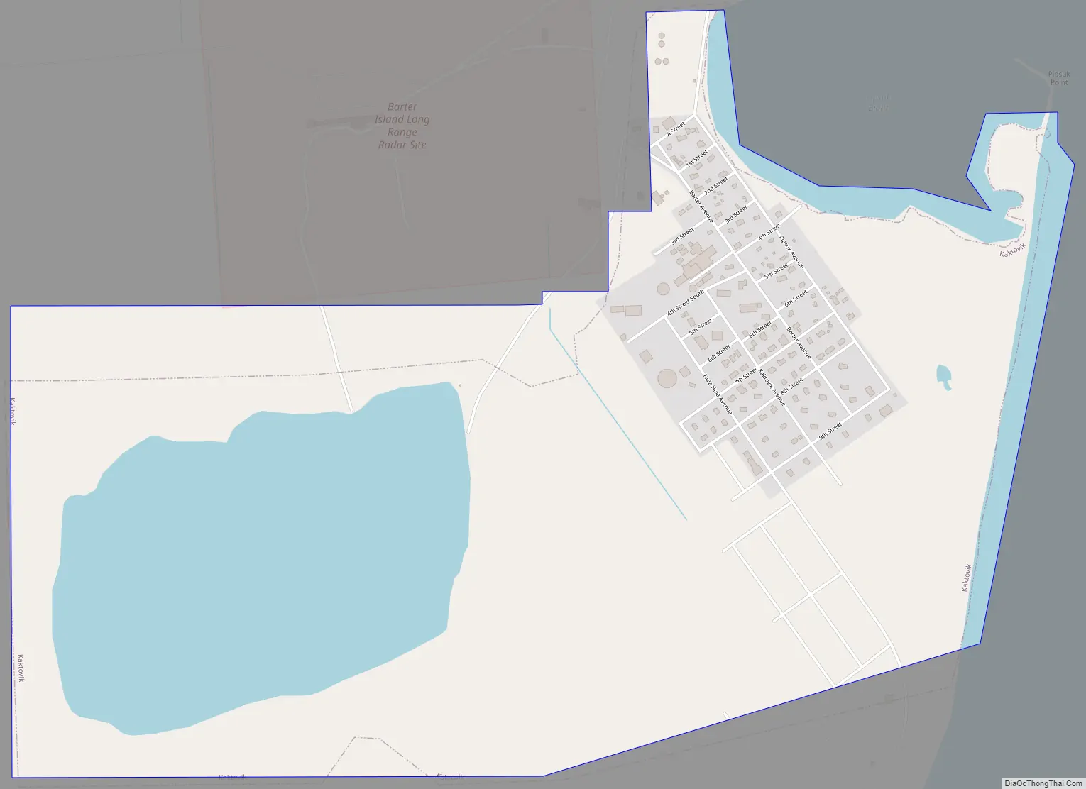
Kaktovik Road Map
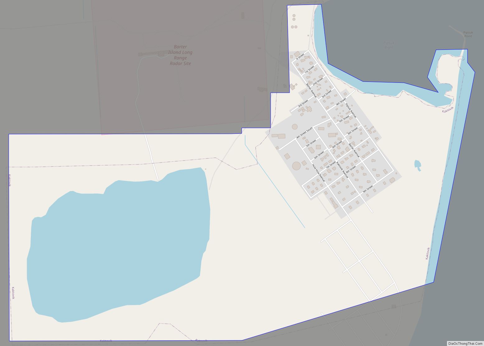
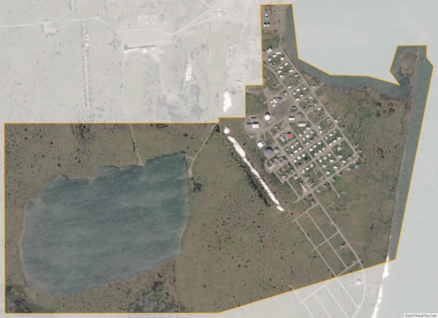
Kaktovik city Satellite Map
Geography
Kaktovik is located at 70°7′58″N 143°36′58″W / 70.13278°N 143.61611°W / 70.13278; -143.61611 (70.132832, -143.616230).
Kaktovik is on the north shore of Barter Island, between the Okpilak River and Jago River on the Beaufort Sea coast. It lies in the 19.6 million acre (79,000 km) Arctic National Wildlife Refuge.
According to the United States Census Bureau, the city has a total area of 1.0 square mile (2.6 km), of which, 0.8 square miles (2.1 km) of it is land and 0.2 square miles (0.52 km) of it (21.00%) is water.
See also
Map of Alaska State and its subdivision:- Aleutians East
- Aleutians West
- Anchorage
- Bethel
- Bristol Bay
- Denali
- Dillingham
- Fairbanks North Star
- Haines
- Juneau
- Kenai Peninsula
- Ketchikan Gateway
- Kodiak Island
- Lake and Peninsula
- Matanuska-Susitna
- Nome
- North Slope
- Northwest Arctic
- Prince of Wales-Outer Ketchi
- Sitka
- Skagway-Yakutat-Angoon
- Southeast Fairbanks
- Valdez-Cordova
- Wade Hampton
- Wrangell-Petersburg
- Yukon-Koyukuk
- Alabama
- Alaska
- Arizona
- Arkansas
- California
- Colorado
- Connecticut
- Delaware
- District of Columbia
- Florida
- Georgia
- Hawaii
- Idaho
- Illinois
- Indiana
- Iowa
- Kansas
- Kentucky
- Louisiana
- Maine
- Maryland
- Massachusetts
- Michigan
- Minnesota
- Mississippi
- Missouri
- Montana
- Nebraska
- Nevada
- New Hampshire
- New Jersey
- New Mexico
- New York
- North Carolina
- North Dakota
- Ohio
- Oklahoma
- Oregon
- Pennsylvania
- Rhode Island
- South Carolina
- South Dakota
- Tennessee
- Texas
- Utah
- Vermont
- Virginia
- Washington
- West Virginia
- Wisconsin
- Wyoming