Lake Minchumina (Menchuh Mene’ [mənt͡ʃʰuh mənə] in Koyukon; Minchu Mina’ in Dinak’i) is a census-designated place (CDP) in Yukon-Koyukuk Census Area, Alaska, United States. As of the 2020 census, the population of the CDP is 30.
| Name: | Lake Minchumina CDP |
|---|---|
| LSAD Code: | 57 |
| LSAD Description: | CDP (suffix) |
| State: | Alaska |
| County: | Yukon-Koyukuk Census Area |
| Total Area: | 249.95 sq mi (647.38 km²) |
| Land Area: | 226.97 sq mi (587.85 km²) |
| Water Area: | 22.99 sq mi (59.53 km²) |
| Total Population: | 30 |
| Population Density: | 0.13/sq mi (0.05/km²) |
| ZIP code: | 99757 |
| Area code: | 907 |
| FIPS code: | 0242820 |
Online Interactive Map
Click on ![]() to view map in "full screen" mode.
to view map in "full screen" mode.
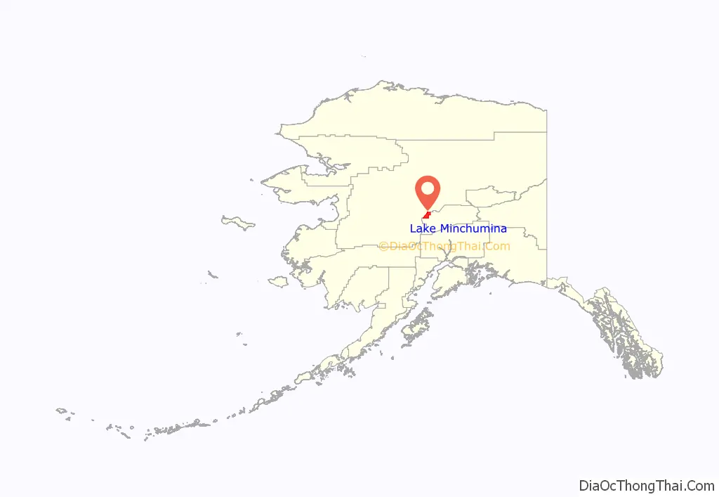
Lake Minchumina location map. Where is Lake Minchumina CDP?
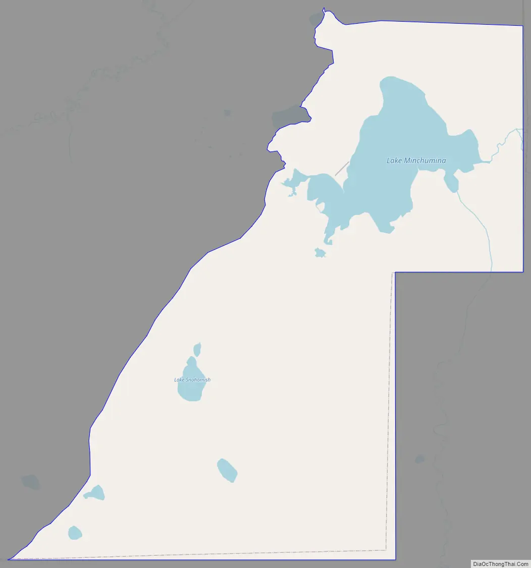
Lake Minchumina Road Map
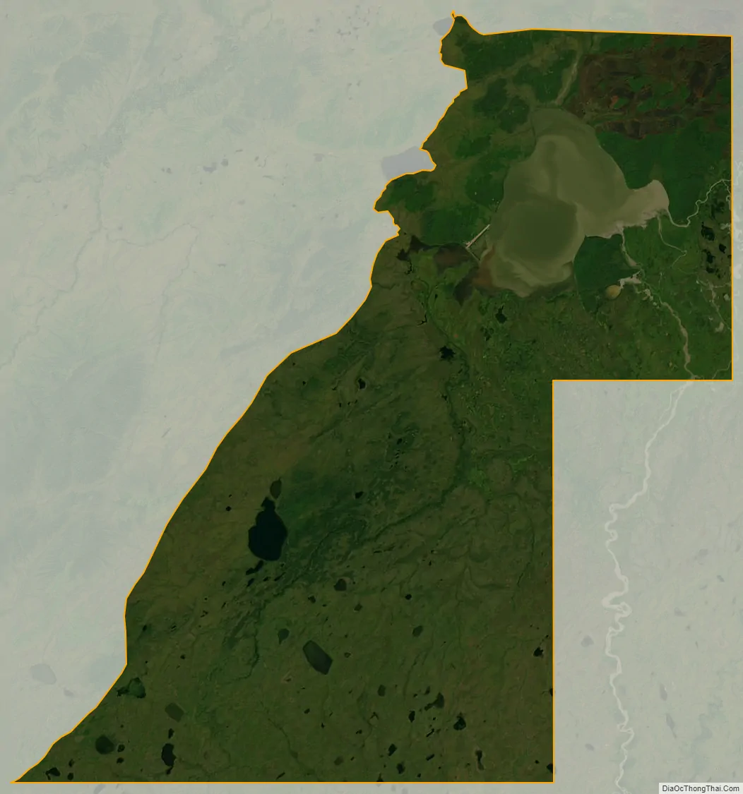
Lake Minchumina city Satellite Map
Geography
Lake Minchumina is located at 63°53′38″N 152°18′7″W / 63.89389°N 152.30194°W / 63.89389; -152.30194 (63.893902, -152.302012).
“If we were to cut out a map of Alaska from a piece of paper and balance the map on the point of a pencil, we would have found the center point of the physical structure of the state. That point is at 63°50’ N, 152° W. or near Lake Minchumina.”
“General Mitchell looked at Alaska on a globe. He saw that Alaska was approximately equal distance from all of the major urban-industrial centers of the world. Figure L.1 is a map of Alaska as seen from space. It is centered on Lake Minchumina in Interior Alaska. Note that we can see the major centers of Asia (Tokyo and Beijing are shown), Europe (Moscow, Berlin, Paris, and London are shown), and North America (New York, Toronto, and Los Angeles are shown). General Billy Mitchell viewed Alaska’s relative location and found that it was, indeed, central to the urban-industrial world.”
Footnote Archived 2011-07-24 at the Wayback Machine
Figure L.1 – Alaska from Space. Orthographic projection
According to the United States Census Bureau, the CDP has a total area of 244.1 square miles (632 km), of which, 216.4 square miles (560 km) of it is land and 27.7 square miles (72 km) of it (11.34%) is water.
See also
Map of Alaska State and its subdivision:- Aleutians East
- Aleutians West
- Anchorage
- Bethel
- Bristol Bay
- Denali
- Dillingham
- Fairbanks North Star
- Haines
- Juneau
- Kenai Peninsula
- Ketchikan Gateway
- Kodiak Island
- Lake and Peninsula
- Matanuska-Susitna
- Nome
- North Slope
- Northwest Arctic
- Prince of Wales-Outer Ketchi
- Sitka
- Skagway-Yakutat-Angoon
- Southeast Fairbanks
- Valdez-Cordova
- Wade Hampton
- Wrangell-Petersburg
- Yukon-Koyukuk
- Alabama
- Alaska
- Arizona
- Arkansas
- California
- Colorado
- Connecticut
- Delaware
- District of Columbia
- Florida
- Georgia
- Hawaii
- Idaho
- Illinois
- Indiana
- Iowa
- Kansas
- Kentucky
- Louisiana
- Maine
- Maryland
- Massachusetts
- Michigan
- Minnesota
- Mississippi
- Missouri
- Montana
- Nebraska
- Nevada
- New Hampshire
- New Jersey
- New Mexico
- New York
- North Carolina
- North Dakota
- Ohio
- Oklahoma
- Oregon
- Pennsylvania
- Rhode Island
- South Carolina
- South Dakota
- Tennessee
- Texas
- Utah
- Vermont
- Virginia
- Washington
- West Virginia
- Wisconsin
- Wyoming


