Mosquito Lake (Lingít: Xunt’i Áa) is a census-designated place (CDP) in Haines Borough, Alaska, United States. At the 2010 census the population was 309, up from 221 at the 2000 census.
| Name: | Mosquito Lake CDP |
|---|---|
| LSAD Code: | 57 |
| LSAD Description: | CDP (suffix) |
| State: | Alaska |
| County: | Haines Borough |
| Elevation: | 305 ft (93 m) |
| Total Area: | 77.61 sq mi (201.02 km²) |
| Land Area: | 77.17 sq mi (199.87 km²) |
| Water Area: | 0.45 sq mi (1.16 km²) |
| Total Population: | 120 |
| Population Density: | 1.56/sq mi (0.60/km²) |
| Area code: | 907 |
| FIPS code: | 0250800 |
| GNISfeature ID: | 1866963 |
Online Interactive Map
Click on ![]() to view map in "full screen" mode.
to view map in "full screen" mode.
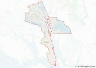
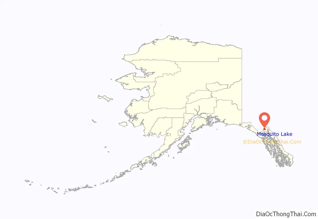
Mosquito Lake location map. Where is Mosquito Lake CDP?
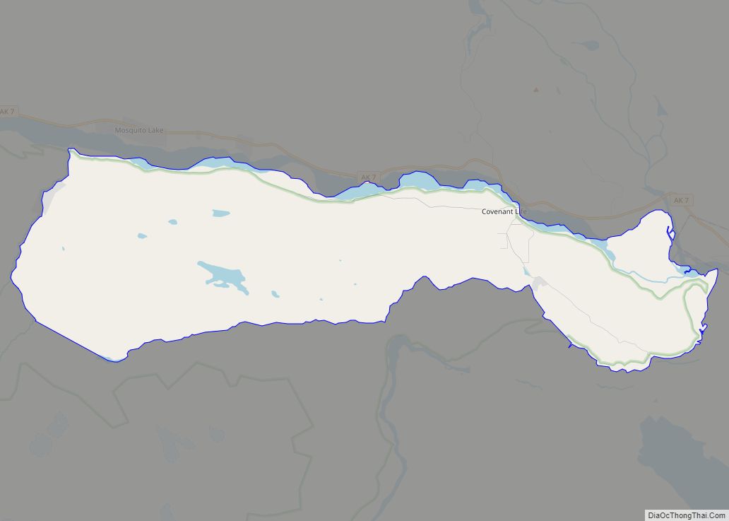
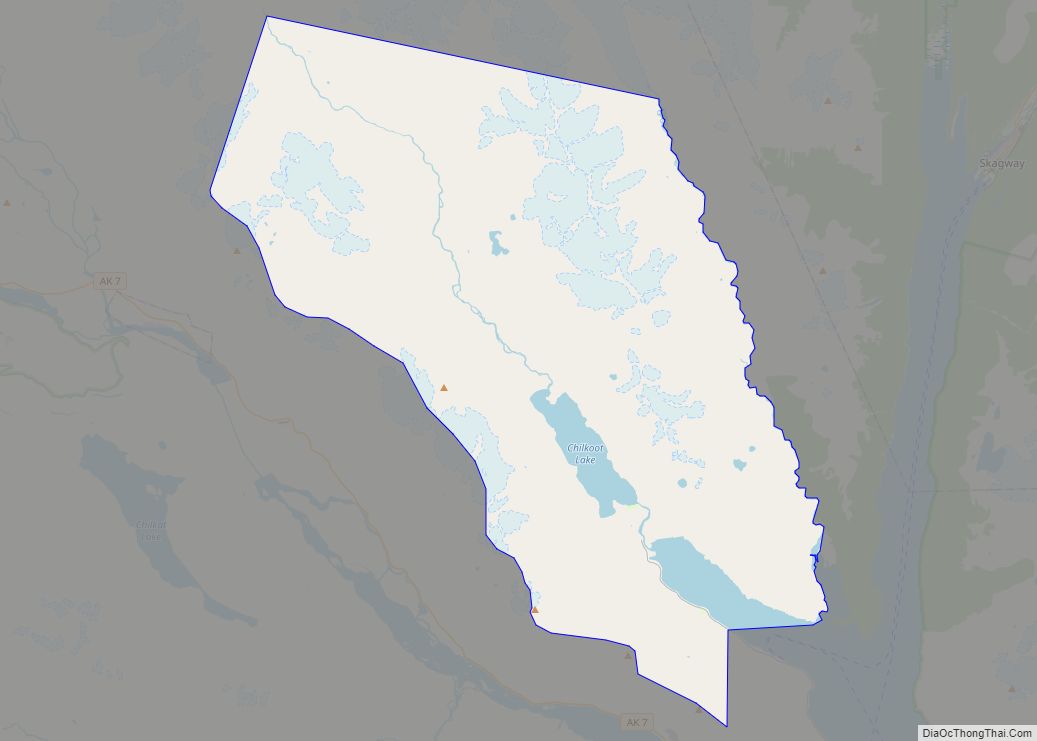
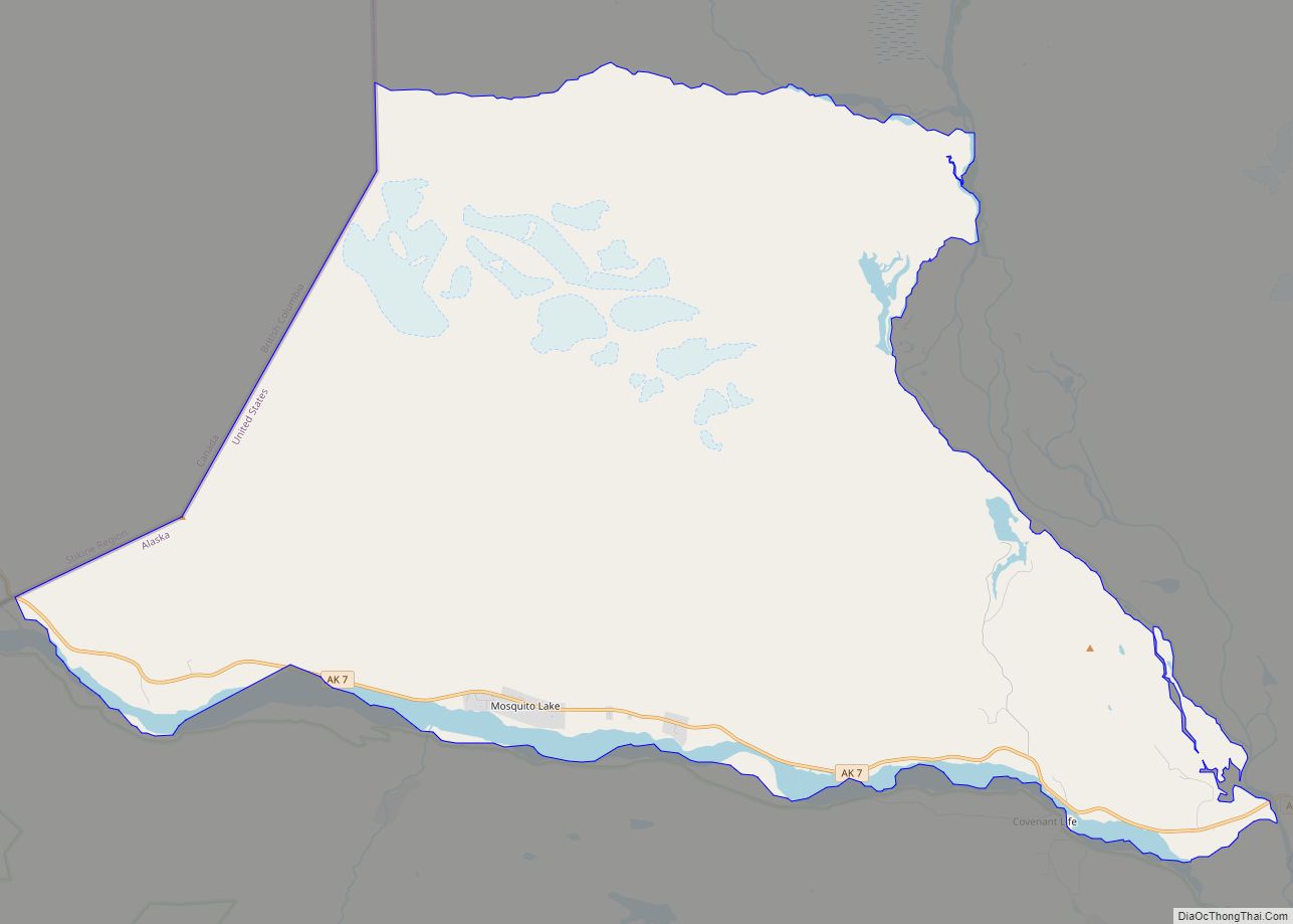
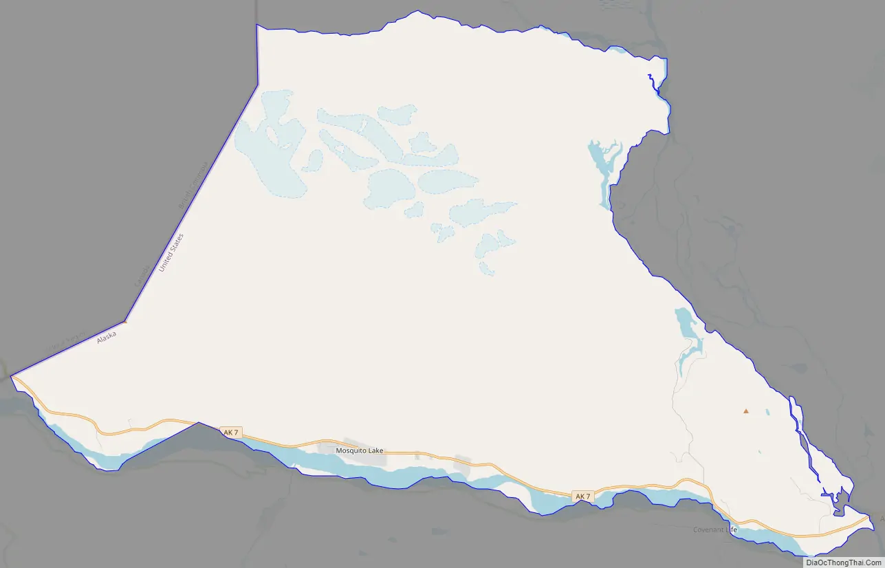
Mosquito Lake Road Map
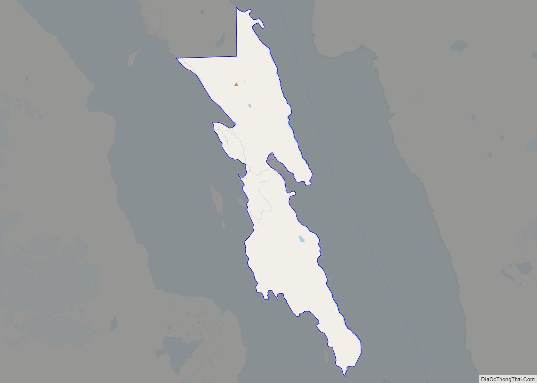
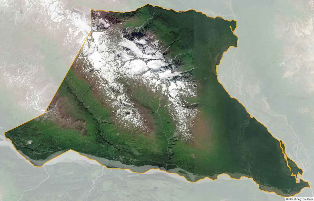
Mosquito Lake city Satellite Map
Geography
Mosquito Lake is located in northern Haines Borough at 59°25′40″N 136°9′48″W / 59.42778°N 136.16333°W / 59.42778; -136.16333 (59.427723, -136.163435). It is bordered to the south by the Klehini River, to the west by the Canada–United States border from the Pleasant Camp border crossing north to Rozaunt Creek, to the north by Rozaunt Creek, Nataga Creek, and the Kelsall River, and to the east by the Chilkat River. To the south across the Klehini River is the Covenant Life CDP, and to the west is the Canadian province of British Columbia. Alaska Route 7, the Haines Highway, runs through the southern part of the CDP in the Klehini River valley, leading southeast 25 miles (40 km) to Haines and northwest 120 miles (190 km) to Haines Junction, Yukon Territory.
The CDP takes its name from Mosquito Lake, a small water body next to the Chilkat River in the eastern part of the community, accessible by Mosquito Lake Road from the Haines Highway.
According to the United States Census Bureau, the CDP has a total area of 76.5 square miles (198.1 km), of which 76.3 square miles (197.6 km) are land and 0.2 square miles (0.5 km), or 0.27%, are water.
See also
Map of Alaska State and its subdivision:- Aleutians East
- Aleutians West
- Anchorage
- Bethel
- Bristol Bay
- Denali
- Dillingham
- Fairbanks North Star
- Haines
- Juneau
- Kenai Peninsula
- Ketchikan Gateway
- Kodiak Island
- Lake and Peninsula
- Matanuska-Susitna
- Nome
- North Slope
- Northwest Arctic
- Prince of Wales-Outer Ketchi
- Sitka
- Skagway-Yakutat-Angoon
- Southeast Fairbanks
- Valdez-Cordova
- Wade Hampton
- Wrangell-Petersburg
- Yukon-Koyukuk
- Alabama
- Alaska
- Arizona
- Arkansas
- California
- Colorado
- Connecticut
- Delaware
- District of Columbia
- Florida
- Georgia
- Hawaii
- Idaho
- Illinois
- Indiana
- Iowa
- Kansas
- Kentucky
- Louisiana
- Maine
- Maryland
- Massachusetts
- Michigan
- Minnesota
- Mississippi
- Missouri
- Montana
- Nebraska
- Nevada
- New Hampshire
- New Jersey
- New Mexico
- New York
- North Carolina
- North Dakota
- Ohio
- Oklahoma
- Oregon
- Pennsylvania
- Rhode Island
- South Carolina
- South Dakota
- Tennessee
- Texas
- Utah
- Vermont
- Virginia
- Washington
- West Virginia
- Wisconsin
- Wyoming