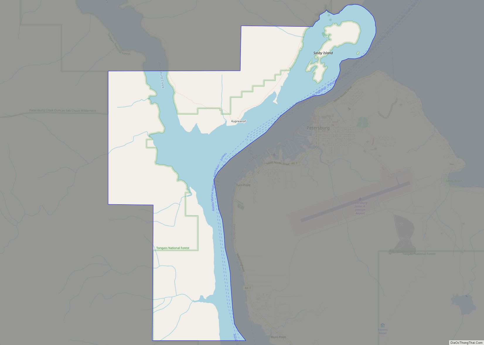
Petersburg (Tlingit: Séet Ká or Gantiyaakw Séedi “Steamboat Channel”) is a census-designated place (CDP) in and essentially the borough seat of Petersburg Borough, Alaska, United States. The population was 3,043 at the 2020 census, up from 2,948 in 2010.
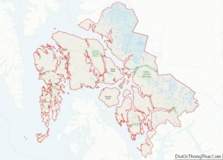
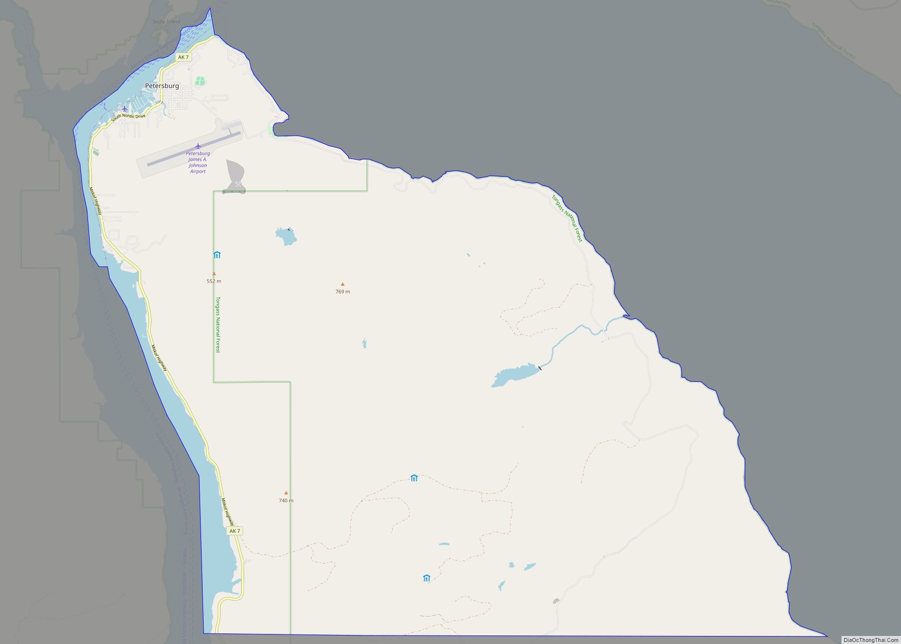
The borough encompasses Petersburg and Kupreanof, plus mostly uninhabited areas stretching to the Canadian–American border and the southern boundary of the City and Borough of Juneau. While the city of Petersburg ceased to exist as a separate administrative entity (the borough assembly created a service area to assume operation of the former city’s services), the tiny city of Kupreanof remains separate within the borough.
| Name: | Petersburg CDP |
|---|---|
| LSAD Code: | 57 |
| LSAD Description: | CDP (suffix) |
| State: | Alaska |
| County: | Petersburg Borough |
| Total Area: | 46.30 sq mi (119.93 km²) |
| Land Area: | 44.17 sq mi (114.40 km²) |
| Water Area: | 2.14 sq mi (5.53 km²) |
| Total Population: | 3,043 |
| Population Density: | 68.89/sq mi (26.60/km²) |
| ZIP code: | 99833 |
| Area code: | 907 |
| FIPS code: | 0260310 |
Online Interactive Map
Click on ![]() to view map in "full screen" mode.
to view map in "full screen" mode.
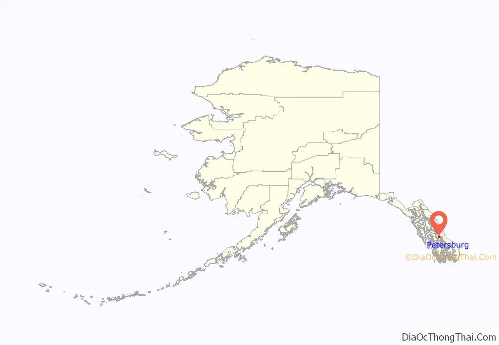
Petersburg location map. Where is Petersburg CDP?
History
Tlingits from Kupreanof Island had long used a summer fish camp at the north end of Mitkof Island. Earlier cultures of indigenous people also used the island: remnants of fish traps and some petroglyphs have been carbon-dated back some 10,000 years.
European explorers to Mitkof Island encountered the Tlingit. In the nineteenth century, Peter Buschmann, a Norwegian immigrant, settled here, building a cannery, sawmill, docks and early structures. The settlement was named Petersburg after him, and it flourished as a fishing port. Icebergs from the nearby LeConte Glacier provided a source for cooling fish.
Petersburg originally incorporated as a town on April 2, 1910. The town had attracted mostly immigrants of Scandinavian origin, thus giving Petersburg the nickname “Little Norway”. The Sons of Norway hall was built on one of the piers. Three other canneries were built and the four have operated continuously since. With the establishment of the cannery, Alaskan Natives, including Chief John Lott, began to work there and live year-round at the site.
The 1939 Slattery Report on Alaskan development identified the region as one of the areas where new settlements would be established through Jewish immigration. This plan was never implemented.
Fisheries were the mainstay of the economy. In 1965, Petersburg fishermen founded Icicle Seafoods. Fishermen Gordon Jensen and Magnus Martens teamed up with managers Tom Thompson and Bob Thorstenson, Sr. to organize a group of fishermen to purchase the Pacific American Fisheries (PAF) plant (the original Buschmann cannery) at a time when the seafood industry seemed in decline. PAF was traded on the NYSE and had been one of the largest processors in Alaska for a half century. The shareholders, including Board members Fred File, Fred Haltiner, Jr., Robin Leekley, Jeff Pfundt, Aril Mathisen, Bud Samuelson and many others (Hofstads, Otness, and Petersons to name a few) began their work to create, improve and institute the fisheries that sustain Petersburg and many other coastal communities in Alaska today. The company was originally known as PFI but in 1977 changed its name officially to Icicle Seafoods.
Petersburg incorporated as a borough in January 2013, encompassing Petersburg and Kupreanof, plus mostly uninhabited areas stretching to the Canada–US border and the southern boundary of the City and Borough of Juneau. While the City of Petersburg ceased to exist as a separate entity (the borough assembly created a service area to assume operation of the former city’s services), the tiny city of Kupreanof remains separate within the borough.
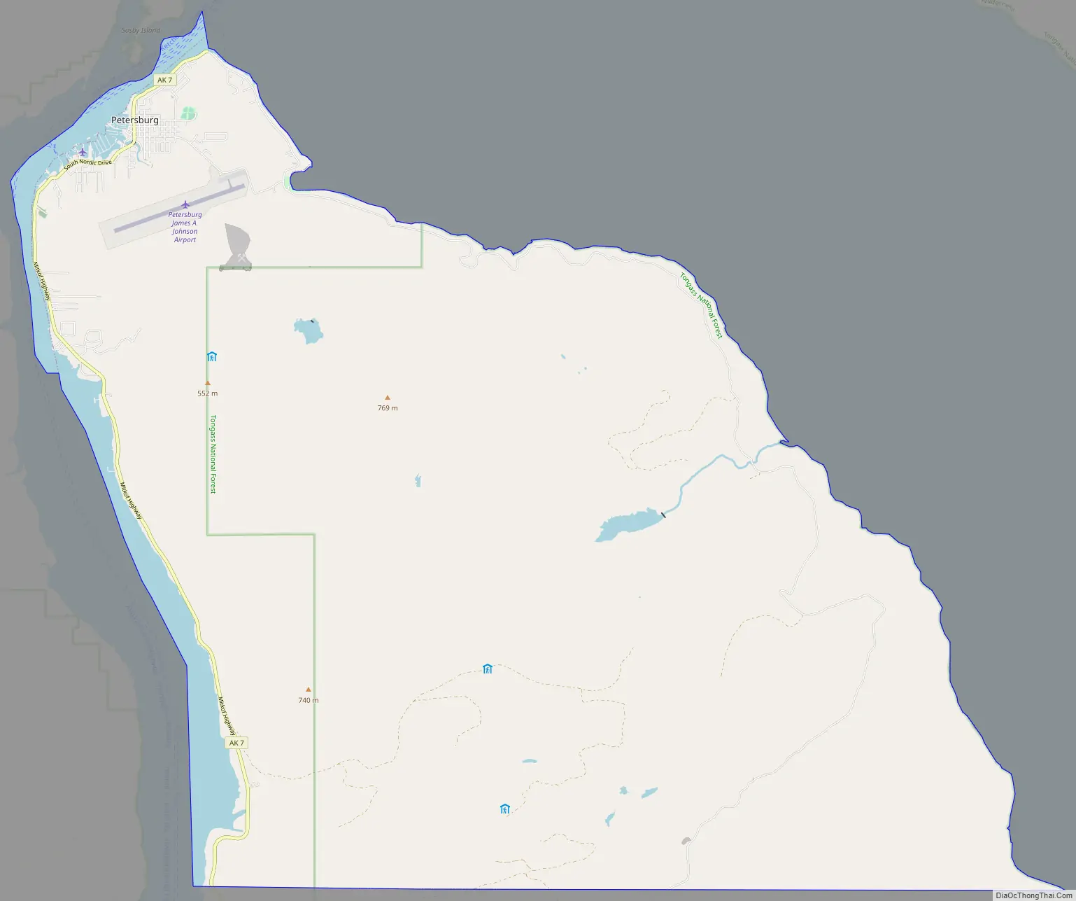
Petersburg Road Map
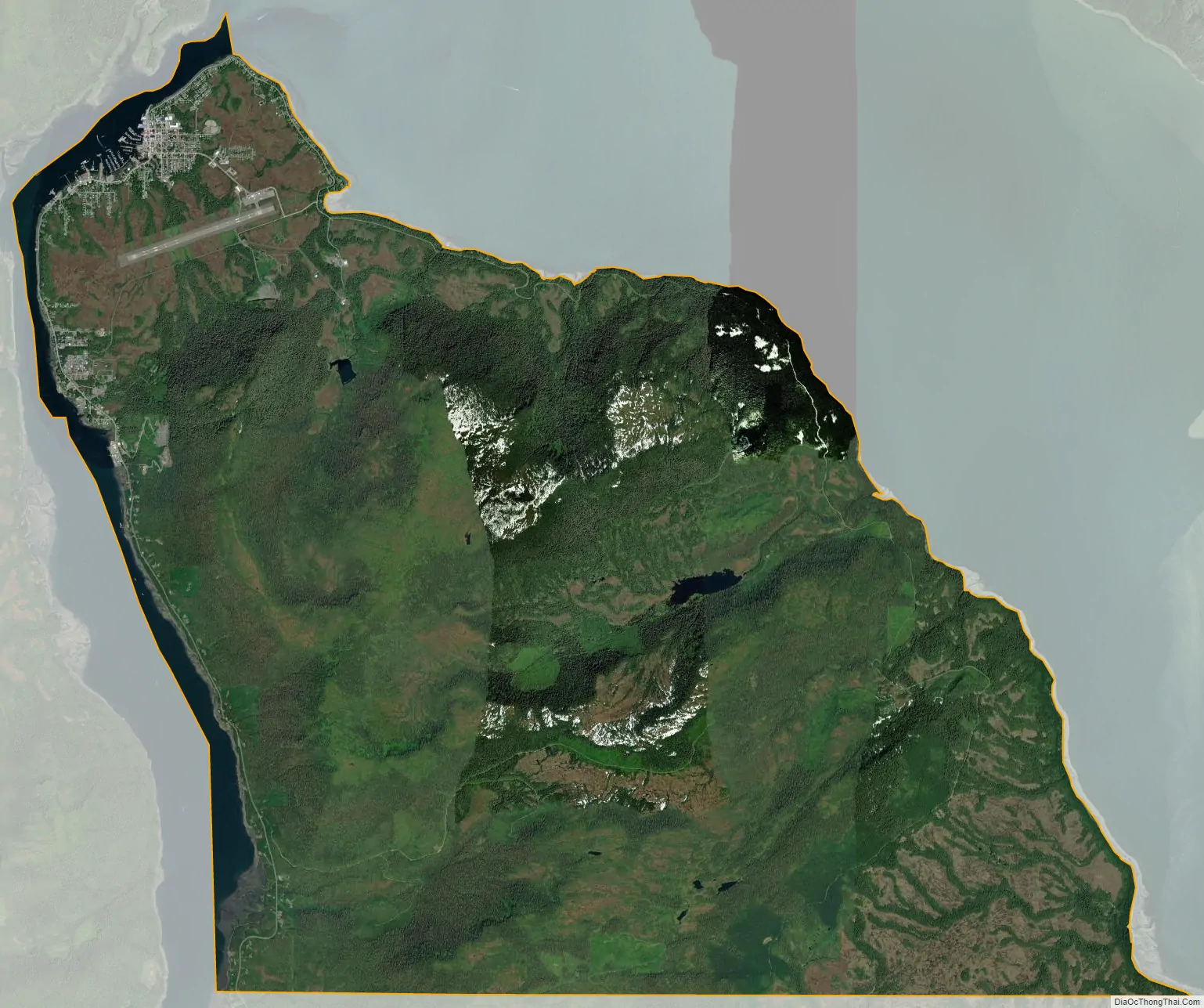
Petersburg city Satellite Map
Geography
Petersburg is located on the north end of Mitkof Island, where the Wrangell Narrows meets Frederick Sound. Petersburg is halfway between Juneau, 190 km (120 mi) to the north, and Ketchikan, 180 km (110 mi) to the south.
According to the United States Census Bureau, the city has a total area of 46.0 square miles (119 km), of which, 43.9 square miles (114 km) of it is land and 2.2 square miles (5.7 km) of it (4.74%) is water.
Mitkof Island is largely covered by low mountains. The lowlands are mainly made up of muskeg, a type of soil made up of plants in various states of decomposition. It is approximately 20 miles from its north end to its south. The western side of the island borders the Wrangell Narrows, one of the six listed in Southeast Alaska. The Narrows provides a somewhat protected waterway for boats, and opens on the south end of the island into Sumner Straits. Mitkof Island has many creeks that empty into the Narrows, including Blind Slough, Falls Creek, Twin Creeks, and Spirit Creek.
According to the National Marine Fisheries Service, the town is the 15th-most lucrative fisheries port in the United States by volume. In 2011, 101 million pounds of fish and shellfish passed through Petersburg, with a dockside value of $65 million. That year Petersburg ranked as 13th in the nation in terms of the value of its catches.
Climate
The climate of Petersburg is a subpolar oceanic climate (Cfc), closely bordering a subarctic climate (Dfc). On January 16, 1981, Petersburg registered a daily maximum temperature of 62 °F (17 °C), the highest ever recorded in the month of January in Alaska. Eleven years later, on February 27, 1992, a high of 66 °F (19 °C) was observed, also setting a monthly state record high.
See also
Map of Alaska State and its subdivision:- Aleutians East
- Aleutians West
- Anchorage
- Bethel
- Bristol Bay
- Denali
- Dillingham
- Fairbanks North Star
- Haines
- Juneau
- Kenai Peninsula
- Ketchikan Gateway
- Kodiak Island
- Lake and Peninsula
- Matanuska-Susitna
- Nome
- North Slope
- Northwest Arctic
- Prince of Wales-Outer Ketchi
- Sitka
- Skagway-Yakutat-Angoon
- Southeast Fairbanks
- Valdez-Cordova
- Wade Hampton
- Wrangell-Petersburg
- Yukon-Koyukuk
- Alabama
- Alaska
- Arizona
- Arkansas
- California
- Colorado
- Connecticut
- Delaware
- District of Columbia
- Florida
- Georgia
- Hawaii
- Idaho
- Illinois
- Indiana
- Iowa
- Kansas
- Kentucky
- Louisiana
- Maine
- Maryland
- Massachusetts
- Michigan
- Minnesota
- Mississippi
- Missouri
- Montana
- Nebraska
- Nevada
- New Hampshire
- New Jersey
- New Mexico
- New York
- North Carolina
- North Dakota
- Ohio
- Oklahoma
- Oregon
- Pennsylvania
- Rhode Island
- South Carolina
- South Dakota
- Tennessee
- Texas
- Utah
- Vermont
- Virginia
- Washington
- West Virginia
- Wisconsin
- Wyoming